Travelling the Tibetan and Mongolian Borders in 1923 - Part 2 Yunnan and Sichuan
A journey of exploration - a doctor's story - Part 2


This is Part 2 of an account of the journey from Yunnan-Fu (Kunming) to Peking (Beijing) that my grandfather Dr Hubert Gordon Thompson (HGT) undertook in 1923 in the company of Brig. Gen. George Pereira.
It has been compiled from the letters and journal of HGT written during the journey and from the lecture “From Yunnan-Fu to Peking along the Tibetan and Mongolian Borders” given by HGT to The Royal Geographic Society on 23rd November 1925
I have also drawn from the journal records of GP that were compiled by Sir Francis Younghusband in the book “Peking to Lhasa”; published by Constable and Company ltd. in 1925.
This second part of the journey was from Likiang (Lijiang) in Yunnan Province to Batang (also known as Xiaqiong ) in the Province of Szechwan (now referred to as Sichuan)
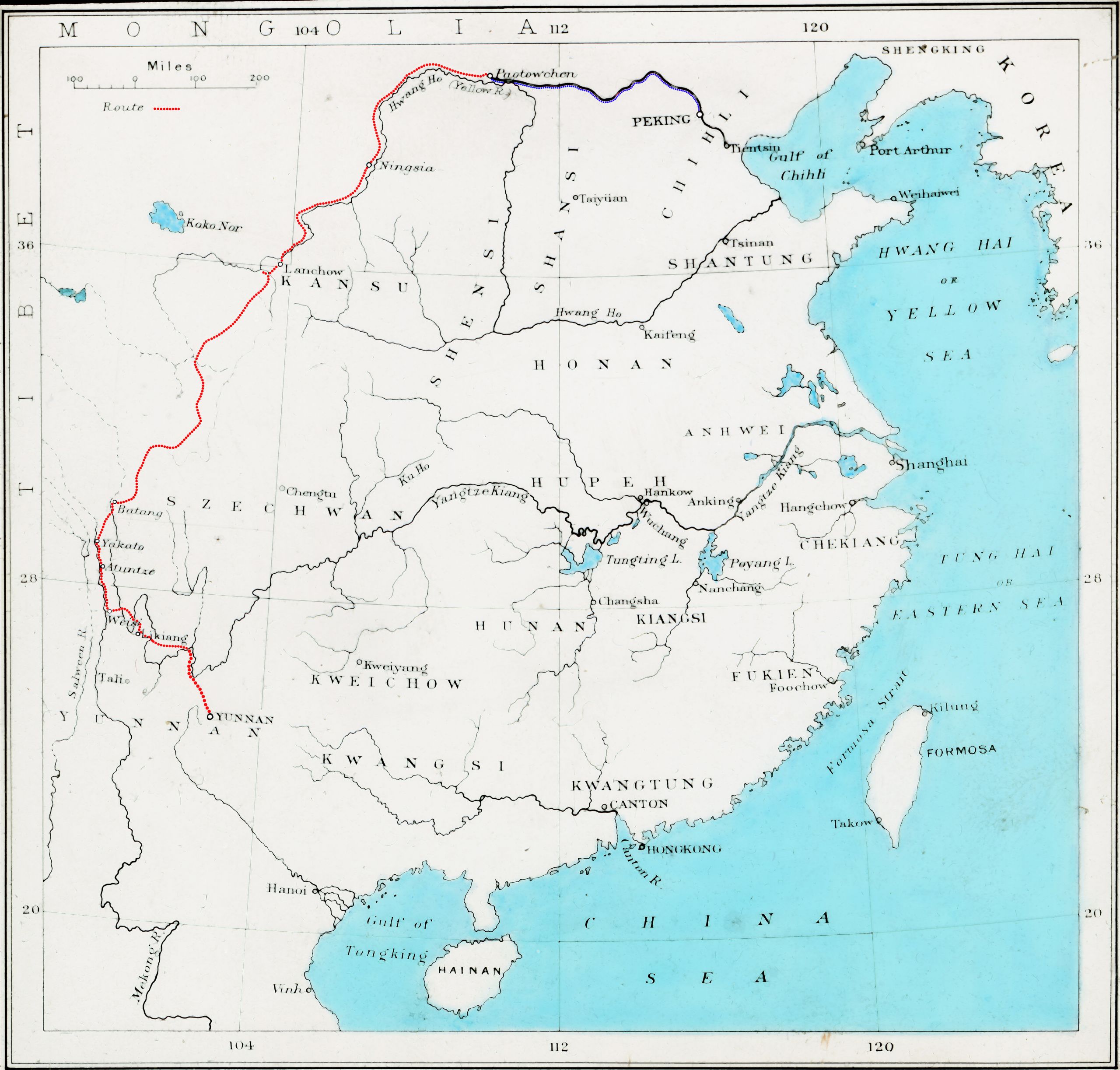
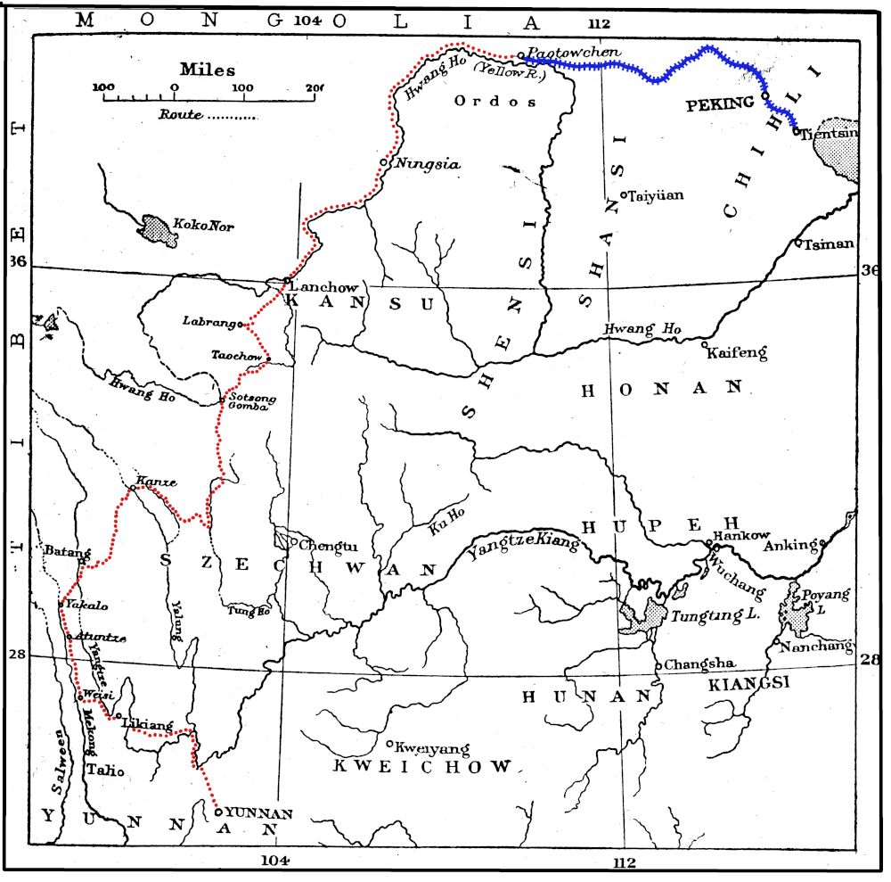
Click on the map above to dee the route taken from Likiang to Batang on a 1922 map
Click on the map above to dee the route taken from Likiang to Batang on a 1922 map

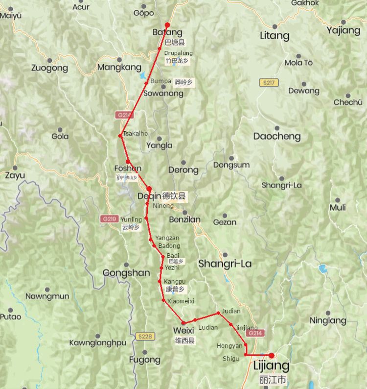
Modern day map of the route from Lijiang to Batang
Modern day map of the route from Lijiang to Batang
Day 27 August 12th 1923 Likiang
(Note: Likiang Fu (Lijiang) was one of the big stages on their northward journey. It was the old Mosuo capital, and inscriptions relate how, nearly four hundred years ago, the Mosuo king drove back the Tibetans, who were encroaching on their territory, and established themselves right along the valley of the Mekong).
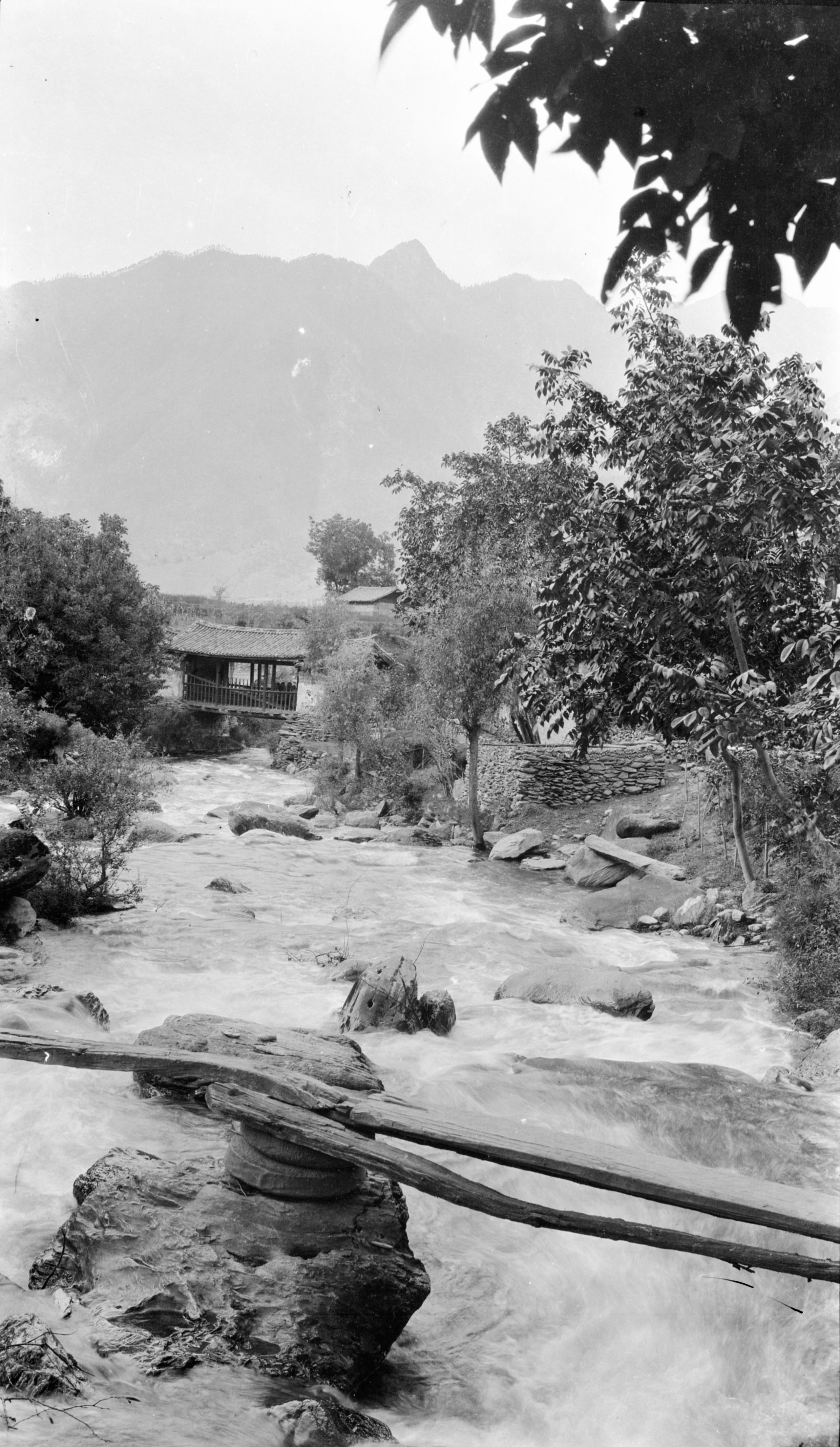
"Likiang (now written as Lijiang) is an unwalled city of some 30,000 inhabitants, (7,561 ft.), and GP made the distance we have travelled from Yunnan Fu to be 872 miles. Many pessimists at Yunnan had said that we would not be able to get through in the rainy season. The roads have certainly been very bad, but not worse than in other parts of China. And though there has been plenty of rain, it fell chiefly at night".
"Behind the city to the north, rise great rocky, peaked mountains running north and causing the great bend in the Yangtze. They are partly snow-covered, and are the highest we have yet seen in Yunnan. GP estimated them at 17,000 feet".
"At the Li Kiang Post Office, we learnt the Telegraph line was broken, however it was repaired by the next morning. So, we are able to wire home as well as post letters".
"I have spent time here seeing patients, taking photos and developing 3 rolls of films. Sadly, the first lot were hardly any good. I hope for better results with a further 5 rolls".

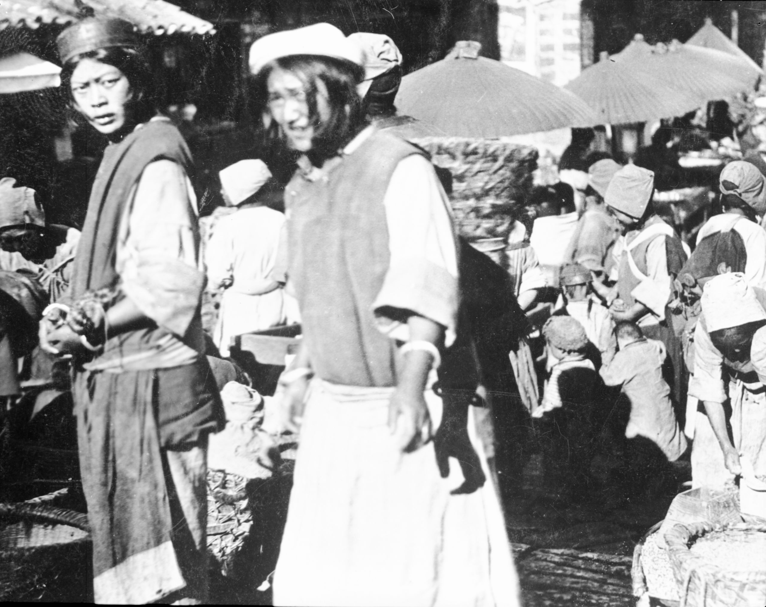
Mo-su women at the market at Likiang
Mo-su women at the market at Likiang
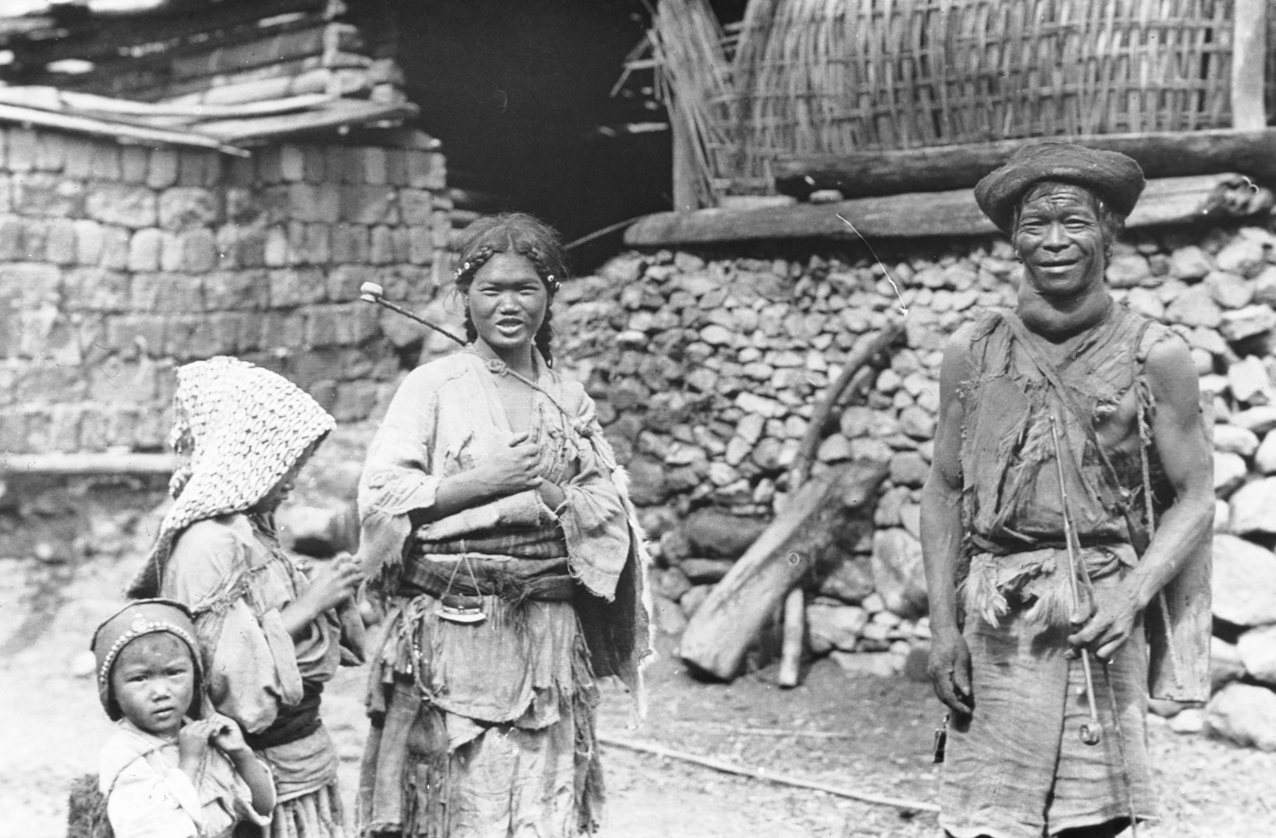
"There are a number of different tribes-people in Likiang. The Mosuo, or Na-shih as they call themselves, which means black people, are found right up the valley of the Mekong and in the country round Likiang".
"The Lisu tribes-people are more aboriginal in character. Driven up to the hills, they inhabit pretty much the same region, but are scattered in the fastnesses of the mountains. In addition, there are Loutze, and La-ma-jen, with an infiltration of Tibetans from across the frontier".

Two Mosuo women
Two Mosuo women

More Mosuo women (Na-Shih) at Likiang
More Mosuo women (Na-Shih) at Likiang
“There being a festival, crowds of Mosu girls had collected. Many were walking together like in a girls' school: others were sitting out. The girls were in parties and the boys were separate. I was interested to notice the presence of cowrie shells, especially among the Lisu people. On inquiry I learnt that they had come from Burma and India; that they were valued at 100 to the Chinese tael, were sometimes used for barter, and were largely used for decoration of the headdress of the girls, being looked upon as a kind of dowry”.
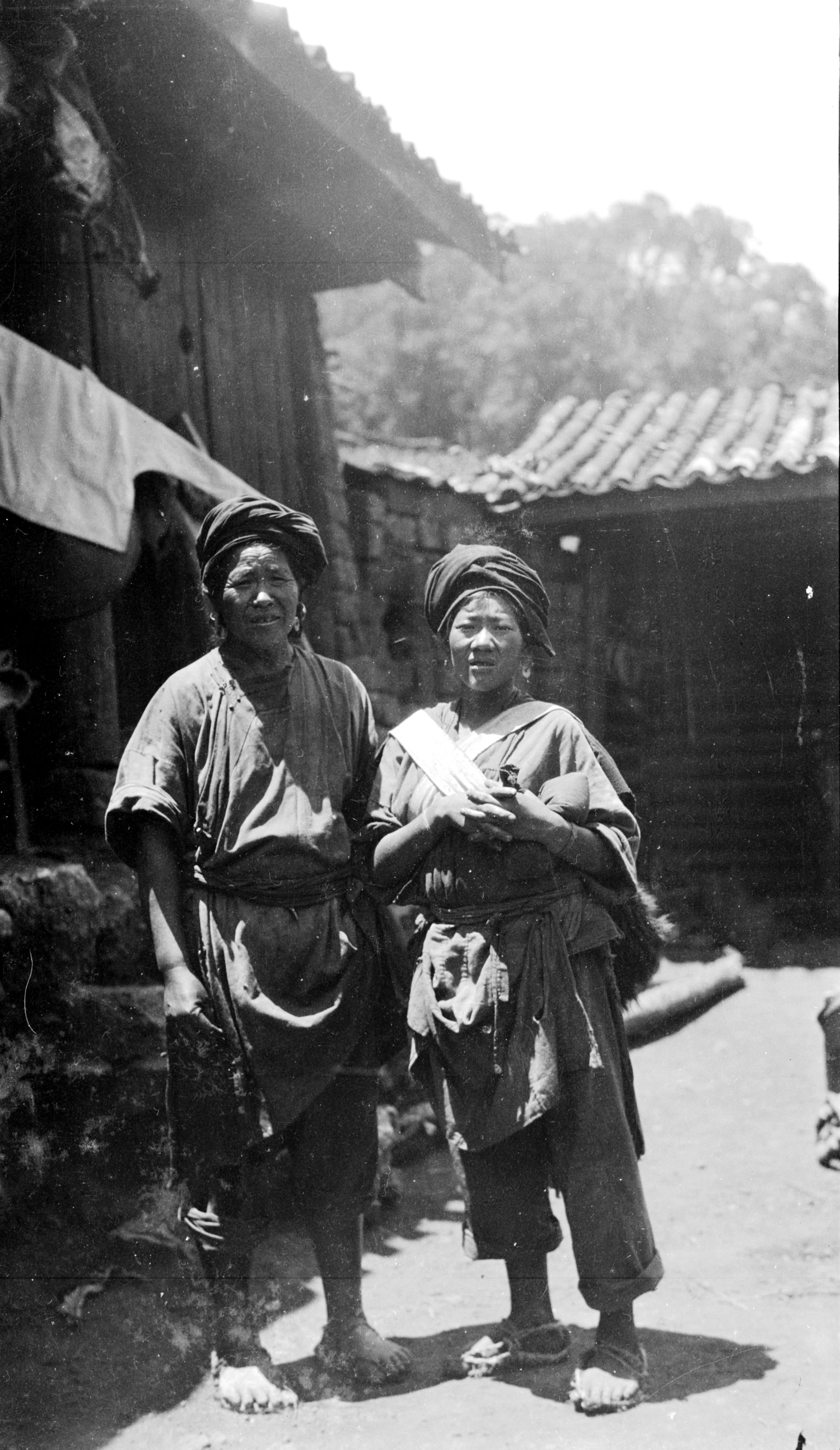
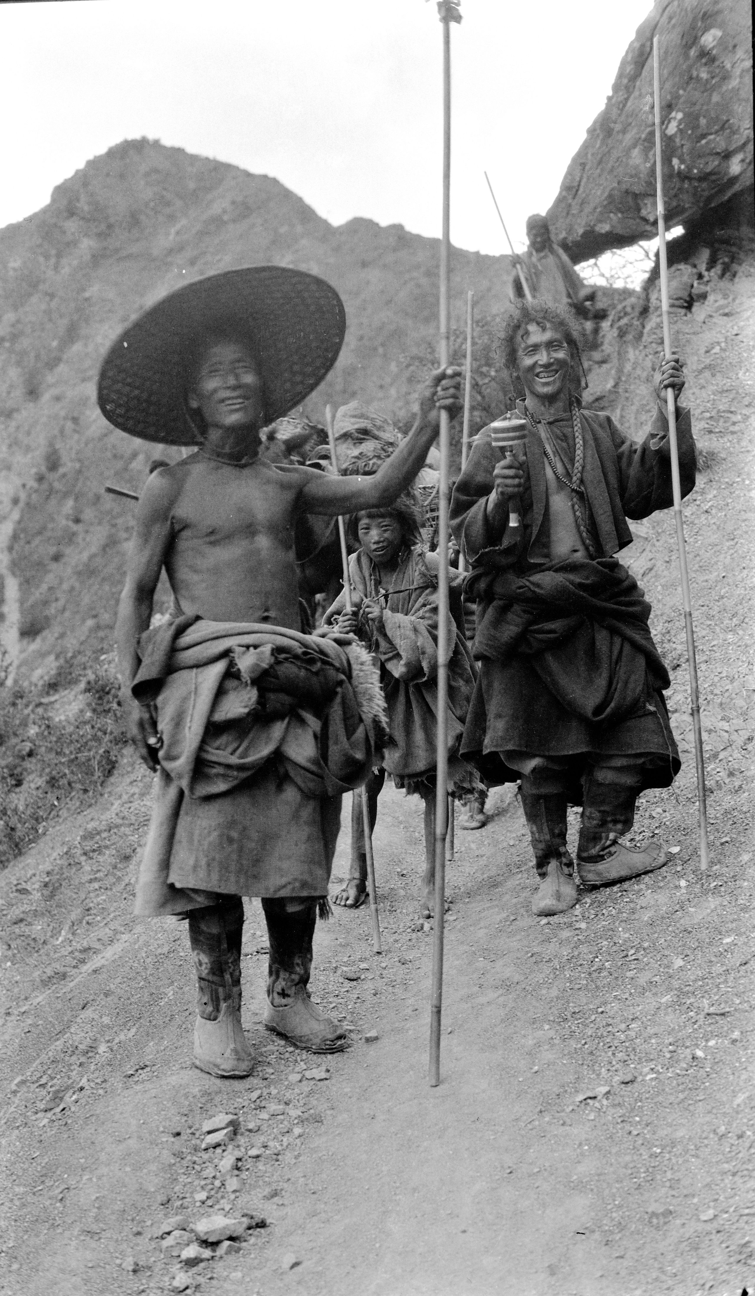
“At the city, we engaged Tibetan muleteers for the next stage of the trip; three weeks' journey to Atuntze. The lead muleteer was an old Tibetan, a most picturesque old fellow, with a big ear-ring in one ear, a broad hat and Tibetan dress, He spoke Chinese, and instead of $1.40 per day the mules were to cost 40 cents”.

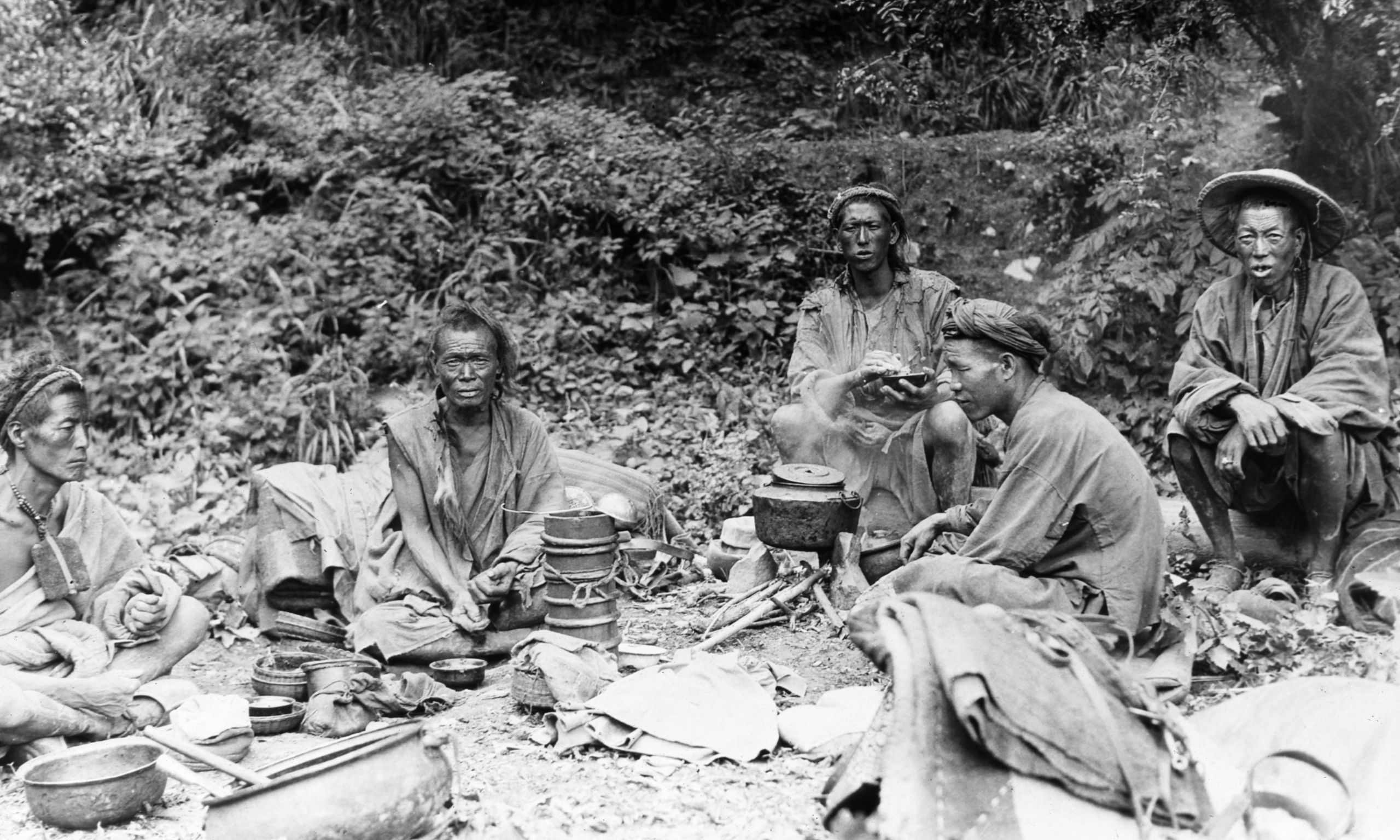
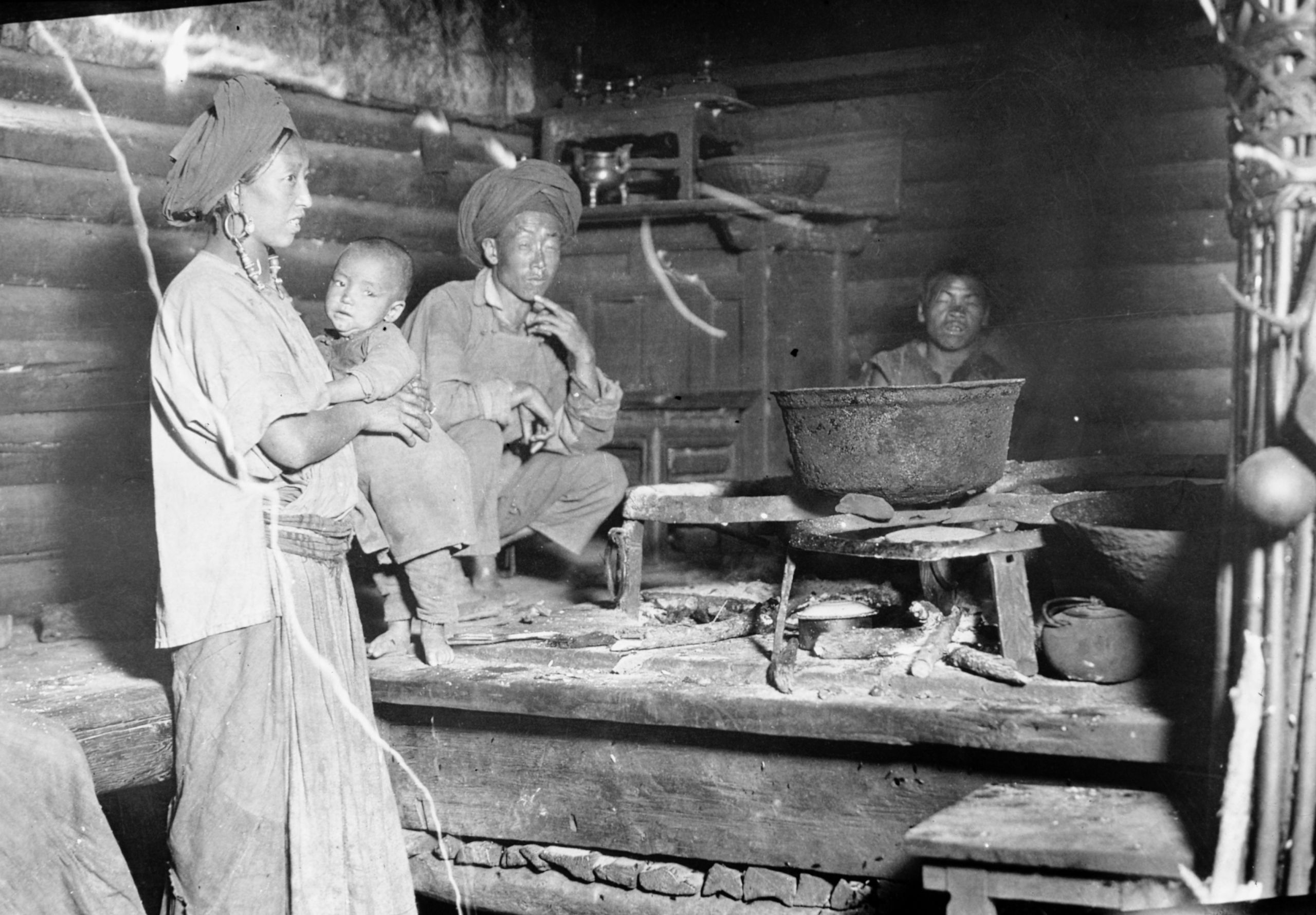
The Tibetan muleteers preparing the midday meal - butter tea Tsamba in churn with ladle on top. The lead muleteer is on the right with large earing
The Tibetan muleteers preparing the midday meal - butter tea Tsamba in churn with ladle on top. The lead muleteer is on the right with large earing
“I wish you could see our Tibetan muleteers. There are four of them and they wear charms wrapped up in a kind of hair cloth round their necks, as well as a chain of beads; a big silver ear-ring in the left ear; a pigtail wound round the head; skin of face and body like tanned leather; a rough belt round their hemp clothing and suspended from it a sheath knife, ornamented with silver - a great metal pipe, a tobacco pouch, a flint and steel etc.”
Day Twenty-four August 9th,1923. still at Li Kiang
At Li Kiang great excitement had been caused in the city by the capture, twenty-two days previously, of Mr. D'Arcy Weatherbe, an English engineer, by Chinese bandits at a place two stages south-west. He had been trying to reach Batang from Burma and was making his way back to Yunnan Fu along the main road. They felt thankful that they had come by their unfrequented route, and so missed the robber band. The bandits’ condition for the release of Mr Weatherbe was that they should be reincorporated into the army.
GP liaised with the local Magistrate and suggested that the bandits' demand for reincorporation into the army should be complied with, while insisting on Mr. Weatherbe's immediate release.
“After careful consideration, we have decided that Mr. Weatherbe's capture need not affect us as he was to the S.E. and our road now is to the N.W, and if we hear of any difficulty ahead, up beyond Ya Ka Lo, we will probably get to Batang - via Tibet - GP was not for running any risks, but if there is trouble ahead we will endeavour to avoid it”.
Day twenty-five August 10th & 11th 1923 Still at Li Kiang
In a letter home HGT said:
10 August 1923
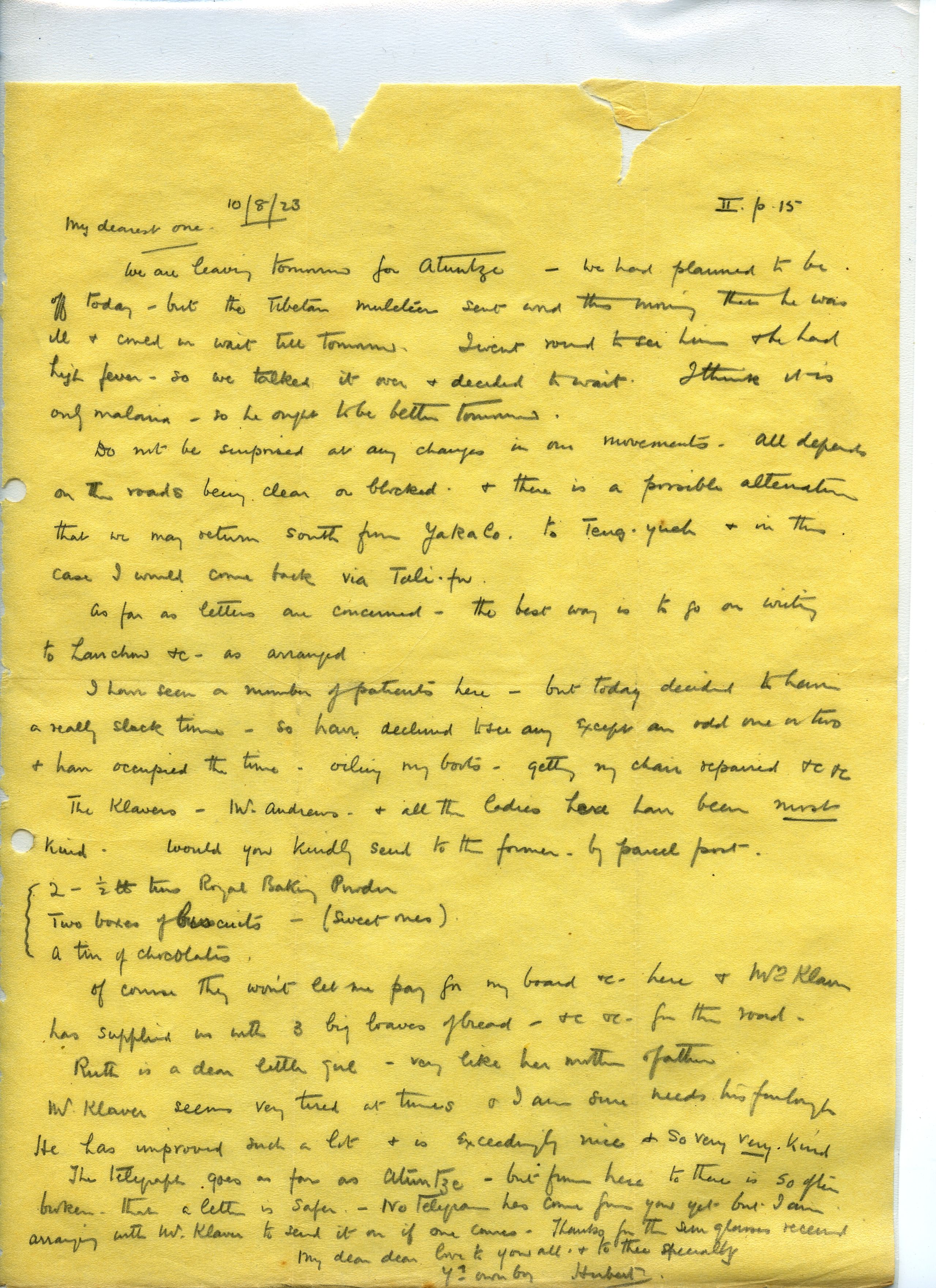
My dearest one,
We are leaving tomorrow for Atuntze - we had planned to be off today, but the Tibetan muleteer sent word this morning that he was ill and could we wait till tomorrow. I went round to see him and he had high fever, so we talked it over and decided to wait. I think it is only malaria, so he ought to be better tomorrow.
Do not be surprised at any changes in our movements - All depends on the roads being clear or blocked, and there is a possible alteration that we may return South from Yakalo to Teng-yueh and in this case I will come back via Tali-fu.
As far as letters are concerned, the best way is to go on writing to Lanchow etc., as arranged.
I have seen a number of patients here - but today decided to .have a really slack time, so have declined to see any except an odd one or two and have occupied the time oiling my boots, getting my chair repaired etc., etc..
The Klavers - Mr. Andrews and all the ladies, have been most kind. Would you kindly send to the former, by parcel post:-
2 ½ lb tins Royal Baking Powder
2 boxes of Biscuits (sweet ones)
1 tin of Chocolates.
Of course they won't let me pay for my board re. here, and Mrs. Klaver has supplied us with 3 big loaves of bread, etc., for the road.
Ruth is a dear little girl - very like her mother and father. Mr. Klaver seems very tired at times and I am sure needs his furlough. He has improved such a lot and is exceedingly nice, and so very, very kind.
The telegraph goes as far as Atuntze, but from here to there is so often broken that a letter is safer. No telegram has come from you yet, but I am arranging with Mr. Klaver to send it on if one comes.
Thanks for the sun glasses received.
My dear, dear love to you all, and to thee specially.
Yr own boy,
Hubert.

Stage 2
Day twenty-seven August 12th, 1923. Li Kiang to Shi ku - 14 miles
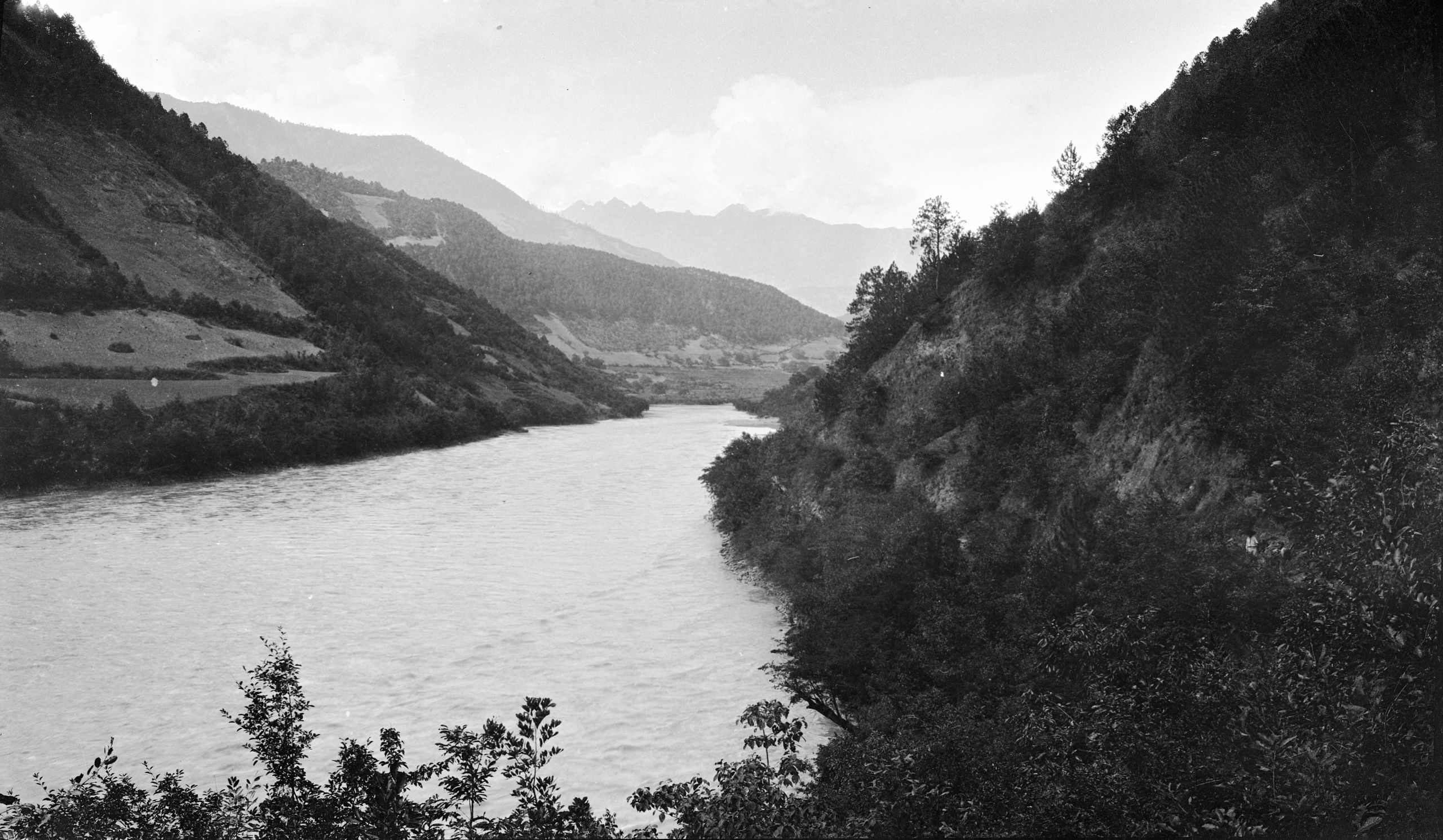
They left Likiang at 8.30 a.m. after the few days' rest, and travelled 9 miles to Chi Li Tsun (Chi-L'o-ts'un). The road led across the plain and round the La-shih-Shui Lake They reached - Lau Shiu Ku, where they halted for lunch at 12.30 noon. It was just at the beginning of the descent to the Yangtze.

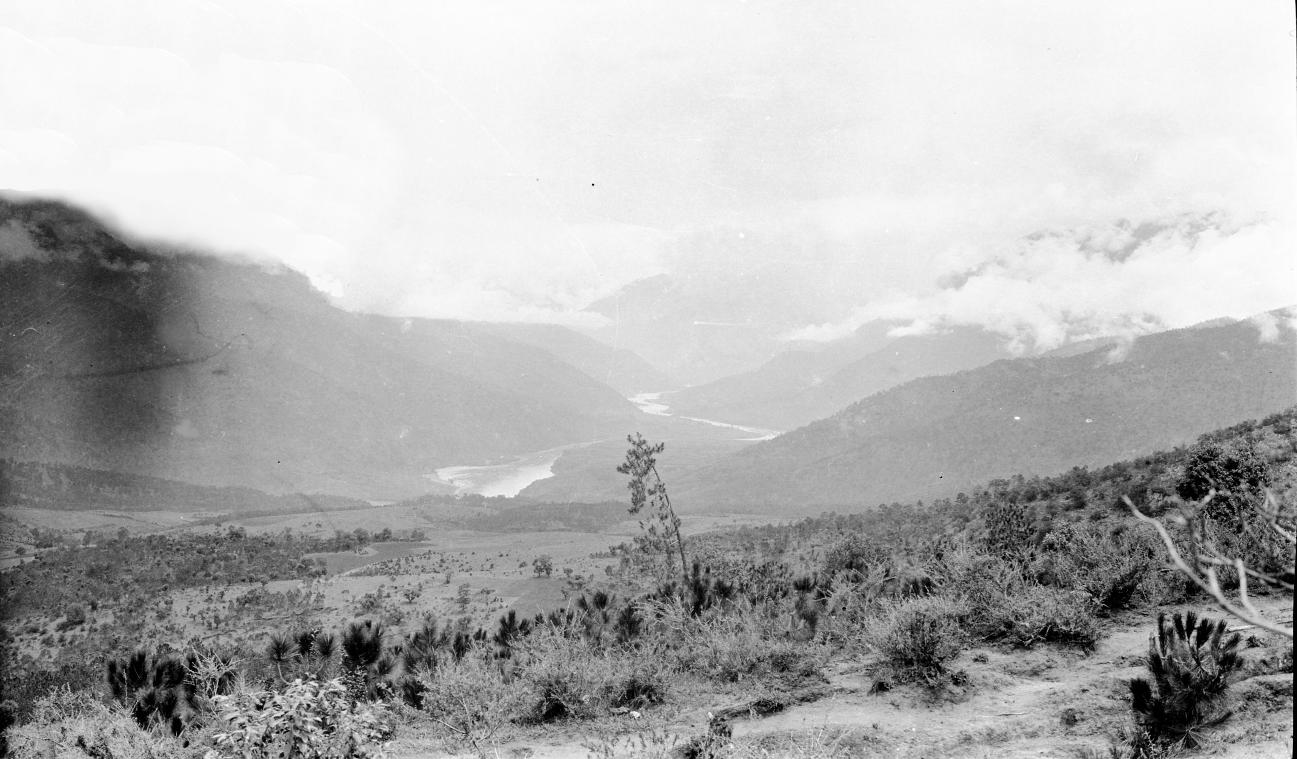
The plain around the La-shih-Shui Lake Looking N along E part of Yang-tze
The plain around the La-shih-Shui Lake Looking N along E part of Yang-tze
At 2 p.m. they set off again and went steadily down to the great river.

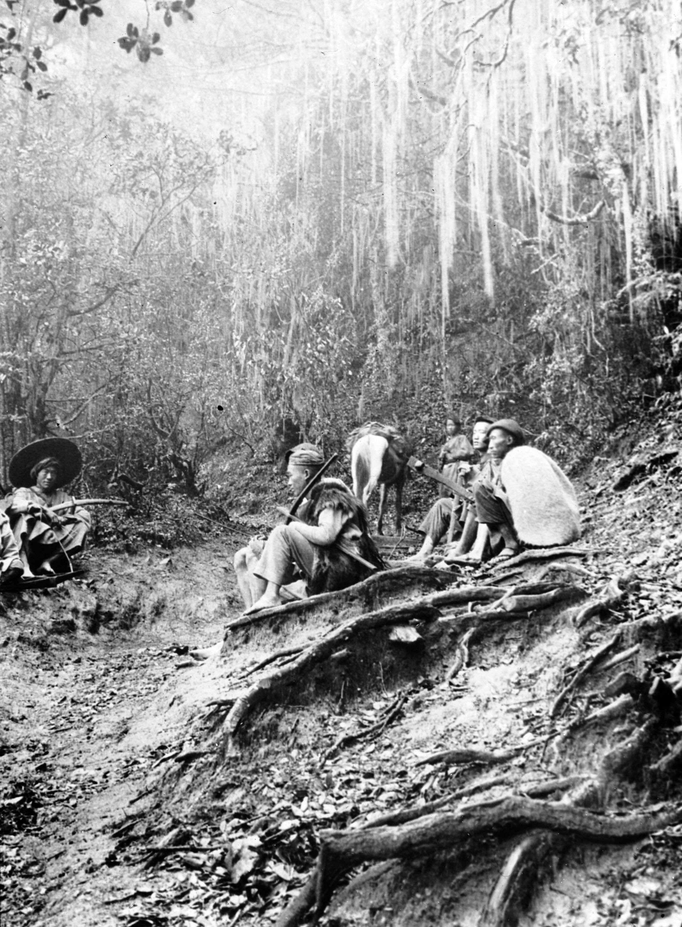
Ascending through woods between Lu-tien & Li-ti-ping. Escorts with crossbows
Ascending through woods between Lu-tien & Li-ti-ping. Escorts with crossbows
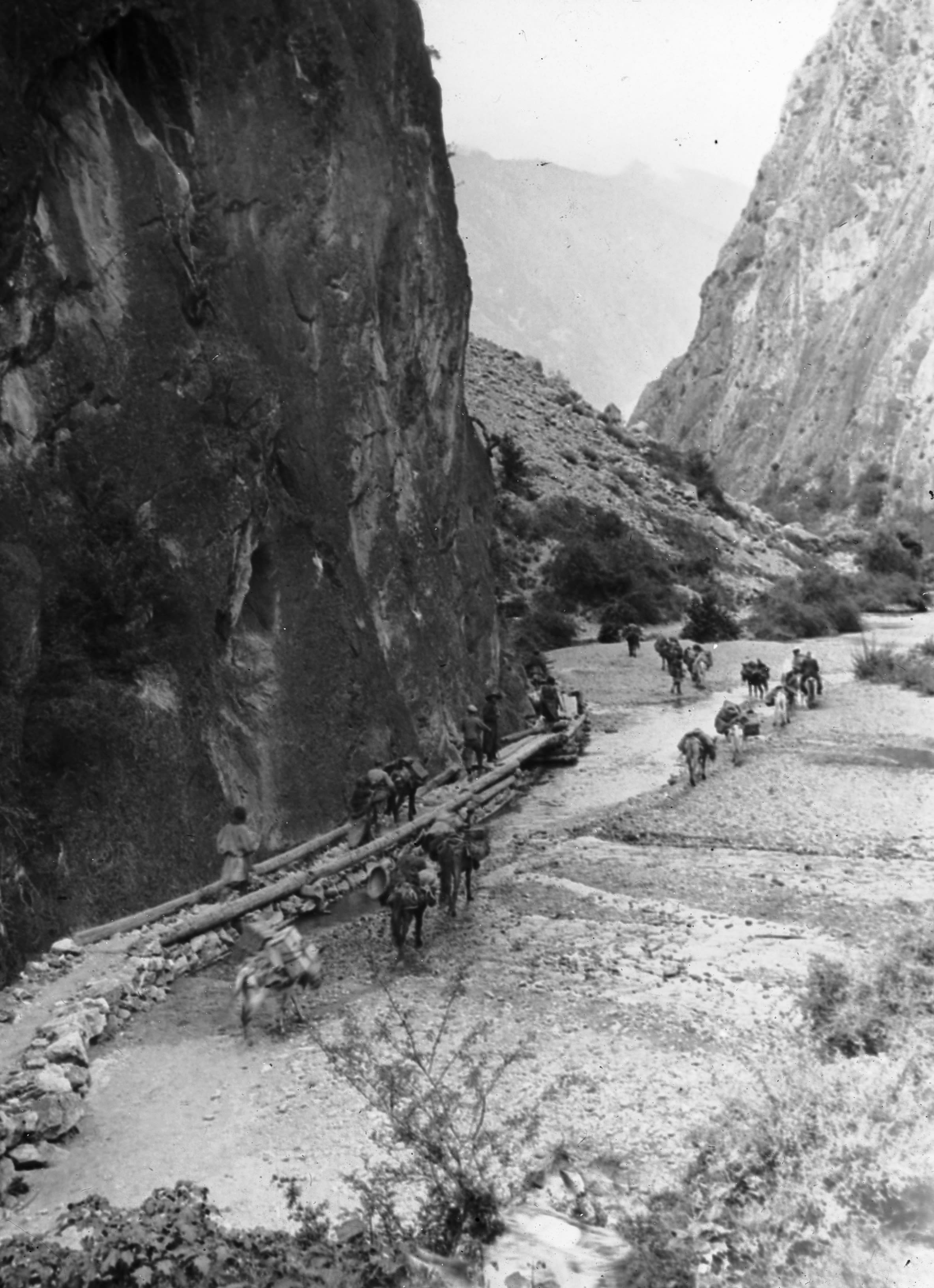
“We crossed the divide between the Yangtze and Mekong by Litiping - a beautiful little plateau about 5 miles in length, carpeted with flowers, with pine woods along its border and great flocks of sheep grazing on the pasture land. As we ascended through the woods between Lu-tien & Li-ti-ping we found “hanging hair” lichen called Usnea Longissima (also known as Methuselah’s beard) - a network of thin hair-like fronds that draped over, hanging from branches. In this area it grows mainly on oak. The escorts are carrying crossbows”.
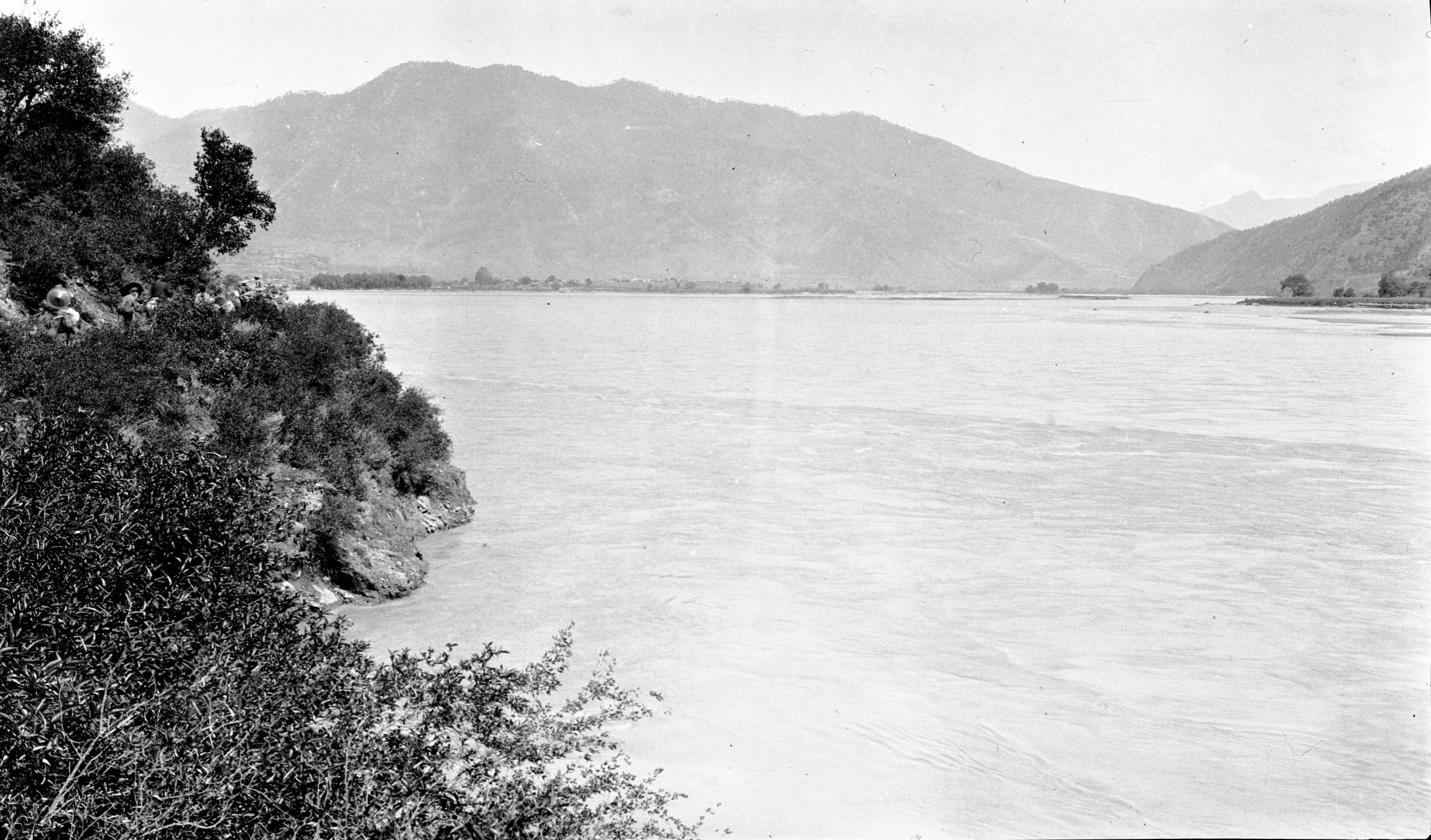
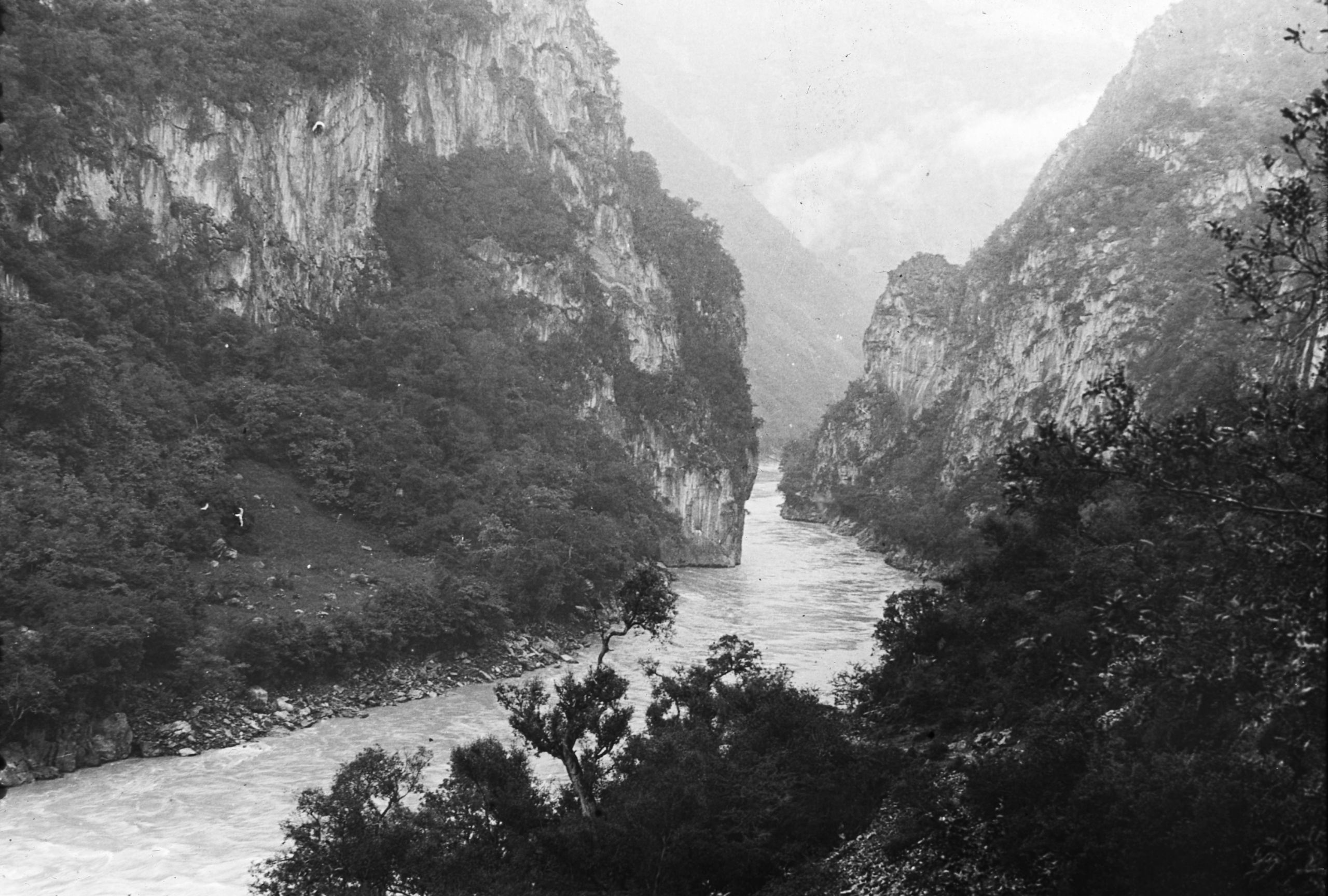
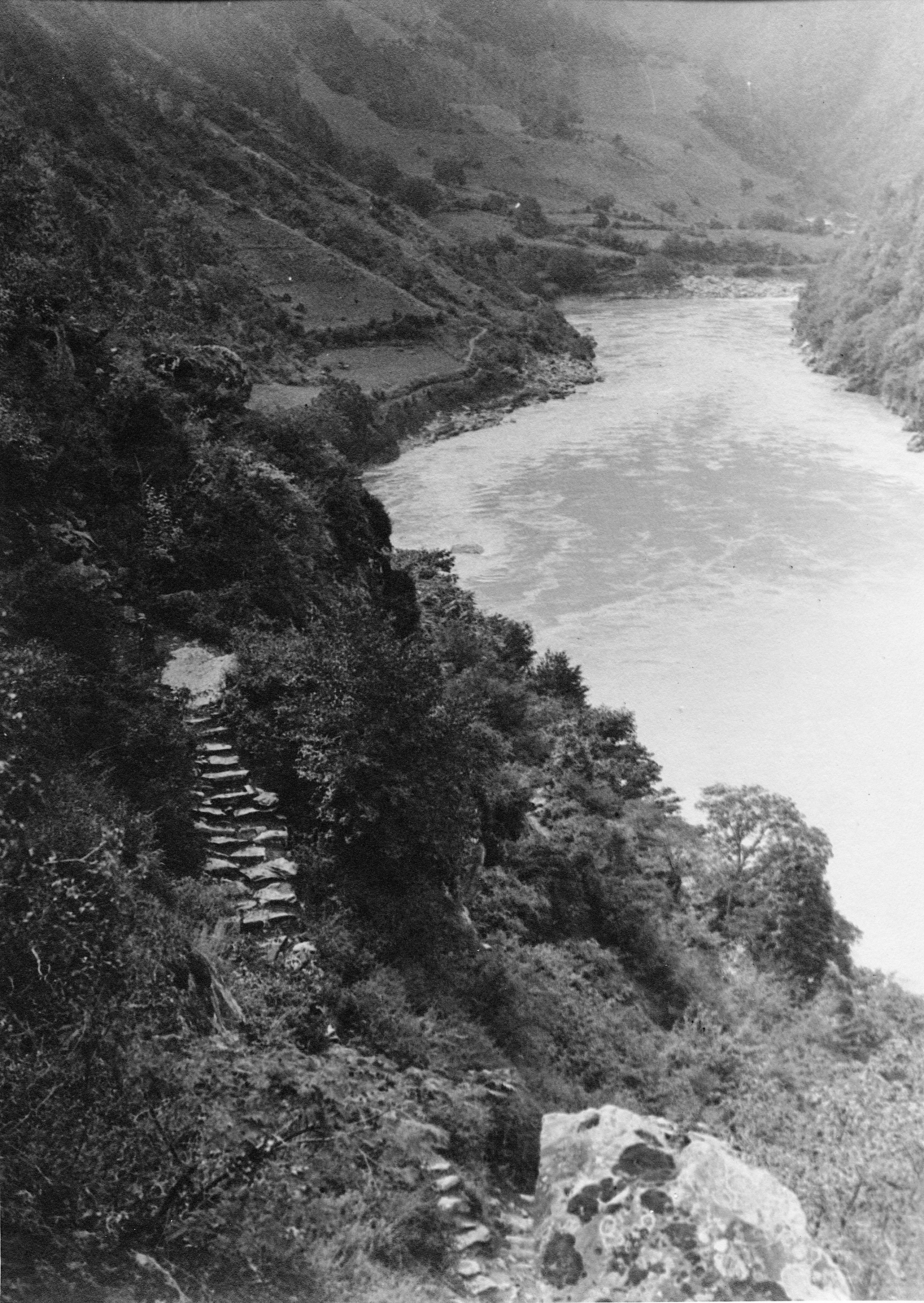
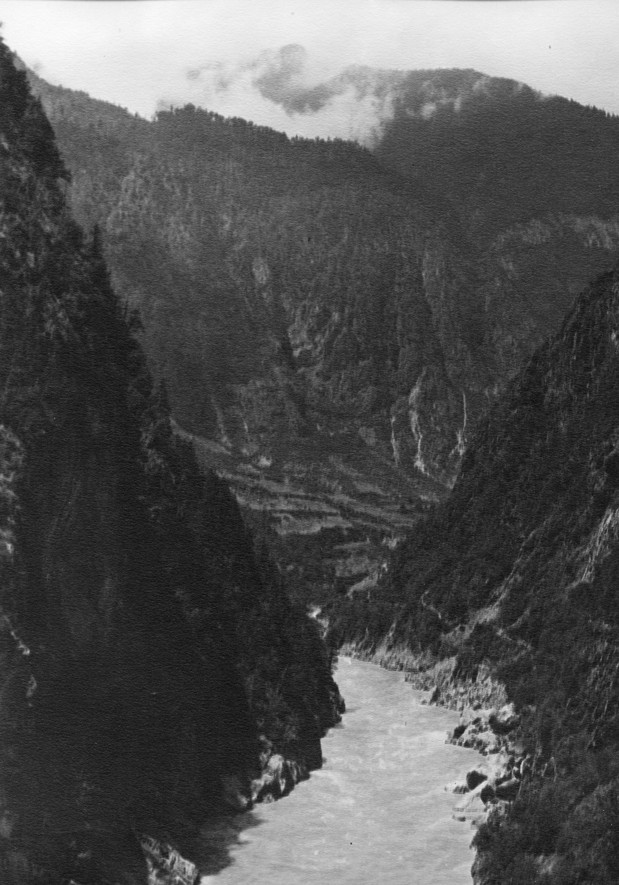
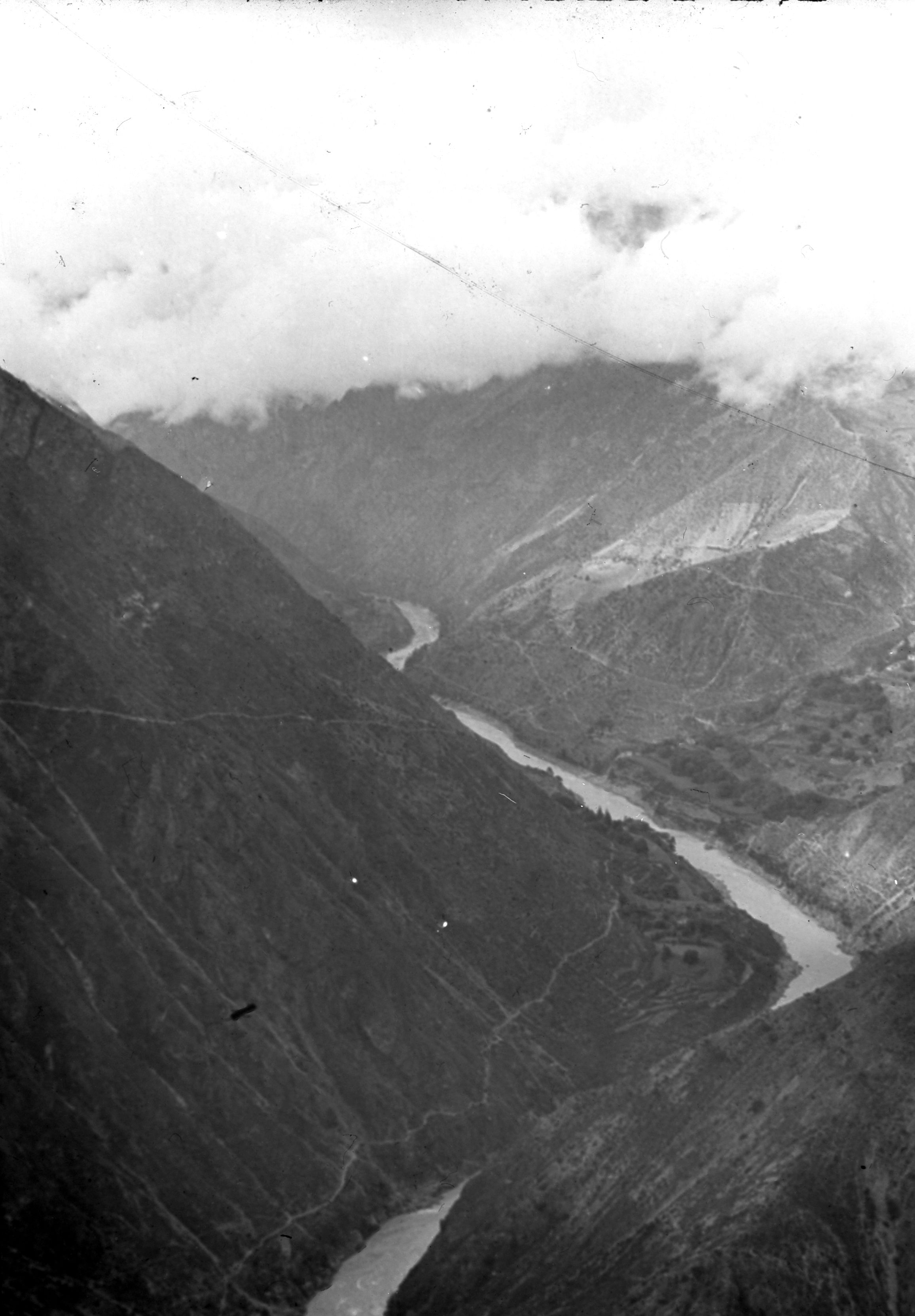
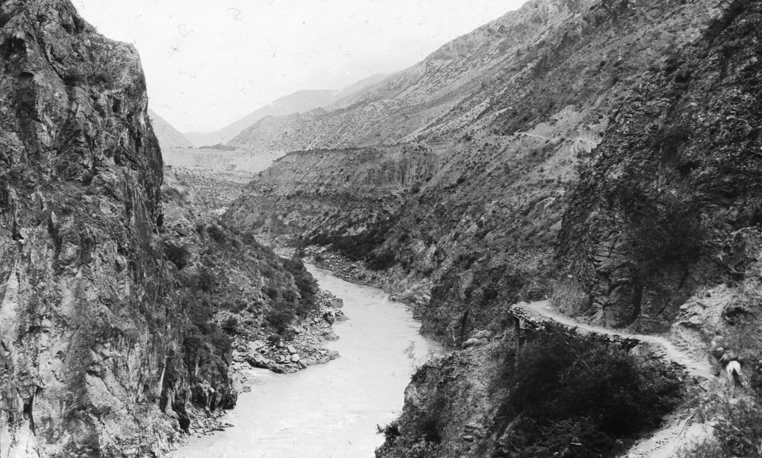
They followed the right bank of the river, travelling West. This is marked on the map just at the place where the Yangtze, here called the Chin-sha-Chiang, gave a sharp bend. The river was in flood and the whirlpools looked tremendously powerful. At one spot all the ponies had to be unloaded to pass a landslide. This of course meant delay, and they did not reach Shia ku till 5.30 p.m.

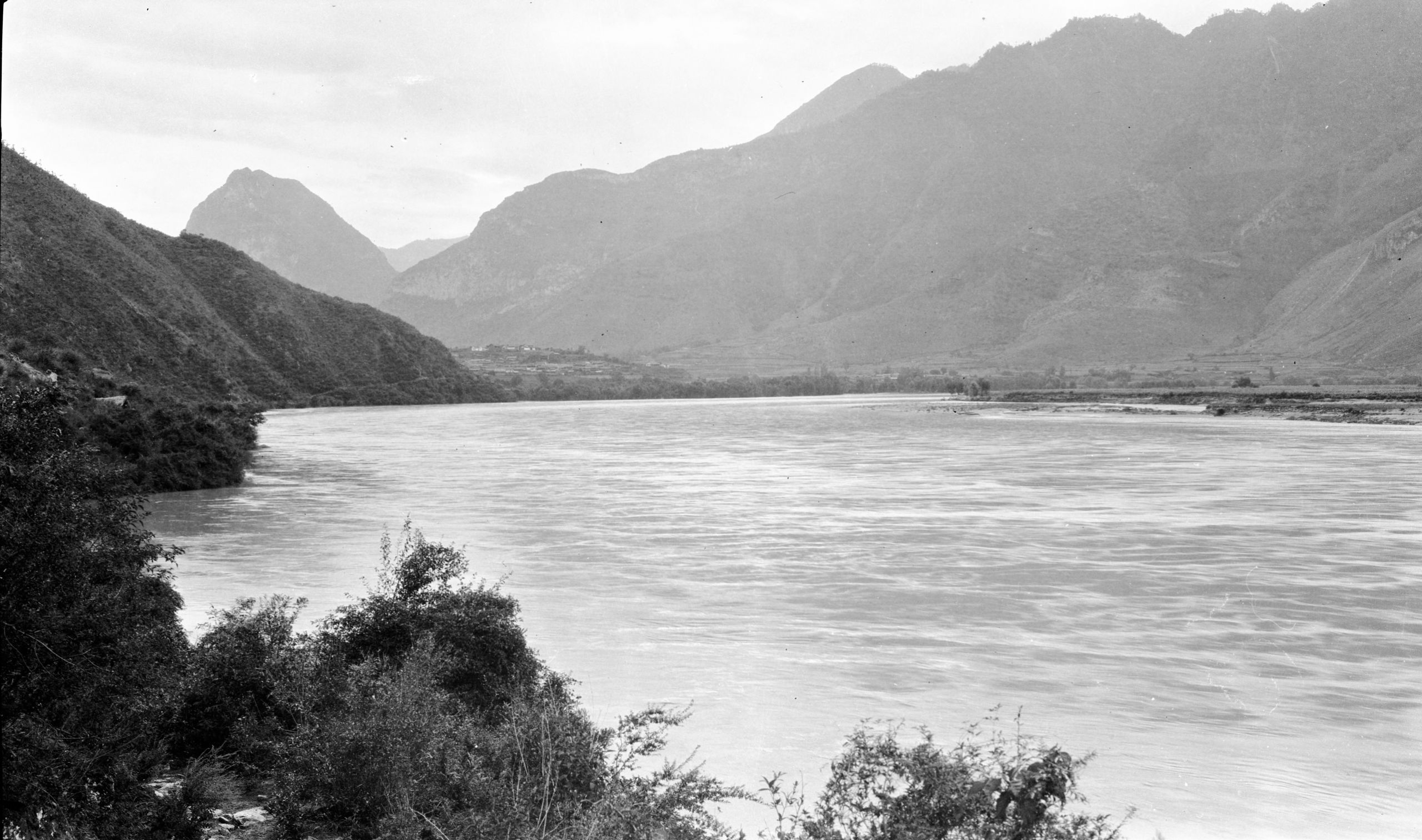
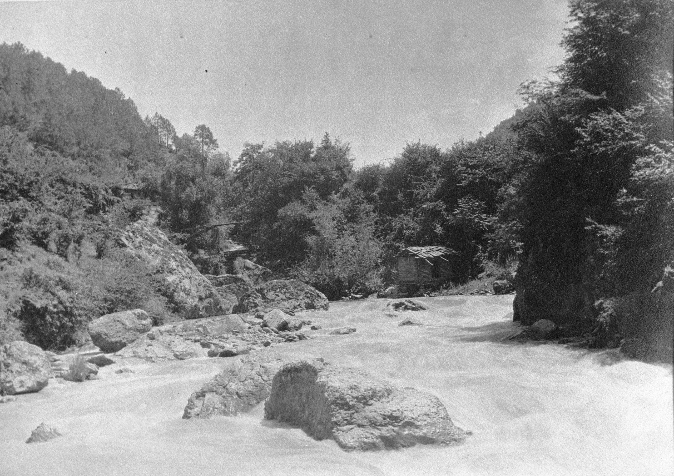
Shia-Ku at extreme Southern point of Yangtze bend
Shia-Ku at extreme Southern point of Yangtze bend
Shia Ku (5,900 ft.) 100 feet above the river, has two hundred families. It stood on a small hill, and had a great stony crag behind it.
“The weather is now quite chilly at night, and even in the day, only hot for a short time”.

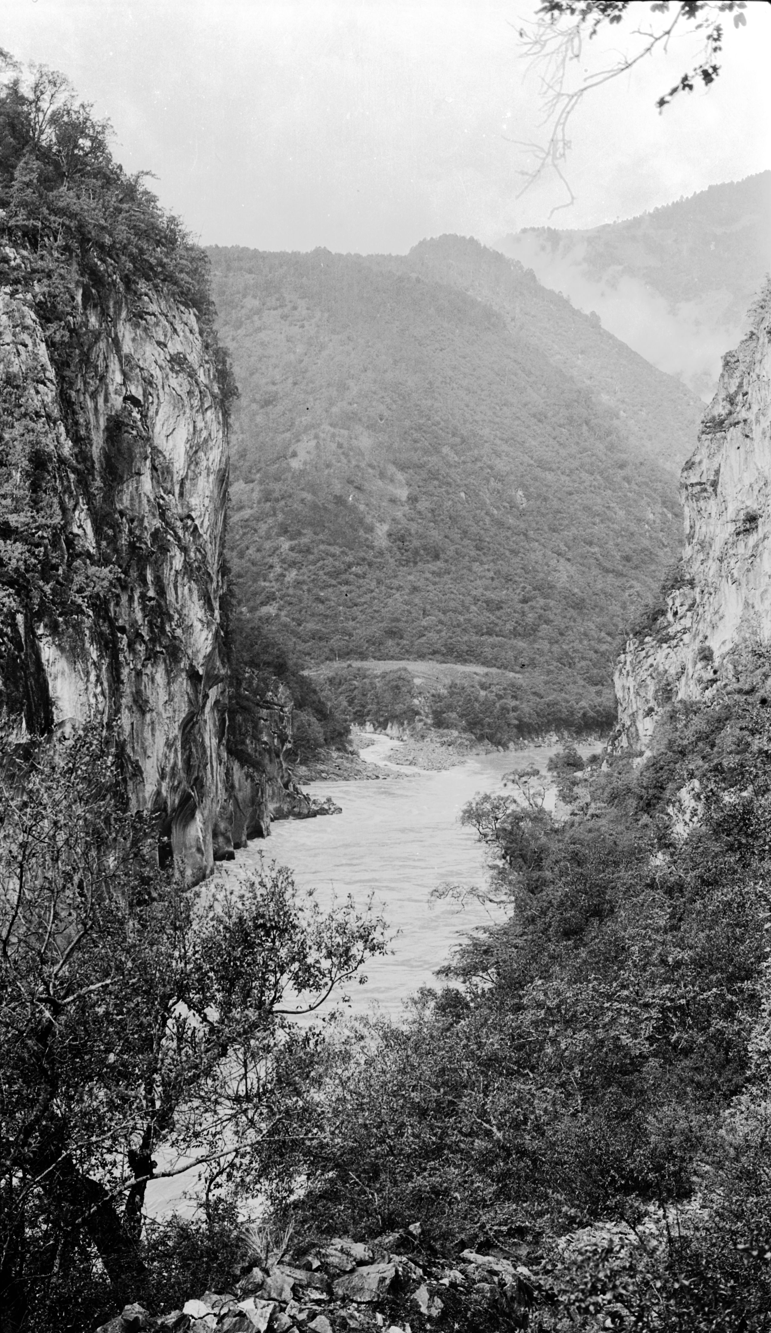
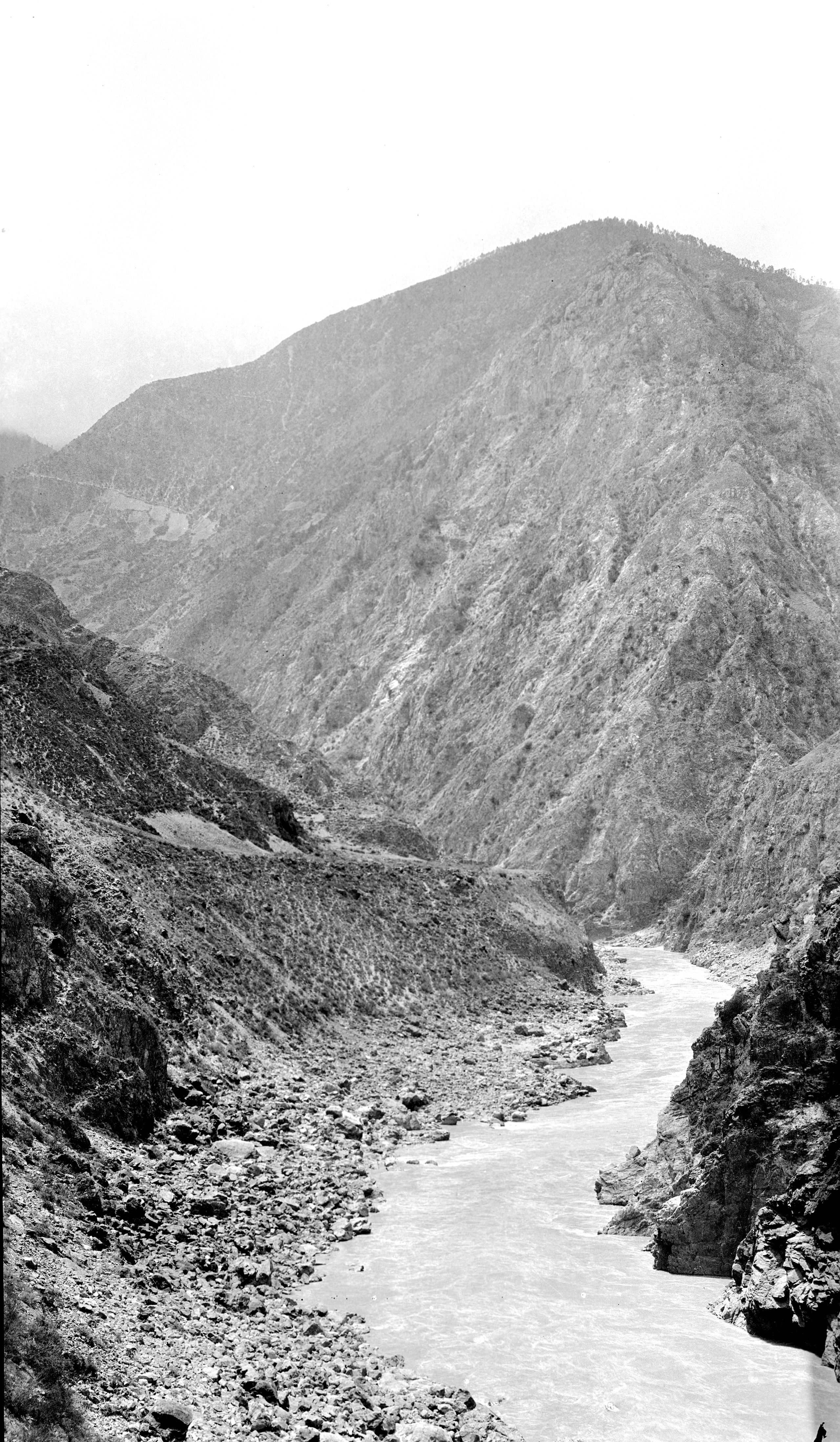
The Yangtze at the Chi-tien bend
The Yangtze at the Chi-tien bend
Day twenty-eight August 13th, 1923. Shia ku to Hsia Kai Tzu - 19 miles
They left Shia ku at 7.30.

Looking up the Yangtze (south to north) near to Shia Ku
Looking up the Yangtze (south to north) near to Shia Ku

Road just above the Yangtze between Shih-Ku and Hsia-Kai-Tzu
Road just above the Yangtze between Shih-Ku and Hsia-Kai-Tzu
The day’s journey might be divided into three parts - each about 20 li.
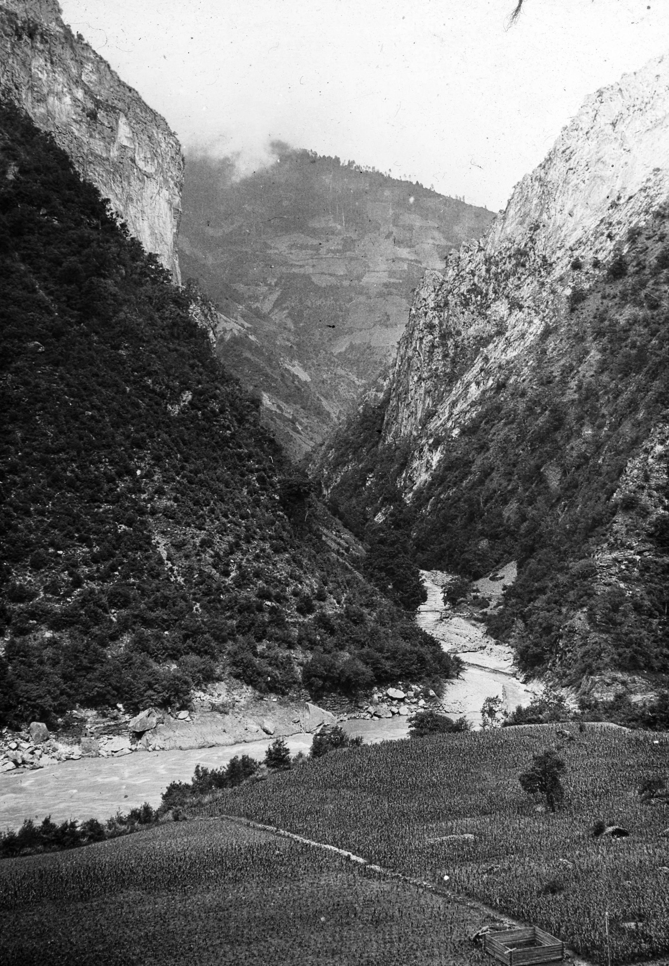
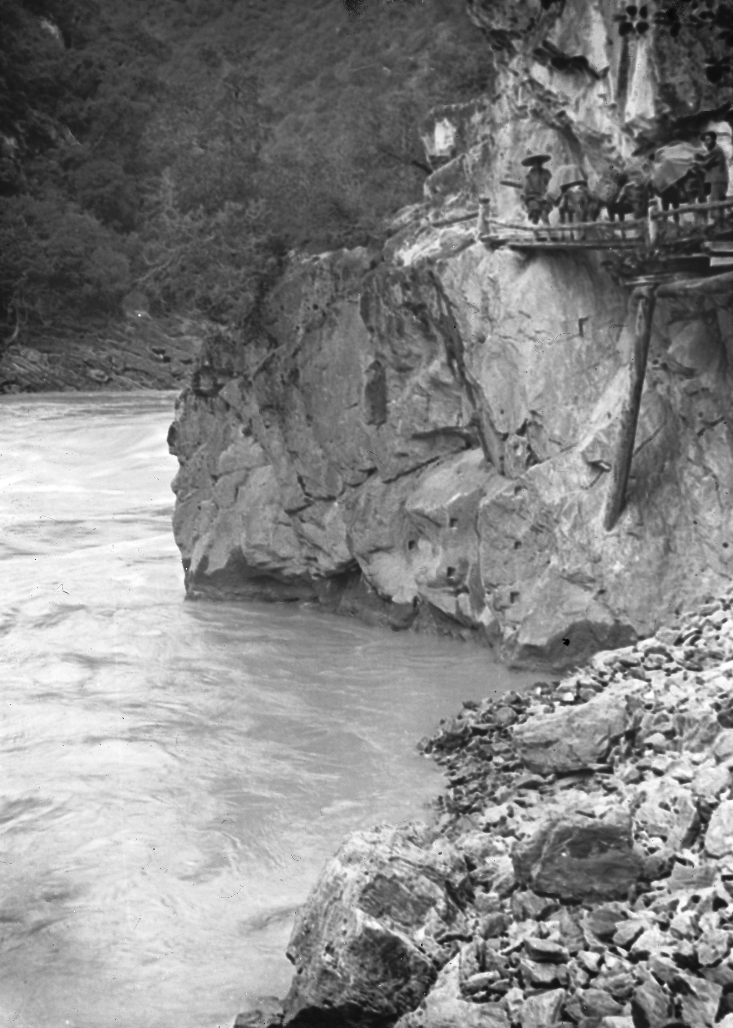
“We travelled on foot, following the River bank of the Yangtze - the river was in flood, and in many places the road had been covered but evidently the water had gone down and was a few inches below the road level. We first passed through the village of Mu Chi Ti. As we neared Shia Ku we passed by a temple on the road (Fig. 9). Then just before reaching Shan Shia Ku we passed under a huge vertical cliff of rock, rising about 500 feet straight up. The road being practically cut out at its foot - A wonderful road!!”
“Hello - here are folks for medicine. I generally see a few each day after arrival and a cup of tea - must stop!”

Road by Yangtze
Road by Yangtze
From Shan Shia Ku they they walked on to Hsia Kai Tzu (6,041 ft.) which in total was just over 19 miles. Hsia Ke Tzu had seventy-five families and at an elevation of 6,041 ft. The villages about were a good deal scattered, and sometimes broken up into two or three clusters.
Day twenty-nine August 14th, 1923. Hsia Ke Tze to Wu Luh Ting (or Tien) - 17¼ miles
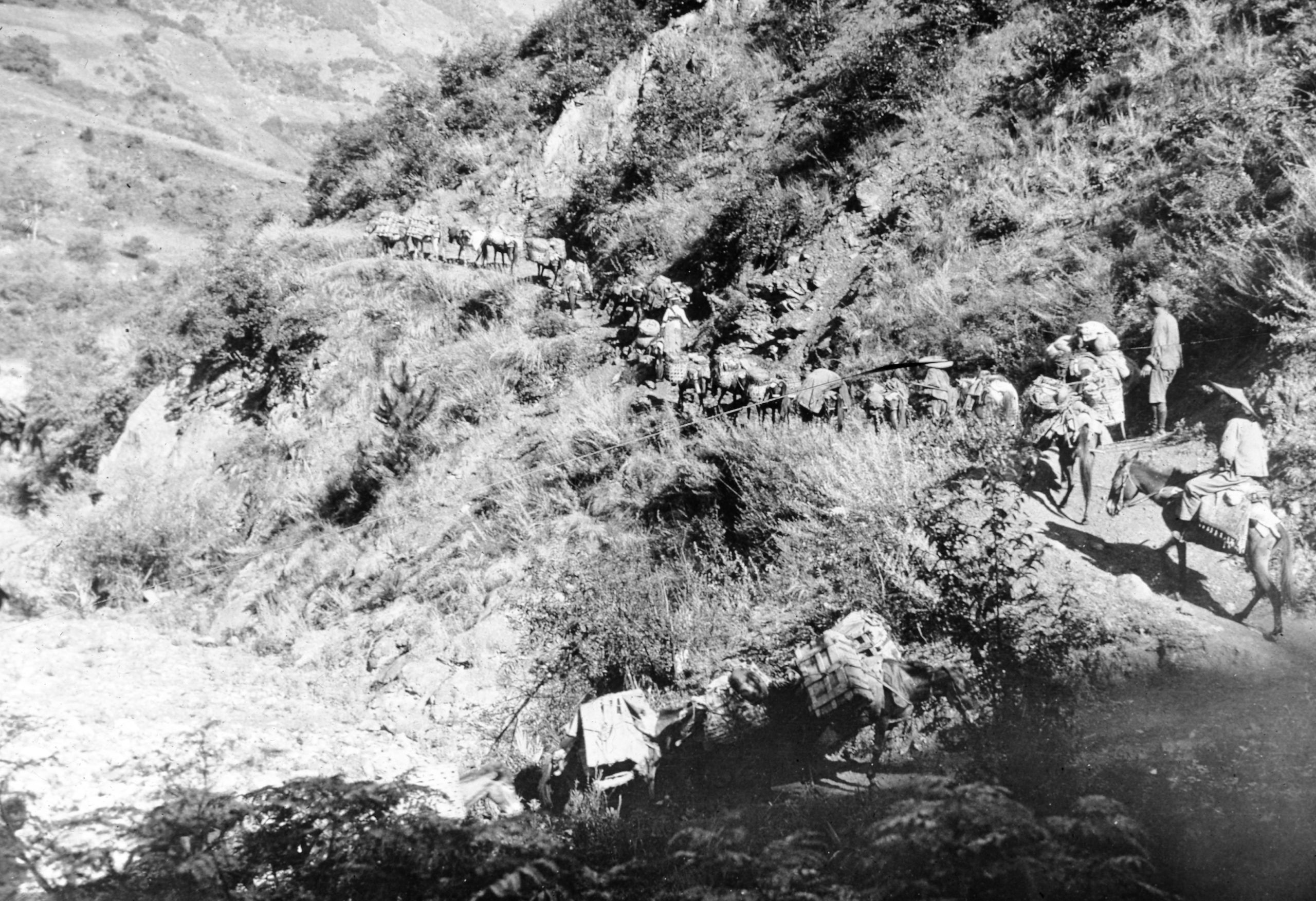
Two soldiers were sent to overtake them to advise that they went by the main road through Wei sheh to Atuntze. They had wanted to go on the smaller road via Peng-tzu-ya because there had been less landslides, but in view of this official advice, GP decided to follow the main road.

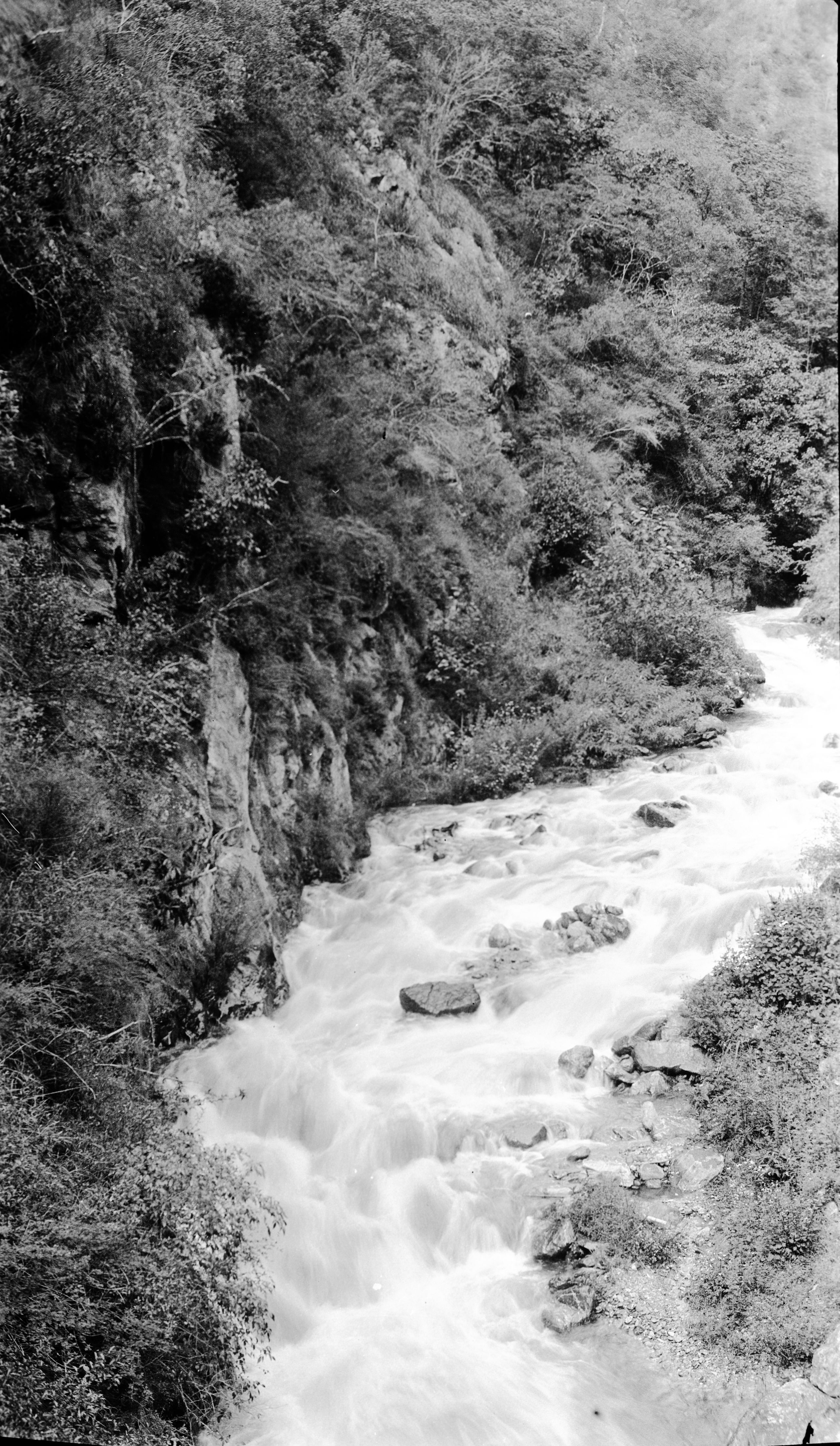
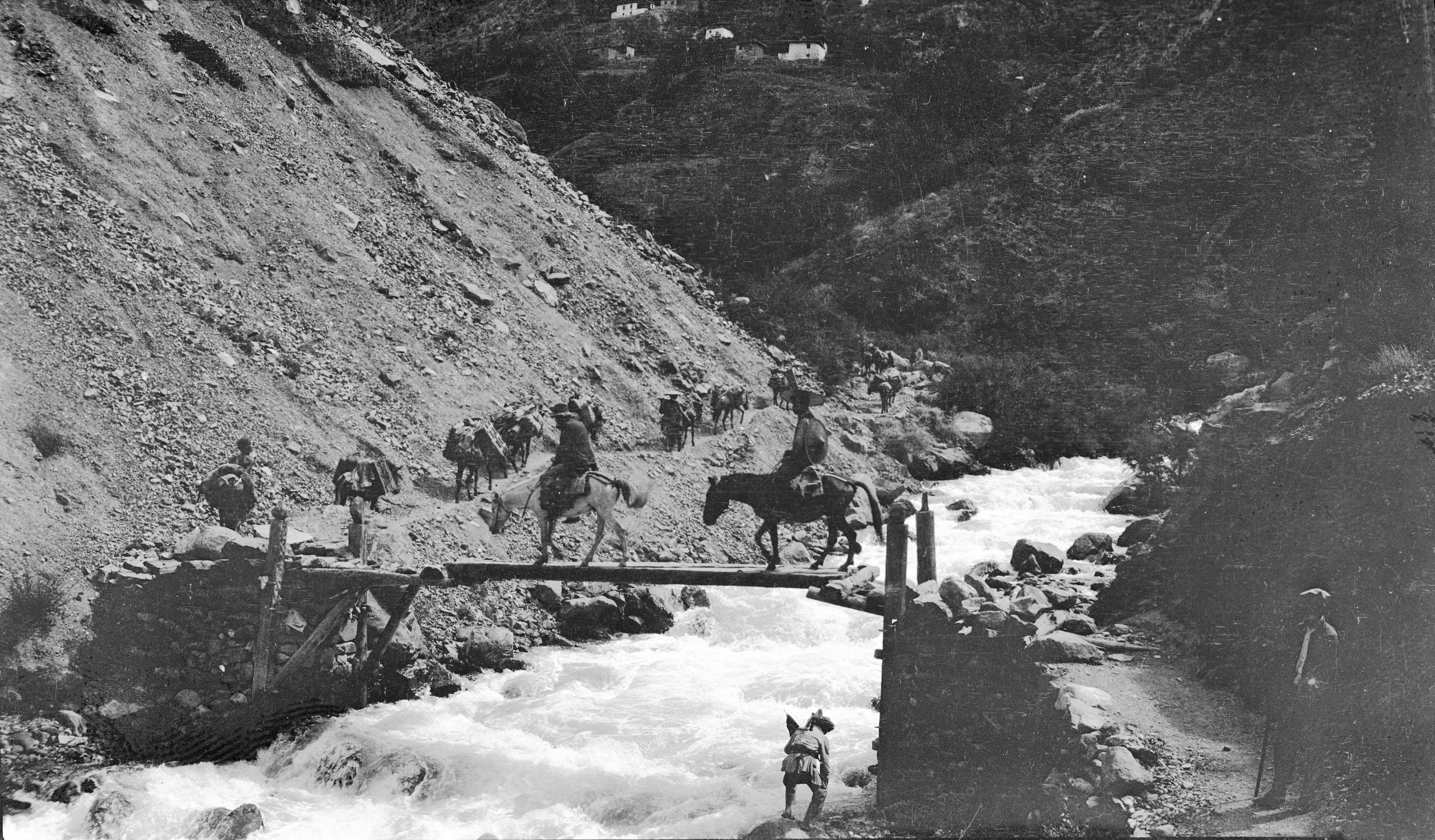
Bridge & falls at Hsia-Kai-Tzu
Bridge & falls at Hsia-Kai-Tzu
“We left Hsia Kai Tsu at 7.30 a.m and have had another day by the side of the Yangtze - following the river bank, travelling North and later on slightly West. It has been a glorious day, and we have come 17¼ miles - again I walked all the way, so you can tell I am in good condition.
“We rested at a place called Ch’iao Tuh, resting from 12 to 2 p.m. We bought some river fish - very like carp - not at all bad eating. It is fairly warm in this valley, and I hope to develop a photograph or two as soon as the sun gets down a bit”.
“The scenery today has been river scenery - the Great River always with us and great mountains on each side. Walnuts and chestnuts are grown in the low valley. Maize is the only crop, and no more rice now seen. The hills are sloping and well wooded. It is said there are many leopards in the woods. The rhododendron is locally called the Ch'a-shan-hua or Tea-hill flower”.
They arrived at Wu Luh Ting (6149 ft.) at 5.15.
Day thirty August 15th, 1923. Wu Lu Ting to La Pien Ku - 10¾ miles
They left Wu Luh Tien at 7.35 a.m. and followed the River bank of the Yangtze for 8 miles.
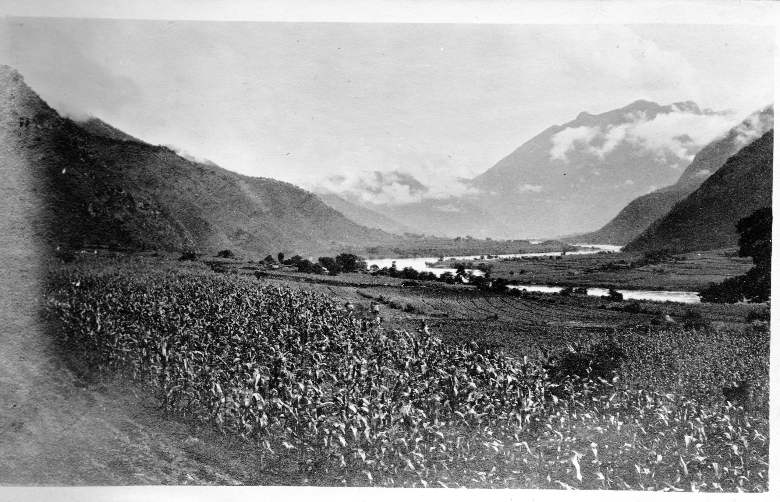
“Just before reaching the village of Chu Tien proper, we branched off to the left taking the Wei shi road. We walked for 2 miles along this pretty little river running down the Pa-tsi-chi Ho valley to join the Yangtze”.
“At 10¾ miles we reached La-p'ien-Ku (6149 ft.). Now the first signs of Tibet have appeared in the form of chortens and prayer flags. Outside the village we saw the first Chorten heap - or mané stones, with the inscription in Tibetan – om mane padme hum”.
In a letter home HGT said:
“Nothing special to note, except that (1) Pereira has just told me that we have travelled 444 miles to date, (2) I saw the first Tibetan prayer flags outside farm houses today - in fact this house in which we are has them - a long pole with a narrow flag like this”:-

HGT's sketch of a Tibetan prayer flag
HGT's sketch of a Tibetan prayer flag
Day Thirty-one August 16th, 1923. La Pien Ku to Lu-Tien - 16¼ miles

T’ai ping tang a typical hill top village near Sheh Ku crossing the Yangtze-Mekong divide
T’ai ping tang a typical hill top village near Sheh Ku crossing the Yangtze-Mekong divide
They started out in the morning at 7.25 a.m. Good weather until mid-day when they had more rain.
“We continued up the the pretty pine-wooded Pa-tsi-chi Ho valley, and at 6½ miles reached the top of the Hui-shao P'o, (7,477 ft.) From there we kept walking along the hill-side and at 9 miles reached the hill-top village of T'ai-p'ing-t'ang, (7,887 ft.) When the rain began we got on our ponies. After our mid-day halt for 2 hours, we arrived at Lu-Tien (8,107) a town of 310 families, at 4.45 p.m. The day’s journey was 16¼ miles in total”.
“We hope to reach Wei Shi tomorrow. It was too hot to develop last night, but I have got a film done this afternoon, which brings me up to date. Have seen about 10 patients since arriving here”.
Day thirty-two August 17th, 1923. Lu-Tien
“Rain during the night and this morning there is mist and rain so Pereira has decided to stay over today. I am rather sorry as I would have preferred the day in Wei shi. We are in quite a clean farmhouse - clean as things go, and so far, have managed to keep our bedding, and the things in our boxes dry. So if tomorrow is fine we will be glad we waited.”
“In the Lu-Tien valley rice as well as maize is grown. There are a good many walnut trees, some wild plums and a wild peach. Some rhododendrons are still in bloom at altitudes over 7,000 feet. Lutien, scattered among fields green with crops and clusters of trees and surrounded by high tree-covered hills, is very picturesque. Of the 310 families, roughly 60 are Chinese, 100 are Tibetan and 150 are Mosu. Three days' journey to the south are some Lisu. Maize is the chief food of the people, but they also grow wheat and barley for a first crop, and for a second crop buckwheat higher up, and rice lower down”.
“The religious character of the people is exemplified by our host. Three or four times a day he will go to the loft where there is a Buddhist shrine and will kotow before it, saying prayers and burning incense”.
HGT noted in his letter that he admired GP and that the two of them were getting on very well together. GP kept busy working out the calculations of their route and altitudes on his map. He planned, on reaching Batang to send a message, (by wire from Taehienlu), to send a wire to Yunnan-fu and to Peking to say they had arrived.
Day thirty-three August 18th, 1923. Lu-Tien to Wei Shi - 18 miles
They packed up and started from Lu-Tien in fairly fine weather, but soon mist and rain arrived. They climbed for 2,600 feet through woods by easy zigzags to Ta-shih-t'ou P'o, (10,755 ft.), also called Si-jam-bu in Mosu, which they reached at 5 miles. They were in a kind of hollow in the hills, and it was the divide between the watershed of the Yangtze and that of the Mekong. It was 4,760 feet above the Yangtze, which they had left at Chu-tien.
“Having reached the valley, we travelled along 3 miles of the most beautiful level country with lots of flowers. The most numerous one was a yellow prunula and there was also a beautiful little purple flower like an anemone. We also saw a huge flock of sheep and goats, probably about 250, grazing on the wide level space - which had a most delightful carpet of grass and was surrounded by thick woods of pine, and maple, and fir”.
“After the 3 miles of undulating grassy plateau, we came to an old Lisu hut at Li-ti P’ing. It was beginning to rain as we stopped for our mid-day halt. We had lunch in the shelter of the old disused hut. During lunch it began to rain heavily, so we hurried up and started again at 1.15 p.m”.
“It poured with rain during the afternoon and we got soaked”.
“At 16½ miles after a slight rise, it was all downhill - a drop of 3,700 feet. The descent in spite of the rain, was beautiful - through great pines 50 to 60 feet high - the road running for the most part along the top of a great spur of hill. Occasionally the mist lifted and we got a brief glimpse of a great range of mountains opposite, which evidently helps to form the Mekong valley. As we went down we crossed 2 streams, swollen with the rain.
“I was so wet that I paddled through one, the little bridge was gone - the water only came up to my ankles but as my boots were already soaked inside and out I did not mind. I had walked up to the top and now got into my Burberry and waterproof cape and walked down. It was a hard tramp, as it poured with rain. I kept dry above, but from 6 inches above the knees and downwards I was just soaked. As I was nearing the bottom, one of the Tibetan muleteers overtook me and one of the escorts. I sent them on to find a place for the night in Wei she and followed on down”.

Looking South along the Mekong Wei-Shi in distance
Looking South along the Mekong Wei-Shi in distance
“At last Wei shi came into sight. A nice river running North, made the approach very pretty. The Wei-shi Ho was crossed by a high, open, and very well made wooden bridge and after the day’s journey of 18 miles, we arrived at 5 p.m. at Wei shi-hsien (7,016 ft.), a city of 250 families. In the city the population was Chinese, in the valley Mosu, and in the hills Lisu.
“I was met by the muleteer who took me to a house where we are to stay. At first the people did not want to give shelter and offered to show them an inn, but when I told them how wet and tired I was, they became very friendly. They brought some tea, a charcoal fire in a brazier, and felt mats to sit on”.
After about 20 minutes GP and the rest of the caravan arrived.
“Before changing I went to the Post Office to see if by any chance there were any letters. I then went to the Gospel Hall, run by a Mr Lewer. Mr. Lewer showed me around his new house and told me to help myself to vegetables. I got two cabbages, two cucumbers, a few beans and the caretaker promised to bring down a little fresh milk. I was glad to get back to the place where we were staying and get a change into dry things. I stretched out two lines and set the things to dry”.
Day thirty-four Sunday August 19th 1923. Wei Shi
“It is Sunday, and pouring with rain today, so we decided to wait over a day, especially as Pereira was a bit off colour. I dosed him up and advised him to keep quiet, so he stayed cosy in bed for breakfast. It was very raw and cold. GP wrapped himself in his great coat and I got out my fur waistcoat and was quite glad of it. After breakfast, I walked up to the P.M.U. Gospel Hall, but as Mr. Lewer was away there was no service".
“The Hall is being looked after by Mr. Hwong, the evangelist, and Mr. Tuh the caretaker, who were very pleasant. I went with Mr. Hwong to his home and saw 3 patients there. One was the builder of the new house, who since the 3rd month has developed glands in the neck, which appear to be malignant. Local people had said it was because he is building for the missionaries – I fear it would prove fatal within 12 months. He saw some more patients during the day - altogether 12.
“On returning to our lodging, I found GP feeling better and up and about. It poured with rain all day, but began to clear at dusk and by bedtime the mountains were visible, and things looked better”.
Day thirty-five August 20th, 1923. Wei Shi to Ka Ka Tang - 14½ miles
Weather fine - sunshine. They left Wei shi at 7.15 and then stopped a little over half way at La Puh-an-Tong. At 4 ¼ miles they crossed the Wei-si Ho by a bridge to the right bank and continued down the valley, passing over the lower spurs.
GP noted: “Ninety soldiers, mostly boys, were also going to A-tun-tze, and passed us twice on the road. Some of the soldiers, besides the officers, were riding. The transport consisted of a few mules, and often the muleteers were carrying seven rifles apiece”.

Falls between Wei Hsi and Ka Ka Tang on the Wei Hsi river
Falls between Wei Hsi and Ka Ka Tang on the Wei Hsi river
“After 8 miles the hills were more sloping and the trees more in clusters. The scenery was beautiful. We had 1¼ hours rest at lunchtime and then travelled on to Ka Ka' Tang (6312 ft.), arriving at 4 p.m. Total distance 14½ miles. Walked all the way. Steady downhill, quite easy going. It was quite hot again, in the sun”.
Ka Ka Tang had 13 families. The people in the village were practically all Chinese, with a few Tibetans. The Mosu and Tibetans (who round there were called Lamas) mostly lived on the hill-sides; and the Lisu lived behind in the higher ranges. GP noted: “the milder Lisu had been pushed back at first by the more virile Mosu, who had assimilated more with the Chinese”; and then “the Mosu in their turn had had to give way to the Chinese”.
“We found a good clean house to stay in at the extreme North end of the village. It has a crescent opening cut in its wooden wall and is quite clean and new. It seemed that there would be 3 sleeping in our room that night, as there was a coffin at one side, fortunately it was well sealed. Later we found the coffin was not inhabited; it was the property of the old main proprietor. He said it was ready for his decease”!
Day thirty-six August 21st, 1923 Ka Ka Tang to Hsiao Wei Shi (Little Weishi) - 19¼ miles
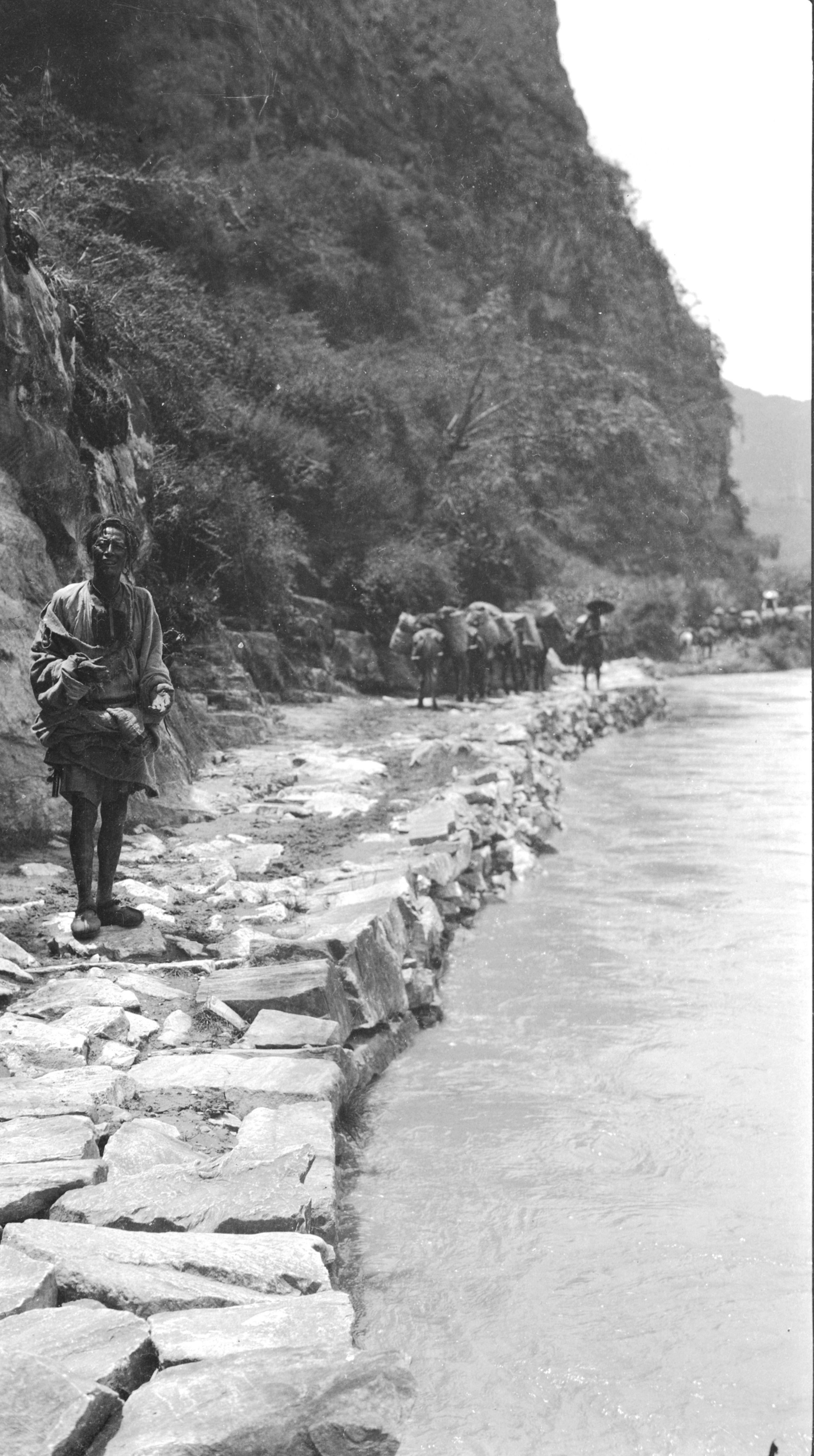
“A wonderful day's journey. We left Ka Ka' Tang at 7.20 a.m. and followed the Wei Shi River. There were numerous places where the path had almost slipped away, and the muleteers had to get one on each side and give the mules a push as they passed over, lest they should toboggan down with the loads”.

Near the landslides between Ka-Ka-tang and A-nan-doh-t'ang
Near the landslides between Ka-Ka-tang and A-nan-doh-t'ang
“The Chinese now appear not to describe distance in li - all is reckoned in Tong - which is very variable.The journey is divided into three Tong - each Tong said to be 30 li - but really it only means a section. The first tong being 5¾ miles from Ka Ka' Tang to the little hamlet of A-nan-do-t'ang”.
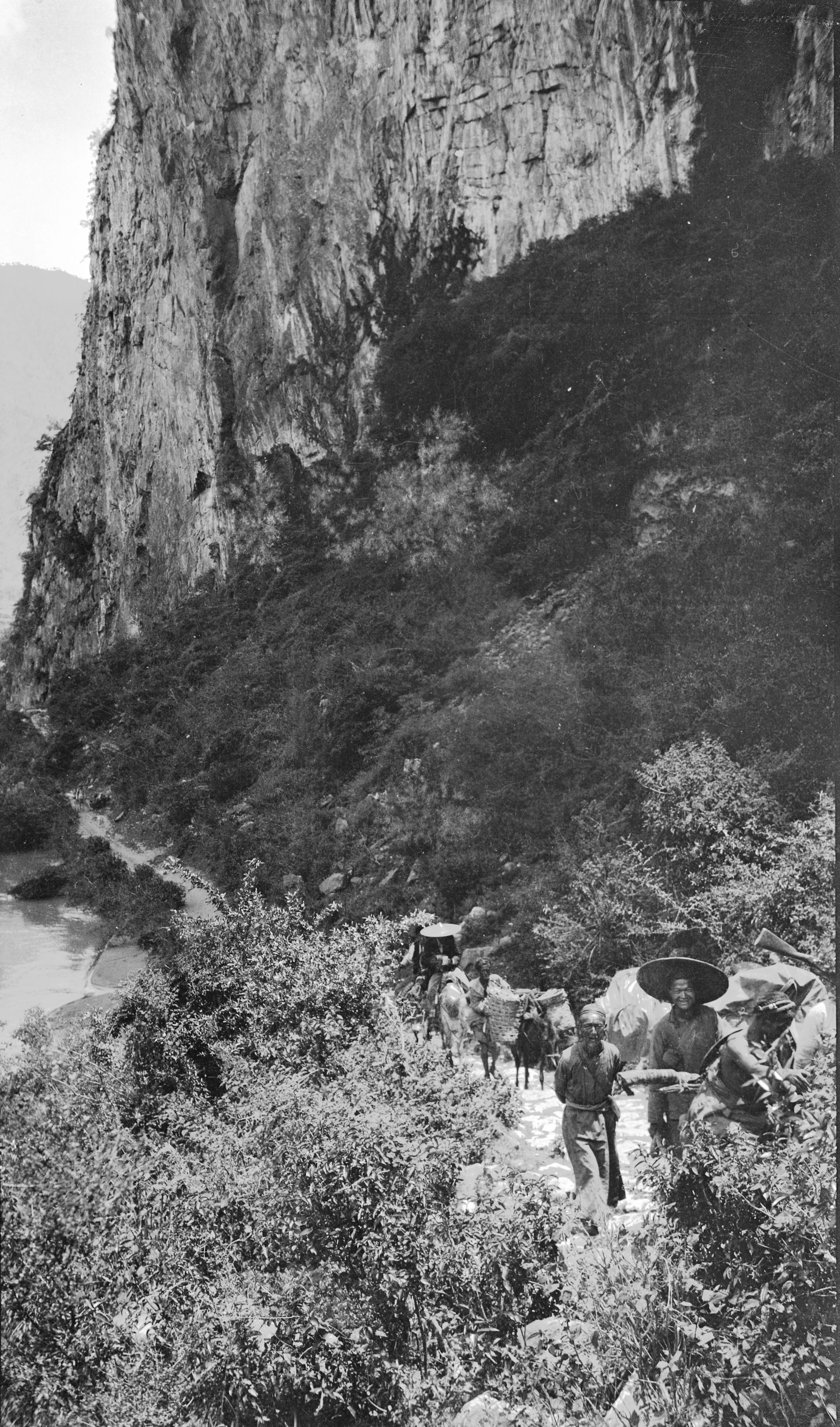
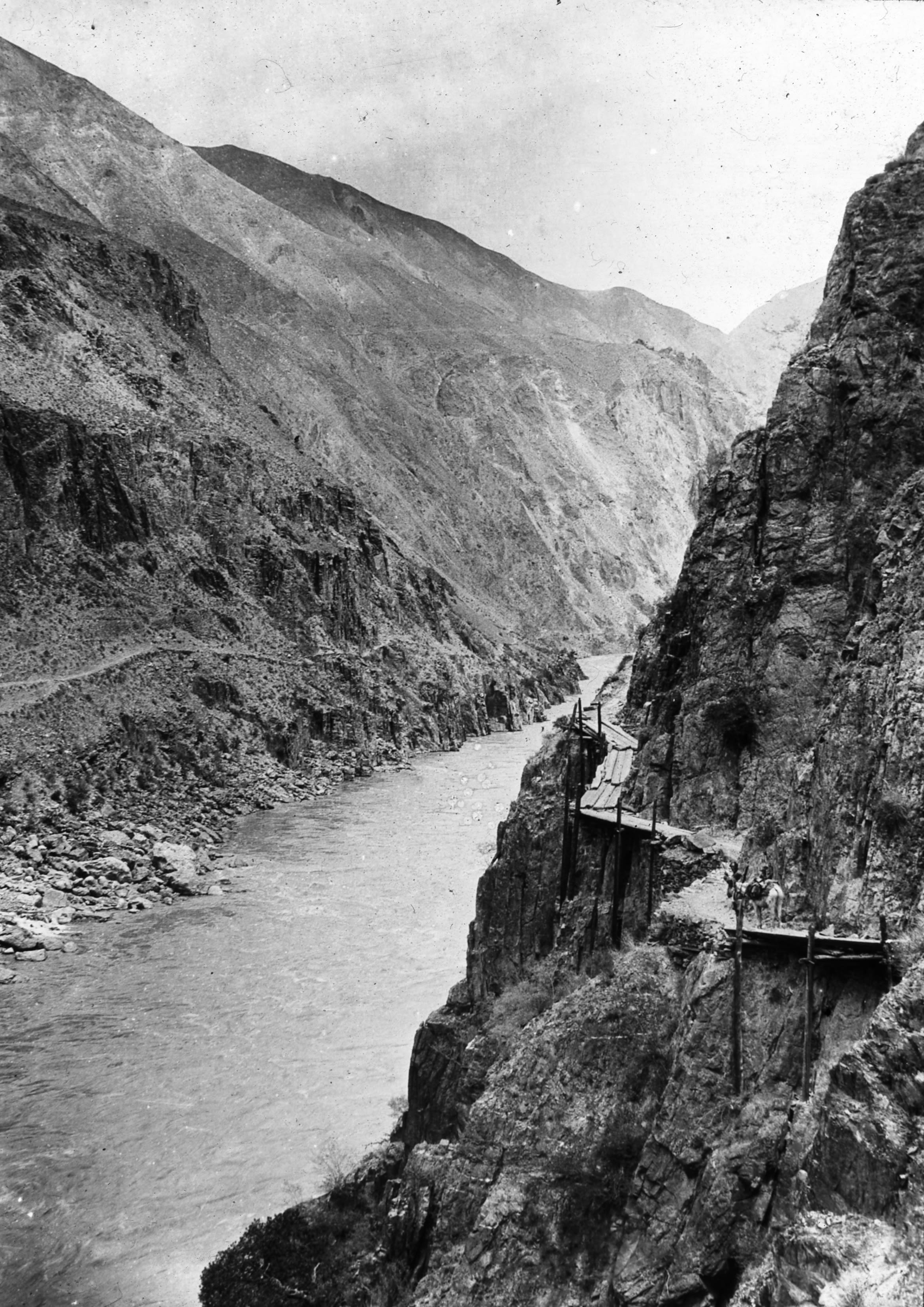
“The second part of the journey to Peh Chi Shun (6 miles) was the most interesting, for the Wei shi River suddenly gave a big bend to the West and as it were, broke its way between two big mountains, great cliffs on each side, and the foaming torrent below. The road was cut out of the rock in places – like the gallery at the Si Shan (or Xi Shan) temple in Yunnan – with the cliff going vertically down to the water's edge - about 200 ft. below”.

The breakthrough of the Wei-shi river to the Mekong approaching Hoh-chiang-ch'ao. Transport on the road
The breakthrough of the Wei-shi river to the Mekong approaching Hoh-chiang-ch'ao. Transport on the road
“In one place the path was cracked and it seemed as if the next rain must certainly bring it down - the muleteers carefully piloted the mules over. I should have been rather anxious for the loaded mules if the weather had been bad - fortunately it was a glorious sunny day, and the road being stony and sandy, had quickly dried”.
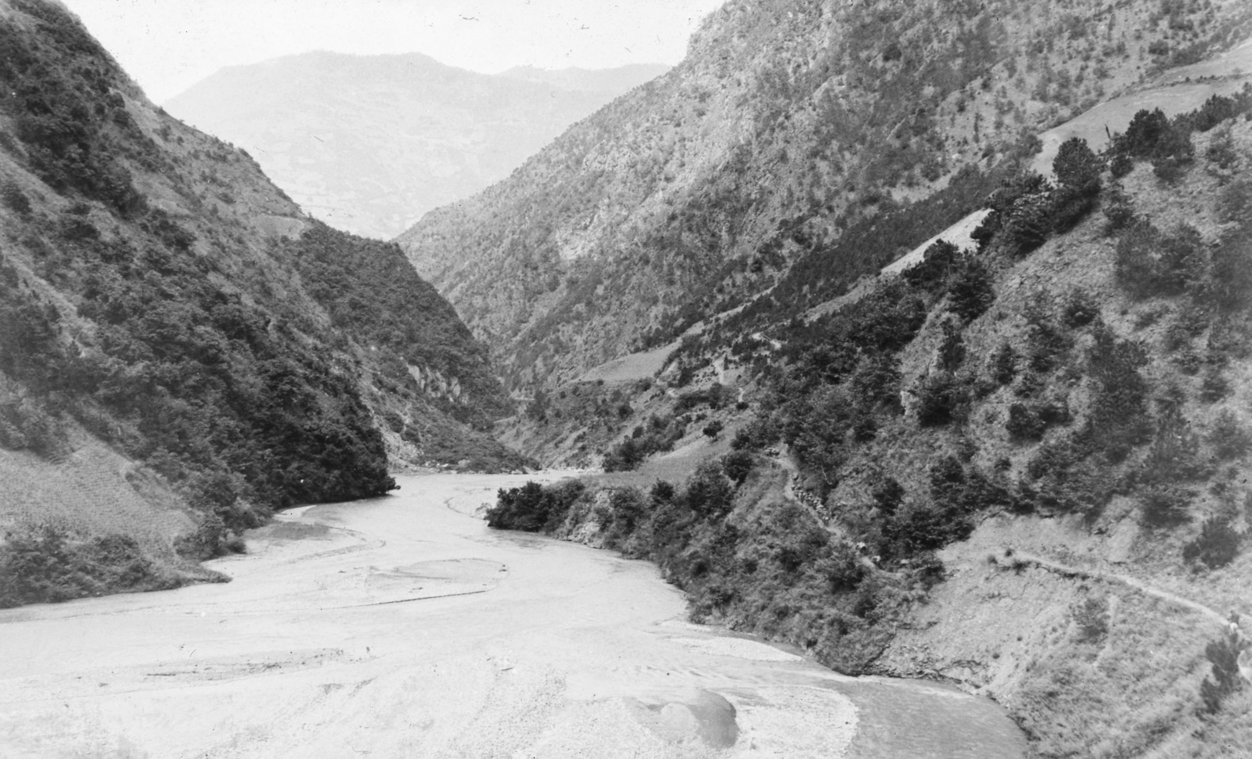
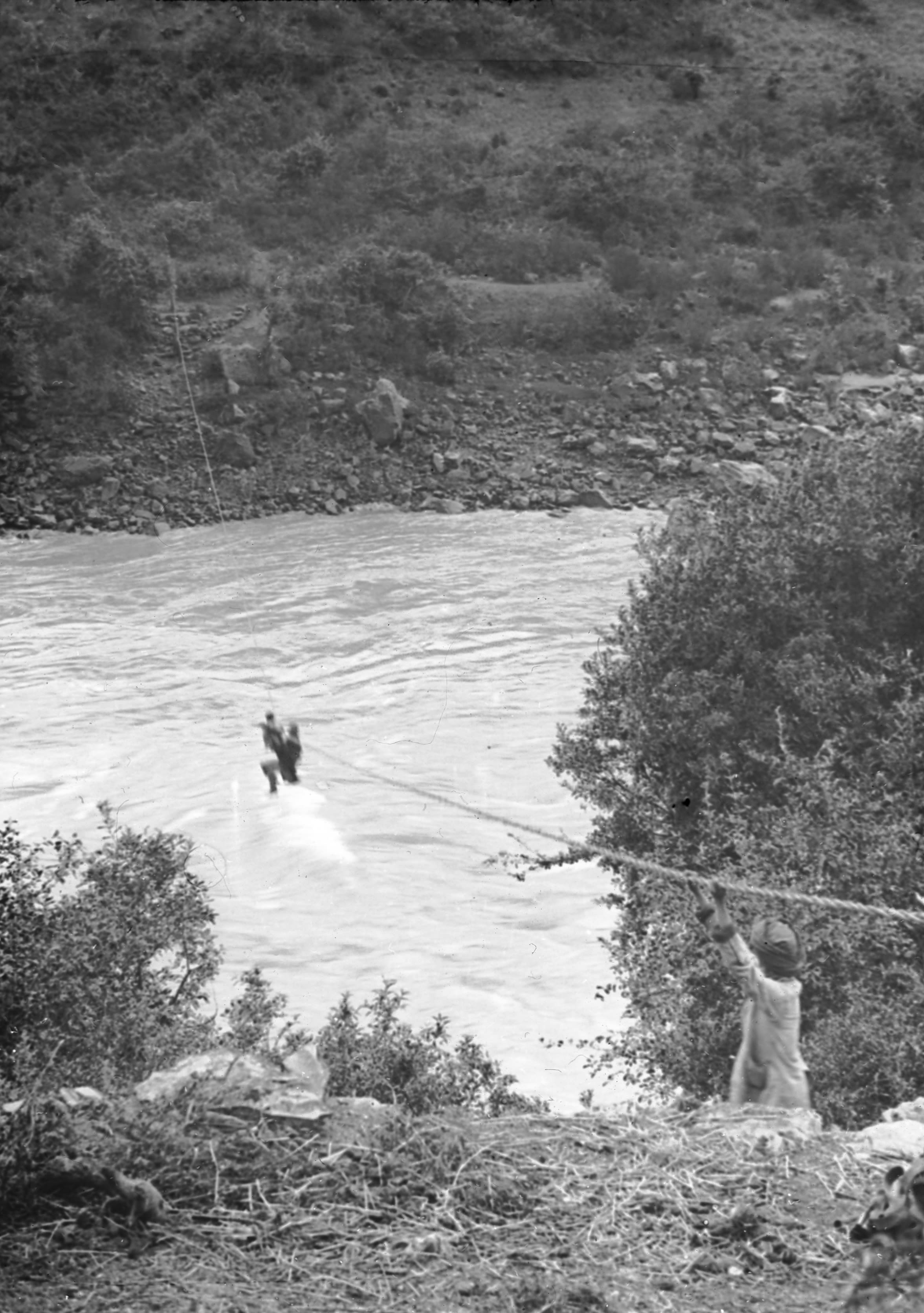
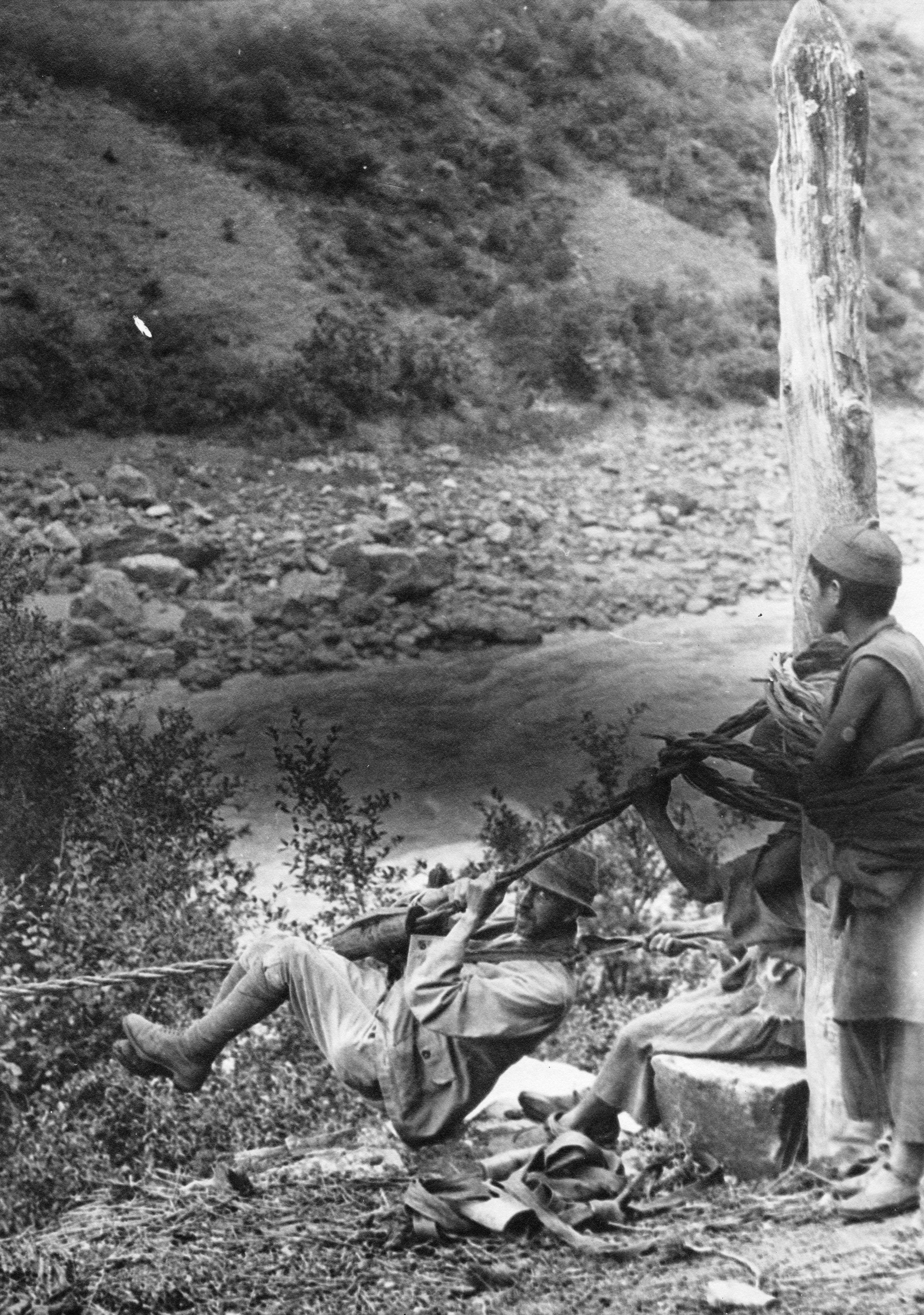
“The road then lead down the narrow and beautiful Alando gorge between high, precipitous, rocky, wooded hills. After a mile or two through this gorge - suddenly the Mekong came in sight - a wide rapid but placid river, such a contrast after the roar and noise of the small Weisi River in the gorge. The river at this point (altitude 5,896 ft.) was called the Lan-tsang Chiang or Dza Chu.The road then turned North and we were at Hoh Chiang Ch'ao where we saw our first rope bridge - a most extraordinary way of getting across the River".

Rope bridge on Hoh-Chiang-ch'ao (Mekong)
Rope bridge on Hoh-Chiang-ch'ao (Mekong)
“A big rope made of twisted bamboo is stretched between two posts on opposite sides of the river. There is naturally a sag in the rope - each man who wishes to cross has his own apparatus, consisting of a short piece of thick bamboo, with one side cut away - forming a slide on which the sling is fixed. The sling consists of a piece of cloth or rope on which the passenger sits, another piece of rope slings the head, and a third the knees. When ready the man pushes himself off and slides rapidly down to the middle of the sag, about half way across the river - then he hauls himself up hand over hand to the other side. In some places there are two ropes a little distance apart, with the end on one bank higher than the other, so that one can slide practically all the way across. The second rope has the highest end on the opposite bank, and is used for the return journey. The rope bridge at Hoh Chiang Chao was about 150 yards long”.

The breakthrough of the Mekong between Peh-chih and Kuan-fun-Ping (5½ miles from Pau-teh)
The breakthrough of the Mekong between Peh-chih and Kuan-fun-Ping (5½ miles from Pau-teh)
After lunch at Hoh Chiang Chao (altitude 5,394 ft.), they set off again at 1.20 p.m. and in about ¼ of an hour were passing through Peh Chi Shun (5½ miles from Pau-teh), a good sized village with a paved street and houses on each side. The road then lay along the left bank of the Mekong River and at 5 p.m. they arrived at Hsia Wei Shi (Little We Si). They were then told that this was not the end of the third Tong, but that was at a place called Ai Wa.
“The road by the side of the Mekong is very pretty; numerous walnut trees helping to shade the path. On the West bank the mountains rise abruptly to several thousand feet, and on the left, or East bank, they seem to do the same, but we can not see it so well as we are travelling under the lee of these mountains”.
“Having arrived at Hsia Wei Shi (5610 ft.) we are now staying at the R.C. Mission. The Chinese priest, a very pleasant man has put a room at our disposal and we are very comfortable. He says there are only about 30 families, four-fifths Chinese and one-fifth Mosu. Li Su live all round on the hills. The R.C. mission has a small school with about 7 children.
Day thirty-seven August 22nd, 1923. Hsiao Wei Shi to K'ang Pu - 17 miles
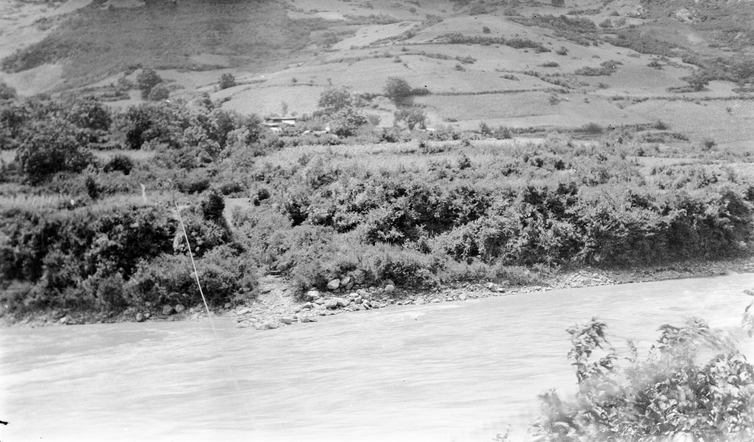
Another day - following up the left bank of the Mekong – They left Hsiao Wei Si at 7.40 a.m. The going was easy all day, without any steep climbs. The hills were mostly sloping and well- wooded. The crops were maize and millet and, when the valley was more level, rice. At Ai-wa (5,448 ft.), after 7½ miles where they rested, there was a ferry boat, but the road to A-tun-tzu continued up the left bank of the river, and three or four tributaries had to be crossed by rope bridges.
“In the hills we are told there are leopards, bear, roe, wild boar, and serow (a type of goat or antelope), but no pandas or tigers”.
“The Mekong seems somewhat different to the Yangtze in that the banks slope very steeply up, whereas the Yangtze banks are either vertical or slope gradually, with lots of cultivated land. The amount of land which can be cultivated on the Mekong appears to be small, though one can see away up on the mountain sides several thousands of feet above the river - occasional Lisu cottages with a patch of cultivated land, growing mostly millet and maize”.

Along the Mekong to NW nearing Kang-pu
Along the Mekong to NW nearing Kang-pu
Ai Wa to their next stop, Kang Pu was 9½ miles. From Wei shi they were accompanied on the road by about 70 soldiers under two officers, who were also travelling to Atentze.
“They (the soldiers) are an awful nuisance as they take all the best accommodation at the stopping places. Fortunately they are staying a day at tomorrow night's halt, so we shall get a day ahead”.
“During the day’s journey, as I was tramping along ahead of our caravan I overtook one of the soldiers (their main body was on ahead). He had got a kind of dysentery and had been left behind to find his way to Kang Pu as best he could. After examining him, I gave him my pony to ride, and we travelled on to Kang Pu together. I later gave him some medicine for the dysentery. He was very grateful. Most of these ‘soldiers' are mere boys. They are provided with no protection from the weather. GP says this is disgraceful”.
That night for dinner at the inn in Kang Pu (5933 ft.) they had three courses - soup, chicken and potatoes and vegetable marrow and stewed fruit.
Day thirty-eight August 23rd, 1923 Kang Pu to Yueh Chih - 14½ miles
“Today we have had another day following up the left bank of the Mekong river. It was only a short stage today, 14½ miles. The country got wilder and the path lead alongside the river up narrow gorges between steep well-wooded hills, with only an occasional farm or patch of cultivation. At 4½ miles there was a steep climb of 800 feet, and then fine views to the north”.
“Three streams break through the mountains, the eastern stream piercing through a great wall of red and grey rock, showing high hills beyond with patches of cultivation, the work of Lisu. At 5½ miles the road descends to the river again and passes by the wonderful La-p'u-Lu rapid, which GP says are the wildest he has ever seen. Here the mighty Mekong, restricted to less than 40 yards in width, thunders through the gorge, the muddy waters in their wild career dashing against the rocks and being churned into great white waves”.

Breakthrough of a tributary of the R. Mekong coming through white limestone cliff
Breakthrough of a tributary of the R. Mekong coming through white limestone cliff
They did two-thirds of the distance to Siu Tong before lunch – having left at 7.40 a.m. they arrived at their lunch place at 11.15. HGT set off again with the Tibetan boy at 1.5 and arrived at about 3 p.m. after walking all the way. They had gone on ahead so as to get a place fixed before the caravan came up.

Hollow pillar for burning twigs etc to the Spirits of the Hills, one mile north of Kang-pu
Hollow pillar for burning twigs etc to the Spirits of the Hills, one mile north of Kang-pu
“One mile after leaving Kang Pu we came to a white hollow pillar, used for burning pine twigs, a Tibetan custom in connection with spirit worship and bones of their ancestors. Next to it was the usual pile of stones, a mani chorten and a prayer flag on a post".

Cliff road zig zagging upwards by Mekong between Kang-pu and Yueh Chi
Cliff road zig zagging upwards by Mekong between Kang-pu and Yueh Chi
After travelling 7 miles they climbed up the bank of the river to a height of about 500 feet. As the bank was too precipitous for the road, the path went zig-zagging upwards. At the highest point were another two white pillars with the usual om mane padme hum inscription. Then they decended again to the River.
“On the opposite bank there was a most striking example of a river breaking through two great vertical cliffs, of whitish stone, and a small clear river rushing between to join the Mekong”.

Breakthrough of the Mekong near Puh-ti
Breakthrough of the Mekong near Puh-ti

Ta-chiao tributary of the Mekong near Puh-ti
Ta-chiao tributary of the Mekong near Puh-ti
“Immediately after this we entered a wonderful gorge - with the La-p’u-Lu rapids. At this point, the great Mekong river narrowed down to about 40 yards passing between vertical walls of rock, with huge boulders in the bed.
“To see the great mass of water tearing through such a narrow channel - roaring and boiling, as if angry with the delay, was a sight not to be forgotten. The rapids were about ½ a mile long, and one had to shout to make oneself heard”.
They mistook a hillside village for Yueh Chih and went out of their way for about a mile, so had to hurry back to get to the proper place before the mules arrived, and they stopped for the night. Yueh Chih (5825 ft) was a village of fifty-five families, Chinese and Mosu.
Day thirty-nine August 24 1923 Yueh Chih to Pa-Ti - 20 miles
Another day nearer to Atentze – they had now gone 5 days out of the anticipated 9 days journey from Wei shi to Atentze – they thought they should arrive on August 28th.
They left Yueh Chih at 7.30. It was raining so HGT rode on the pony for a couple of miles, where the road passed through paddy fields and was very muddy and then when the rain was practically over, he walked the rest of the way - Total distance 20 miles.
“During the morning, we passed some Lisu working in the fields and one woman had a curious head-dress with about 3 rows of cowrie shells. Half an hour later I saw a little girl with a similar head-dress, but covered with cowrie shells and little straw tassels hanging down at the back. I reckoned that there were about 300 shells. On enquiring we found that this is quite a common head-dress amongst the Lisu families about here. The shells come from Burma and cost 100 to the tael - Frequently 700 are used, which would mean it costed about 10 dollars”.

A Li Su family and child with cowrie shell head-dress
A Li Su family and child with cowrie shell head-dress
“Most of the Lisu women carry and smoke a pipe with a long thin stem and a big wooden bowl. I gave the little girl a little cash and persuaded her father and mother to stand for a photograph - after showing them the picture in the view finder”.
“We stopped for lunch at Puh-ti on the banks of the Mekong, and just before reaching there, being on ahead, I caught up to a Chinese man and chatted with him. I found that he had been in the employ of the French merchant at Atentze and he gave us much information about the road etc."
“The trouble up near Batang was now over, that it was as we had heard before, fighting between the two lamas - -Kang K’a lama and Lan K'a lama. That Kang K'a lama had come out top and that now they had made peace. The fighting took place in the Chinese 4th month - we reckoned that this was probably early in June, and this was probably about the time Mr. Weatherbe was up there. Hence this was most likely the reason why he was turned back.”
“As peace is now made we hope that things will be alright when we get there”.
"At Puh-ti, 13½ miles from Yieh Chih, we bought two fresh fish (probably carp) and had one right away for lunch. It was delicious. We had the other for dinner that evening”.
Leaving Puh-ti at 2.15 they pushed on and arrived at Pa-ti (6,095 ft.) after 6½ miles at 4.35 p.m. There were no Chinese in this village, which has only 6 or 7 families - all Mosu. They stayed in a Mosu home.
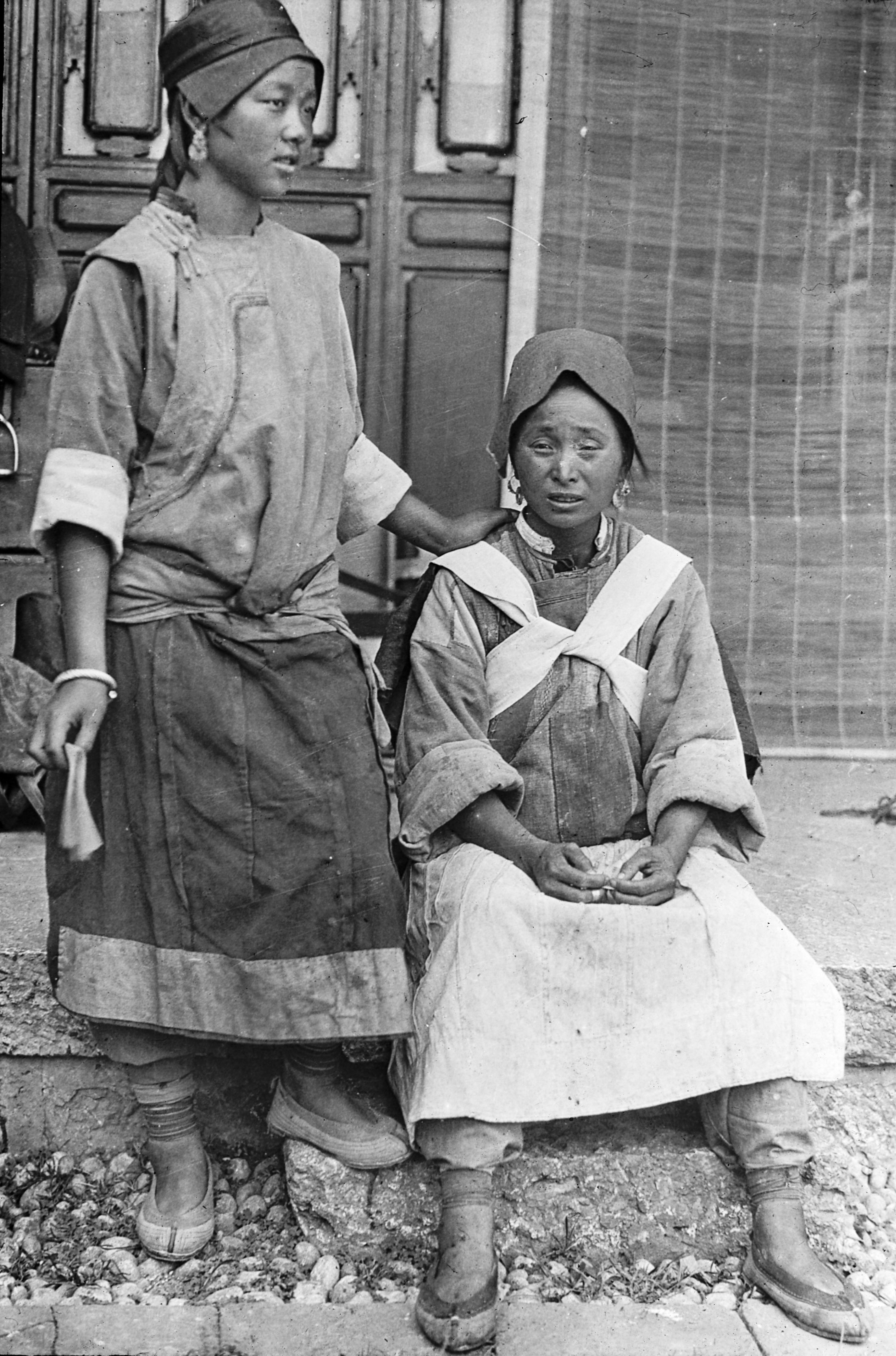
"The women wore a big pleated apron - a heavy looking turban with a silver rosette like ornament, often with a coloured stone in the centre of the rosette, and somewhat to one side, (the right side) above the forehead. Big earrings with pendants with coloured stones gave them quite an attractive appearance".

A Mosu home and kitchen in Pa-ti
A Mosu home and kitchen in Pa-ti
“I saw 3 or 4 patients and then got permission to take a flashlight photo, which I hope will give a better idea than words what this remarkable place is like.
“It is a big place with a log wall. In the centre a pillar with a few dried pine branches fastened round, meant as an offering to the kitchen spirit. Up in one corner a little shrine, with a god and bowls for incense sticks &c., In the centre of the room a big open fire place with 3 copper tripod stands, with shut legs to support pots or pans over the fire. In one corner - a huge copper water tank about 3 feet in diameter. Around the wall, on two sides, a raised place, like a big continuous dresser, the same height as the fire place and about 4 ft. wide, on which the family can sleep near the fire in winter”.
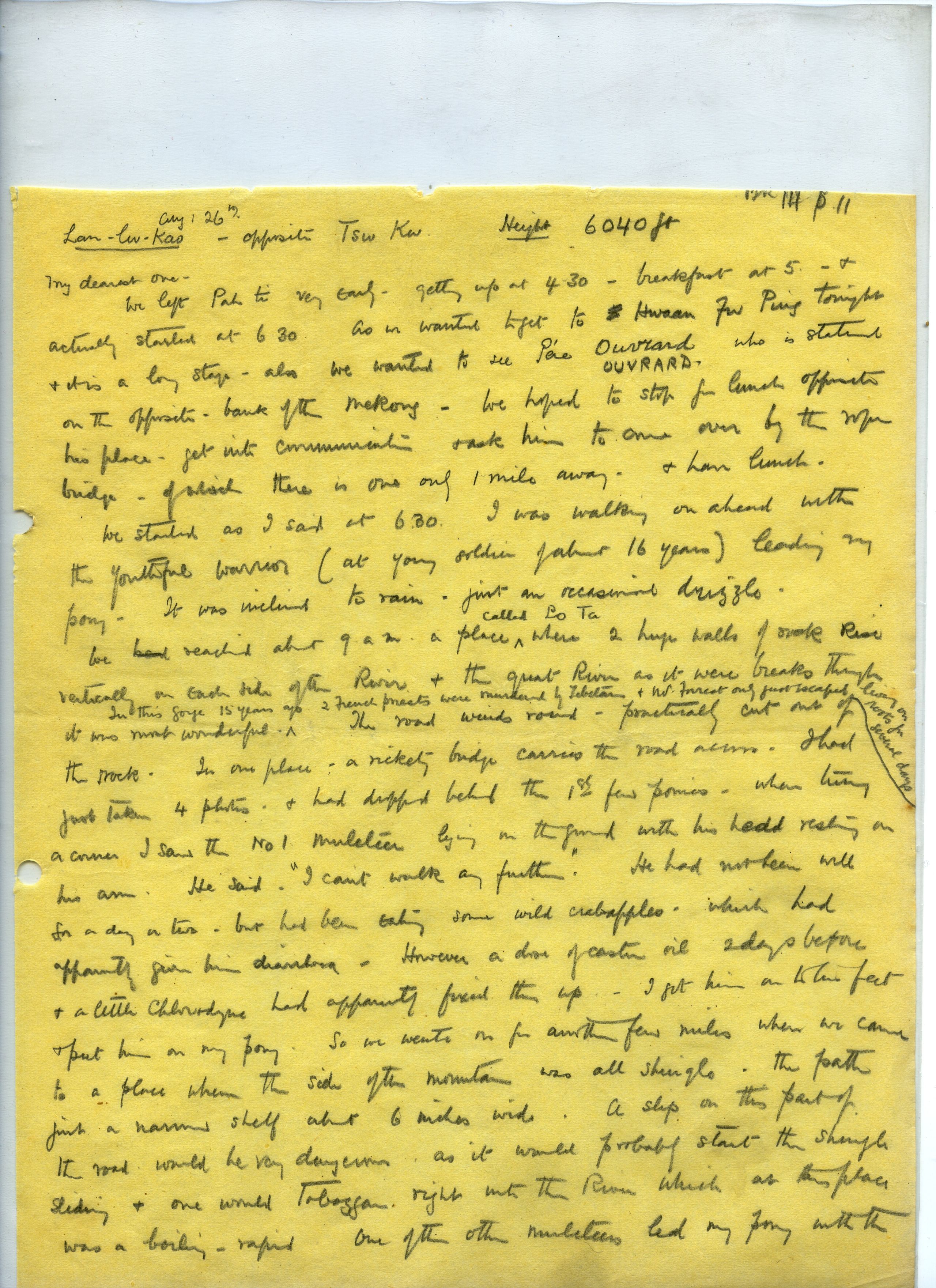
LAH- lu-Kao (opposite Tsu Ku) Height 6040 ft.
August 26th.
My dearest one,
We left Pah-ti very early, getting up at 4.30, breakfast at 5 and actually started at 6.30. as we wanted to get to Hwaan Fu Ping tonight and it is a long stage - also we wanted to see Père Ouvraad who is stationed on the opposite bank of the Mekong. We hoped to stop for lunch opposite his place, get into communication and ask him to come over by the rope bridge - of which there is one only 1 mile away - and have lunch.
We started as I said at 6.30, I was walking on ahead with the youthful warrior (a young soldier of about 16 years) leading my pony. It was inclined to rain, just an occasional drizzle.
We reached about 9 a.m. a place called Bo Ta where two huge walls of rock rise vertically on each side of the river, and the great river as it were breaks through - it was most wonderful.
In this gorge 15 years ago two French priests were murdered by Tibetans and Mr. Forrest only just escaped - living on roots for several days. The road winds round, - practically cut out of the rock. In one place a rickety bridge carries the road across.
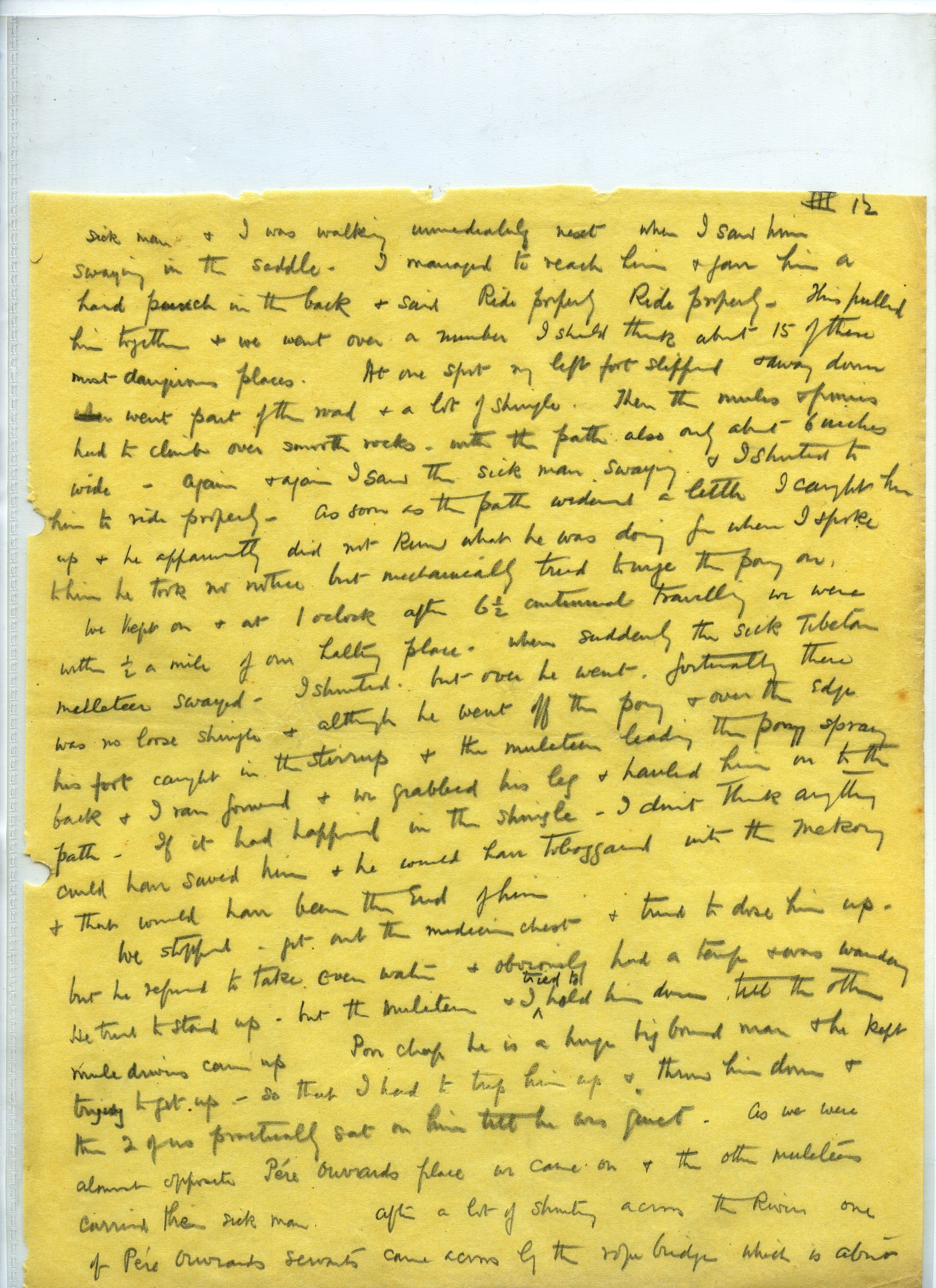
I had just taken 4 photos and had dropped behind the first few ponies when turning a corner I saw the No.1 muleteer lying on the ground with his head resting on his arm. He said "I can't walk any further". He had not been well for a day or two, but had been eating some wild crab-apples which had apparently given him diarrhoea. However, a dose of castor oil two days before and a little chlorodyne had apparently fixed him up. I got him on to his feet and put him on my pony. So we went on for another few miles, when we came to a place where the side of the mountain was all shingle, the path just a narrow shelf about 6 inches wide. A slip on this part of the road would be very dangerous, as it would probably start the shingle sliding and one would toboggan right into the river, which at this place was a boiling rapid. One of the other muleteers led my pony with the sick man and I was walking immediately next, when I saw him swaying in the saddle. I managed to reach him and gave him a hard punch in the back and said "Ride properly, ride properly". This pulled him together and we went over a number, I should think about 15 of them, most dangerous places. At one spot my left foot slipped and away down went part of the road and a lot of shingle. Then the mules and ponies had to climb over smooth rocks with the path also only about 6 inches wide, again and again I saw the sick man swaying and I shouted to him to ride properly. As soon as the path widened a little I caught him up and he apparently did not know what he was doing, for when I spoke to him he took no notice, but mechanically tried to urge the pony on.
We kept on, and at 1 o'clock, after 6½ miles continual travelling we were within ½ a mile of our halting place, when suddenly the sick Tibetan muleteer swayed - I shouted, but over he went. Fortunately there was no loose shingle and although he went off the pony and over the edge, his foot caught in the stirrup and the muleteer leading the pony sprang back and I ran forward and we grabbed his leg and hauled him on to the path. If it had happened on the shingle I don't think anything could have saved him. He would have tobogganed Into the Mekong and that would have been the end of him.
We stopped - got out the medicine chest and tried to dose him up, but he refused to take even water, and obviously had a temperature and was wandering. He tried to stand up, but the muleteer and I tried to hold him down, till the other mule drivers came up. Poor chap he is a huge big built man, and he kept trying to get up - so that I had to trip him up and throw him down, and the two of us practically sat on him till he was quiet. As we were almost opposite Père Ouvraad's place we came on and the other muleteers carried the sick man. After a lot of shouting across the river, one of Père Ouvraad’s servants came across by the rope bridge which is about a mile down the river. He said that the French priest, Père Ouvraad was away, but he was due back tomorrow. So as there is a peasant's cottage just here we have decided to stay the night. I have dosed the man up with hypodermic quinine, and we hope he will he fit to travel in the morning - a litter is being made to carry him on, and provided he is quiet I think we shall manage to get along. If impossible we will wait a day, see Père Ouvraad and get him to look after him - but we want to get on if possible.
I am so looking forward to getting a letter at Atentze and perhaps a telegram. I arranged with Mr. Klaver to send the next mail on to Atentze and if it misses us there we shall get it at Batang.
I have just been down to a small rivulet and had a tub, and having had dinner we shall soon be in bed. I wish you could see this log hut, the roof is open at the ends and the wooden boards which take the place of tiles do not meet in the centre, where there is a gap of about a foot - provided it does not rain tonight it will be alright - but if it rains ...... well we must put up with it.
Good night!!


Day forty August 25th. Pa-Ti to Lan-Lu-K’a (or Na-lon-k’a) (opposite Tse Ku) - 19 miles
They left Pa-ti very early, getting up at 4.30 a.m., breakfast at 5 and actually started at 6.30. as they had wanted to get to Hwaan Fu Ping (6,040 ft.) that night and it was a long stage.
“We want to see French priest Père Ouvraad who is stationed on the opposite bank of the Mekong. We hope to stop for lunch opposite his place which is accessible by a rope”.
“I was walking on ahead with the young man I call the youthful warrior (a young soldier of about 16 years) leading his pony. It was inclined to rain, just an occasional drizzle. The country was now wilder. The hills were steep and well-wooded and the road passed through some grand gorges. At about 9 a.m. they reached a wonderful place called Bo Ta where the river broke through rocky cliffs - two huge walls of rock 500 to 700 feet in height rose vertically on each side of the river”.

Bridge at Bo Ta on defile by R Mekong near Hwan-fu-ping
Bridge at Bo Ta on defile by R Mekong near Hwan-fu-ping
“In this gorge 15 years ago two French R.C. priests were murdered by Tibetans and a botanist Mr. Forrest only just escaped - living on roots for several days. The road wound around, - practically cut out of the rock. In one place a rickety bridge carried the road across”.
“I had just taken some photos and had dropped behind the first few ponies when turning a corner I saw the No.1 muleteer lying on the ground with his head resting on his arm saying "I can't walk any further". He had not been well for a day or two, but had been eating some wild crab-apples which had apparently given him diarrhoea. However, a dose of castor oil two days before and a little chlorodyne had apparently fixed him up. I got him on to his feet and put him on my pony”.
“We went on like this for another few miles, until we came to a place where the side of the mountain was all shingle, the path just a narrow shelf about 6 inches wide in places. A slip on this part of the road would have been very dangerous, as it would probably have started the shingle sliding and one would toboggan right into the river, which at this place was a boiling rapid”.

HGT on just a narrow shelf path by the Mekong river
HGT on just a narrow shelf path by the Mekong river
“One of the other muleteers led the pony with the sick man and I was walking alongside. When I noticed that he was swaying in the saddle, I managed to reach him and gave him a hard punch in the back and said "Ride properly, ride properly". This seemed to pull him together and we went over a number, about 15 of them, of very dangerous places”.
“At one spot my left foot slipped and down went part of the road and a lot of shingle. The mules and ponies then had to climb over smooth rocks with the path only about 6 inches wide. Again and again I saw the sick man swaying and shouted to him to ride properly. As soon as the path widened a little I caught him up and spoke to him. He took no notice and didn’t seem to know what he was doing, but mechanically tried to urge the pony on”.
“We kept on and at 1.00 p.m, after 6½ miles continual travelling, we were within ½ a mile of their halting place, when suddenly the sick Tibetan muleteer swayed and over he went. Fortunately there was no loose shingle and although he went off the pony and over the edge, his foot caught in the stirrup. The muleteer leading the pony sprang back and I ran forward. We grabbed his leg and hauled him on to the path. If it had happened on the shingle nothing would have saved him. He would have tobogganed into the Mekong and that would have been the end of him”.
“I got out the medicine chest and tried to dose him up, but he refused to take even water, and obviously had a temperature and was wandering. He tried to stand up, and the muleteer and I tried to hold him down, till the other mule drivers came up. Poor chap, he is a huge big-build man, and he kept trying to get up - so that I had to trip him up and throw him down, and the two of us practically sat on him till he was quiet”.
As they were almost opposite Père Ouvraad's place at Tse-ku they carried on, with the other muleteers carrying the sick man. After a lot of shouting across the river, one of Père Ouvraad’s servants came across by the rope bridge which was about a mile down the river.

Peasants' cottage at Lan-lu-k'a giving a fire offering to the spirits of the hills
Peasants' cottage at Lan-lu-k'a giving a fire offering to the spirits of the hills
The French priest, Père Ouvraad was away, but due back the following day, so they decided to stay the night at Lan-lu-k’a (6,040 ft.) - opposite Tse-ku - as there was a peasant's cottage where they could stay.
“I dosed the man up with hypodermic quinine, and hoped he would be fit to travel in the morning. A litter was made to carry him on, and provided he was quiet I think we shall manage to get along. If impossible we will wait a day, see Père Ouvraad and get him to look after him.
Day forty-one August 26th, 1923. Lan-lu-k’a
“The sick man was no better in the morning so we decided to wait over today and see Père Ouvraad late afternoon. I spent the morning down by a beautiful little brook close by, developing 3 films, and washing through two shirts, pants and socks. It is a lovely day. We hung out our washing and the films which have come out well are nearly dry”.
“In the afternoon we saw Père Ouvraad and fixed up with him to look after the sick man – I think he will either be dead or better within 4 or 5 days”.
HGT noted that Père Ouvrard was himself suffering from malaria. His parish extended some 89 miles to the south to Yeh-chih and on the north nearly to Yakalo. He had 622 baptized Christians, of whom over 400 were Tibetans and the rest mostly Chinese. A few were Mosu. He said the tendency in these parts was for the Chinese to become Tibetanised.

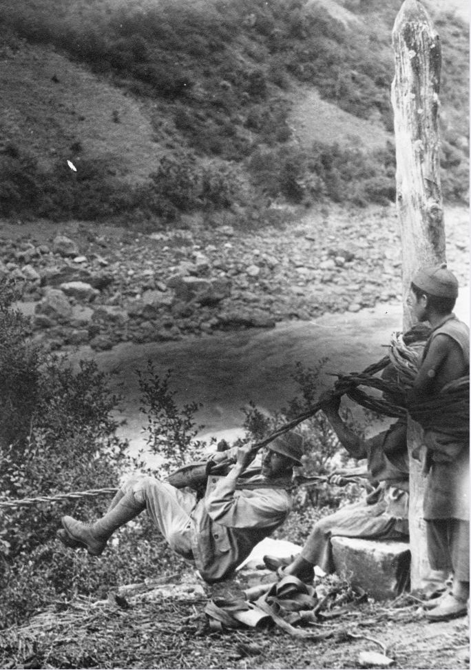
GP crossing the river by rope bridge sitting on the knees of a Tibetan
GP crossing the river by rope bridge sitting on the knees of a Tibetan
They crossed the river by the rope bridge. It was now 7 o'clock and on reaching the rope bridge it was dark - except for a little moonlight. GP went over with a Chinese to whom he clung, and the two were slung together on to the slider.
“I got a snapshot of them half-way across. I waited till there was a distant shout, a rumble on the bamboo rope, and the General appeared in sight, hanging on to his companion for dear life!!!. Then it was my turn”.

HGT preparing to cross the rope bridge
HGT preparing to cross the rope bridge

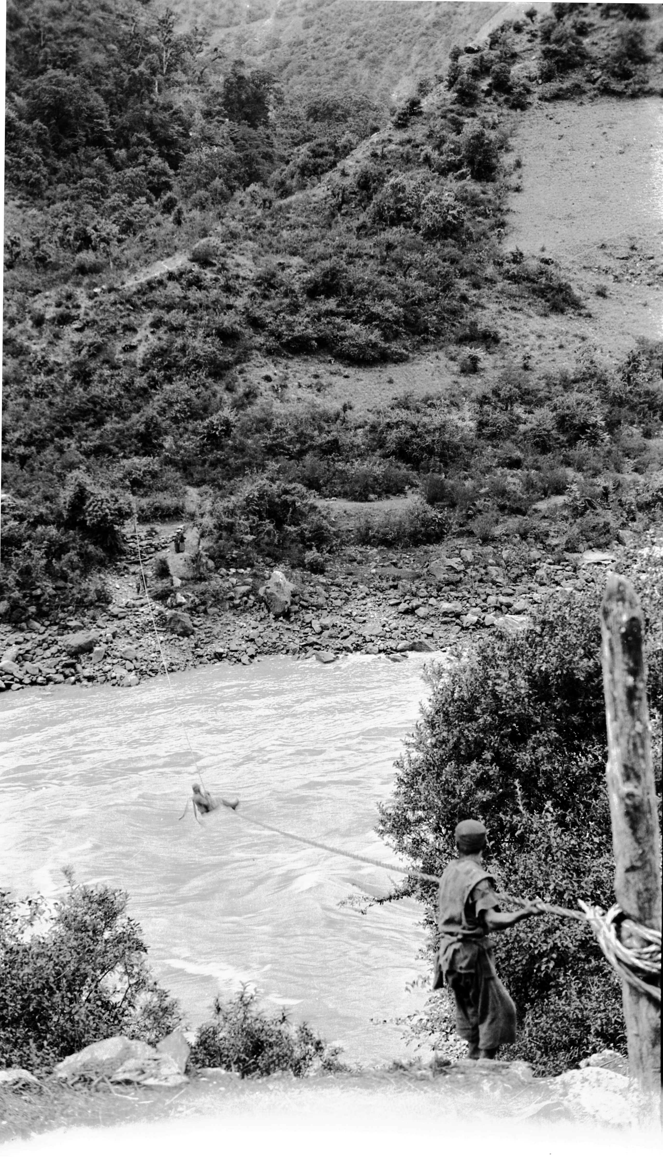
HGT ½ way across the Mekong on the rope bridge
HGT ½ way across the Mekong on the rope bridge
“It was most weird to be launched out into the darkness over the rushing river - and to be hanging like this”:-

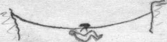
HGT's sketch of the rope crossing
HGT's sketch of the rope crossing
“I was trussed up with a leather band under one's thighs and then over one shoulder and under the other arm. Then with the word “Go” one was launched off the edge of the cliff and went sliding down over the river. About 15 yards from the opposite bank one stopped and had to haul oneself along, hand, over hand”.
Day forty-two August 27th, 1923. Lau-lu-k’a to Hwan-fu Ping - 5 miles
The Ma-fu-tao died at 4 a.m. - malignant malaria. This was a severe form of malaria prevalent along the Mekong valley, which the Chinese called the "chang chih", and which was generally very rapidly fatal.
“The previous afternoon, Père Ouvraad had turned up with a couple of patients – which is very opportune. It is a most extraordinary set of circumstances - the Ma-fu-tao, the head muleteer who had been walking and riding the pony 36 hours ago is now dead. Breaking down just opposite the R.C. Mission meant we have all the advantage of Père Ouvraad’s help. Père Ouvraad can both speak and write Tibetan and this was a great help as he can get a certificate written in Tibetan to say he died from sickness and had not been murdered”. .
“We buried the Ma-fu-tao at 12 o'clock mid-day. Père Ouvrard said that the Tibetans usually bury the corpse temporarily, and when decomposed dig it up, burn the bones in a vase and bury them again. The poorer either take the corpse on to the hills to be devoured by wild animals or else dump it in the Mekong. If it sticks on the rocks, they push it off again lest the Christians take it up for re-burial!”
They set off again at 1.30 p.m. On the road and very glad to get away. They decided to only do a very short stage of 15 li and arrived at the village of Hwan-fu Ping (6,144 ft.) a village of sixteen families, at 3 p.m. They had tea – HGT developed a film and was just going to write his journal when he was asked to see a patient. He saw him and immediately there was a crowd of other patients and he had to go on till it was too dark to see. Altogether he saw about 25 and in this village there were only 16 families.
Day forty-three August 28th, 1923. Hwan-fu Ping to Yang Cha - 16 miles
“It seemed as if we were never going to get off from Hwan Fu Ping”.
“The Tibetan muleteers had driven their ponies out on to the hillside for the night, and in the morning, 5 of the 25 were missing. They were off up the hills, hunting everywhere, and at last brought in 4, but still there was one wanting. Just as we thought we should have to tell them to start with one short he was spied away up on the brushwood. The Tibetan villagers on their housetops had spied him (the house tops are flat) and away went one of the muleteers up the steep hillside, directed by shouts from the men on the house roof till at last in came the runaway”.
The result was instead of starting at about 7.00 a.m. they did not leave till 10 minutes to 10. They agreed to go right through without a mid-day halt. HGT put a couple of pears, 3 bread cakes and a stick of chocolate in his pocket and ate them at 1 o'clock. They got into Yang cha (in Tibetan La-dze) at 4.10. The mules did not arrive till 5, so it was a good thing that it was decided not to halt at mid-day, for these halts meant stopping for at least two hours. One of the mules had broken down but they managed to carry the load in.


The gorge and the road alongside the Mekong between Hwan fu-peng and Yang cha
The gorge and the road alongside the Mekong between Hwan fu-peng and Yang cha

Another view of the gorge and the road alongside the Mekong between Hwan fu-peng and Yang cha
Another view of the gorge and the road alongside the Mekong between Hwan fu-peng and Yang cha
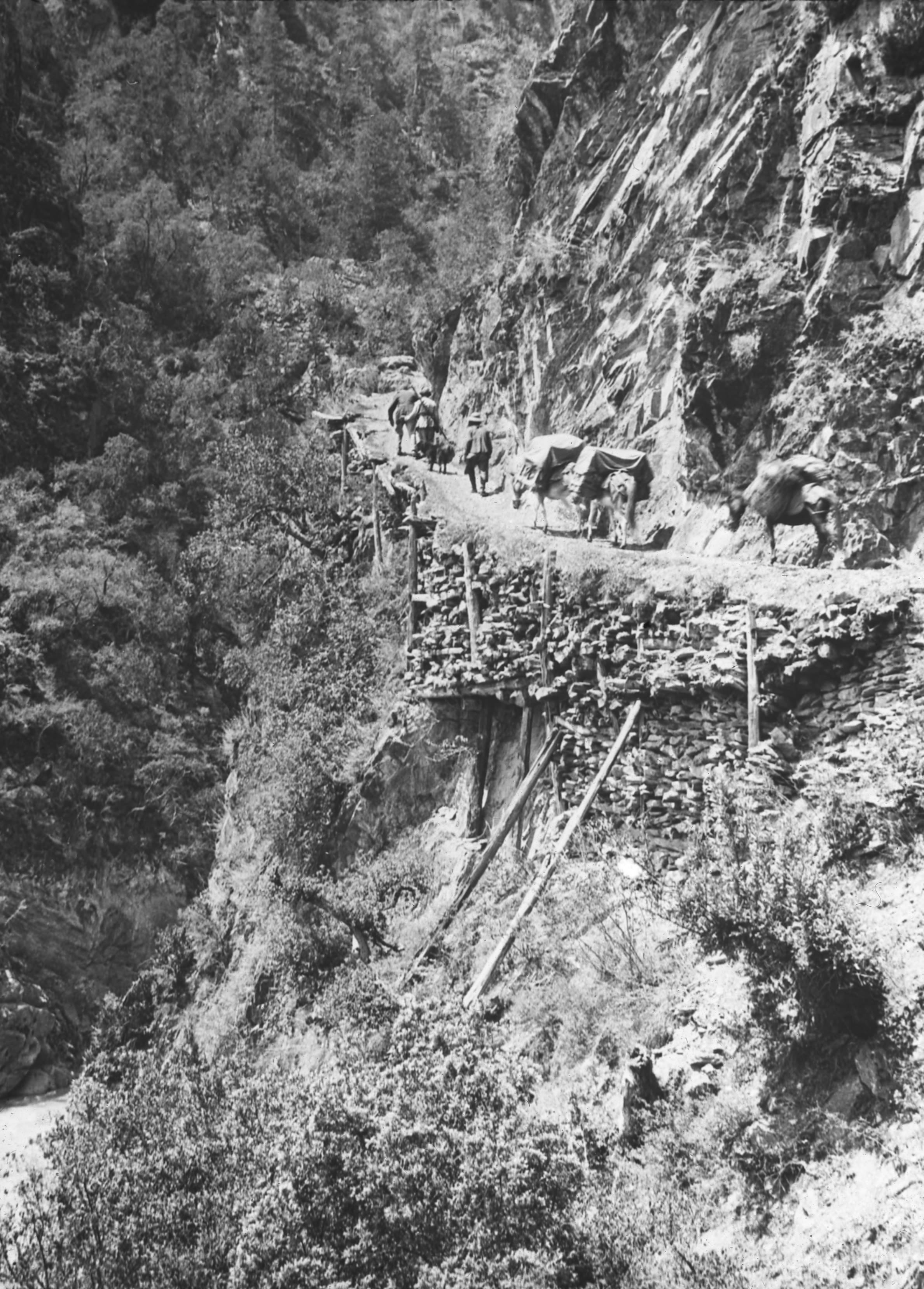
“The road today was absolutely wonderful. About noon we entered a great ravine, which looked as if it were a gateway of rock on a huge scale, the rock on each side rising vertically from the river to a height of about 500 feet and above this, more steep heights clothed with pines. The road crept round the face of this rock, in some places supported on trestles, and at several of the corners the muleteers stood on guard and gave each mule a pull in to the rock for the outer edge of the path was only supported by rather rotten looking lengths of pine with the bark still on”.

Final view of Mekong gorge between Hwan Fu Ping and Yang Cha
Final view of Mekong gorge between Hwan Fu Ping and Yang Cha
“In one place the road was again just a hand span wide, and a slip by a mule would have meant straight down to the river Mekong. After passing through this ravine we still followed the river’s windings. Its appearance seems to alter and all along the edge of the river bank are beautiful firs and cypresses. We have arrived at Yang Cha (6366 ft.) which has the Tibetan name of La Dza. It has five families, all Tibetan”.
That night they put up in a real Tibetan home. All along this road they kept meeting Tibetans, and only saw two Chinese all the way today.
“They seem a very happy lot of people and return our salutations with a delightful smile, and turning the hands up, and often putting out the tongue. The men wear long felt boots reaching nearly to the knees - decorated in colours - trousers are often decorated with a red pattern. Then they have a sackcloth coat, which they drop down to the waist if the weather is hot, and the belt with their flint and tinder box - sheathed Jack knife, pipe, bowl, gimlet and other odds and ends”.
“We passed several rope bridges and in two places there was an additional rope with prayer flags attached - with the words "om mane padme hum" repeated over and over again. I asked a Tibetan who overtook us what it was for. He beckoned to the sky and told me in sign language that they wanted rain very badly. The crops of maize are very late and Père Ouvraad fears that in some districts there will be a famine as the wet season is nearly over and the crops have not developed for want of rain”.
All these Tibetan houses - either on the flat roof, or just nearby - had a kind of brazier on a 4-legged stand in which each morning they would burn some twigs and leaves, which would give off a lot of smoke, as an offering to the spirits of the mountains.
Odd notes
A Tibetan house
In outside appearance the Tibetan house appears very clean generally the lower stories are plastered and whitewashed. It consists of two or three stories –
The whole house is built with a wooden frame – the lower story on the ground floor has the walls filled in with stone and the outside is plastered and whitewashed. Most of the floor is occupied by domestic animals, cows, pigs and goats which are usually supplied with straw or green twigs of trees to form a bed.
A wooden staircase ascends to the first floor. This staircase is most frequently opposite the main entrance to the house. The first floor has a floor of beaten earth on top of the floor beams. The outside walls are of stone or beaten earth, plastered and whitewashed. Outside, the inner walls are of wooden logs fitted together like a log cabin. Where there are one or two sleeping rooms with wooden floors generally quite clean. Another room is set apart for a kitchen. Here there is a central fireplace with iron or copper tripods to take pots and pans. The fire being made on a trough containing wood ash. Wood, or more rarely charcoal, is the common fuel. Long low stools and one or two small tables can be found in each room. Around the sides of the kitchen, against the walls, there is a raised part which forms a place where the family can sleep in the cold weather.
The third floor is generally reached by a notched beam which, placed on the slant, forms a stairway leading on to the flat roof - a favourite place for the members of the family to take the air. The roof is about 5 inches thick and is made of broken stone and beaten earth which has a very slight slope to the edge. When the roof leaks as is often the case someone is sent up aloft to beat the crack and so stop the leak. At one side of the flat roof there is generally a covered shed, also with a flat roof, generally facing the main direction of the house - closed at the back and sides but open to the rest of the roof on the one side. It is used for the fowls to roost and also for storing straw and odds and ends. Sometimes, one part is enclosed and forms a sleeping room – a nice airy spot. At each corner of the roof are frequently to be seen small white dome like structures said to be potent for keeping away sickness. At some place on the roof there is a kind of stove with a chimney in which twigs of trees, green for preference, are burnt each morning as an offering to the spirits of the mountains. The dense smoke from the green twigs pouring out of the little chimney. The ordinary smoke from the kitchen finds its way out of the roof by one or more square openings which may or may not have a raised cover to keep out the rain.
A big Tibetan mastiff is generally on guard near the front door.

Day forty-four August 29th, 1923. Yang Cha to Chia Pieh - 12½ miles
They set off in good time this morning - just after 7 a.m. At first there was a somewhat steep zigzag up the hill side to about 15OO feet above the Mekong - then the road remained fairly level with a slight tendency to rise, until about 9.30 when we reached Chia Pieh Ya’kou the highest point (7,980 ft.) There was the usual heap of "mane" stones and a path leading off to the right to a lamasery away up in the hills.

Looking South along the Mekong towards Yang-cha
Looking South along the Mekong towards Yang-cha


Further along the gorge by the Mekong
Further along the gorge by the Mekong
“The view from the top back towards Yang 'Tsa was magnificent - a great valley with steep sides and the Mekong away down below. As we descended we saw Tibetan houses with their white walls and flat roofs glistening in the sun - a sharp ascent and an equally sharp descent brought us at 11 a.m. to Kuo Nia - another Tibetan village with its own rushing stream of clear water - making its way down to the Mekong.

Great gorge and rocks after leaving Kuo-nia (by the Mekong)
Great gorge and rocks after leaving Kuo-nia (by the Mekong)
“We rested for 2 hours and then the Tibetan boy and I went on ahead, to see what we could fix up in the way of a night's lodging. We had another climb over a small ridge, thereby cutting off a big loop of the River - where it wound round a conical mountain with a white beacon on the top. When we got down by the River again it passed through great cliffs of yellow sandstone - mostly bare of trees, and the river way below. We started once more to rise and went steadily up to a pass only about half a mile from this place. On the way up we had our first view of the great snow-covered mountain K’a K’a Pu”.


View of the K'a K'a Pu mountain range
View of the K'a K'a Pu mountain range
“Coming down the path we met a number of pilgrims and on enquiring found that they are making a pilgrimage round the mountains. It takes 14 days. All seem to be in their best clothes, although one man had his coat off, hanging round his waist. Another jovial old man was twirling his prayer wheel. I persuaded one group to stand while I took a snapshot. Each one was carrying a bamboo, mostly with a tuft of green tied on the top. One young man would not stop and rushed past me, but the others were very jolly about it and took it as a great joke. They said they were a group of about 40 all from one little district near the mountains and leaving one or two at home to look after the stuff, they were on this pilgrimage - men, women and children”.

Tibetan pilgrims near River Mekong, going around K'a K'a Pu mountain
Tibetan pilgrims near River Mekong, going around K'a K'a Pu mountain
Their path descended to the pretty little Tibetan village of Chia Pieh (7,234 ft.) a village of eight families, surrounded by steep bare hills, and with the Mekong just close to it and away down below.
“The Tibetan boy and I arrived at 3 and got things fixed up. Then about half an hour later the others began to arrive. GP arrived about 1 hour after them. He said that the mules had practically all given out and one had died. The Tibetan Muleteers said it was because the No.1 muleteer had died, (I thought the real reason was that since his death they had been underfeeding the animals, so as to pocket the money). One mule which was nearly finished was sold for $5.00. The rest struggled in and we will start afresh with new mules when we reached Atuntze”.
Day forty-five Aug; 30th 1923 Chia Pieh to Atuntze - 16 miles
They left Chia Pieh at 7.30 a.m. The first part of the road was down-hill to the Mekong (7,020 ft.) again, then along the left bank to the Mekong for three miles. The country now seemed to be different in character - great bare hills with no trees and only a little scrub scattered over them. After the 3 miles practically on the level they left the Mekong and entered a big valley (Yung-chu valley), down which a rushing stream made its way to the Mekong. Their path lay up this valley going NE. The stream came from Atuntze (known in Tibetan as Gyu), and it was a case of following it upstream till they got there.

Last view of road by Mekong before leaving for Atuntze
Last view of road by Mekong before leaving for Atuntze
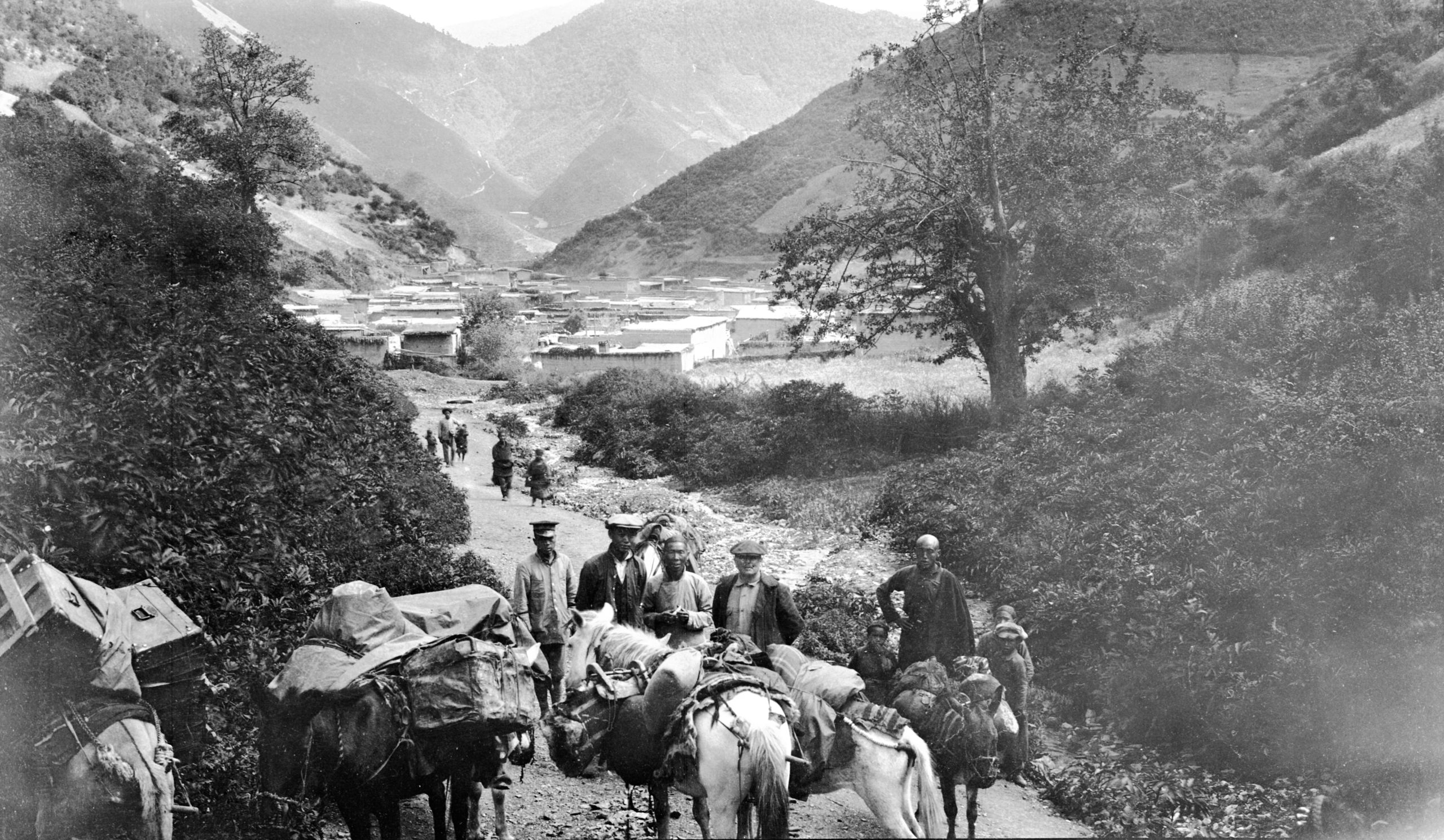
“The mules were rather rocky again. At Kung Shui we had a two hours rest, and then at 1.15 p.m. I pushed on with the “youthful warrior”, and GP followed with the caravan. We continued to follow the small river till we came to a place where the valley gave a big bend to the right and then curved to the left. This brought us to the top part of this valley. There were numerous scattered houses before the little town of Atuntze (10300 ft.) came into sight. It was a steady climb all the way till we arrived at 4.15 p.m. We went to the house of Monsieur Peronne, a French musk merchant who had been there 20 years. He is exceedingly kind and had heard we were coming. He arranged for us to be put up at a house belonging to the R.C. Mission where Mons. & Madam Haeffuer had lived 2 years before”.
“GP arrived soon after us with the mules and we got fixed up. At 6.30 we went for dinner with M. Peronne. He has a Tibetan wife, a little girl about 9 years old, and a boy aged about 6”.
Atuntze was 631 miles from Yunnan-fu
At Atuntze 28th August 2023
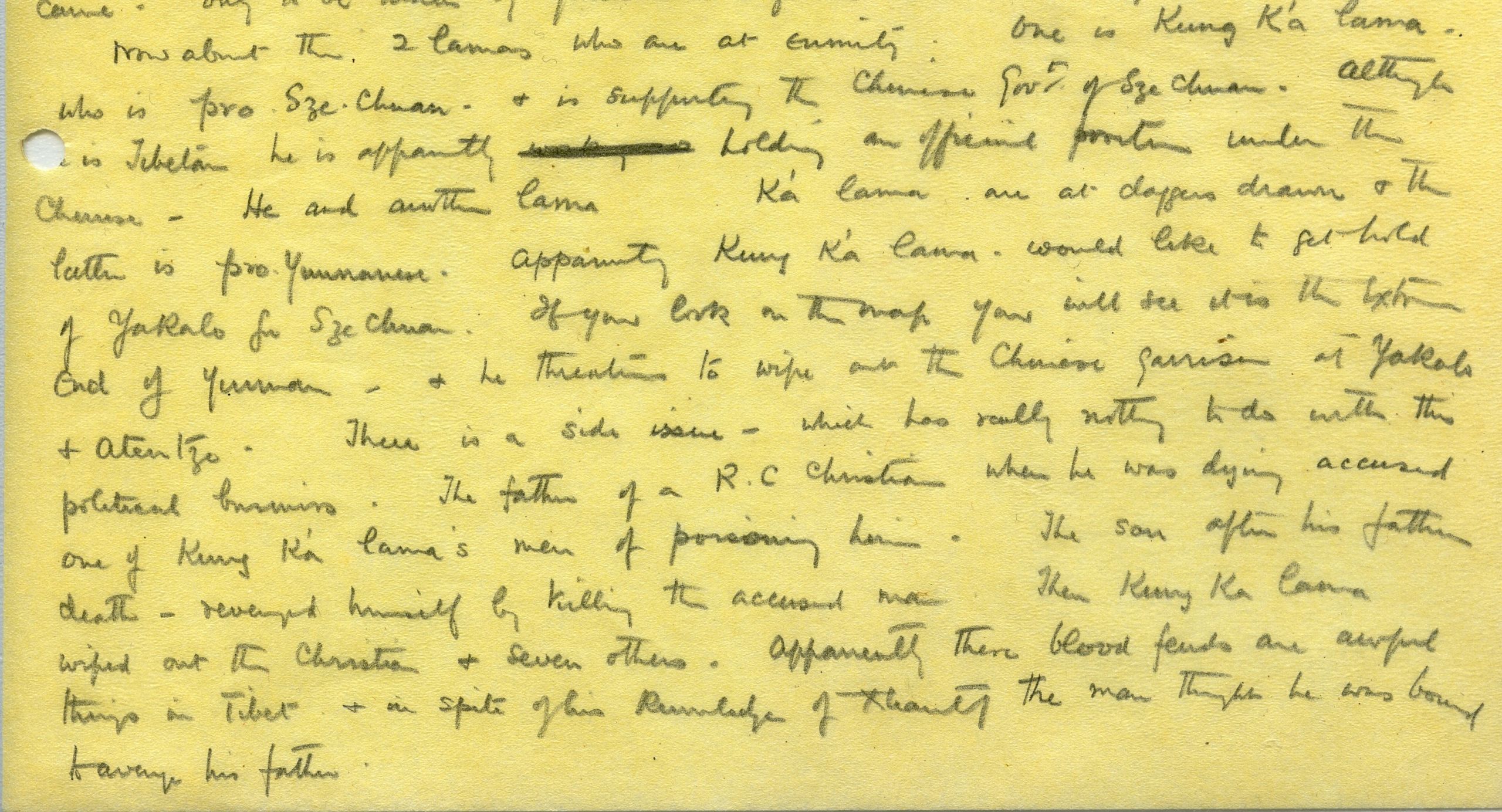
HGT made the following entries in his journal about the two warring lamas:
"Now about the two lamas who are at enmity. One is Kung K'a lama who is pro Szechuan, and is supporting the Chinese Government of Szechuan. Although he is Tibetan he is apparently holding an official position under the Chinese. He and another lama, Lan K'a lama are at daggers drawn and the latter is pro-Yunnanese. Apparently Kung K'a lama would like to get hold of Yakalo for Szechuan. If you look on the map you will see it is the extreme end of Yunan, and he threatens to wipe out the Chinese garrison at Yakalo and Atuntze".
"There is a side issue - which has really nothing to do with this political business. The father of a R.C. Christian, when he was dying, accused one of Kung K'a lama's men of poisoning him. The son after his father's death - revenged himself by killing the accused man".
"Then Kung K’a Lama wiped out the Christian and seven others. Apparently these blood feuds are awful things in Tibet and in spite of his knowledge of Xhantj the man thought he was bound to avenge his father".
"At Atuntze we met the Tibetan Chief (t’wiss) of Dong. He told them that the Kun Ka Lama had killed his father (the “son” above), and seven of his family - some of them brothers. “Now” he said, “I am waiting my time - there are several other chiefs ready to join in, and then we will do our best to kill Kun Ka Lama.” I asked, “does not Kun Ka Lama want to kill you?” - “Yes”, he said, “but so far he has not had the chance”. In spite of his knowledge of Xhantj the man thought he was bound to avenge his father".
"These Tibetan blood feuds go on, sometimes for hundreds of years, until one side is wiped out or both sides are exhausted".
"There is apparently no trouble between Atuntze and Yakalo, but between Yakalo and Batang we shall have to be careful.”


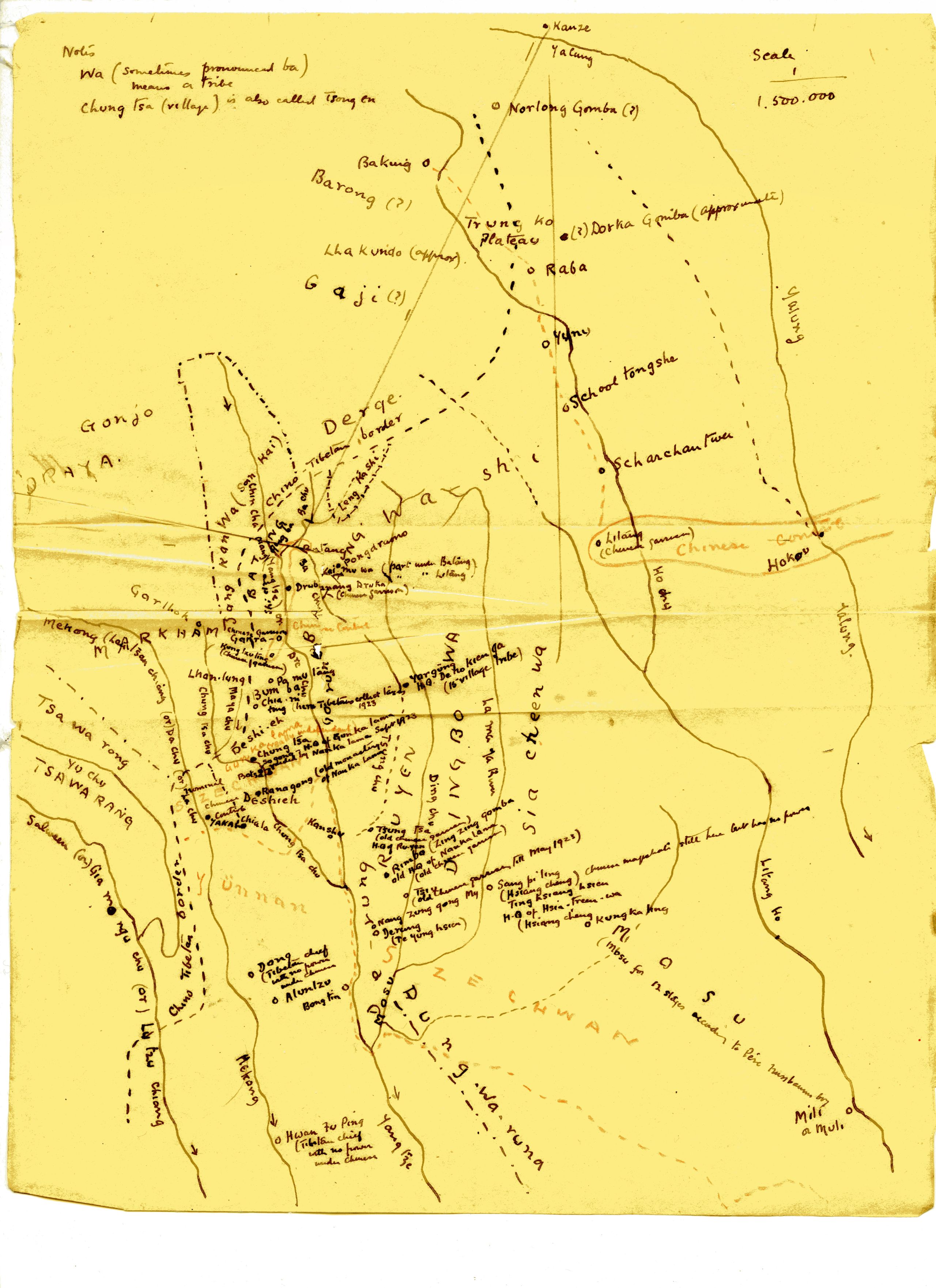
Sketch map of the route from Atuntze to Batang and on to Kanze
Sketch map of the route from Atuntze to Batang and on to Kanze
Days forty-six to fifty Sept 1st-5th 1923 Stayed in Atuntze
“Whilst there (at Atuntze) we got some more news about the squabble between the Kun K'a lama and the Lan Ka lama. It seems the latter crossed the Yangtze into Szechuan - a few months ago, invited some of the Szechuan soldiers to a feast, and then attacked them - killed 4 and bolted with 300 rifles, a lot of ammunition and a small gun. The former, the Kun Ka lama had also wanted the Szechuan soldiers to help him to attack Atuntze. They refused, there was a squabble. He attacked them and they retaliated and nearly killed him, but they could not fire straight. He got away with his men and is now somewhere in this country - waiting till he is strong enough to make another move”.
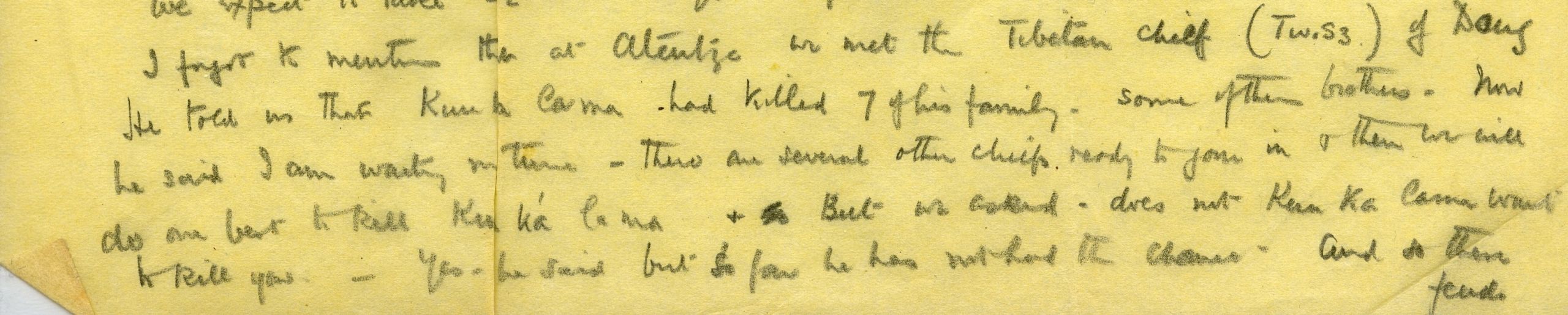
The Tibetans in this district, where they formed the majority of the population, seemed to prefer to be under Chinese rule. M. Peronne said the lamas were constantly fighting among themselves, and there was a vendetta between the chiefs, whilst the Chinese did keep some sort of order and peace. In Atuntze, they met the local Tibetan chief (called Twiss) from Dong, their next stop.
They learnt the Mekong and Yangtze in these parts do not freeze, though there is sometimes an ice fringe on the banks of the Mekong. They planned to stay at Atuntze for 2 full days and then start on again for Yakalo on the third day.
“A-tun-tze is a town of four hundred families, half Chinese and half Tibetan, at an elevation of 10,810 feet. The country is nominally under Tibetan princes to whom the Chinese have granted the rank of t'u-ssu, but they have no power. The northern prince rules the country from Yakalo to Dong, the next stage north. The southern prince rules some way south down the Mekong. A third t'u-ssu is a Mosu who resides at Yeh-chih".
"Trade is very bad. The Chinese are gambling and letting things go. Chinese rupees are current here. Among the rupees I found one of the East India Company of William IV. 1835. There is a bad habit here of cutting the rupees in half, and often people will not take what they considered the smaller half!”.
Day fifty-one September 5th Atuntze to Dong - 9 miles
“We left Atuntze just after 2 p.m., having hired fresh mules and after I had recovered from an attack of fever, and set out again on our march to Yakalo (in 4½ days) and then on to Batang. Monsieur Peronne accompanied us to the end of the little town, then the general went on, while I waited to see to the mules and get a parting snapshot of Atuntze”.

Leaving Atuntze & saying farewell to M. Peronne
Leaving Atuntze & saying farewell to M. Peronne
“M. Peronne is very keen on stereoscopic photography. He has taken two snaps of GP and myself - and has promised to send us copies. They are intended for use with a magnifying stereoscope. He also has some beautiful negatives of the district. He has just got out a hundred ,and 20 dozen plates; to last him, he says the next two years, after which is going back to France. He speaks English quite well, and was most kind. We went to him to lunch each day and he came to us for dinner".
“The first part of today’s journey - a steep climb for two and half miles - was uphill to the Chu la pass (11480 ft.). Then downhill all the way for six and a half miles to the village of Dong (8216 ft.) It is a Tibetan village of forty families situated deep down in a valley”.

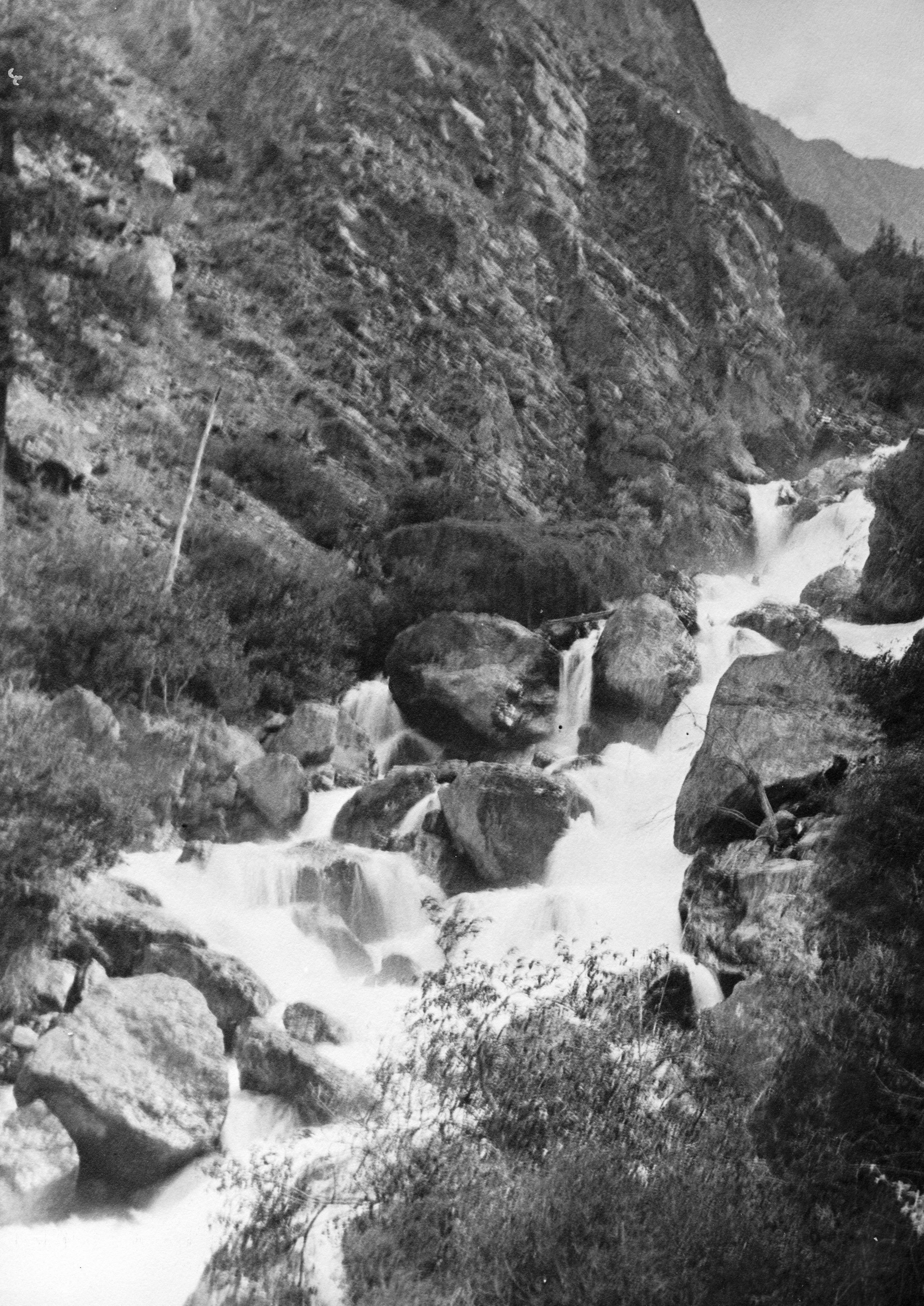
Waterfall at Dong
Waterfall at Dong
“The downhill part of the journey was very beautiful, following a small stream, which every now and again broke into small cascades and waterfalls. About halfway down, a huge vertical rock - about 500 ft. high, - stood out in the defile on the right-hand side, like some great sentinel guarding the way.
“Looking back, the great mountain of light sandstone, with firs, growing from the crevices of the rock looked like a beautiful Xmas tree - shining in the sunlight of the setting sun, while we were down in the shadows”.
Day fifty-two September 6th 1923. Dong to Ku Shih (or Go-hsieh) - 19¼ miles
They left Dong at 7:30 a.m. and at 9:15, after following the small river from Dong down, they arrived at the Mekong again. It was of a dark reddish colour, showing that it had been raining lately in Tibet. They then followed the Mekong and arrived at Ku Shi at 12:30, after travelling 13½ miles. From this point on they planned to only travel in short stages – days’ walk.
“On route we met a man from Ba-Tang. He reassures us that the road from Yakalo to Ba-Tang is quite quiet”.

The Ru-wa-shou Gorge between Dong and the R Mekong - GP riding
The Ru-wa-shou Gorge between Dong and the R Mekong - GP riding
There was a rather steep descent down the Dong-lung Chu valley. The path lead through the wild Ru-wa-shou gorge between high rocky precipices - great walls of rock, rising almost vertically, of red and yellow sandstone. High up on a ledge was a monastery.
Then there was a climb of 500 feet to the Ma-pa La, (7,890 ft.), from which there was a steep descent. GP recorded in his journal:
- “On the opposite side was Ma-pa-t'ing, from which there is a trail between A-tun-tzu and Chamdo. After two stages this trail leaves the river, crosses the wild Shu La and proceeds on to Pi-t'ou monastery, which has always been notorious for its anti-foreign feeling, and which pays little attention to the Kalon Lama at Chamdo”.
HGT noted in his journal and letter home:
“We stayed in a house in Ku-Shih – on the inside veranda. In one corner was an old lady who was blind – she spent her time, sitting on the floor – tailor fashion, counting beads and turning a small prayer wheel. The landlady admired my carpet slippers!”
“There is quite a strong breeze blowing from the south, and it looks like rain. I must stop”.
Day fifty-three September 7th 1923 Ku-Shih to Sung-Shih - 19½ miles
“We left Ku Shih at 7 a.m. and for the first hour had a stiff climb (1,600 ft.) up the hill – till we reached the topmost point, Ku-La (8,655 ft.) At this spot was a small white square erection, which at home would be called a cairn – but here is called a “luan shi”. There are frequently stones carved with the characters “om mane padme hum,” placed there when for example a child is sick. But this one had no special significance except to mark the highest point”.
After reaching that height, they skirted round the mountains, passing through Jung, a scattered village of about sixty-five houses. All the while they kept parallel to the Mekong – which was about 2,000 ft below. They reached their midday halt at 11:30 – a place called Tang Ku Kung (or Tang Ku Gung). They could see the road stretching far ahead – over a big round spur of mountain, and then over a sharp knife-edge ridge – away in the background was a five peaked mountain.
They lunched under the shade of a big Walnut tree and looking across the Mekong could again see the great snow-capped Ka' Ka Puh mountain (or Ka-go bo mountain) said to be 20,000ft (though the map they were using said 16,000 ft).
“As we face the mountain, – just to the left, on the other side of the river was a great valley, – up which we could see a path running, which we were told was the main road up to the Shu-la (Shu pass) across which practically all the traffic between Yunnan-fu and Tibet (Lhasa) passes”.

Bridge over torrent by a landslide near Sung shih
Bridge over torrent by a landslide near Sung shih
After lunch they started again at 1:15 and keeping at a high level, crossed the rounded, and then the sharp knife edge spur of the mountain. There was a steep descent to a gully, then a slight rise to Sung-ting at 17 ¾ miles, and down to cross a torrent near a landslide, followed by a short rise to Sung-shih.
“Since leaving Atuntze, we have in the caravan, a merchant who had asked permission to join us, and also a woman with a child. The woman was from Batang and was making her way back".
“The woman’s story is that she, her husband and child whilst on their way down to Wei Si had all their belongings stolen by Tufei (bandits). The husband who was on his way to Kwang Tung – had gone on and left the woman to make her way back to Batang with the child (about 3 years old). A round faced cheerful little woman, – she is carrying the little one on her back. As she looked so tired (as I was walking) I told her she could ride my mule, or put the little one on it. She gladly accepted the offer for the child, so the wee mite was put on the saddle and then tied on with the woman’s girdle and the mother walked alongside. She would not ride herself, but it was a great relief to her, and mother and child chatted together as they travelled. On arrival at Sung Shih, GP and I talked things over, and agreed to pay for someone to carry the child the following day. We also gave her $1.00 to help her with food, for she had nothing except what had been given her, and our two “boys” were seeing that she had some of their food".
They had hoped to reach Napu, but stopped at Sung-Shih (7,126 ft.), 3 miles short, as they had had a long day – a distance of 19½ miles.
HGT wrote in his journal and letter home:
“I could not help thinking of my dear little Greta and her dear mother, and “fellow feeling makes us wondrous kind”.
“Alas, and alack! – My little green teapot went smash yesterday, and one of the Worcester cups. The teapot had lost its lid – near to Wei Si, and now the teapot spout has gone, right down at the base – so after nine years’ service, it is done for. However, the “boy” still manages to make tea in an enamelled cup. I hope to raise another teapot at Batang. (I must stop).”
Day fifty-four September 8th 1923 Sung-Shih to Pa-mei - 15 miles
They left Sung Shih at 7:30 a.m., and an hour later passed through Napu.
This was the place they had hoped to reach the previous day.

Na-pu houses built against rocks in the Mekong valley
Na-pu houses built against rocks in the Mekong valley
They continued along the left bank of the Mekong – in its various bends and turns. At one place, close to Chao Ba, the river gave a great bend, with its concavity to the West, and here the road which had previously been slowly rising above the river – dropped down to river level. At one place there were pieces of scaffolding to support planks for a roadway against the rocks.
HGT noted:
“I’ve never seen such a variety or colour of rock – these form the cliffs running down to the river. There was red sandstone and a blueish slate – a golden yellow formed by quartz – a beautiful purple, where the little streams had made watercourses, – and then away up and above, perhaps 2000 ft. up the deep green pine trees and down near the river, the bright green of the cultivated fields of an occasional village. It was marvellous – for at the foot of the cliffs was the river Mekong – an absolute chocolate brown – due to the rains in Tibet”.
“At one place looking up a great valley we could see towering above in the background, the snow-clad heights of the mountains which continue the Ka Ka Pu, and form the Mekong Salween divide. The pure white snow was glistening in the sun. Oh! for the brush of a ready painter! It was no use photographing it for the photographs would not show the colours”.

The road carried on scaffolding along the Mekong cliffs
The road carried on scaffolding along the Mekong cliffs
After descending to river level, the road mounted again to about 500 ft. above the river, and edged along the face of the rock, being carried on crude scaffolding. This was just about 9 miles from our starting place, one could look down from these rough planks, almost vertically to the river below.
HGT wrote:
“It was very strange for I had just mounted my pony after walking the first three hours, and was busy eating walnuts and getting the kernels out with a penknife, when the old soldier (a Tibetan with an antiquated gun), who is leading the way, called out to me, and looking up I saw this marvellous piece of scaffolding. I was soon off the pony and taking a photograph”.
Once again, the road descended to the River’s edge and then 3 miles from here, began to rise and zigzagged up to reach the village of Pa-mei (8,381 ft.) which was hidden in a small fertile fold high up on the hill-side - a village of twenty-five families.
Day fifty-five September 9th 1923 Pai meh to Peh Yung Gung - 15¼ miles
Heights: Ascent to Ta Key No 9,867 ft.
Drop to Shi-ti Chw Ka (lunch place) 8,490 ft.
Ascent to Mu Chia Kung 10,199 ft.
Slight descent to Peh Yung Kung 10,088 ft.
N.B. Gung (or Kung) = A Monastery; short for Gomba
They left Pai Meh at 7:10 and had a sharp zig zag climb up the hill – about 1,400 ft., - then a long stretch on the level to Ta-key-no –at an altitude of 9,687 ft. – The atmosphere cool and bracing, but unfortunately the mountains on the river bank of the river were enveloped in mist – though occasionally it lifted a little and they caught a glimpse of snow-clad heights. Some rain after lunch and a rest of 1½ hours – they then started again and had another stiff climb, 1,700 ft. The rain soon ceased and the mists began to clear.
On the way up the hill, they met some more Tibetans who had just come from Yakalo – they told them that a messenger from Batang had been waiting for them for 4 days at Yakalo. They were glad to hear this, for it meant they could get the latest news, when they arrived there the following day.

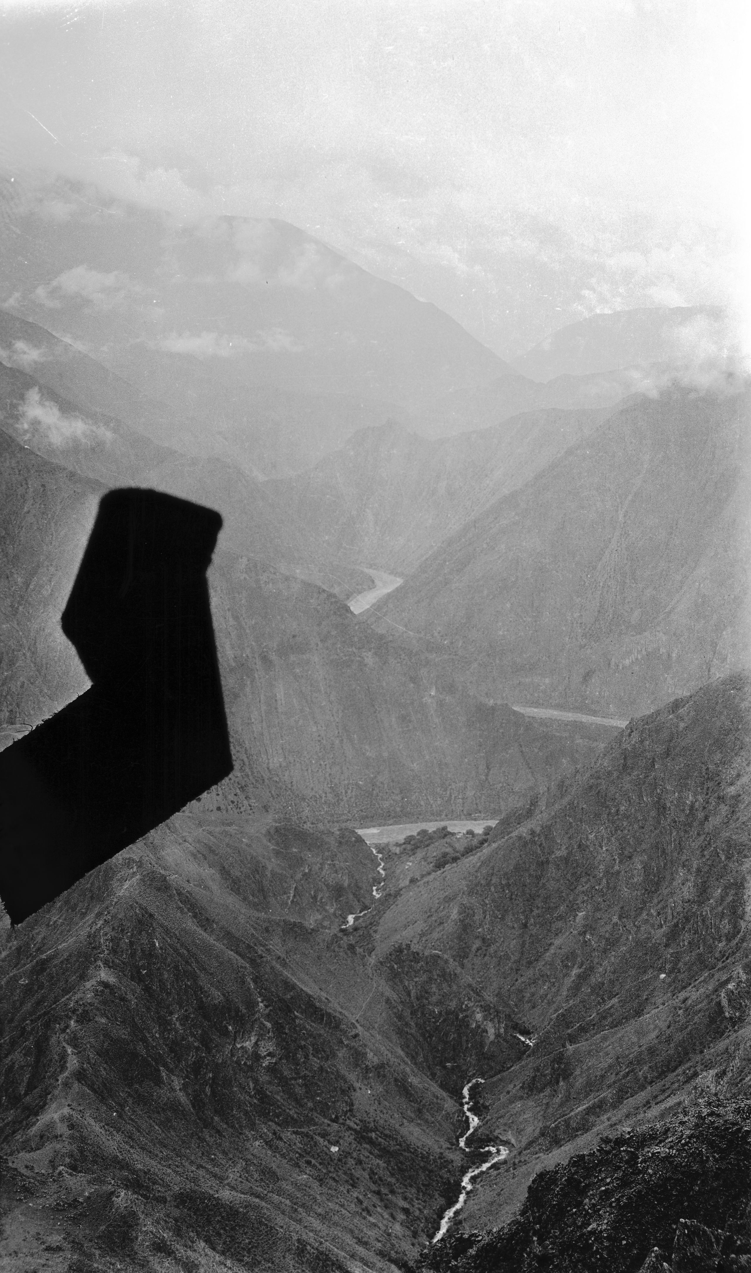
View looking North along Mekong towards Yakalo
View looking North along Mekong towards Yakalo
“After reaching Mu Chia Kung, the highest point (10,199 ft.), we had a most glorious panorama. Behind, and to the left are the great sacred mountains of Ka ka Pu (estimated by Handel-Mazetti at about 20,000 ft.), now about 35 miles distant – the top covered with snow. Then from this runs the mountains of the Mekong Salween divide – also snow-covered – then further north – a great peak stood out listening white in the sun. The mountain is called Ta Mei Yung. Below the peaks are banks of white cloud – lower down below the snowline – the reds and greens of the hillsides – sloping sharply down to the Mekong – a chocolate brown streak away below, with patches of vivid green in the lower valleys – where there is land which can be cultivated”.

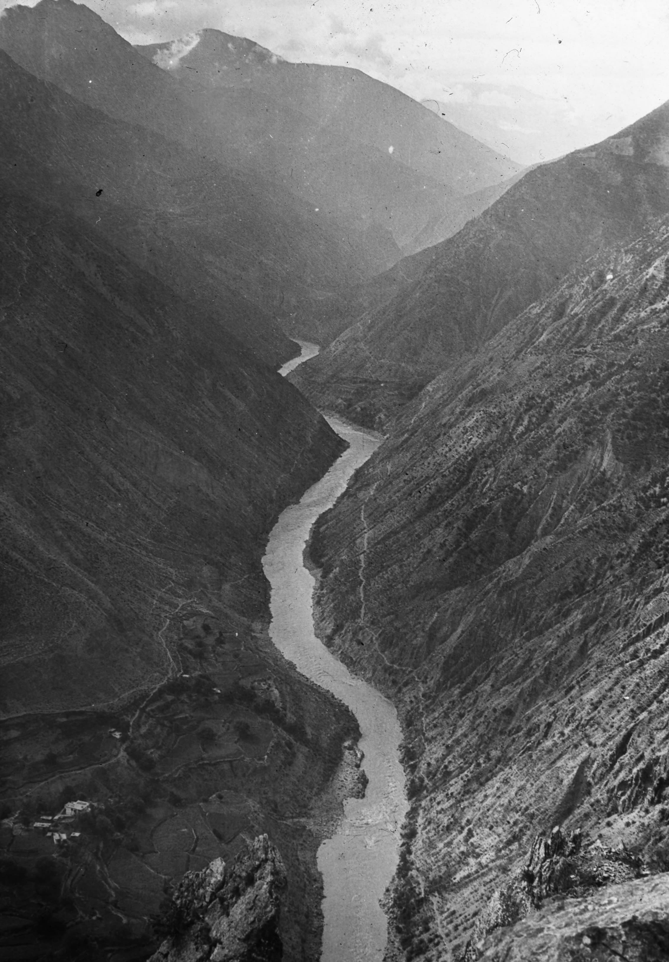
View looking south down the Mekong valley
View looking south down the Mekong valley
Figure 52 Picture of the wooden dagger given to HGT
They arrived at their stopping place – Peh Yung Gung (or Pa Yung Koh), (10,088 ft.) at 3:45 – a very cold wind blowing – GP got into his greatcoat and HGT into his fur lined waistcoat.
GP recorded that "Peh Yung Gung had twelve families. There was a very small lamasery there, the monks of which have cartridge belts and knives". It was very cold. They were in a Tibetan house, and had the usual eggs and milk.

Dagger given to HGT
Dagger given to HGT
Over the doorway was a string of wooden daggers – meant to guard the house from evil spirits. HGT was given one as a curio. He saw three patients, and did some writing before dinner.
HGT later wrote in his letter:
“A most glorious day– surely the works of God are marvellous, and makes one say “what is man that thou regardest him?”
Day fifty-six September 10th 1923 Peh Yung Koh to Yakalo - 13¾ miles
They left Peh Yung Ko at 7:30 and after one descent – then a climb up again, then another descent, they arrived at the town of Yien Ching (meaning Salt Wells). They just skirted around the town, which was separated from Yakalo by a ravine about 500 ft deep. The two places were only at a distance of about 1 mile from each other, but they were separated by the ravine.
“As we climbed up the Yakalo side we were met by Père Goré – the R.C. father – a very interesting man who has spent three years here, previously he had been 10 years at Ta Chun Lu and before that two years in a place near to Ta Chen Lu”.
A few miles out from Yakalo they crossed the frontier between Yunnan and Szechuan, so were now in the latter province. They also experienced their first stormy winds which were apparently a feature of Tibet.
HGT recalled a curious experience at Peh Yung Kung.
“About 3 a.m. there was suddenly a big thump and scuffle in the rooms where we were sleeping. I switched on the hand lamp and saw a big black cat in the room. I opened the door and let it out. The next morning, we found a small dead rat under my bed which the cat had evidently caught – coming down through the usual ventilating hole in the roof, by which all smoke finds its way out of a Tibetan house”.

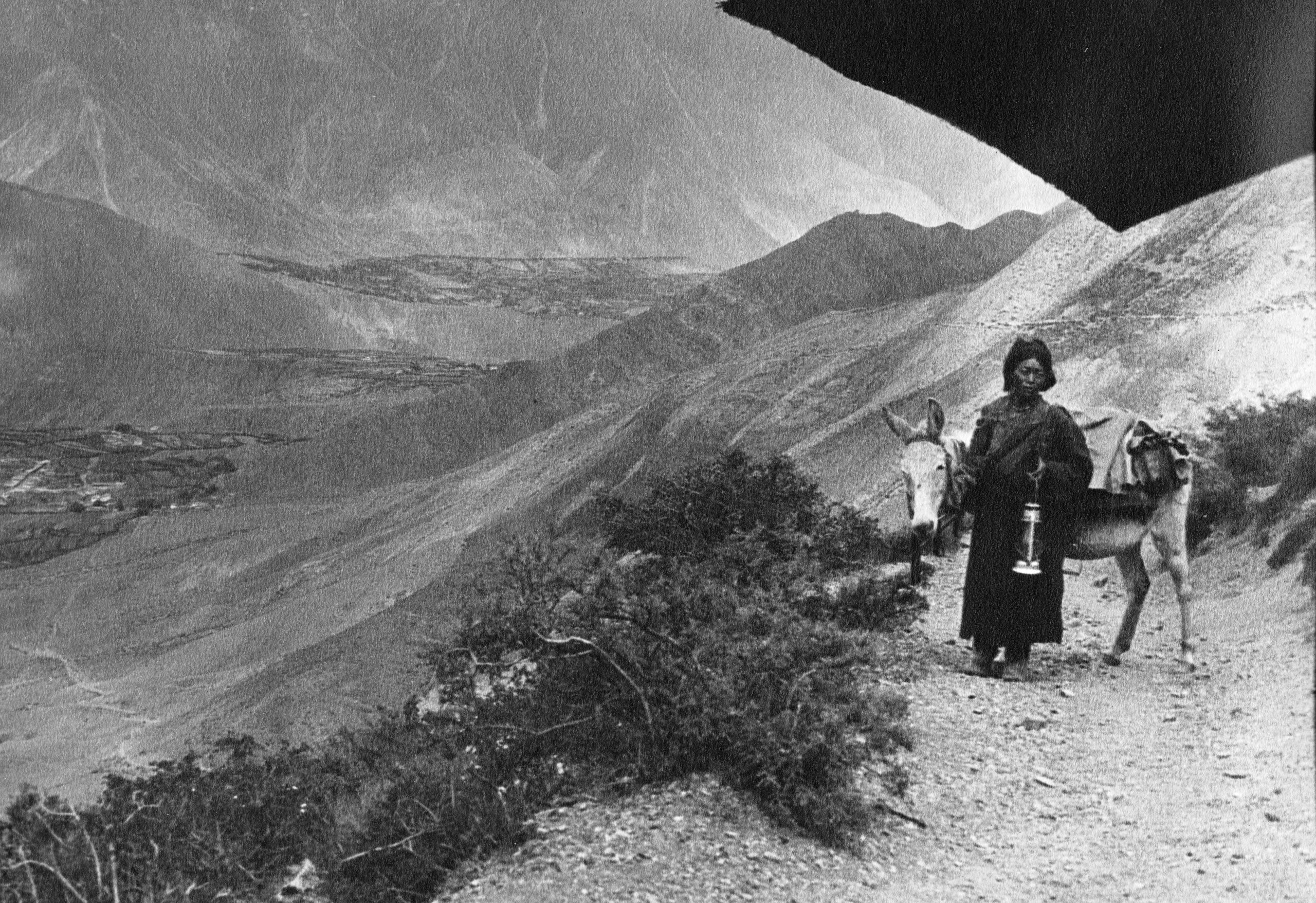
Overlooking Yien ching near Yakalo - The lady with the lamp was their escort
Overlooking Yien ching near Yakalo - The lady with the lamp was their escort
“On leaving Peh Yung Koh, our escort, has now dwindled down to an old woman who carries in one hand our precious hurricane lamp and with the other held my pony while I was taking a photograph. I christened her after Florence Nightingale (the lady of the lamp). She also carried the official paper to hand on to the headman of the next village.”
The day’s journey had been 13¾ miles, and they got in to Yakalo (8,655 ft.) soon after 1 o’clock. They did not get lunch till 3 PM.
“After lunch I got an upset stomach. I put it down to some Tibetan butter which we had this morning. It lasted till about 2 a.m. when it began to pass off”.
Day fifty-seven September 11th, 1923. Staying at Yakalo
They stayed at Yakalo for 3 full days– HGT was glad that the stay at Yakalo was settled before he was taken ill – “seedy” in his words. He wrote:
“Stayed quietly in bed this morning – but up for tea and dinner. Insides quite right again”.
GP wrote in his journal “HGT had a fever and was worried it might be cholera. He didn’t want to be the one delaying the expedition”.
Day fifty-eight September 12th, 1923. Still at Ya Ka lo
“I am feeling lots better, and ready to go on. We are due to leave the day after tomorrow. The mail goes every 6 or 7 days and Père Goré tells us it is dispatched from a small postal station just a little distance from Yakalo”.
The mail was due to be taken that afternoon so they sat down to write letters.

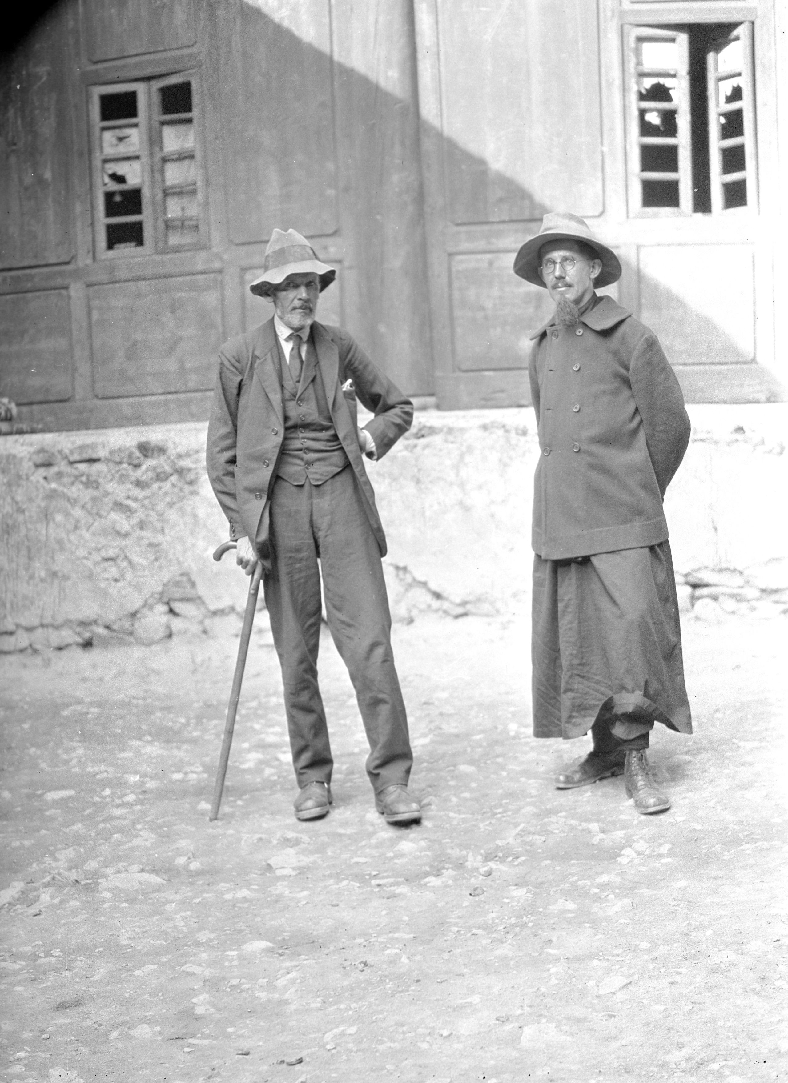
GP with Père Goré at Yien Ching near Yakalo
GP with Père Goré at Yien Ching near Yakalo
GP thought they should stay at Yakalo for two or three days, then aim to get to Gartok at the weekend – taking about 5 days. Then maybe stay at Gartok for a day or two to see the Markham Tegi and get his permit to go on to Batang. It would take additional time if the permit had to be obtained from the Galon lama (at Chambdo). Once at Batang they would then go on North through Tibetan territory to Kanze.
HGT wrote in his journal letter:
“If a permit has to be obtained from the Galon lama at Chambdo this will take time, and we shall either go on to Batang and wait there, or wait a day or two longer at Gartok”.
“It is a pity that we have these delays, but it is much better to go quietly and run no unnecessary risks. Everybody seems to agree that if Weatherbe had not been in such a rush, he would have been perfectly all right and not turned back – simply because he would not wait for permission”.
Day fifty-nine September 13th 1923 A trip out to Yien Ching from Yakalo
Père Goré had three mules and they started off mounted. They went down the ravine and then up the other side to Yien Ching where they called on the Magistrate who had been there for 12 years. They then went about 2 miles further on up a most beautiful gorge, through which the road to Batang ran. They called at a small temple, which was clean, compared with some Chinese temples – the paintings on the wall looked quite fresh. The gorge was quite narrow, about 50 yards across and the rocks on each side rose practically vertically from their base. It was marvellous, and coming down through the gorge was a brook, which supplied Yien Ching and Yakalo with water.
HGT wrote in his journal:
“On the way we saw a lama riding a mule. He too had attendants with him, and he was dressed in dark red – with a peculiar hat, shaped something like this.

Something like an old Roman soldiers’ hat.
Something like an old Roman soldiers’ hat.
"The surface was gilded and ended in a point above. Père Goré told me that this was the sign of a living Buddha. I was sorry I had not got my camera. As we passed him, we could see he was a man about 43 years old. He looked a happy individual. He bowed politely, smiled and held up the palm of one hand in salutation. After going up the gorge for about 2 miles we returned to Yakalo”.
Day sixty September 14th 1923 Still at Yakalo
“A quite morning developing films. In the afternoon we had the mules again and went down to the banks of the Mekong – a drop of 1300 ft. to where the salt wells are situated. It was most interesting”.

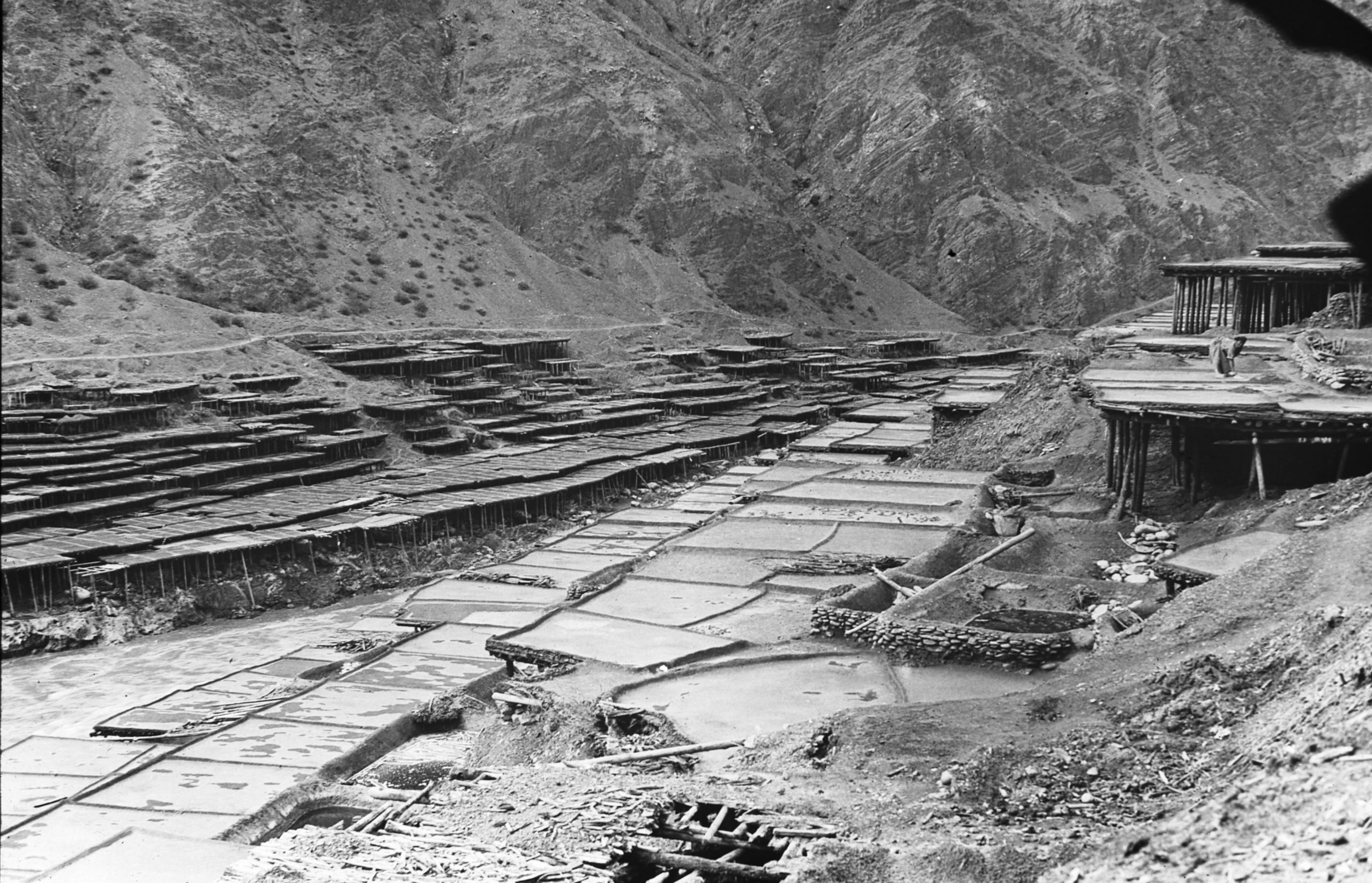
Salt terraces at Yien-ching
Salt terraces at Yien-ching

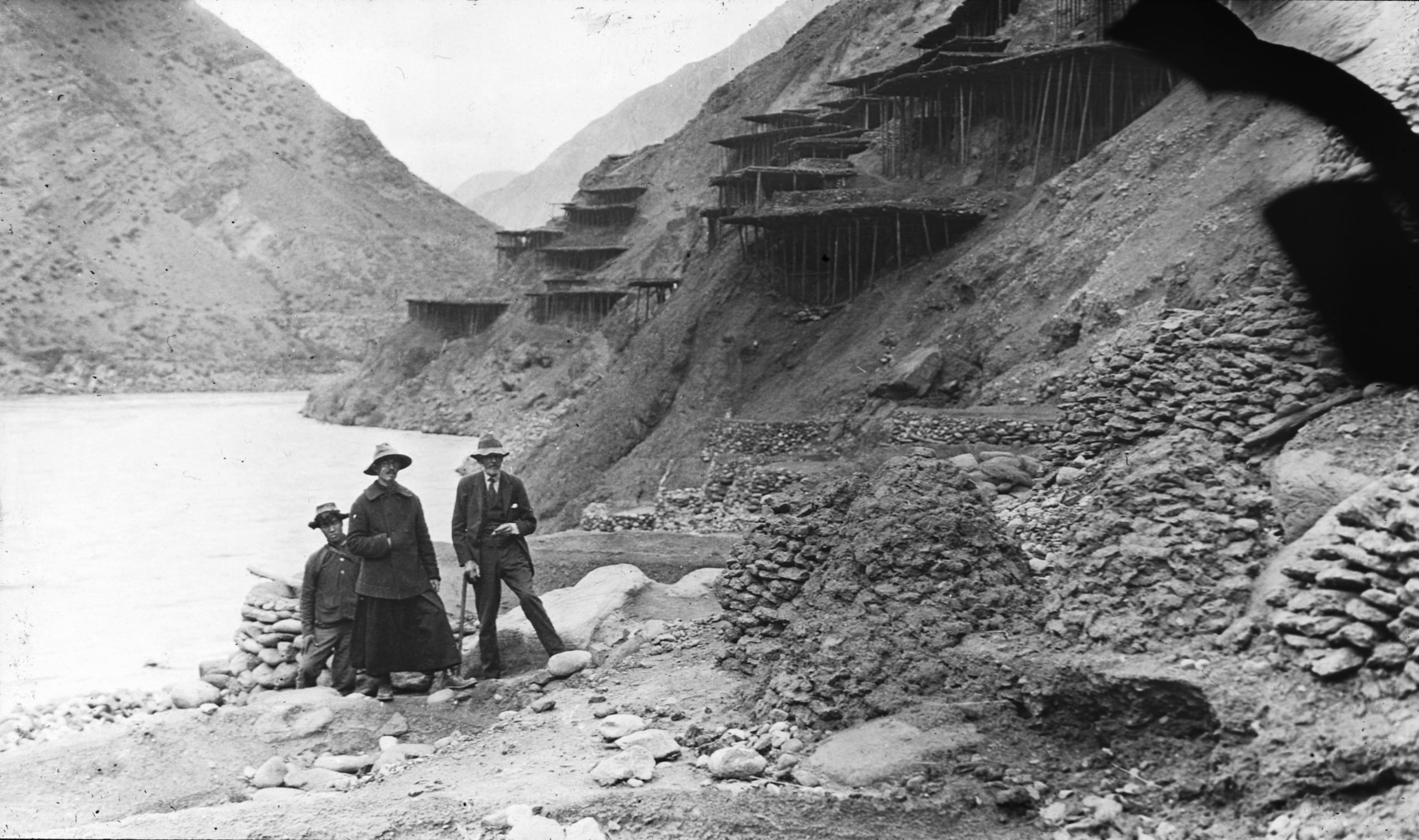
Père Goré with GP and one of the boys at the salt flats near Yakalo
Père Goré with GP and one of the boys at the salt flats near Yakalo
“Along the banks of the river are about 6 or 7 terraces, simply flat roofs – made with earth plastered, so as to form shallow troughs about 10 ft. sq and 3 inches deep. Into these the brine is ladled and the combined action of the sun and wind evaporates it and crystallises the salt. The openings of the actual wells are down by the river level and in July, August and September these openings are covered by the river, which would then be in flood. The people who worked there are all women. They use the time repairing and re-plastering their terraces. The terraces are divided up between the different families. The flat roofs supported by polls like scaffolding. A tax of 2 rupees per mule load is exacted by the Chinese authorities when the salt is loaded up for transport.
“Curiously, on the right bank of the river, the terraces are all a deep red sandstone colour, and the salt is red when crystallised. On the left bank it is a so-called white (dirty cream colour) and the terraces are a corresponding colour. They presume it is due to the right bank being a red sandstone and the left a kind of granite or yellow sandstone. Along the banks of the river on each side, near the water’s edge, there are circular troughs shaped like a large basin about 6 ft. in diameter, into which the brine is first deposited”.
“We returned to Yakalo where we found a messenger from the Markham Tege, with a letter saying that he had referred the question of our route to the Galon Lama at Chambdo – who would reply to it at once to Batang. As far as he was concerned, he (the Markham Tegi), could not give them permission to proceed North via Gartok, but that he would meet them at a place called Dja ni ting (which is on the main road from Yakalo to Batang) – where he said he would “explain clearly”.
As the road to Batang was said to be quite safe – at least as far as Dja ni ting – they planned to leave the following day (Saturday) and meet the Markham Tegi at Dja ni ting. Then, most likely, go right on to Batang – hopefully arriving in 8 days.
“Père Goré who is staying on, will leave on Monday – and having a fast mule will properly overtake us on the Wednesday – and then go on with us to Batang. He is an exceedingly pleasant man, and quite an authority on things Tibetan. He speaks practically no English, so I have had to struggle with French. The little Chapel at Yakalo has been destroyed 3 times and the missionaries had to flee for their lives, the last time in 1912, but they were back again the following year and rebuilt the station. “Père Goré told us he has a large number of Christians among the salt workers. Brave men indeed!”
Day sixty-one September 15th 1923 Yakalo to Tha Ta Ting - 6¼ miles
“We packed up in the morning – Saturday – ready to start at midday. The Magistrate of Yien Chung and Yakalo called at 11 o’clock to say goodbye, and to ask Père Goré not to go – we wonder whether it is because it might be difficult for him to get back, or whether the Magistrate likes to have him at hand for advice. Père Goré thought the chances were that by Monday he would be able to get away”.
In addition to their normal baggage, they had several additional mule loads for them to take to from Père Goré to Dr. Hardy of the American mission in Batang. Père Goré had had them for some time, but not been able to send them on.

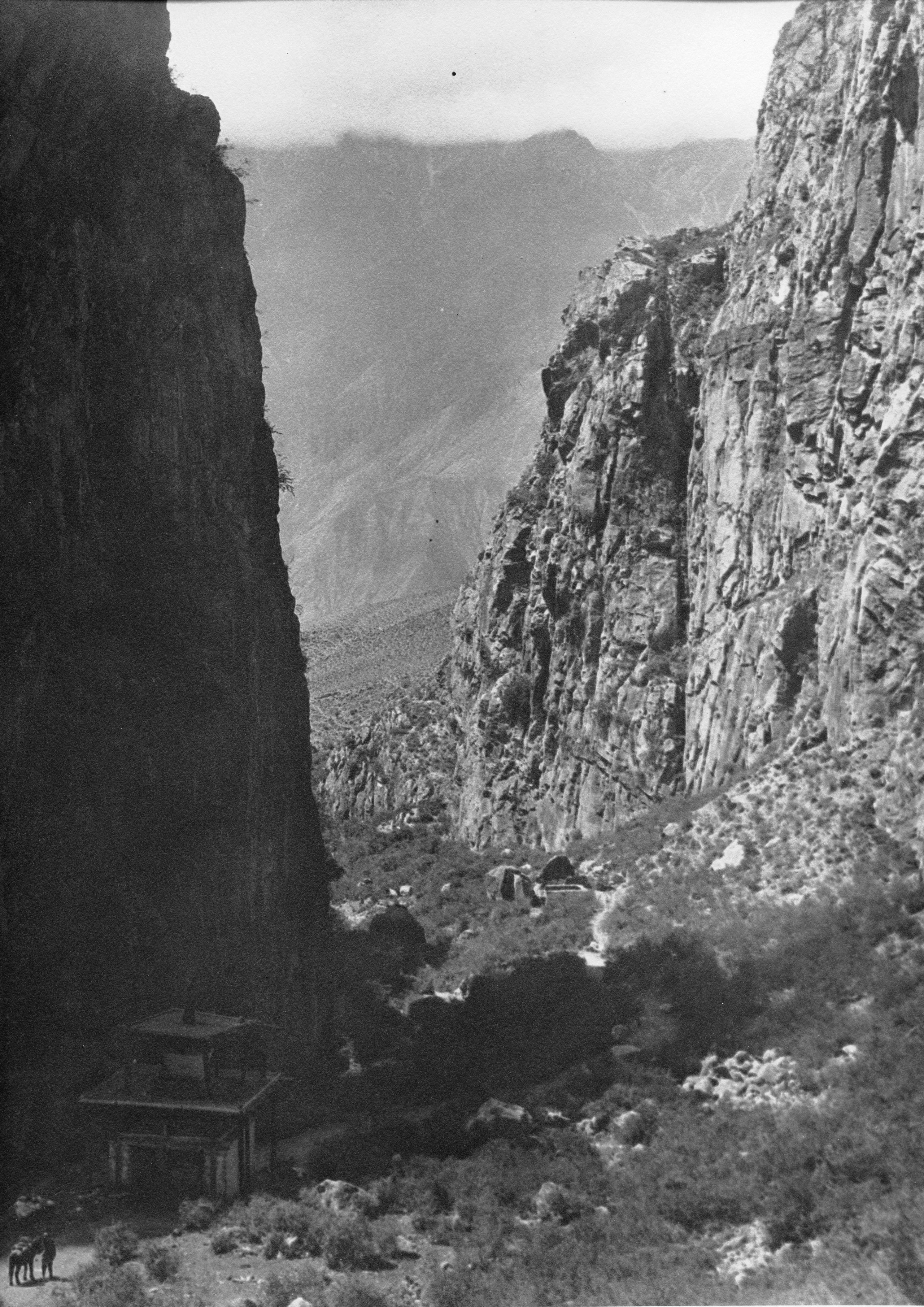
Looking back after leaving Yakalo - note the Temple at the bottom left
Looking back after leaving Yakalo - note the Temple at the bottom left
“As planned, we left at 12 noon and Père Goré and the Magistrate accompanied us to the beginning of the gorge, through which the road to Batang runs. We said goodbye and then began the ascent of the gorge, passing the Drag-shih canyon. We travelled 6¼ miles, and at 3.0 p.m. we arrived at, Tha-da Ting (11,312 ft.), not a very big days travel (stage), but it took us up the gorge and the valley, and the following day we will climb the pass, which marks the Mekong-Yangtze divide. During the day’s journey we climbed 2,700 ft. and from that point, the great mountain Da-mi-yung could be seen, though it did not seem so high as when first seen some stages back”.
Day sixty-two September 16th 1923. Tha-da Ting to Ngu Chu - 13¼ miles
“We left Tha Ta Tung at 7 a.m. and at once began the ascent to the Cha la pass. It is very cold, and I was glad to be able to unstrap my Burberry from the saddle and get into it, and put my hands into the pockets to keep them warm”.
A stiff climb of 2800 ft. brought them to the pile of stones marking the summit of the pass (14,130 ft.). According to Père Gorè, these heaps of stones with Tibetan prayers engraved on them, many of which they had passed on the road-side, are called Dobourg, meaning a hundred thousand stones. Their Tibetan boy pronounced it Mbembong. This word was also used for the stone piles, with prayer flags stuck in them, which are found on the top of every pass in Tibet.
They also learnt from Père Gorè that the small mud white-painted pyramids on the roofs of Tibetan houses are for burning incense and not to ward off sickness.
“On the way up, we passed through some glorious pinewoods – with huge trees. Where there are open spaces, there is an abundance of a very pretty yellow flower growing in clusters, and shaped like a small orchid. There was also a profusion of blue flowers (light and dark), which GP thinks are Gentiana Nubigena, which he said is found in many places in Tibet at an altitude of over 11,000 ft.”
“At the summit of the pass a stiff cold breeze was blowing, and it was difficult to get the boiling point to estimate the altitude. It took about half an hour to get the thermometer steady. After reaching the summit of the pass we had a glorious view - looking back towards the valley of the Mekong with the snow-capped mountains (including Da-Mi en) on the other side”.

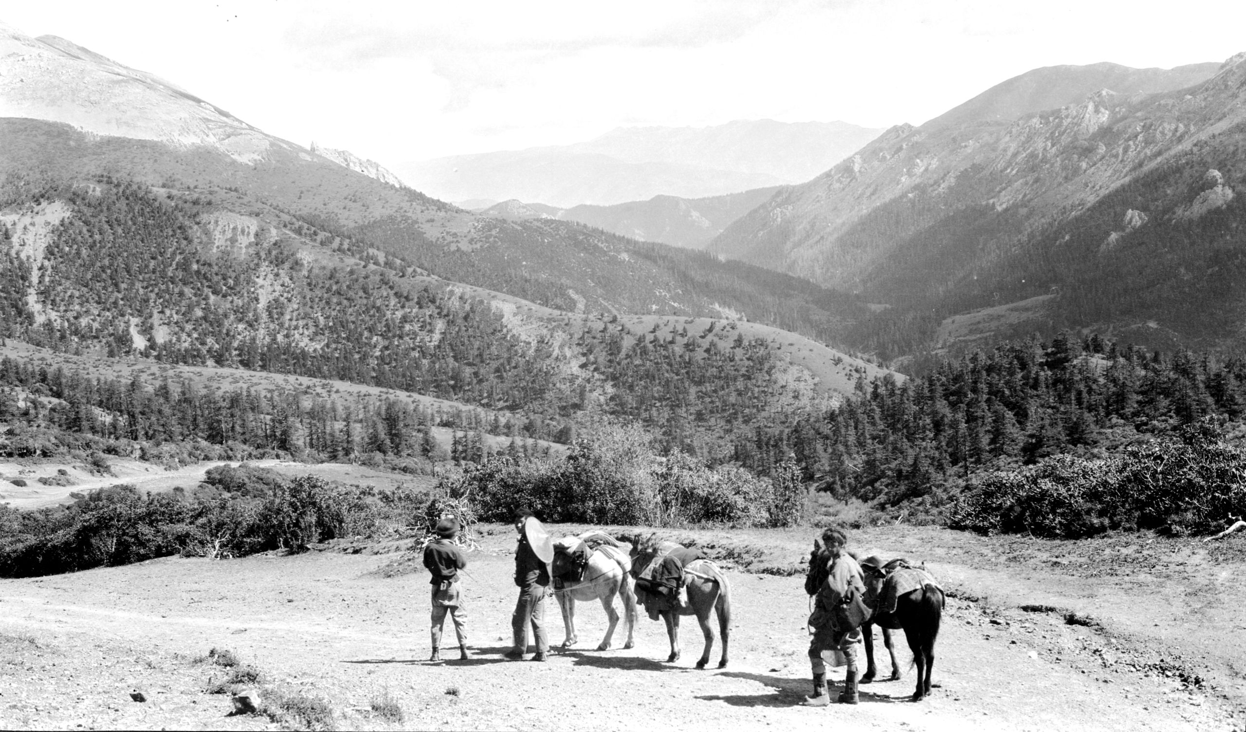
Looking north just after crossing the Cha La pass at the Mekong-Yangtze divide
Looking north just after crossing the Cha La pass at the Mekong-Yangtze divide
“From the summit the road slipped down into the Durashi valley – full of firs and a tree which we did not recognise, which was now beginning to change to a red autumn tint. We descended into the valley, and at 11.30 stopped for lunch by the side of a large stream, which was flowing down in the same direction in which we were travelling”.
“At 1 p.m., the mules and donkeys were loaded up again. We crossed and re-crossed the stream and began another climb, not so high as the Cha la, but which still reached 13,111 ft. As we crossed the stream for the last time – a small donkey stumbled and was at once swept off its feet. The brook was only about 2’6” deep, and the muleteers were into the water at once. They dragged off the load, freed the donkey then pulled it to the bank. It was very frightened, but none the worse”.
The narrow Durashi valley was stony and often muddy, and would have been bad after rain, but luckily the weather was fine and warm, though it had been rather chilly and windy at the top of the pass. At 9 miles the path crossed to the right bank and ascended to the Chu-chih La, (12,500 ft.) The route then wound down before ascending again to the Chih-ru La, (13,111 ft.), at 11¾ miles.
“From the top we could see that the road lay down a large open valley. It was an easy descent and at 3.30 we arrived at Ngu Chu (11984 ft.), where we were staying for the night. This is a hamlet of five houses in a small valley with some cultivation”.
“The day’s scenery was quite different to anything here hitherto – the mountains bordering the valleys are clothed with magnificent pine trees at their base and 2/3rds of the way up their sides – the upper ⅓ rd is generally bare of trees and composed of almost white rock which glistens in the sun. The most beautiful contrast to the dark pines below”.
There was considerable fear among the Chinese escort of raids on the next day's march, and they wanted to get ten men as escort. The Gunka Lama's men had fled into the hills and might be dangerous. GP thought two additional men would be sufficient.
Day sixty-three September 17th 1923 Ngu Chu to Dja ni ting - 16¾ miles
“We left Ngu Chu at 7 a.m. and had a splendid gradient downhill – until we arrived at a large river called the Tsung Tsa, one of the tributaries of the Yang Tze. It is spanned by a Bridge near the village of Souda (9,978 ft.) – it is of a cantilever design and looks as if it might collapse at any moment”.

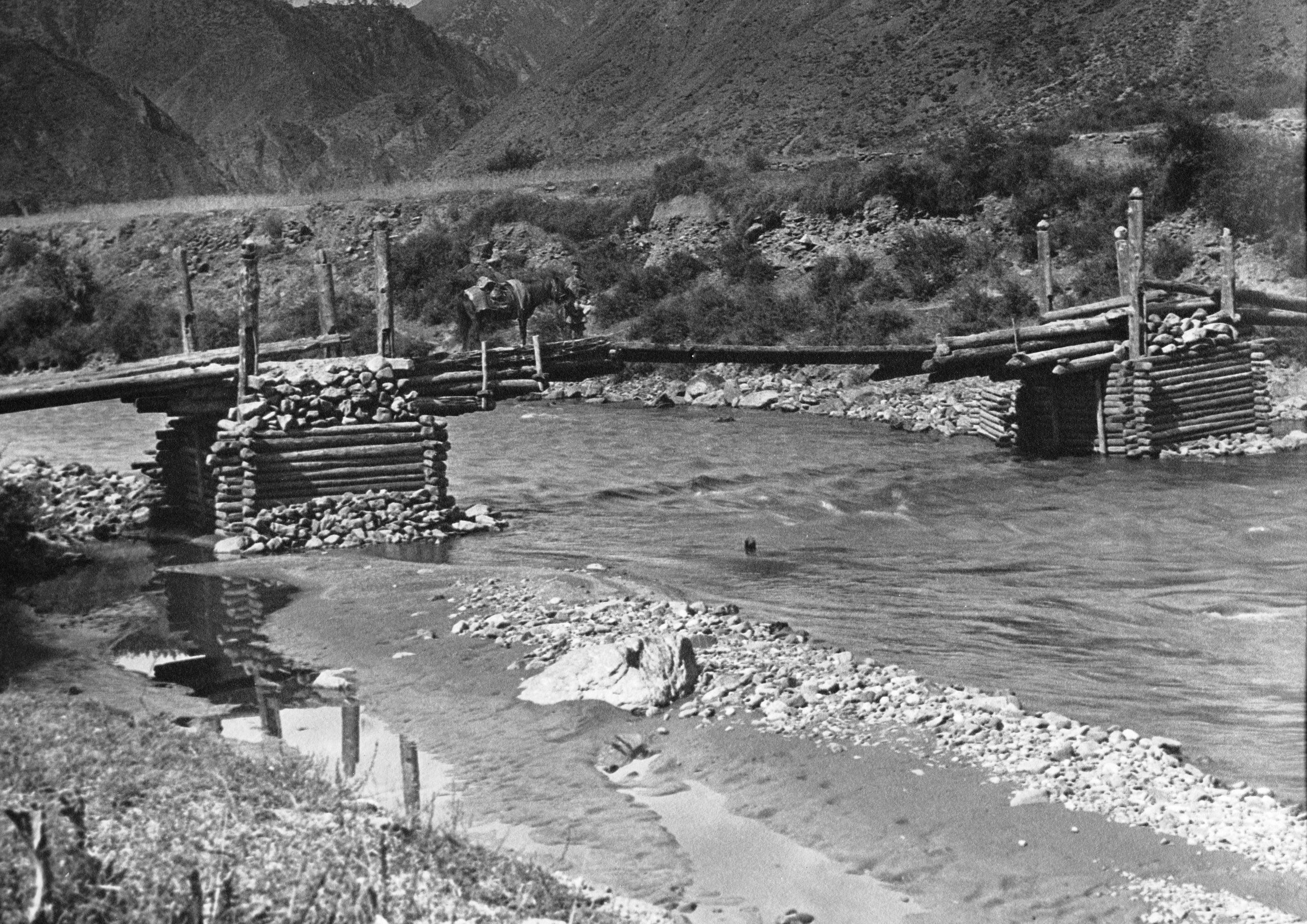
Cantilever bridge at Tsung-tsa
Cantilever bridge at Tsung-tsa
“After crossing the bridge and passing the village of Tsong Gung we started the ascent of a long valley which was very prettily wooded. After one half hours, at 11 a.m., we arrived at Olong (10,644 ft.), a tiny village in the midst of barley and cornfields. Here we had lunch, started on again at 12.15, still ascending the valley and after 16¾ miles we arrived here at Dja Ni Ting (12,209 ft.) at 3.30 p.m. where a messenger from the Markham Tegi was waiting”.
The messenger explained that the Tegi had a pain in his leg and was sorry he could not come to meet them. It transpired that the Markham Tegi had not yet written to the Galon lama at Chambdo. They offered to go on to Llandu, where the Tegi is staying as it was only a few hours further, but across the frontier into Tibet. The messenger, very politely said it was not necessary. On pressing it, it was obvious that they were not willing for them to enter Tibet. GP responded firmly:
“Very well, we go straight on to Batang and will wait there 10 days for the Galon Lama’s answer. If none is forthcoming, I will write to the Galon Lama myself, and complain, and also to Lhasa and complain of the way I have been treated.”
He also told the messenger the route they wished to take by Tibet to Kanze and urged him not to waste further time.
“The messenger, a pleasant faced old man, bowed himself out and soon we heard the jingle of the bells on his pony which signalled his departure. We are not optimistic that we will get a favourable response.
Day sixty-four September 18th 1923 Dja ni ting to Ba Mu Tang - 15¼ miles
They left Dja Ni Ting at 7 a.m. and immediately began the ascent to the plateau, which formed part of the watershed of the Yangtze. Their caravan had swelled from their seventeen animals and eight extra for the Batang Mission to sixty-eight animals, and some pedestrians. After an hour and forty minutes steady climb they reached the plateau. From where they could look away over to the West, and look into the Forbidden land of Tibet. The village of Llandau, where the Markham Tegi was staying, was hidden by a hill, but they could see up the valley beyond, and it seemed strange to know that they could not crossover that small stretch of country between.

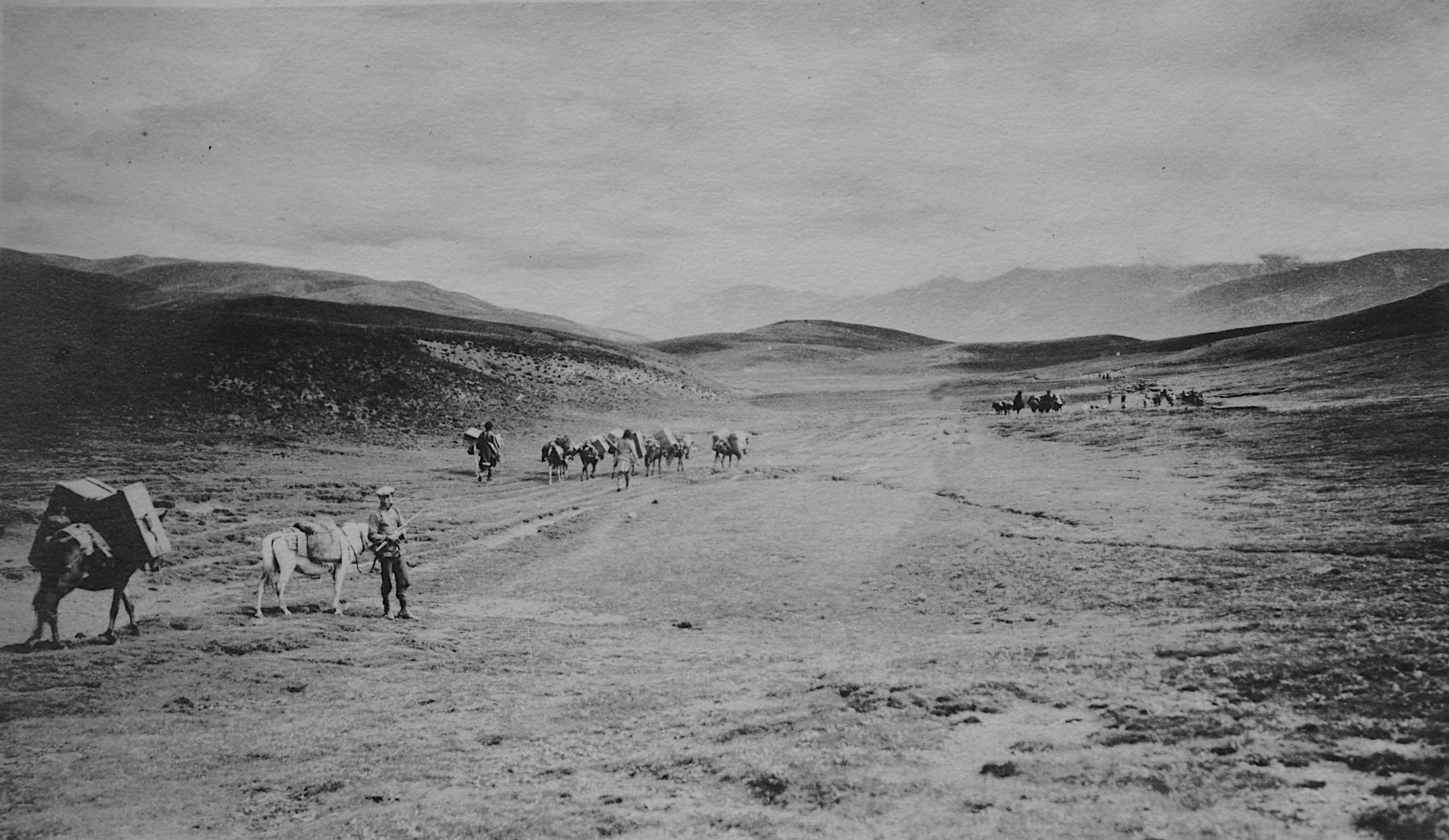
On the plateau on the Tibetan border by the Mekong-Yangtze divide
On the plateau on the Tibetan border by the Mekong-Yangtze divide
They had about an hour’s level going on the plateau, the highest point called the Bongla being 13,054 ft. In a small valley was a nomad camp with several hundred sheep and a herd of yak grazing round the tents.
After the plateau came a descent to Tchamba latsa (11,984 ft.) which they reached at 11.30 a.m., and had lunch. Some Tibetans were shearing sheep close by:
“In shearing sheep, they do not cut the wool very close, but leave about 2 inches in length – the wool is cut with a knife. The women had black grease smeared over their cheeks to either add to their beauty or detract from it – not sure which.”.

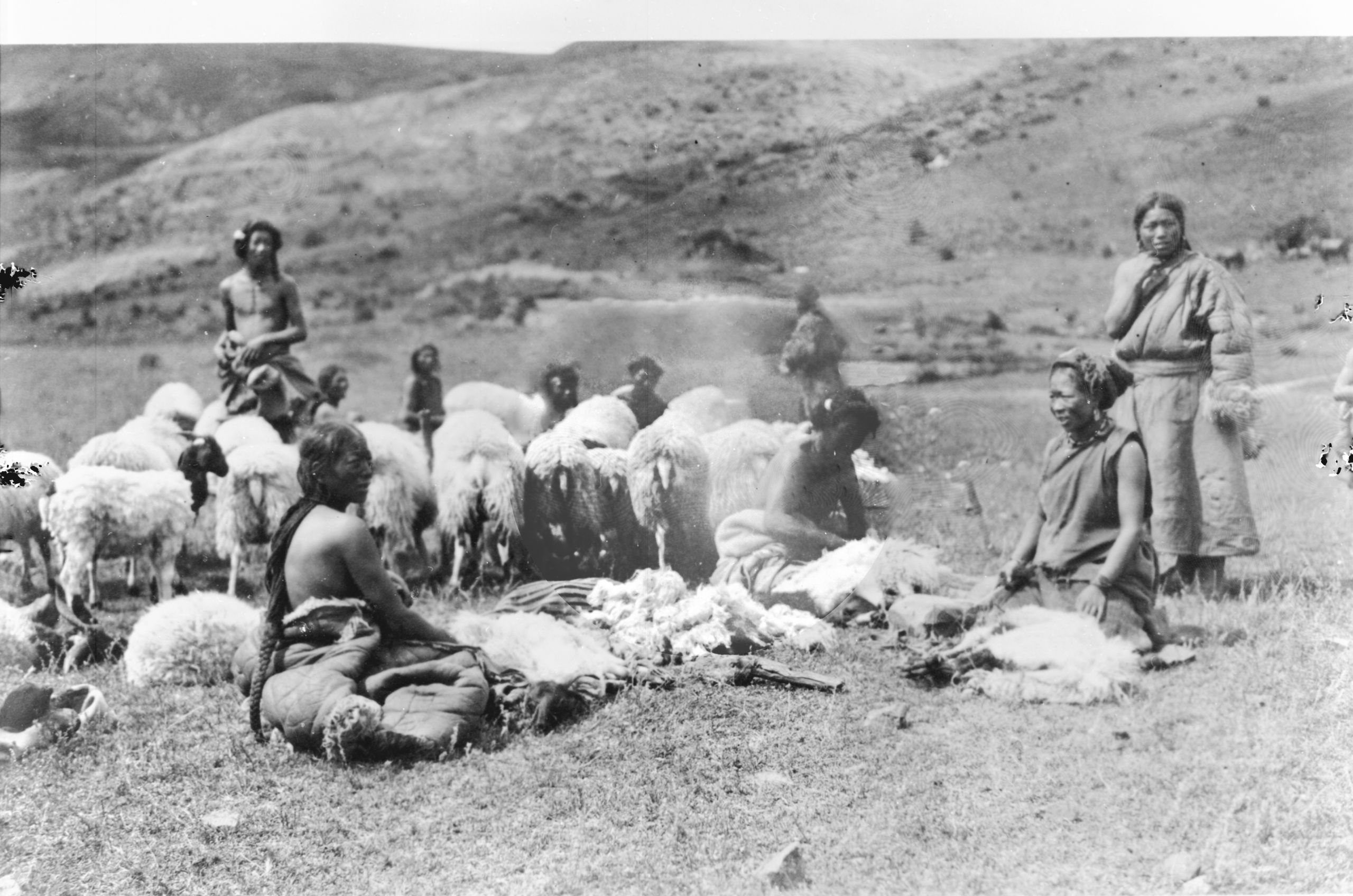
Sheep shearing by Tibetan women at Tchamba latsa
Sheep shearing by Tibetan women at Tchamba latsa

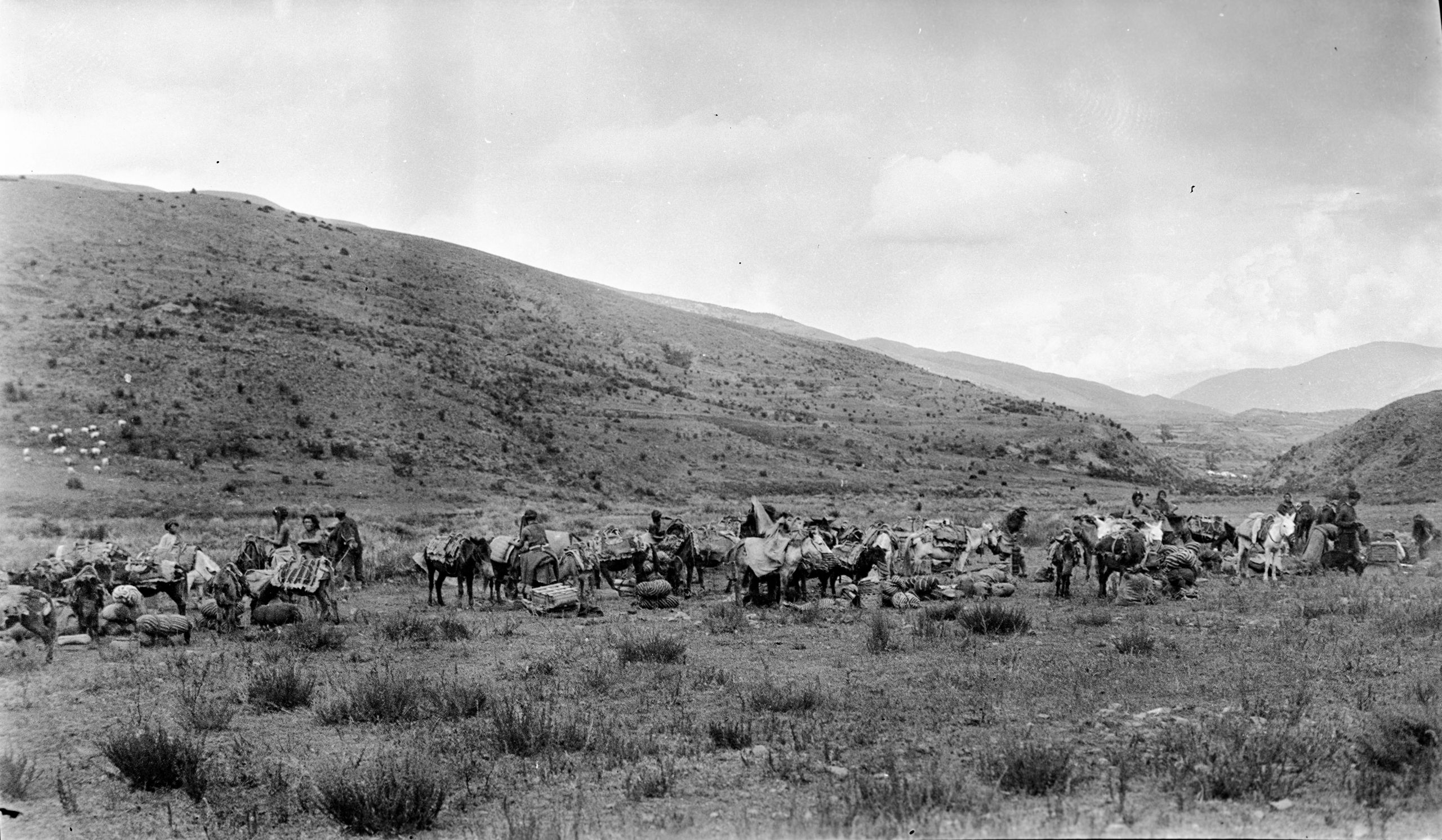
Midday halt at Tchramba latsa
Midday halt at Tchramba latsa
“At Tchamba latsa we found another letter waiting from Dr Hardy. He had sent a runner with it – but the man, after waiting for 5 days, had left the letter and returned. The letter says a warm welcome is awaiting us. We left Tchamba latsa at 1 p.m. and after a journey of 15¼ miles we arrived at Ba Mi Tong (11,090 ft.) at 3.30 p.m. just getting the tail end of a thunderstorm”.

Black Tibetan camp with Yaks and sheep (repaired slide)
Black Tibetan camp with Yaks and sheep (repaired slide)
“At Ba Mi Tong a messenger from the Markham Tegi arrived. He says “The Markham Tegi has dispatched a messenger to the Galon Lama at Chambdo, but won’t get a reply in under 15 days. So, we shall have to wait at Batang 10 days”. GP has sent a strong message back. Things look a little more hopeful for permission to get to Kanze via Tibet. We will know more when we receive the Galon Lama’s reply at Batang".
Day sixty-five 19th September 1923 Ba Mi Tang to Gunra - 14¾ miles
“We left Ba mi Tang at 7.10 a.m. and followed the torrent through a long gorge. The road lay over high rolling grassy downs. There were few trees, and the path was stony. At 3¾ miles the Dong-ti La pass (12,998 ft.), was crossed. It opened on to the top of the downs. Beyond it there was a slight drop and then a rise to the Bum La, (13,054 ft.), at 5½ miles. At 7½ miles the descent became steeper to the Tamba-Larji grass valley, where there were some nomad tents. The valley has a rushing stream, which the road crosses and re-crosses on log bridges until finally the road is on the left bank. We kept to the hillside, while the stream – now a small river – took a sharp bend to the east and disappeared down a side valley, evidently making its way to the Yangtze”.

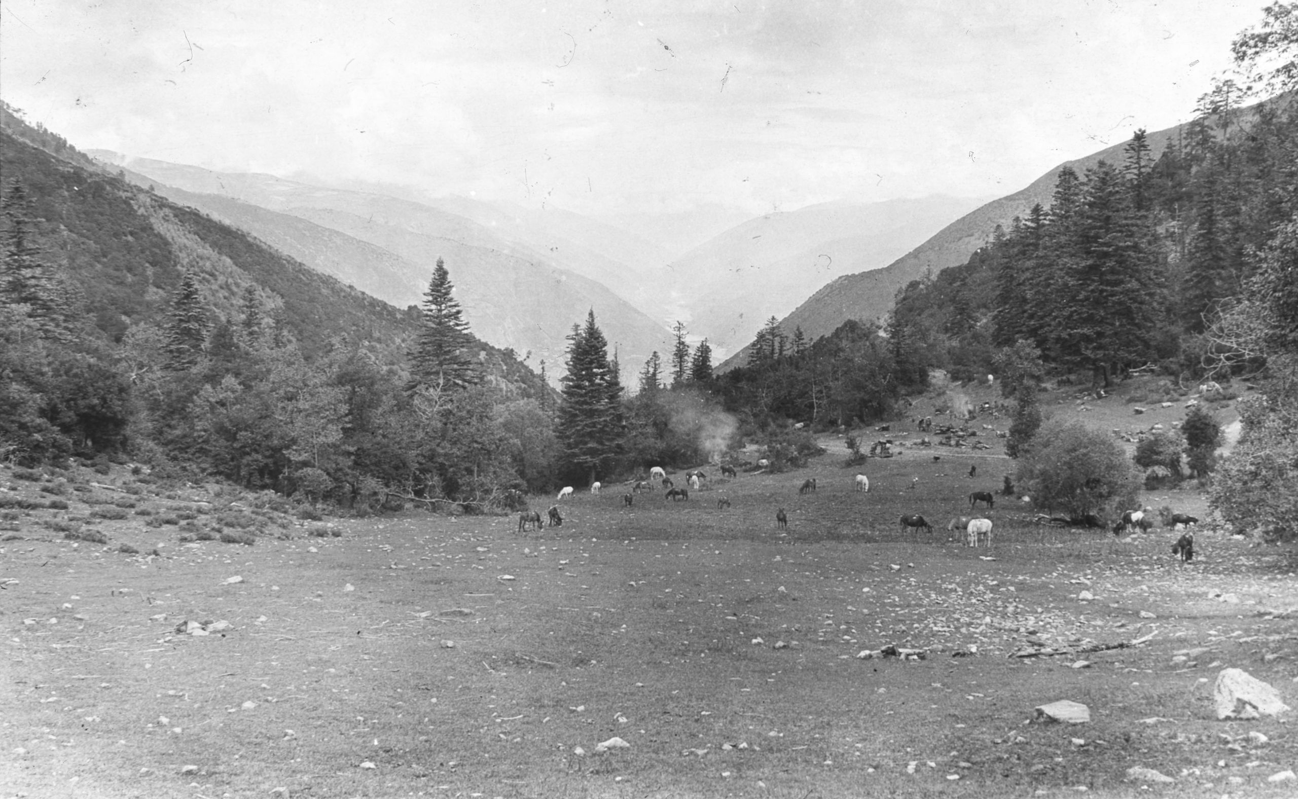
Looking down at the upper Yangtze valley - midday halt at Kung tsz kha
Looking down at the upper Yangtze valley - midday halt at Kung tsz kha
“On the way, one of the men told us that Père Goré was just behind. We waited, and soon he turned up, having done the journey from Yakalo in a little over 2 days – whereas it has taken us 4. It is very nice to see him again, and we halted just over the crest of a hill for lunch at Kung-tzu-la (11,090 ft.) Lunch over, at 12 noon, we started on again – a steady downhill along the valley – brought us at 1 o’clock to Tegating. Another one hour and 10 minutes, and after a day’s march of 14¾ miles, we arrived here at Gunra (7997 ft.), about 150 feet above the banks of the Yangtze. We are staying in a temple overlooking the river. It is a village of eight houses, and seventy Chinese soldiers are stationed in it. It was chilly on the top of the pass, but down below it is quite hot and fine”.

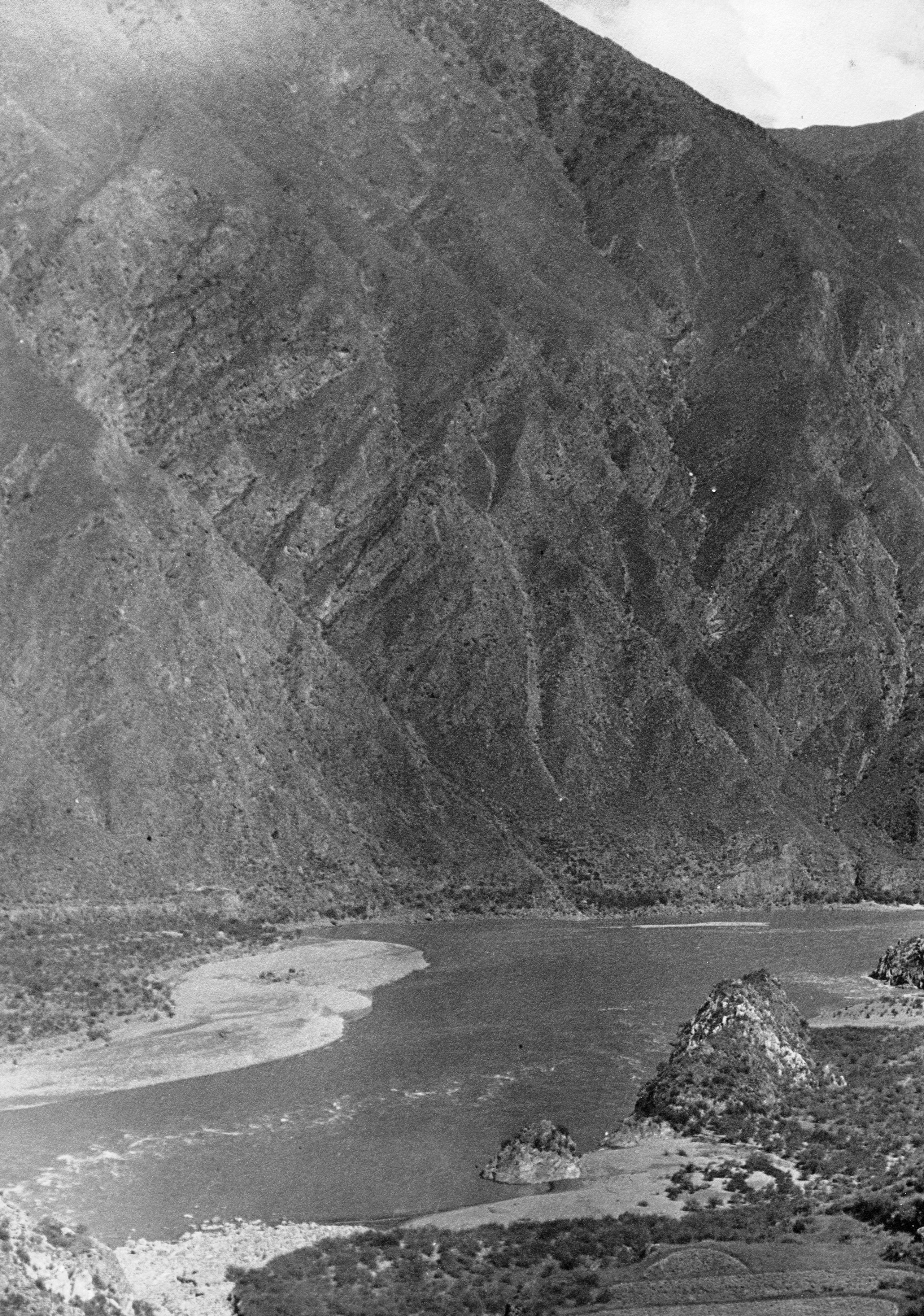
The Yangtze river. Looking south from Gunra
The Yangtze river. Looking south from Gunra

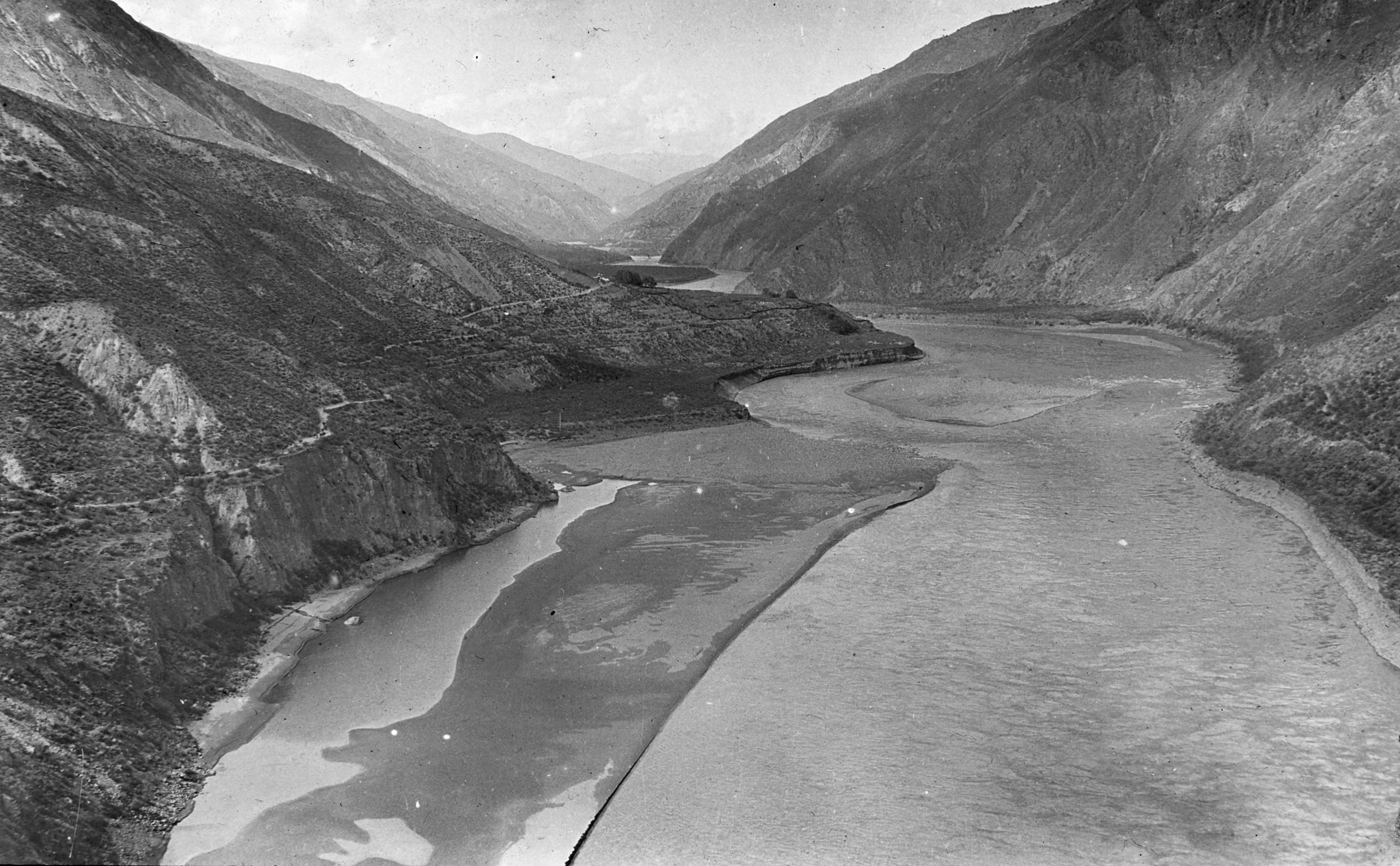
The Yangtze river. Looking north from Gunra
The Yangtze river. Looking north from Gunra

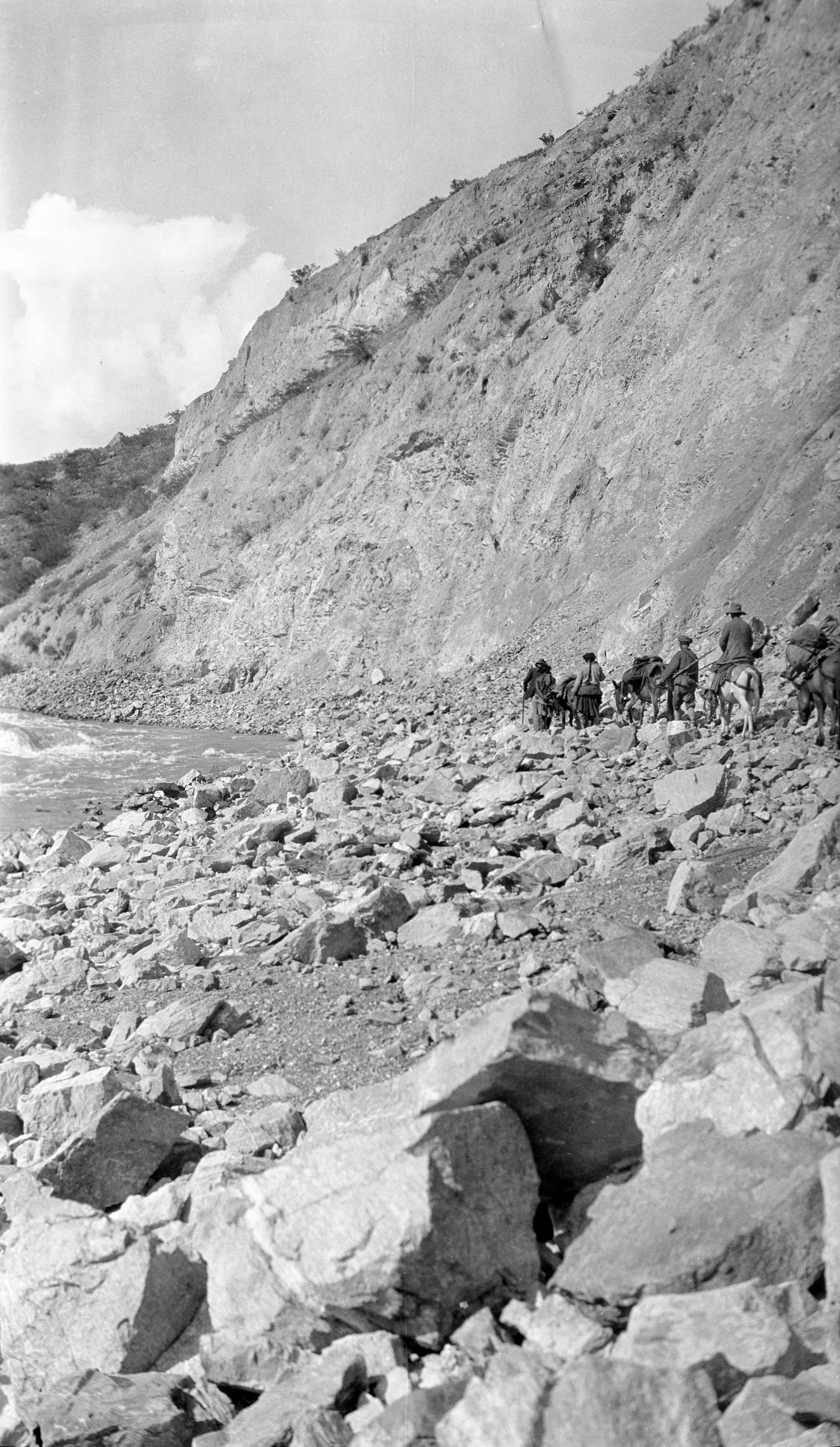
Hard going travelling north by the Yangtze near Gunra (Right bank of river)
Hard going travelling north by the Yangtze near Gunra (Right bank of river)
“We are now back by the Yangtze. It was very hard going, but we could see the position of the Drubalong ferry in the distance which heartened and spurred us on as we will then be only one day’s journey from Batang”.
Day sixty-six September 20th 1923 Gunra to Drubalong - 9¾ miles
“We were up at 5 a.m. and ready to start at 6 a.m. – but the muleteers came in with the news that the mules could not be found. They had been let loose to graze on the mountainside overnight. After half an hour all had been rounded up except 12, and after what seemed an age the truant 12 were brought in. At 7.30 a start was made”.
“A messenger had been sent on in advance to get the Drubalong (Chu-pa-lung in Chinese) ferryboat to come down the river, as on our side (the Rt. Bank), there is a small river running into the main river, which has been swollen by the rain during the night. We arrived at the appointed place at about 11 a.m., but there was no ferry and we had to wait 2 hours before it turned up”.

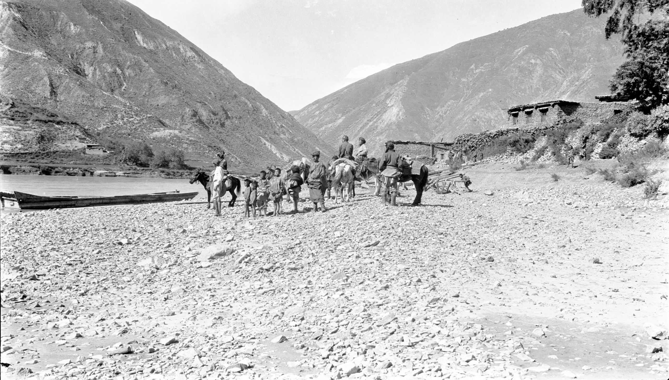
Waiting for the Drubalong ferry
Waiting for the Drubalong ferry

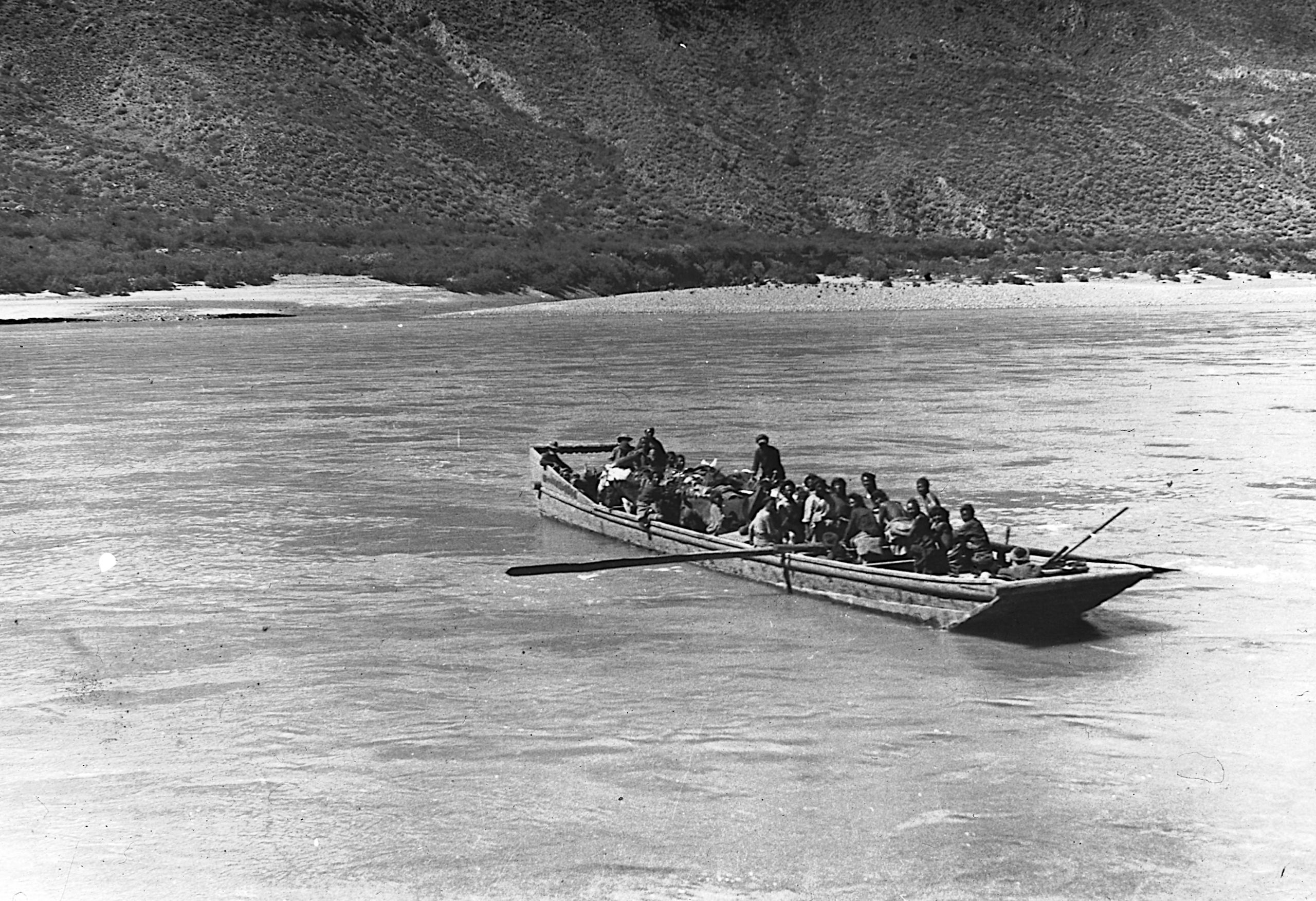
Crossing on the Drubalong ferry (GP and Père Goré in boat)
Crossing on the Drubalong ferry (GP and Père Goré in boat)
“At 1 o’clock I crossed with the 1st load of baggage. It took ¾ of an hour for each load to cross the river. After the 2nd crossing – Père Goré and I went on ahead with a soldier and a few meals whilst GP waited to see the other mules across and loaded up. GP thought it was very necessary for someone to be there as this was just the sort of opportunity which bandits might take for a raid. (GP said that with 10 men he could pick off everybody from the boat and hold the whole ferry while the mules were ferried off, loaded and walked off). All got over safely – and after 1 hour’s march, we arrived at the real place for the ferry".

HGT drew a sketch of the day’s route in his journal
HGT drew a sketch of the day’s route in his journal
The following day they were due to pass the place where Dr. Shelton had been killed.
HGT wrote in his journal:
“What memories this brings up”.
“Dr. Shelton of the American Mission was murdered by Kei-mu-wa tribesmen in February 1922. The tribe was a pastoral race who had been plundered by the Sia-chern-wa people who live to the south- east, and being reduced to dire straits, had turned brigands. The murderers were known, but the Chinese at Batang were too feeble to arrest them”.
“The orders for tomorrow are: – there are no definite news of any robbers, but it is best to be on the safe side and keep together. We are now a big party so it is not at all likely that we would be bothered. When we left Yunnan fu we had a total of 18 mules, now there were 63 at the crossing – besides which there are also about 10 yak with their owners”.
“Drubalong Druka is a village of thirteen houses and has a garrison of sixty men”.
Day sixty-seven September 21st, 1923. Drubalong to Batang - 20½ miles
They were up at 5 a.m. and off at 6.10 in the hope of making Batang.
The first part of the journey was along by the Yangtze.

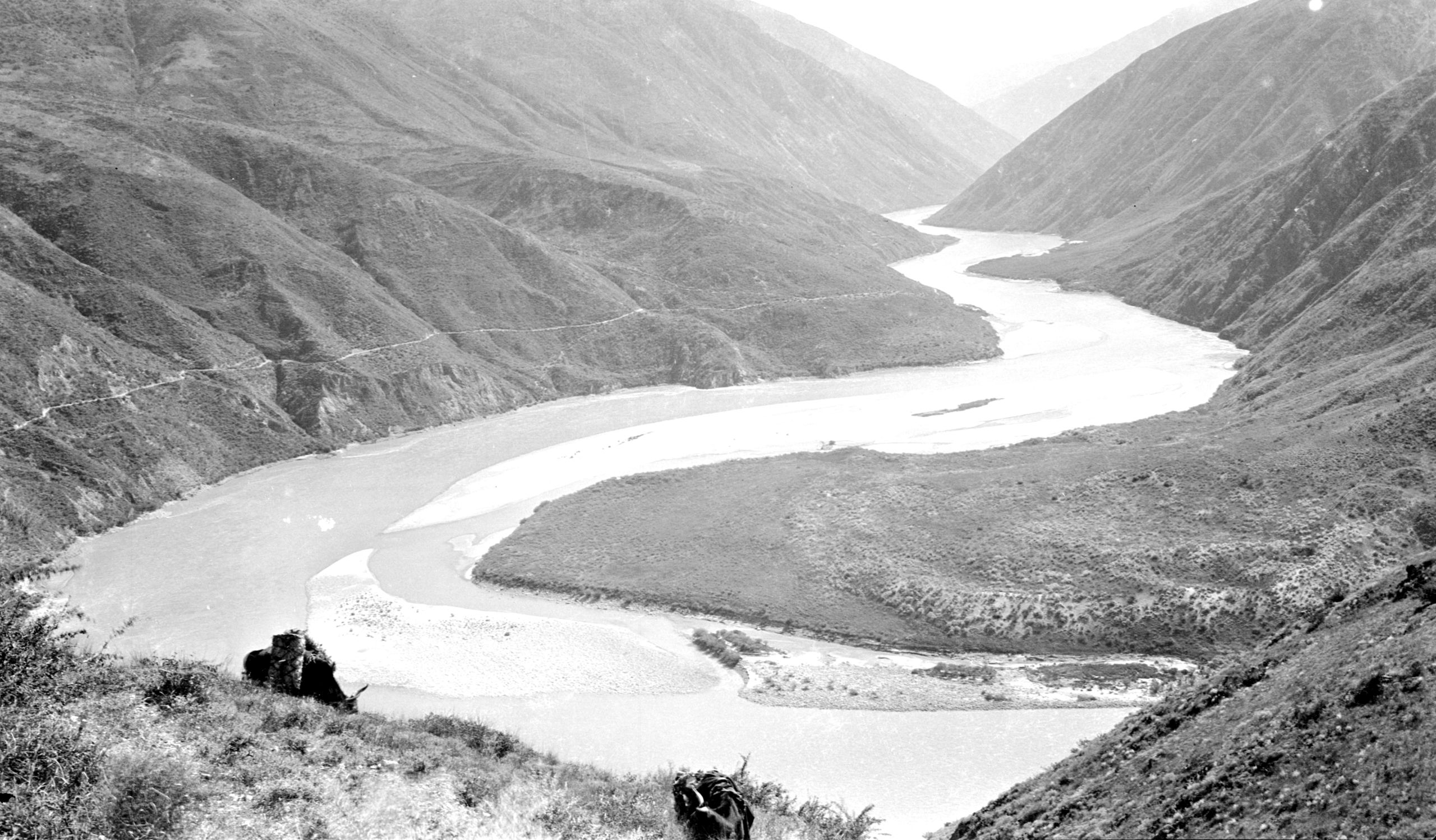
Looking south towards Drubalong taken from the spot where the Batang road leaves the Yangtze river
Looking south towards Drubalong taken from the spot where the Batang road leaves the Yangtze river
HGT wrote in his journal:
“It is fresh and cool with the sun shining on the mountain tops but not yet down into the River valley. - after following the left bank of the river for 6 miles we changed escort and hours after starting came to the crossing of a rivulet called Lamda. It was at this spot - Père Goré told us - that 40 years in 1881, a French priest, Père Brieux, was killed by bandits. One hour later we arrived at Leh Lei (Shui-mao-kou in Chinese) - and ¼ of an hour further on the village of Nieu-chiu, (or Nyu-shu), a village of five families, where we stopped for lunch. We were in good time – 1½ hours rest for lunch and then on again into Batang, as our next stop”.

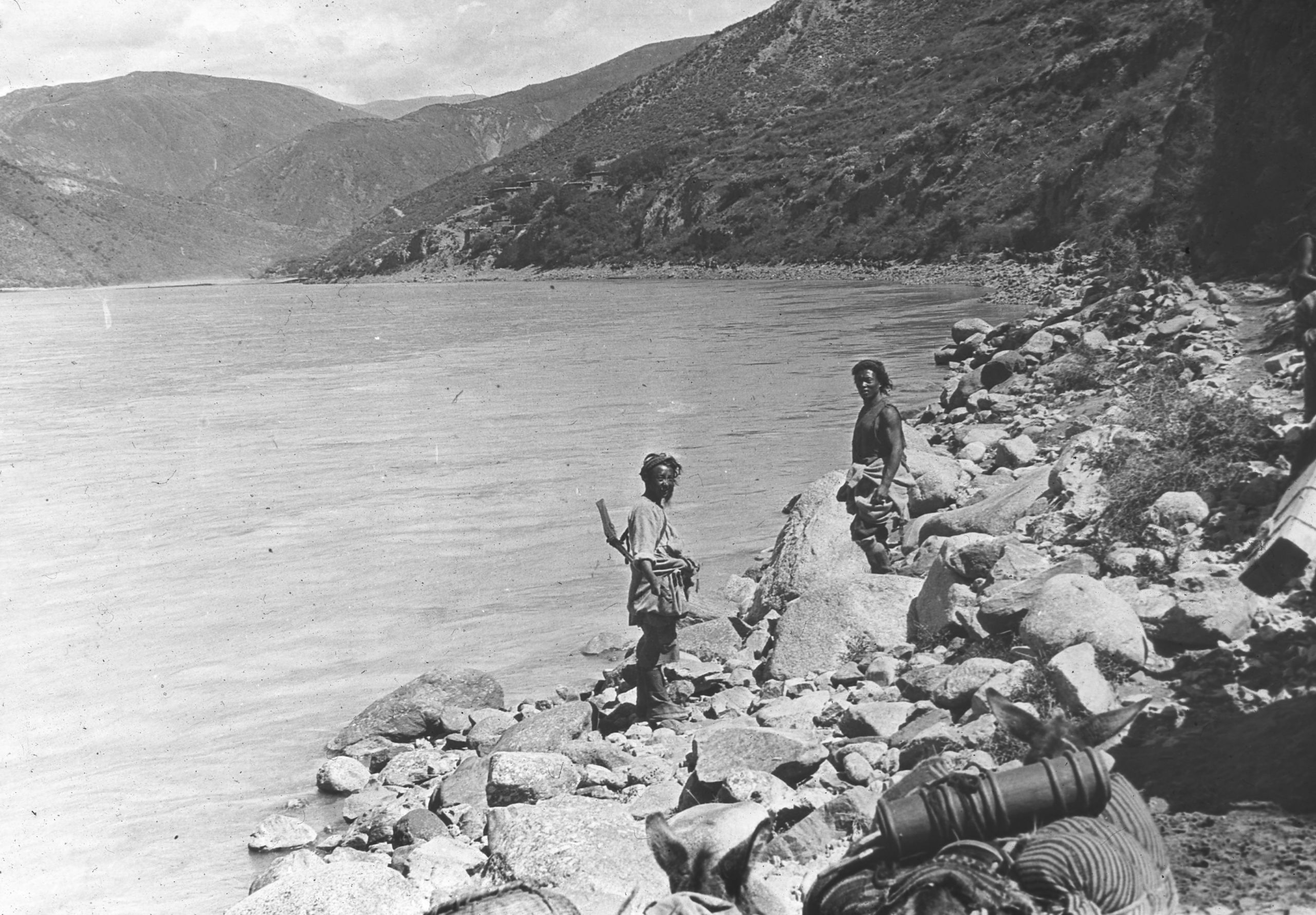
Leaving Nieu chiu en route to Batang up hill on the left bank of river Yangtze
Leaving Nieu chiu en route to Batang up hill on the left bank of river Yangtze
On leaving Nieu-chiu the road began to ascend, cutting off a corner between the junction of the Batang River and the Yangtze. HGT made the following sketch in his journal:-

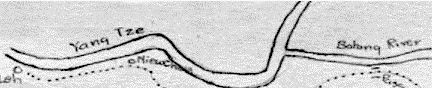
HGT's sketch of the junction of the Batang river and the Yangtze river
HGT's sketch of the junction of the Batang river and the Yangtze river

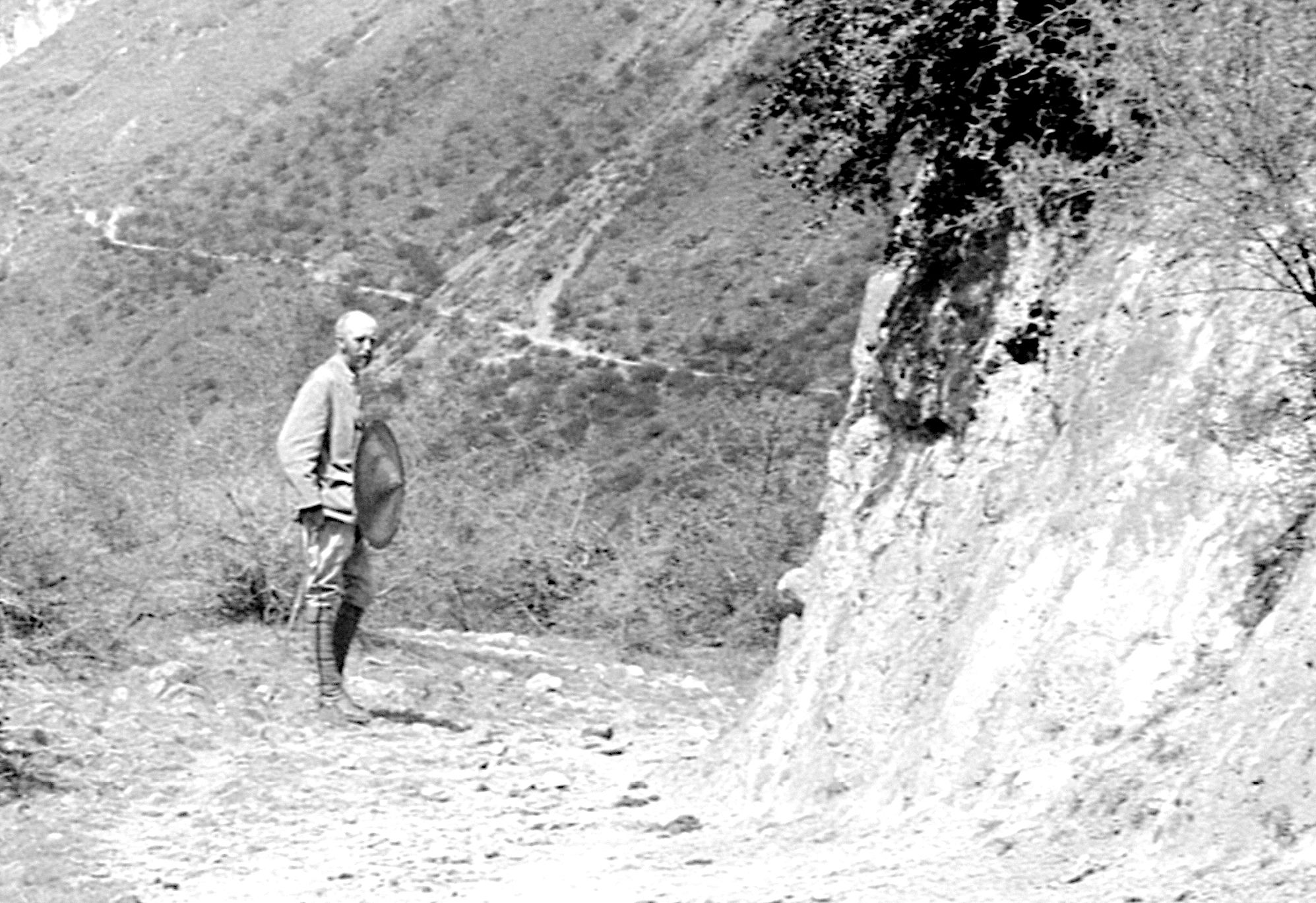
HGT on the road to Batang at the spot where Dr Shelton was shot
HGT on the road to Batang at the spot where Dr Shelton was shot
“Slowly mounting along the side of the hill we followed a big bend with the Yangtze away down below - until at last we came to a corner which Père Goré pointed out to them and said, "This is the exact spot where the Doctor was shot". I took a photo and then let the caravan turn the corner - out of sight”.
“I knelt down for a moment and asked that I might be as faithful as he who had given his life there”.
On again, up the hill side until they reached the Ku-yu La pass (8,985 ft.) at the top. As they started the steep descent through the pleasant green fertile Ba Chu valley, which is formed by the Kan Chu coming from the north-north-east from Dam, and the Ba Chu coming from Batang, they caught their first glimpse of the Batang plain, two hours journey away. The road then ascended through the Ba Chu valley to Batang.

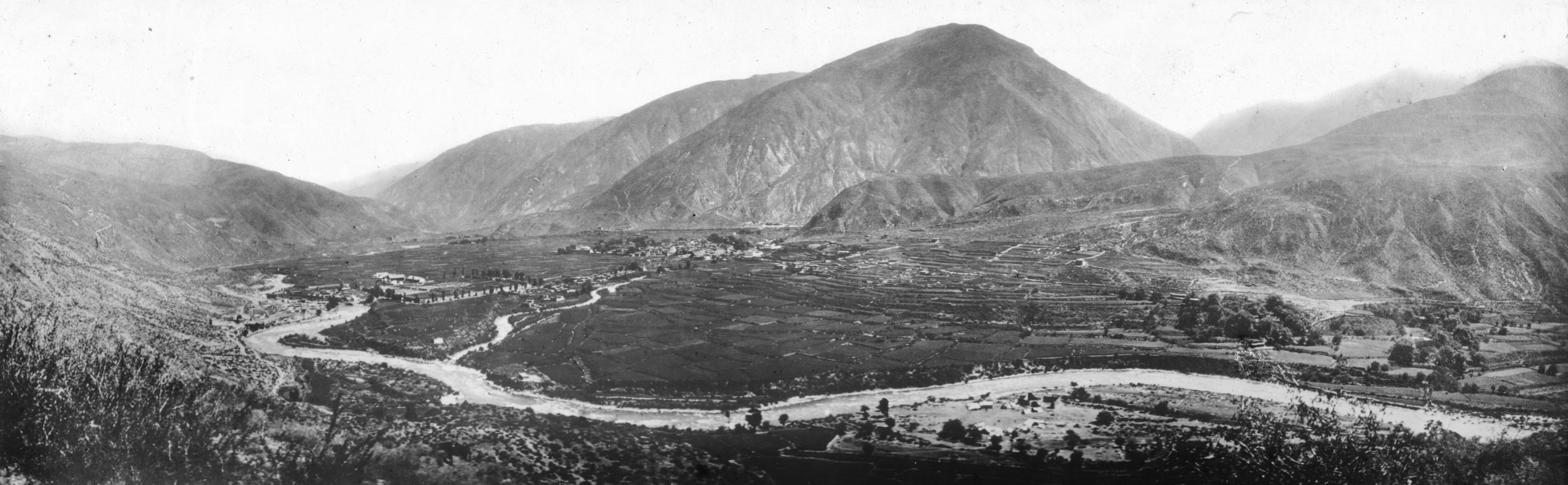
Batang from below the junction of the two rivers - the road into Batang is on the extreme right
Batang from below the junction of the two rivers - the road into Batang is on the extreme right
“An hour later a party of horsemen came in sight, and we could see they were foreigners. A few minutes more and we were shaking hands with Dr. Hardy, Mr. MacLeod, Mr. Moore and Mr. Duncan. Then ¼ of an hour later we met Dr. Hardy's two children with their amah, one on a donkey, and the other on a small pony. Then on again, and on approaching the hill that had concealed Batang from sight, Mrs. Hardy and Mrs. MacLeod were waiting for us.
Batang (8,271 ft.) had been reached after a day’s march of 20½ miles. It was a little Tibetan town with two-storied Tibetan houses. It was formerly a great centre of industry, but, due to the chaos in China at that time, trade was at a stand- still. There was a Lamasery of the Bon (or Red) sect in the town. The abbot was the Laka Lama. It was founded in A.D. 600, and the district was conquered in turn by Mongols and the Mosu - the Tibetans drove out the Mosu in A.D. 1650, and later the Chinese came into and kept possession, though the population was almost entirely Tibetan.
In 1905 the Chinese Amban, returning from Lhasa, was killed just outside Batang, and in revenge Chao erh fung, the viceroy of Szechwan, destroyed the monastery and beheaded the Chief Lama. The Lamasery was rebuilt and at the time of their visit, had 250 monks, though not all lived in it. The abbot was the Laka Lama.
“We were given a great welcome in Batang. In a few minutes we were at the American Mission Compound. The General and Père Goré went off to the MacLeod's for tea, while I went to Dr. Hardy's.
“Oh! how beautiful everything seemed - sweet and clean, the gardens with flowers and fruit trees - the house, cool and delightful. The only dirty objects - the two travellers, who were very grubby. Delightful fresh tea (Lipton's) with thick cream and freshly baked cookies. I don’t know how many cups of tea I had, but I think I ate up 50% of the cookies”.
“We had a long talk and the latest news, followed by a bath and a change. Then dinner, more talking and off to bed. Everybody is so very, very kind. Dr. Hardy had brought out the letter from AT (Amy Thompson) when he met us on the road. It seemed they could not do enough to show their delight at welcoming us, and to show us kindness and hospitality.
HGT noted in his journal;
“There was only one thing wanting, and that was my dearest old girl by my side, and that would have made it perfect. Now I must stop as I have to go across the garden to the MacLeod’s”.
Day sixty-eight September 22nd 1923. At Batang
“Breakfast at 7 a.m. - after a delightful night's rest on a proper bed. Then a chat with Mr. MacLeod who walked off with a pair of my boots and then returned them two hours later with the heels built up again and studded with iron nails - making them good for at least 6 weeks or 2 months. I am now set up in footwear for the next stage of the journey”.
The local Chinese feared that the Nanka Lama was going to attack Batang. GP did not put very much faith in these rumours. Nevertheless, within the last fifteen years there had been fierce attacks of Tibetans on Chinese and Chinese on Tibetans with wholesale massacres — and also murders of Europeans. The possibility of further conflict could not therefore be ruled out.
Dr. Hardy and Mr. MacLeod suggested that they should consider going on through the Washi country. There were Washi people in Batang, and if they got their guarantee of protection, they would pilot them through their country and then on to Kanze. It would mean turning East and travelling North of the Tachienlu road (which was blocked) until they got to Litang, then turning North on up to Kanze.
“Mr. MacLeod has begun the negotiations with some of the Washi people in the town. Two tents have been sought, one for me and GP, and one for the boys. After a short visit to the Hospital with Dr. Hardy, I then called at the French R.C. Mission, met Père Nussbaum and again saw Père Goré and GP. Then we called at the Duncan's and the Hardy's. Back for lunch. Afternoon I went with Dr. Hardy to see a case, did some writing and then we went over to the MacLeod’s for tea and supper”.

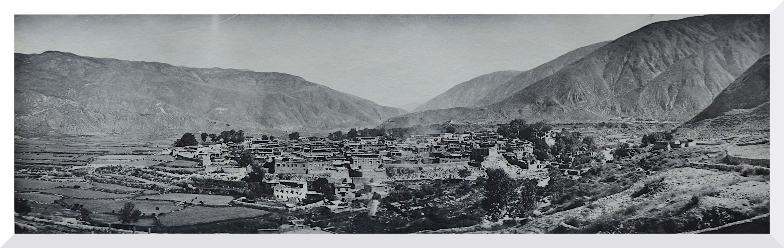
Panoramic view of Batang from the top of the hospital
Panoramic view of Batang from the top of the hospital

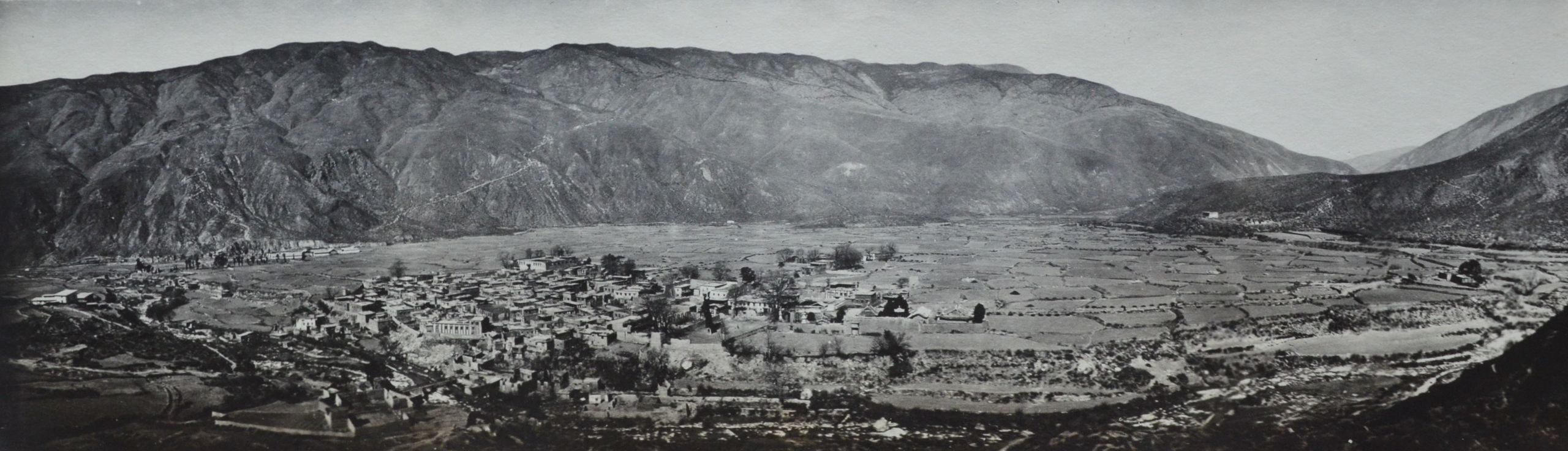
View of Batang from the hill east of Hardy's house - the hospital is on the extreme left of the picture
View of Batang from the hill east of Hardy's house - the hospital is on the extreme left of the picture
Day sixty-nine September 23rd, 1923 Sunday at Batang
“Breakfast at 7.30. After seeing some patients at the hospital with Dr. Hardy, I attended a Tibetan Service with Communion (using individual cups). The simple service, with about 25 people present, was taken by Mr. MacLeod. After the Service, there was Sunday School – classes of about 10 to 12. Average attendance was between 60 to 70. There are about 30 orphans in the town; two-thirds are the children of soldiers who had been stationed there, taken Tibetan wives, and then left them. Some of the children are the orphans of people who had died in the recent epidemic of pernicious malaria”.
“In conversation with Dr. Hardy and Mr. MacLeod, I learnt that when digging out and levelling the land for the compound they had some across some very old graves, about 15 feet below the surface. This didn’t fit with the Tibetan custom of either giving their dead to the vultures, or cremating the body or throwing it into the river. The workmen thought these graves were those of a race of people now extinct who were the aboriginal inhabitants of this part of the country, and were called the Chung people. Dr. Hardy had a small piece of pottery which came from one of these graves, which they said was not Tibetan and not Chinese”.
“We went up later to see these graves. The land has been cut away to a vertical face to provide earth for small buildings and levelling. The “graves” were along the face of this newly cut surface. We noticed bones embedded in the earth and unearthed one or two – a patella – a first meta-tarsal and part of a humerus. They are obviously human bones. The General doubts if they are proper graves, but more likely the remains of people killed in an earthquake which devastated Batang some 200 years ago, when Batang used to be located on the side of the river. He thought that the stones found in relation to the bones were probably the remains of walls which had fallen on the people when the houses collapsed”.
Day seventy September 24th. 1923 Batang
“Visited Dr. Shelton’s grave. Back for tea and a game of tennis. Dr. Hardy took some photographs of us all”.

Headstone to Dr. Albert Shelton
Headstone to Dr. Albert Shelton
Day seventy-one September 25th. 1923 Batang
“In the morning I went with Dr. Hardy to investigate the epidemic which at this time is very bad in Batang. Blood examinations and clinical features confirms a serious form of Relapsing fever. I advised the use of Neosalvarsan which Dr. Hardy is going to adopt. I reckon that in this small town which only has about 300 families there have been 200 deaths”.
HGT wrote in his journal:
“In one blood film the spirillum bacteria were present in numerous numbers. That case was fatal about 4 hours after the blood film was taken”.
“At 3.30 we went to the Chinese General’s for a complimentary dinner. Arrived back about 6 p.m. went to the MacLeod’s for a cup of coffee and some hymn singing”.
Day Seventy-two September 26th 1923 Batang
GP noted in his journal:
“The Magistrate and the local Chinese General do not want us to go with the Washi people to Kanze. It looks very much as if they are trying to save face, as they have lost control over these people, although nominally they have them under their orders”.
Within the last fifteen years there had been fierce attacks of Tibetans on Chinese and Chinese on Tibetans with wholesale massacres — and also murders of Europeans. The possibility of further conflict could not therefore be ruled out.
Meanwhile HGT went over to the Hospital again for further investigation of the epidemic. Dr. Hardy was beginning the new treatment that morning and they were interested to see the effect.
Journal and letter home
Monday, September 24th.
Visited Dr. Skelton’s grave. Back to tea and a game of tennis. Dr. Hardy took some photographs of groups.
Tuesday September 25th.
Away with Dr. Hardy in the morning investigating the epidemic which is at present very bad in Batang. Blood examinations and clinical features confirm a serious form of Relapsing fever. Advised Neosalvarsan which Dr. Hardy is going to adopt. They reckon that in this small town which only has about 300 families there have been 200 deaths. In one blood film the spirillous was present in numerous numbers. This case was fatal about 4 hours after the blood film was taken.
At 3.30 we went to the Chinese General's for a complimentary dinner. Arrived back about 6 p.m. went to the MacLeod's for a cup of coffee and some hymn singing.
September 26th
“The General is seeing what arrangement can be made to meet the difficulty – but at present it is difficult to know what route we shall be taking”.
“There are rumours that the Leng-ka-shi, annoyed by the arrest of some of their people, were going to attack the Chinese at Litang; that the Chantui (or Nyarong) people were threatening to attack Ta-chien-lu from the north-west, and that Kanze was disaffected and wanted to be rid of the Chinese garrison. In addition to all this the Chinese feared that the Nanka Lama was going to attack Batang”.
“…within the last fifteen years there had been fierce attacks of Tibetans on Chinese and Chinese on Tibetans with wholesale massacres — and also murders of Europeans. The possibility of further conflict could not therefore be ruled out”.
Meanwhile HGT went over to the Hospital again for further investigation of the epidemic. Dr. Hardy was beginning the new treatment that morning and they were interested to see the effect.
HGT wrote in his letter home:
“Am going to the Moore’s for midday dinner. Mr. Moore has printed some of the photographs we took en route and they are quite good. The mail goes out today, so I must get my letters ready.
Yours, Hubert.
P.S. Père Goré left on his return journey this morning. We hear that there were some of the Nanka Lama’s men at a village near Drubalong, so we have just avoided them. The report was that they were not strong enough to attack Drubalong”.


View of Batang school and hospital from below
View of Batang school and hospital from below

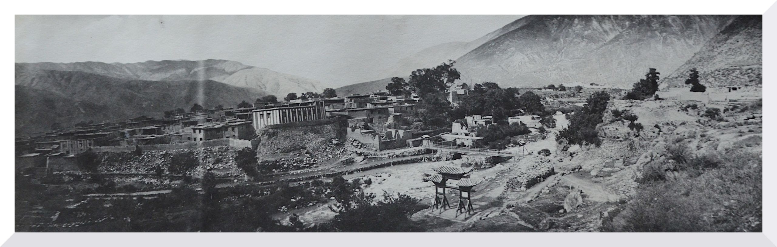
View of Batang from the water ditch showing the Shelton memorial before completion
View of Batang from the water ditch showing the Shelton memorial before completion

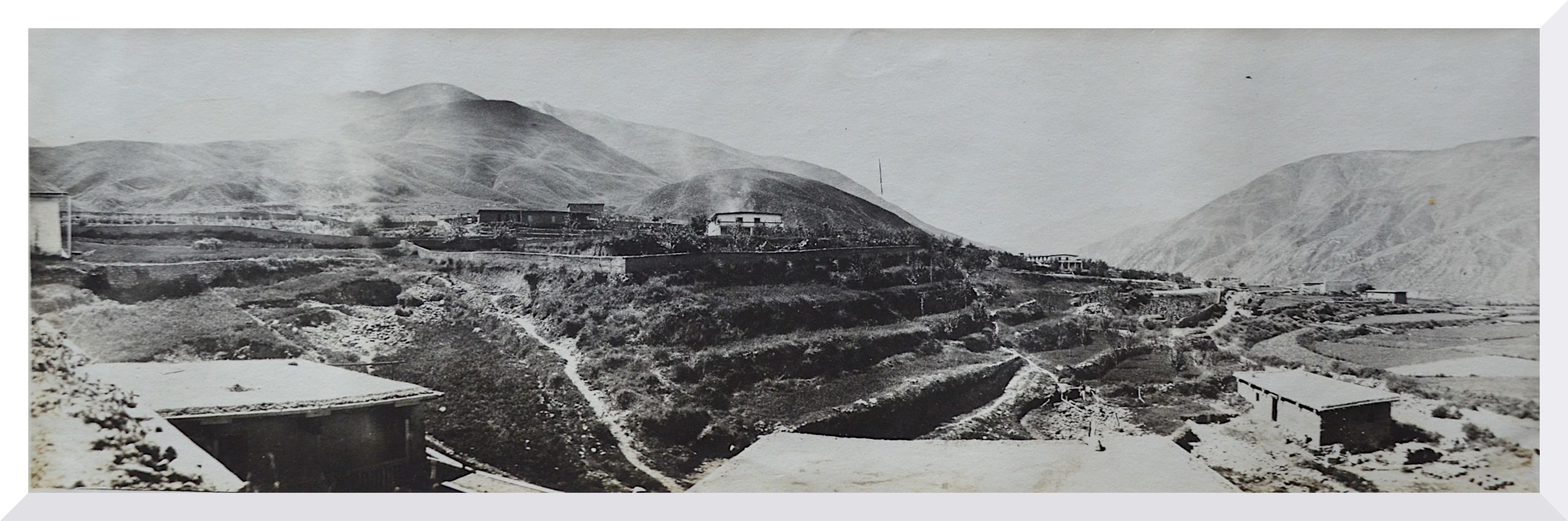
View of Batang from the roof of the uncompleted school
View of Batang from the roof of the uncompleted school
Days Seventy-three and four September 27/28th 1923 Batang
“Two quiet days – on the latter day and at about 4 p.m. Mr. MacLeod and I walked up the Batang valley for about 1 mile and took a pair of strong glasses with us. The great mountains on each side were a fine sight, as seen through the glasses and MacLeod tells me that they are great places for pheasant and deer, and hares”.
Day Seventy-five September 29th. 1923 Batang
“I investigated the local shops with Dr. Hardy but found really nothing to be bought”.
In the afternoon HGT and Dr Hardy went up to the great Lamasery to call on the Bao Lama. He was out, but the Abbot gave permission to go into the temple where a kind of incantation service was in progress.
HGT described the ceremony:
“The temple consisted of a large hall, 2/3rds of the roof was comparatively low, supported by ornamented pillars decorated in colours. At the end, where most of the images were, the roof was much higher - light came in by fanlight windows in between the lower and higher roofs. There were a large number of smaller images on each side of the central image. In the loftier part of the temple, the wall to the left had shelves, pigeon holed so as to contain the sacred books. On the wall to the right were more images. A table for incense and numerous lamps were in front of the images”.

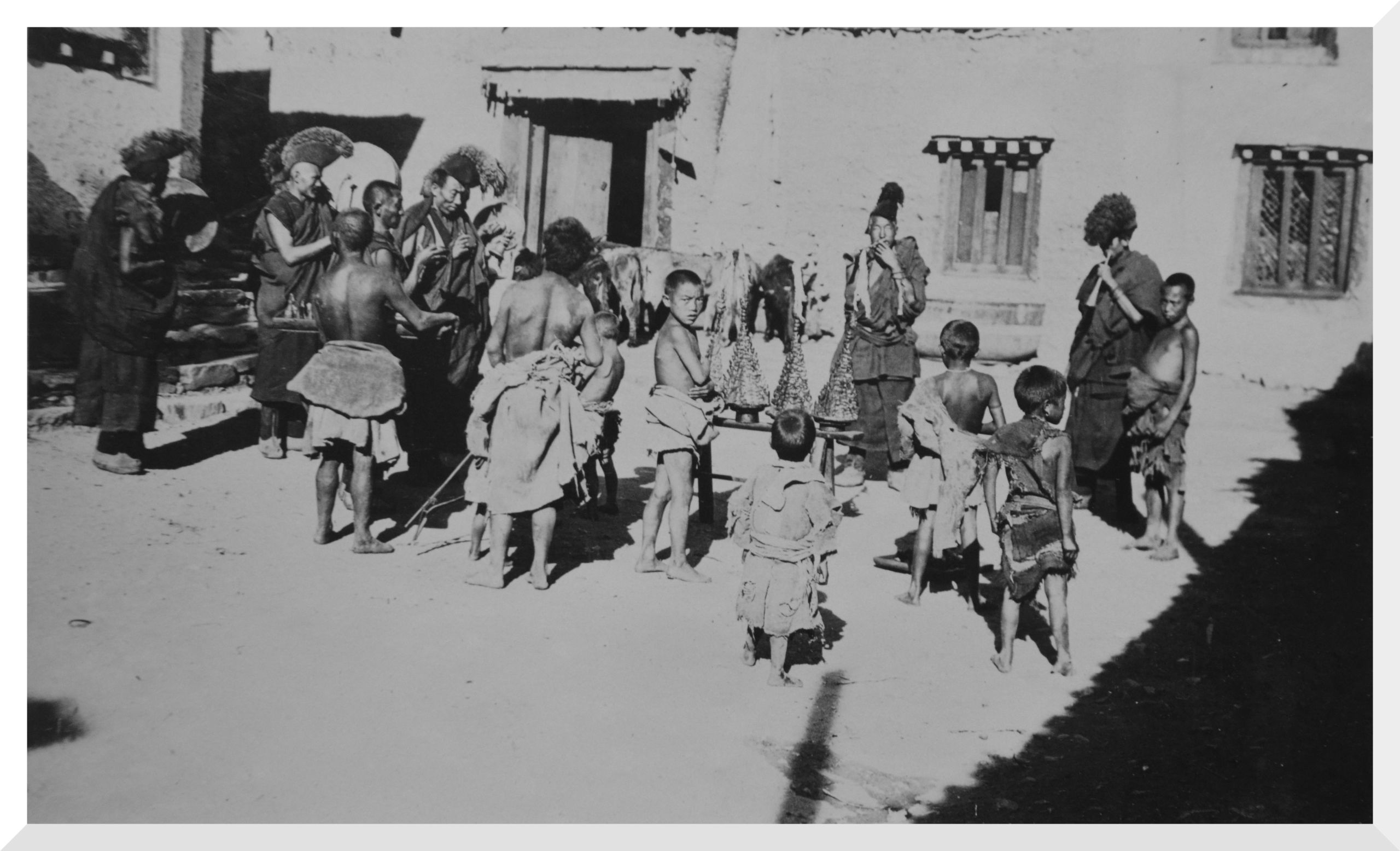
Tibetan ceremony at Batang Lamasery. Tsamba pyramidal structures on a stool
Tibetan ceremony at Batang Lamasery. Tsamba pyramidal structures on a stool
“In the part with the lower roof many of the pillars had fastened to them huge straight trumpets - sharpened like a telescope, which when closed measure about 5 ft, in length, but which when pulled out were about 15 ft. long”.

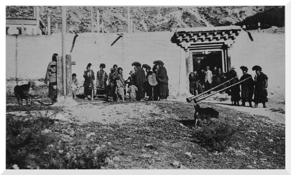
Tibetan ceremony at Batang Lamasery. The long trumpets were blown and the lamas chanted
Tibetan ceremony at Batang Lamasery. The long trumpets were blown and the lamas chanted
“There were 2 long mats parallel to one another running up the centre of the temple, and at the end of each, near the images was a small table. These mats were obviously for the lamas to sit on during special devotions. In one corner of the temple there were 16 lamas sitting - going through an incantation service to expel sickness from a man in this town who was ill. The lamas sat on the mats in 3 rows - on 3 sides of an oblong. The Chief Lama had a small hand bell and a black scarf. He was sitting at the open end of the oblong where there was a small table on which were several red pyramidal structures, standing about 18 inches high, and made out of tsamba (a staple foodstuff made of roasted flour from barley or wheat and yak butter tea). In addition, there were eggs, and packets of a butter-like substance shaped into small cones and coloured red”.

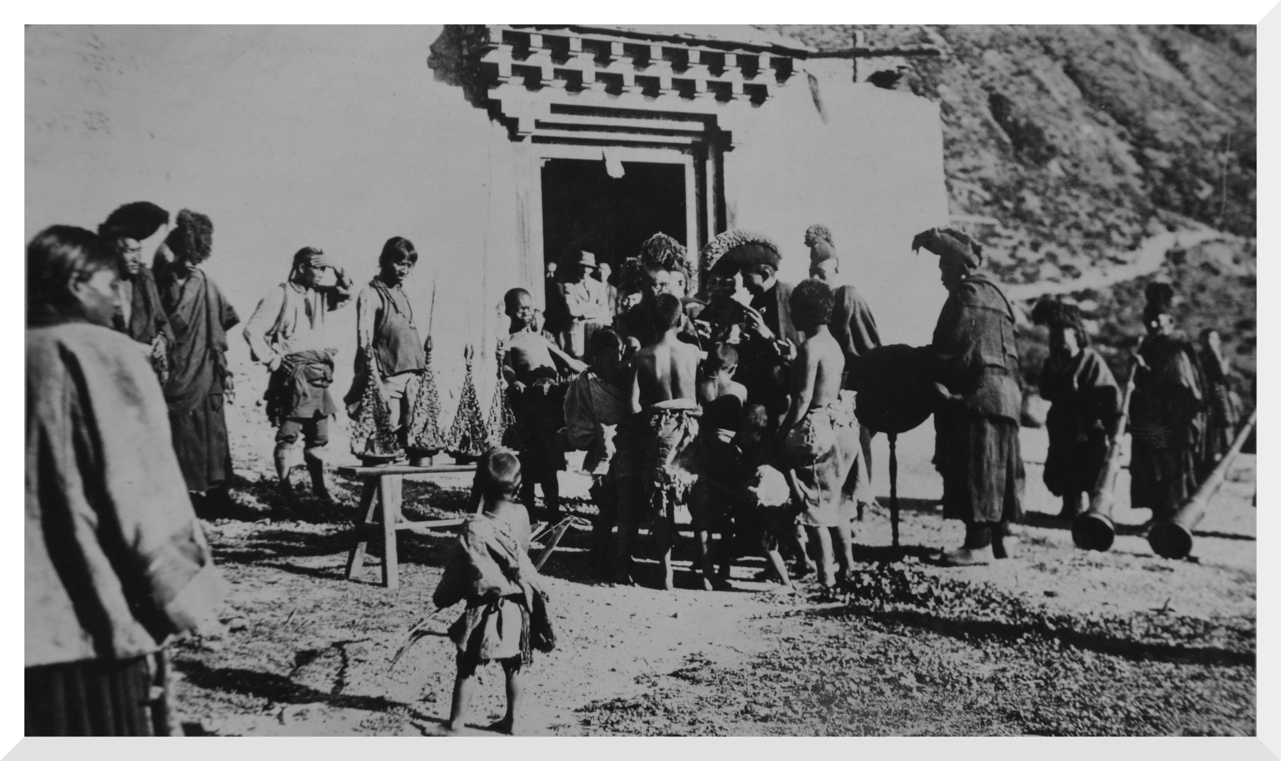
Tibetan ceremony at Batang. The Chief lama exorcising the spirit of evil in the tsamba pyramid
Tibetan ceremony at Batang. The Chief lama exorcising the spirit of evil in the tsamba pyramid
“The lamas sitting cross-legged, had various instruments including 2 of the long trumpets - six small trumpets, about 18 inches long - large and small cymbals. One of the lamas mono-toned in a deep tone some form of incantation and then the others joined in, growing faster and faster until at last the trumpets blared, the cymbals clashed and all died away, while the one chanting lama went on with the incantation in a sepulchral voice”.

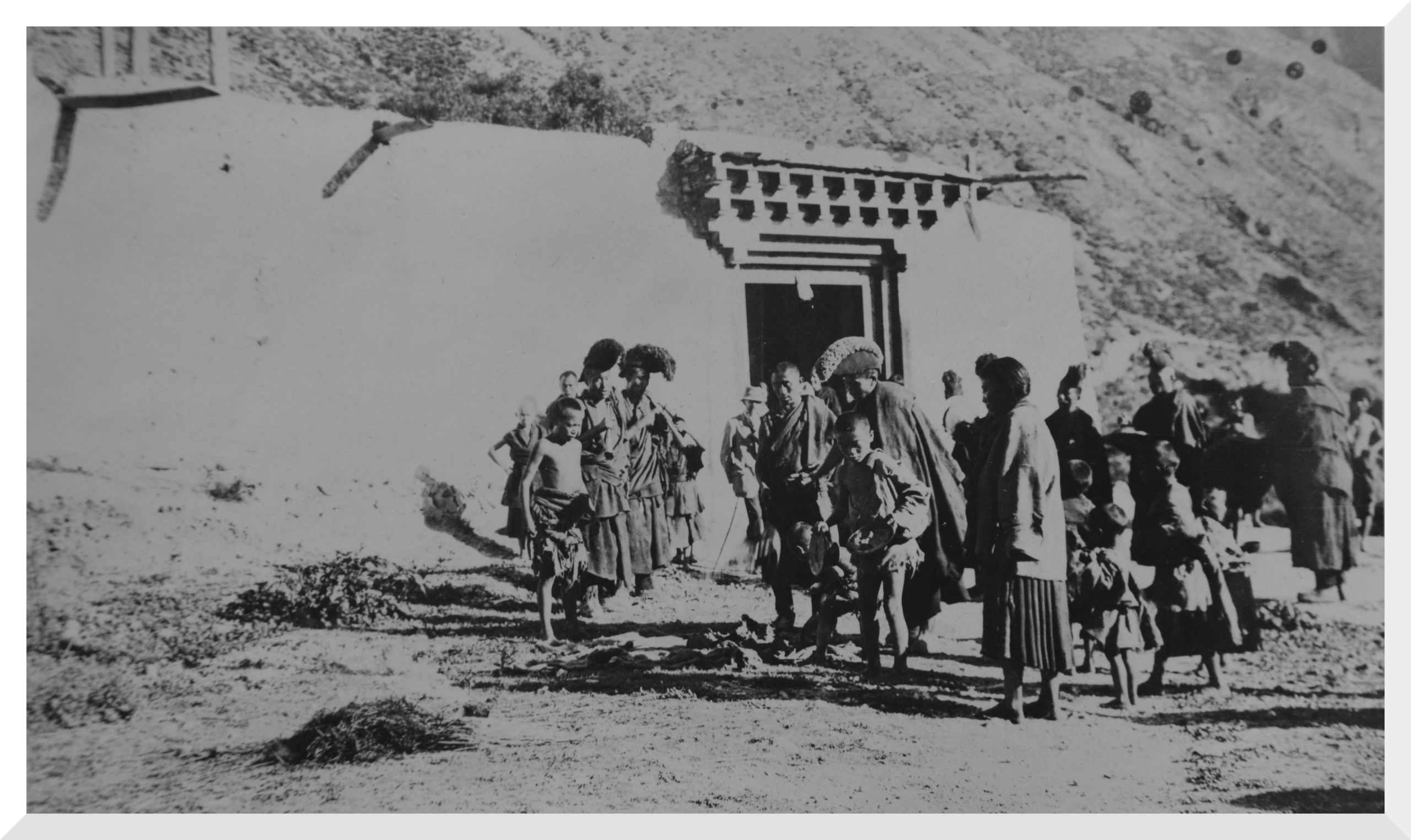
Tibetan ceremony at Batang. The Chief lama distributes food to the beggars then breaks the tsamba pyramids on the ground
Tibetan ceremony at Batang. The Chief lama distributes food to the beggars then breaks the tsamba pyramids on the ground
“After a short time, a signal was given and the pyramidal structures were taken outside and placed on a stool, the big trumpets were taken out the courtyard and lamas with the small trumpets followed. The others remained in the temple. The trumpets outside were blown and the lamas inside took up their chanting”.
“Then all went outside and the chief lama began to exorcise the spirit of evil in the tsamba pyramid. At the same time a number of beggar boys came around and some of the eggs and other food was thrown into their bowls. A procession was formed and the tsamba pyramid was taken outside the door in the outer wall of the lamasery. More incantations followed and a truss of straw was built up into a cone and lighted by a woman, evidently the wife of the sick man. As the straw blazed up the chief lama took a bow and arrow from his assistant and shot the arrow over the tsamba pyramid and the burning straw - with more incantations the remaining food, eggs, etc., was distributed to the beggars and lastly the red tsamba pyramids were taken and dashed to the ground and broken. The incantation was complete, and the service was over. The lamas wearing their red robes and a head dress like a Roman soldier - returned into the lamasery and HGT and Dr Hardy returned home”.
Day Seventy-six September 30th to Day Eighty Oct. 4th. 1923 Batang
“At Batang - Sunday, September 30th - Communion Service and spoke at English service – spent the following days in the Hospital investigating cases of Relapsing Fever”.
Copyright © 2021 John Hague. All Rights Reserved
Special thanks to Mr Edward Pereira, great nephew of Brig. Gen. George Pereira for providing me with copies of his great uncle's journal.
References:
The Geographical Journal Vol. LXVII No. I
The Royal Geographical Society January 1926 Published by Edward Stanford 1926
Peking to Lhasa by Sir Francis Younghusband.
The Narrative of Journeys in the Chinese Empire Made by the Late George Pereira . Compiled by Sir Francis Younghusband from Notes and Diaries.
Published by Houghton Mifflin, Boston, 1926
The Illustrated London News
No 4528 Vol 168 published on 30th Jan 1926
and
No 4529 Vol 168 published on 6th Feb 1926