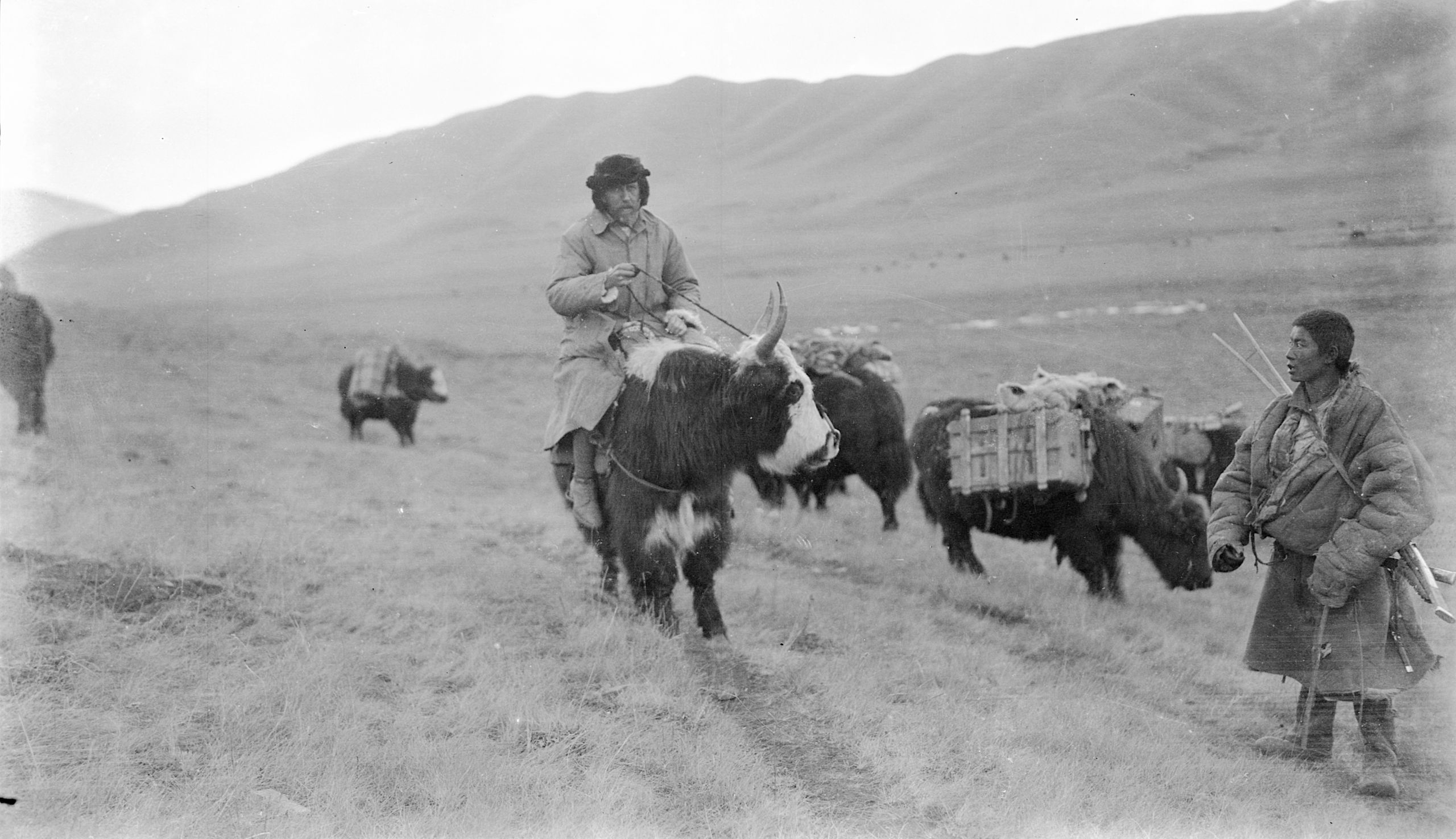
Travelling the Tibetan and Mongolian borders in 1923 Part 1 Yunnan
Introduction
Setting out on a journey of discovery.


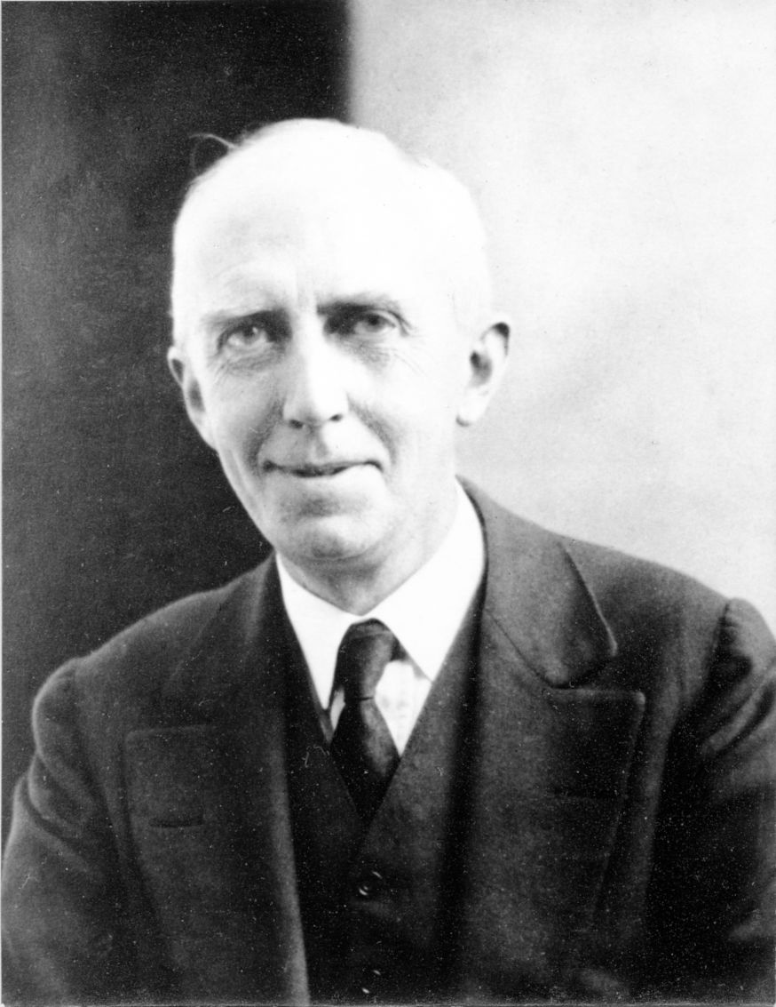
Dr. Hubert Gordon Thompson

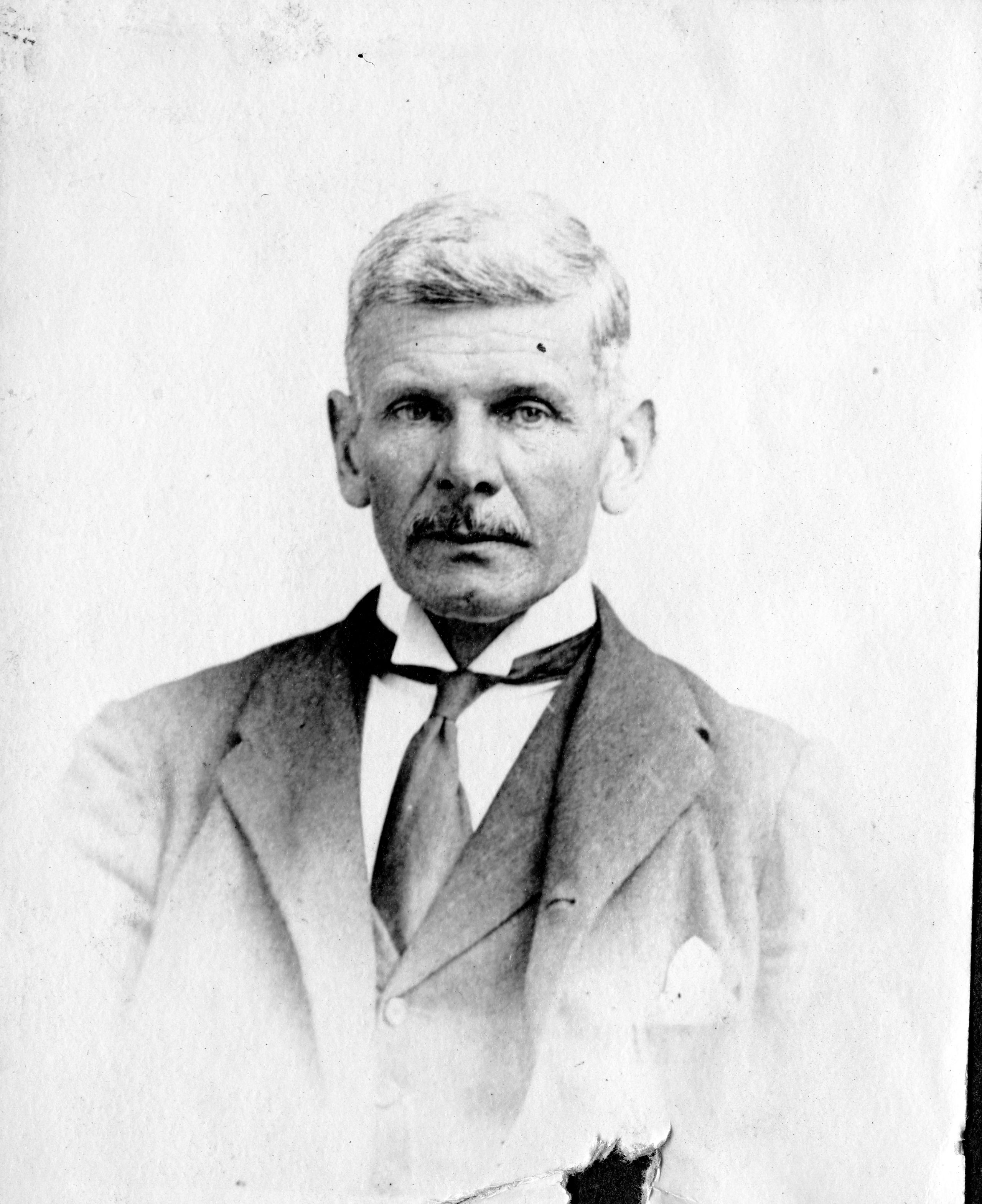
Brig. Gen. George
Pereira

Introduction
This is the story of a journey in China along the borders of Tibet and Mongolia in 1923 made by my grandfather Dr Hubert Gordon Thompson (who liked to be known as HG or HGT) and Brig. Gen. George Pereira (whom I shall refer to as GP or the General).
It may be helpful to have some background to these two men.
HGT was born in Liverpool on 24th February 1878.
He studied Medicine at Liverpool university and went on to become a successful surgeon. He was also elected to be Deputy Mayor of Liverpool. His other passion was photography which as you will see played an important part in his travels.
HGT felt a need and calling to travel and help people in other parts of the world. In particular he had a deep desire to be a missionary doctor in China. He applied to join the Church Missionary Society but they turned him down. They said he was too scrawny! Undeterred he signed up to work his passage to China on the ocean-going liner called the SS India which was owned by the Pacific and Orient line (P&O). He sailed from Tilbury docks in London on 23rd November 1906

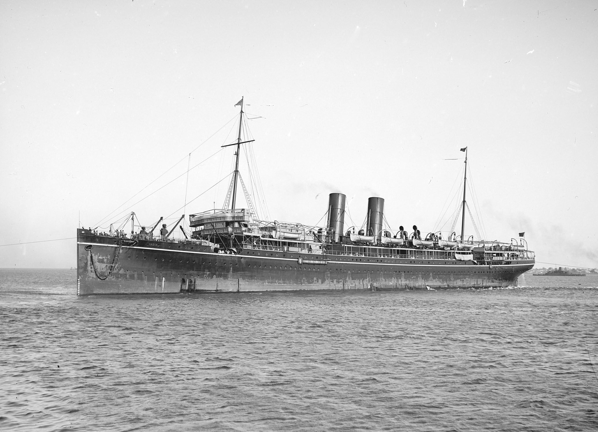
SS India
SS India
Once he reached China HGT’s aim was to meet up with an old friend from University, Dr. Neville Bradley, who was at that time running a hospital in Pakhoi (now called Beihai) in South East China not far from the border with Vietnam. In large part, it was a hospital for people with Leprosy and HGT’s skills as a surgeon would be very useful. Quite by chance, whilst on the boat, he met some of the family of Dr. Bradley’s wife, and together they journeyed and had a family reunion in Hong Kong. HGT worked alongside Dr Bradley for the next 6 years. During this time, he met Dr Bradley’s sister Amy, a very determined young woman who travelled out on her own to stay with her brother. They fell in love and were married in the church that was attached to the hospital in Pakhoi in 1912. 100 leprosy patients attended their wedding. Three years later, HG was asked by the Church Missionary Society, to move to the city of Yunnan-fu (now known as Kunming) in South West China to build and run a hospital.
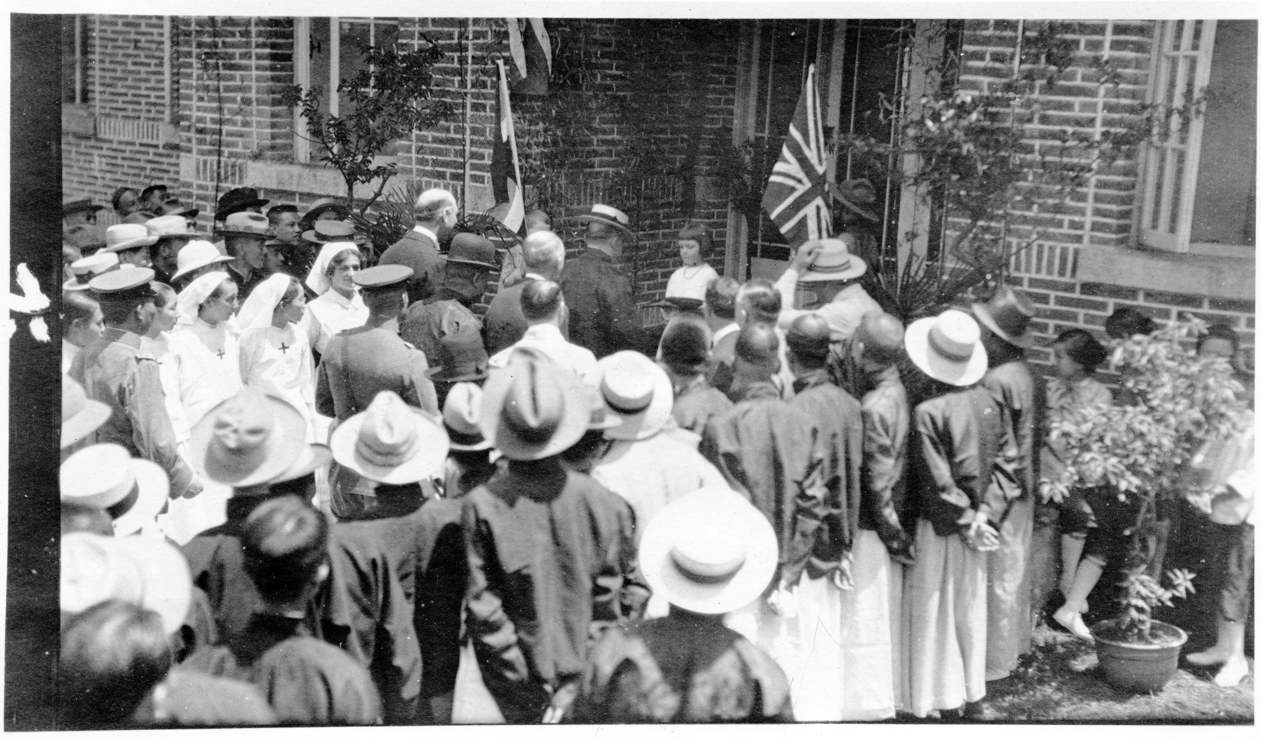
The hospital was opened by the Governor, Tang Jiyao, in 1921
Greta, my mother, aged 4, presented the Governor with the key

Brig. Gen George Pereira was born in London on 26th January 1865. He joined the British Grenadier Guards at the age of 18 in 1883 and saw active service with this regiment in many parts of the world through till 1918 at the conclusion of WW1. Apart from his keenness for military service two passions ruled him: one was racing; the other was travel.
It had long been his ambition to be the first to map the route from Peking to Lhasa, the capital of Tibet. Whilst many people had made the journey from India to Lhasa, the route from China to Tibet was more difficult. In 1848 two French missionaries, Pères Hue and Gabet, had reached the Holy City of the Grand Lama (Lhasa) from China. But since then no European had followed in their steps. The border had been more or less closed since the Xinhai revolution in China that had overthrown the last Imperial dynasty and established the Republic of China in 1911.
His passion for travel had possessed him during all his military service in China. He had visited every Province. He had also travelled over the whole of Korea and right across Manchuria, Mongolia and Chinese Turkestan. When Military Attaché in Peking, he had made a point of visiting the various units of the Chinese Army. His tact, his understanding of Chinese etiquette and his conversational ability enabled him to make personal friendships with many people of all backgrounds and position.
GP set off from Peking in February 1922 and eventually reached Lhasa in Tibet on October 23rd 1922 where he was received by the Dalai Lama. It had been a journey of 6,682 miles taking 8 months. From there he travelled down through India to Calcutta (now Kolkata) where he spent some time recuperating from a thrombosis in his leg. Yet his urge to travel and map China was not complete. Starting again from India he travelled up through Burma (now Myanmar) , to the Chinese border and from there to Yunnan-fu (Kunming). He then traversed Yunnan to the highest navigable point of the Yangtze, and then followed that river to its mouth at Shanghai.
So, having travelled from east to west and from west to east across China, GP now wanted to complete the task with a journey from south to north. So instead of travelling home to England, he sailed from Shanghai to Haiphong in French Indo-China (now Vietnam). From there he went by rail to Yunnan-Fu which would be the starting point of his final journey.
Having reached Yunnan-fu, GP stayed with Mr Henry Edward Sly, the Consul General. Whilst there he met HGT and asked him to join his expedition to map the route from Yunnan-fu (now Kunming) to Peking (now known as Beijing) along the Tibetan and Mongolian borders.
By this time HGT and his wife Amy had a fourth child, Peter, who was by then just over one year old. I find it hard to imagine the conversation that must have gone on between HG and his wife when he was asked by GP to join him on the journey. Sadly, I have not found any diary record of this.
Following the death of the Empress Dowager Cixi in 1908, and the ensuing fall of the Qing dynasty, there had been unrest and civil war across the newly established Republic of China. Only the previous year in 1922, HG had acted as a mediator and negotiated a truce between two contending armies outside the city of Yunnan-fu. (I believe he received a special civic decoration for his services at this time though I haven't as yet been able to identify and document this award, though it was mentioned in his obituary in the British Medical Journal for March 14th 1953).
Three of their four young children were living with them, the eldest, John, having been taken back to the UK for his secondary schooling, and there was also a lot of fighting along the border between China and Tibet and along the Mongolia border. Yet somehow GP persuaded HG to agree. The only stipulation that HG made was that he would be able to treat patients along the way and be able to give out religious leaflets that talked of the love of God manifested in the life of Jesus. HG was a great believer that you had to treat the soul as well as the body.

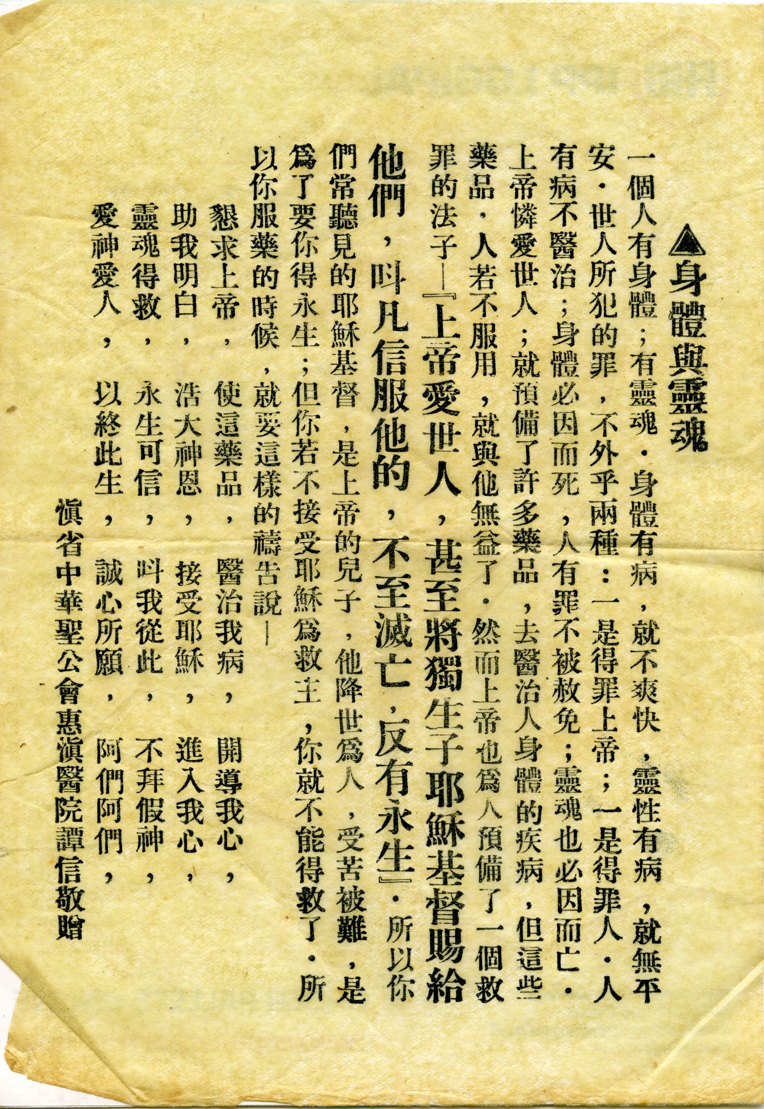
Tract in Chinese - Body and Soul
Tract in Chinese - Body and Soul
They prepared carefully for the journey and whilst they each undertook to make their own notes, they divided the duties of the journey roughly as follows: General Pereira (GP) would make a compass traverse of the route, making a note of the numbers of families and their ethnicity wherever they stopped; while Dr Thompson (HGT) was responsible for the altitudes and the photography.
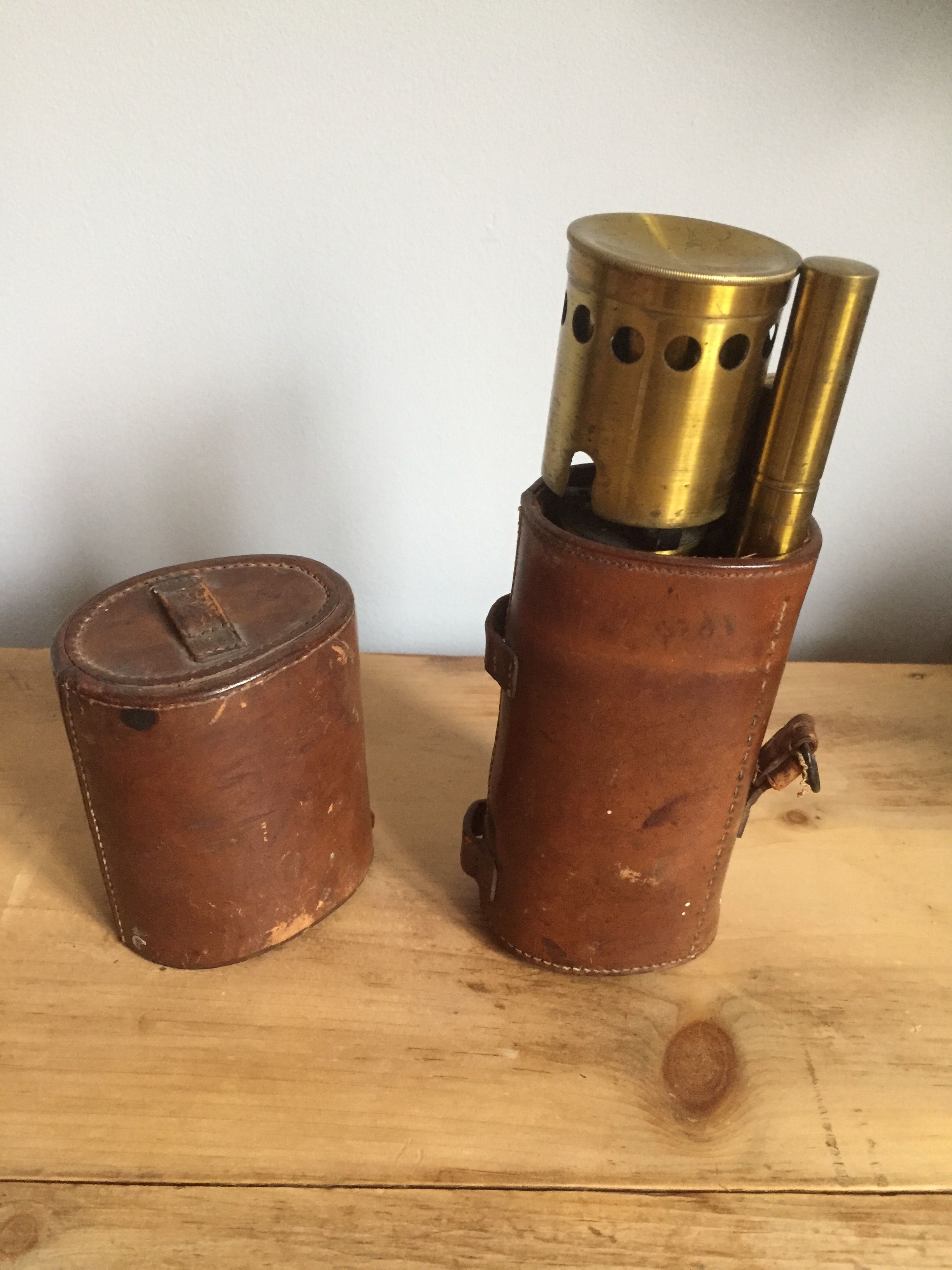
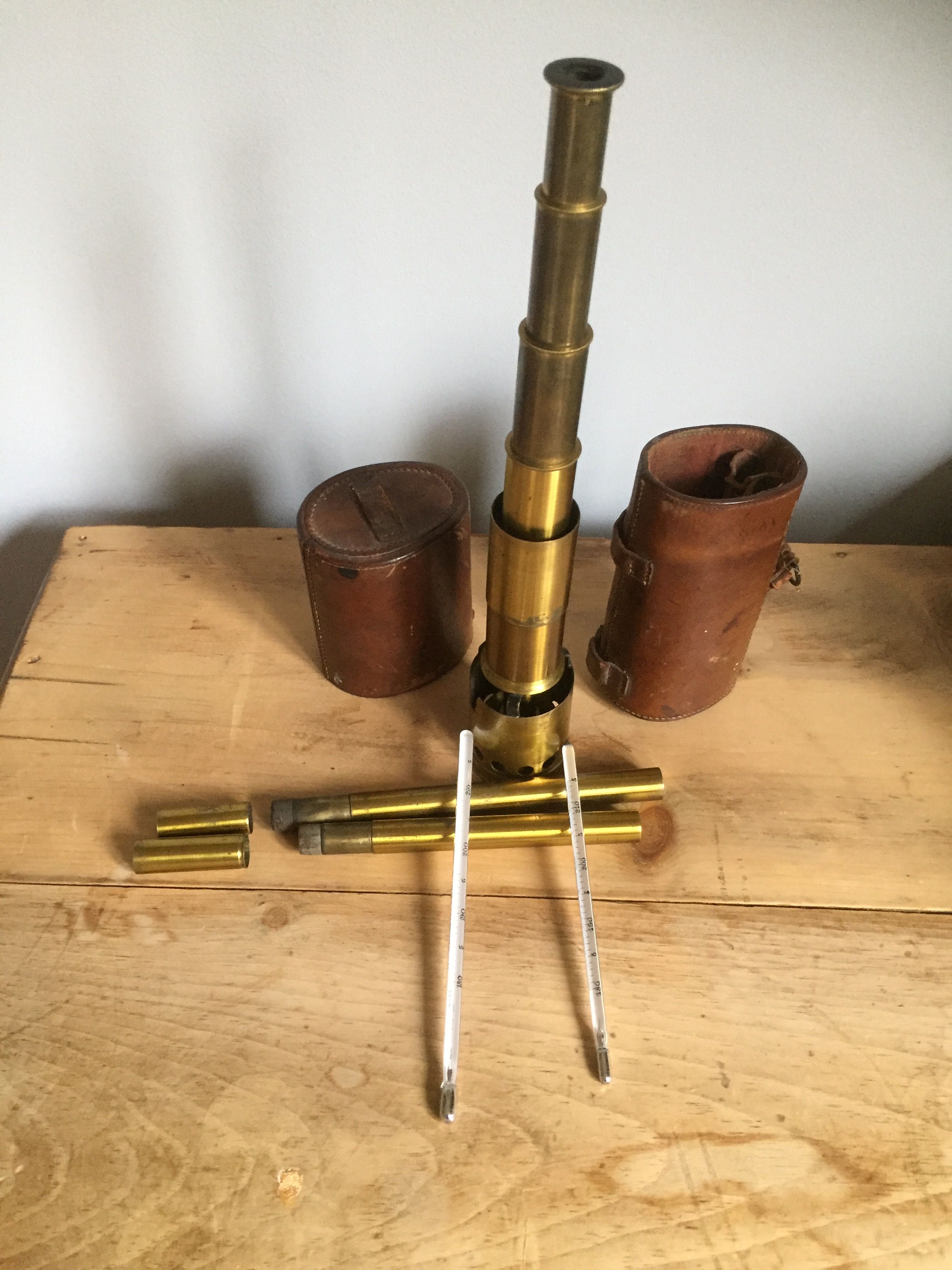
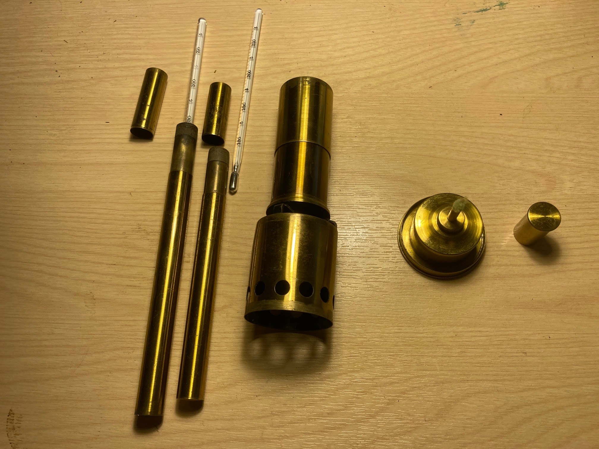
Cary Hypsometer assembled ready for use
To measure their height above sea level HGT took with him a brass Cary Hypsometer in a leather case. (Note: A Cary Hypsometer is an instrument that measures altitude indirectly by measuring the boiling point of water, which varies with atmospheric pressure. These Hypsometers were popular with mountaineers, explorers and the military in the second half of the 19th century but fell out of favour when pocket aneroid barometers / altimeters became more readily available).
Note: A Cary Hypsometer consists of a small oil burner at the bottom that heats the water in a small reservoir above it. This is surmounted by a jacketed column in which the thermometer can measure the temperature of the water vapour produced when the water boils. A simple formula could then convert the boiling point into their height above sea level.


Patients waiting to be seen.
Whenever they stopped for a rest-day, HGT took the opportunity of promoting goodwill by seeing patients and helping them in body and soul. At one little market town where they rested one day, he saw 250 patients. To his mind medical work was a golden key to unlock the doors for peaceable exploration.
I have put together this account of the journey from the letters and journal of HGT written during the journey and from the lecture “From Yunnan-Fu to Peking along the Tibetan and Mongolian Borders” given by HGT to The Royal Geographic Society on 23rd November 1925, that was written up in the Society’s magazine and featured in two editions of the Illustrated London News – 30th January and 6th February 1926. The latter edition being the one where they also reported on the discovery of the tomb of Tutankamun.
I have also drawn from the journal records of GP that were compiled by Sir Francis Younghusband in the book “Peking to Lhasa”; published by Constable and Company ltd. in 1925. I am indebted to copies of his journal that were provided by his great nephew Edward Pereira.
Throughout the account of the journey, I have used the Pinyin version of the place names written in their journals and letters, that was current at that time. Since then many of these have changed (e.g. Peking is now Beijing) and some place names have changed as well. In each Part I have plotted their route on both a map from 1923 and a modern map which will show the current place names.

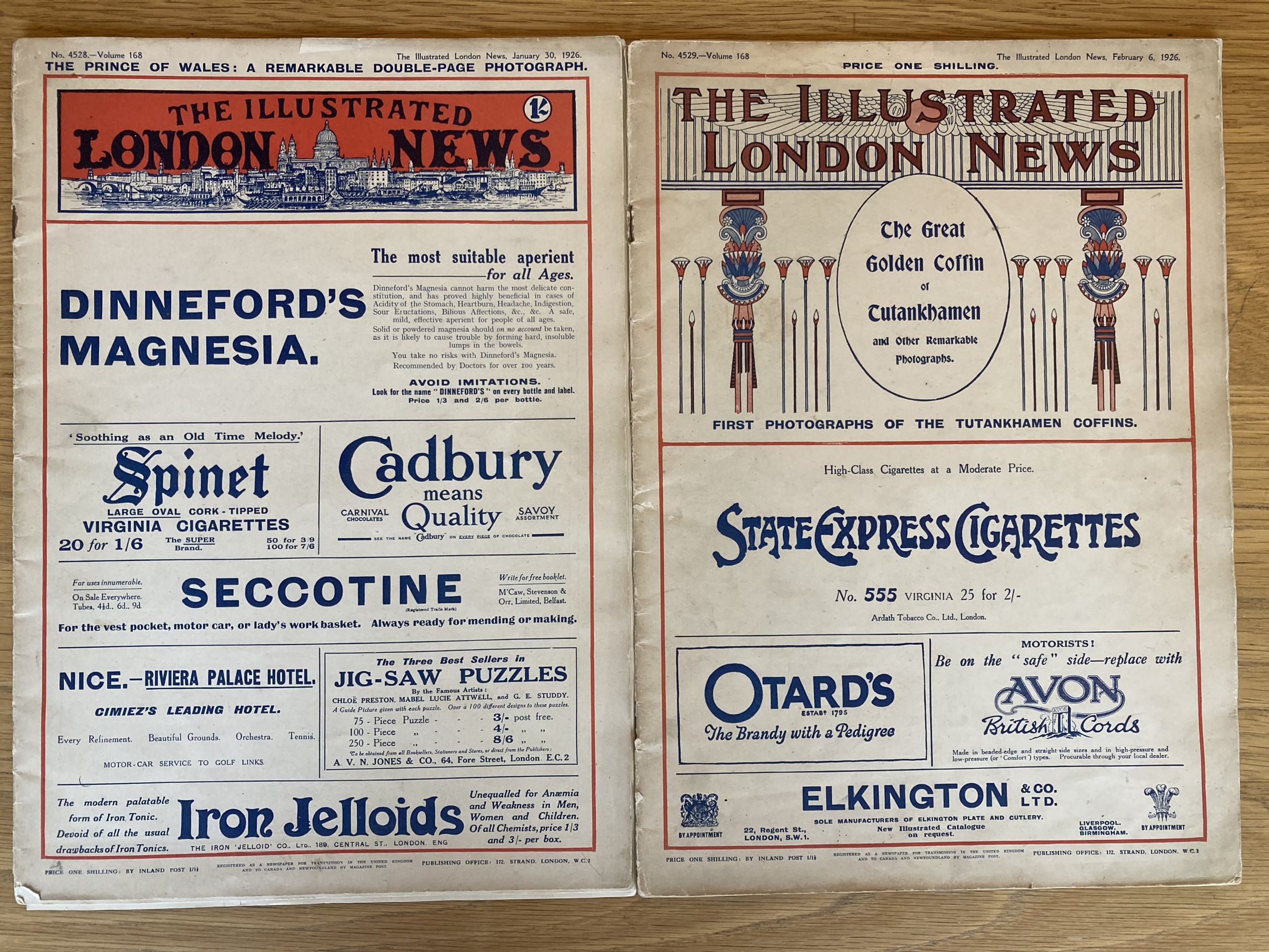
Front Pages of the Illustrated London News 30th Jan 1926 and 6th Feb 1926
Front Pages of the Illustrated London News 30th Jan 1926 and 6th Feb 1926
As you will see later, I have sought to show the route on both a map of China that was produced in 1923 and a current online map of China. This has been complicated as many place names have been changed, and some of the villages and some of the monasteries and other cultural sites were damaged or destroyed during the civil war and later in the Cultural revolution between 1966-1976. Along the route some of the places had both Tibetan and Chinese names. In some instances, it has been difficult to decipher the name of the village from the hand-written notes.
Whenever I have quoted from their journals or letters, I have put them in “direct quotation marks”. I have also added some Notes of interest for readers.
The journey may be divided into six parts:
· Part 1 Yunnan, from Yunnan-fu to Likiang; A Introduction and Setting out on a journey of discovery
· Part 2 Yunnan to Sichuan, from Likiang to Batang;
A journey of exploration - a doctor's story
· Part 3 Sichuan, from Batang across the Washi country to Kanze;
Final journey of a remarkable traveller and companion
· Part 4 Sichuan to Gansu, from Kanze to Sotsong Gomba at the bend of the Yellow river;
Finding the way through dialogue and cultural exchange
· Part 5 Gansu, from Sotsong Gomba to Lanchow;
Mountains, rivers, Lamaseries and people
· Part 6 Ningxia to Inner Mongolia, from Lanchow to Paotow then by rail to Peking.
The final chapter - Held for ransom and then escaped!

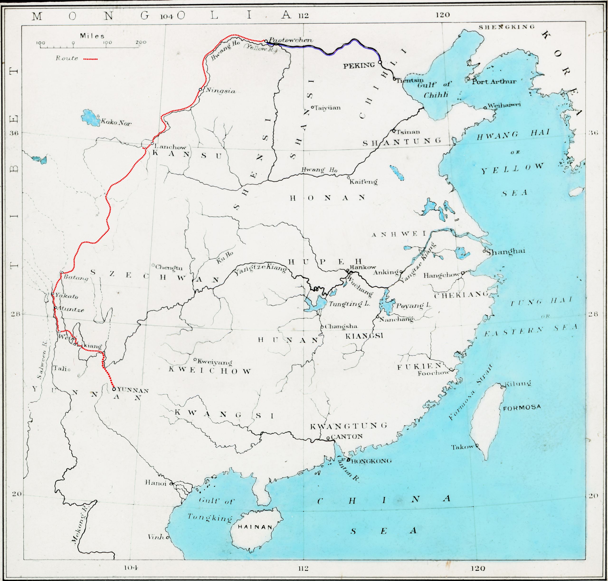
Overall route on old map of China
Overall route on old map of China

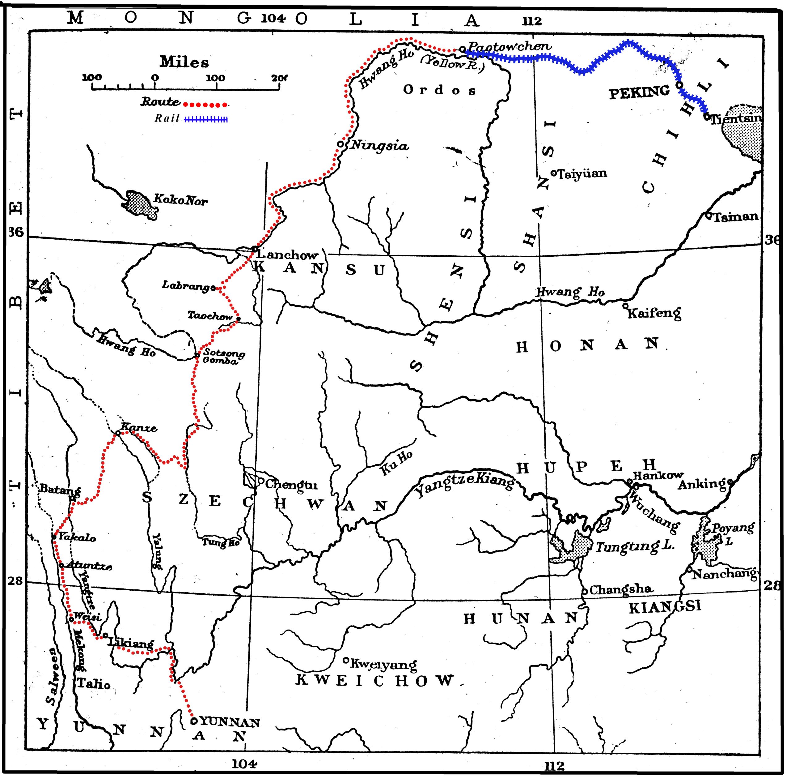
More detailed map of their route
More detailed map of their route
Click on the map above to see the route taken from Yunnan-fu to Likiang (on a 1923 map).
Click on the map above to see the route taken from Yunnan-fu to Likiang (on a 1923 map).

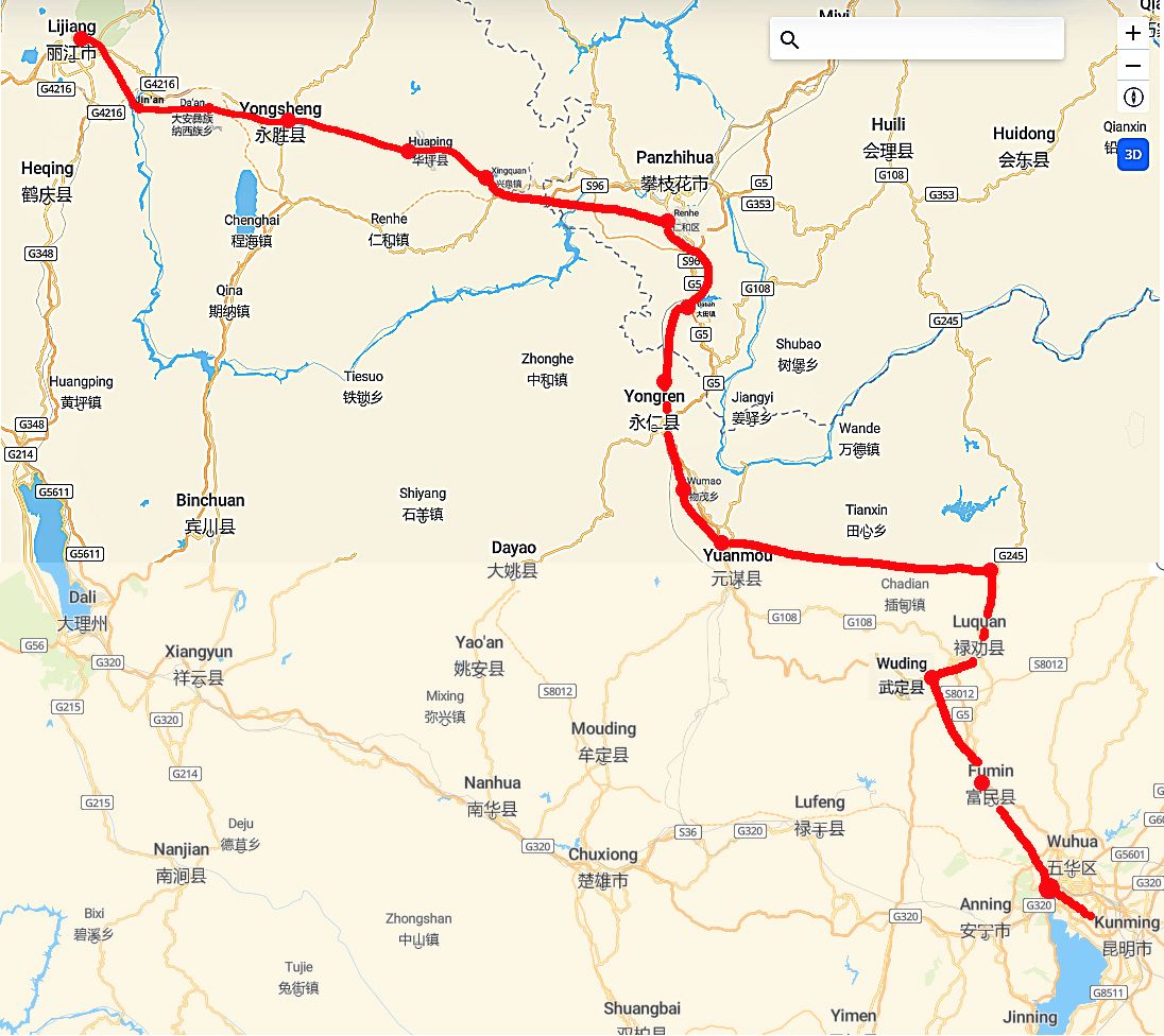
Map with current place names on the route from Kunming to Lijiang.
Map with current place names on the route from Kunming to Lijiang.
Part one: Yunnan-Fu (Kunming) to Likiang (Lijiang)
Overview
They set off on July 17th 1923
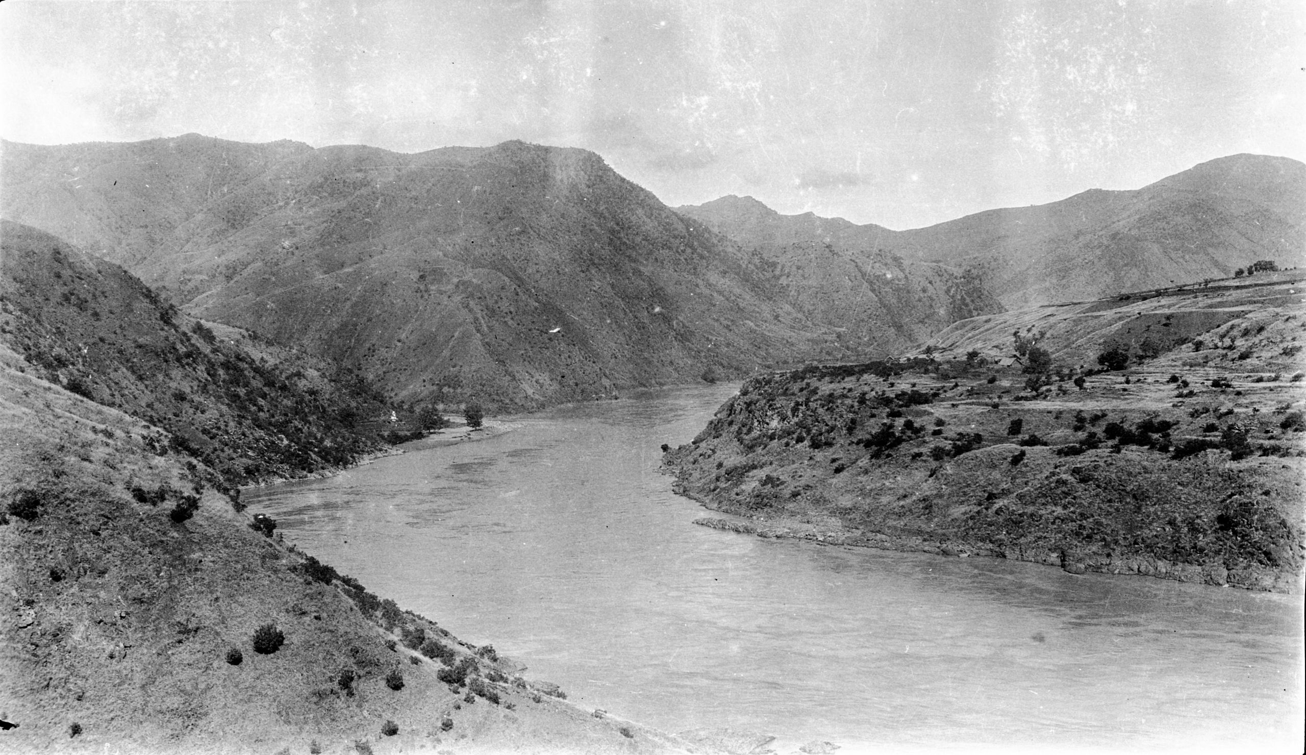
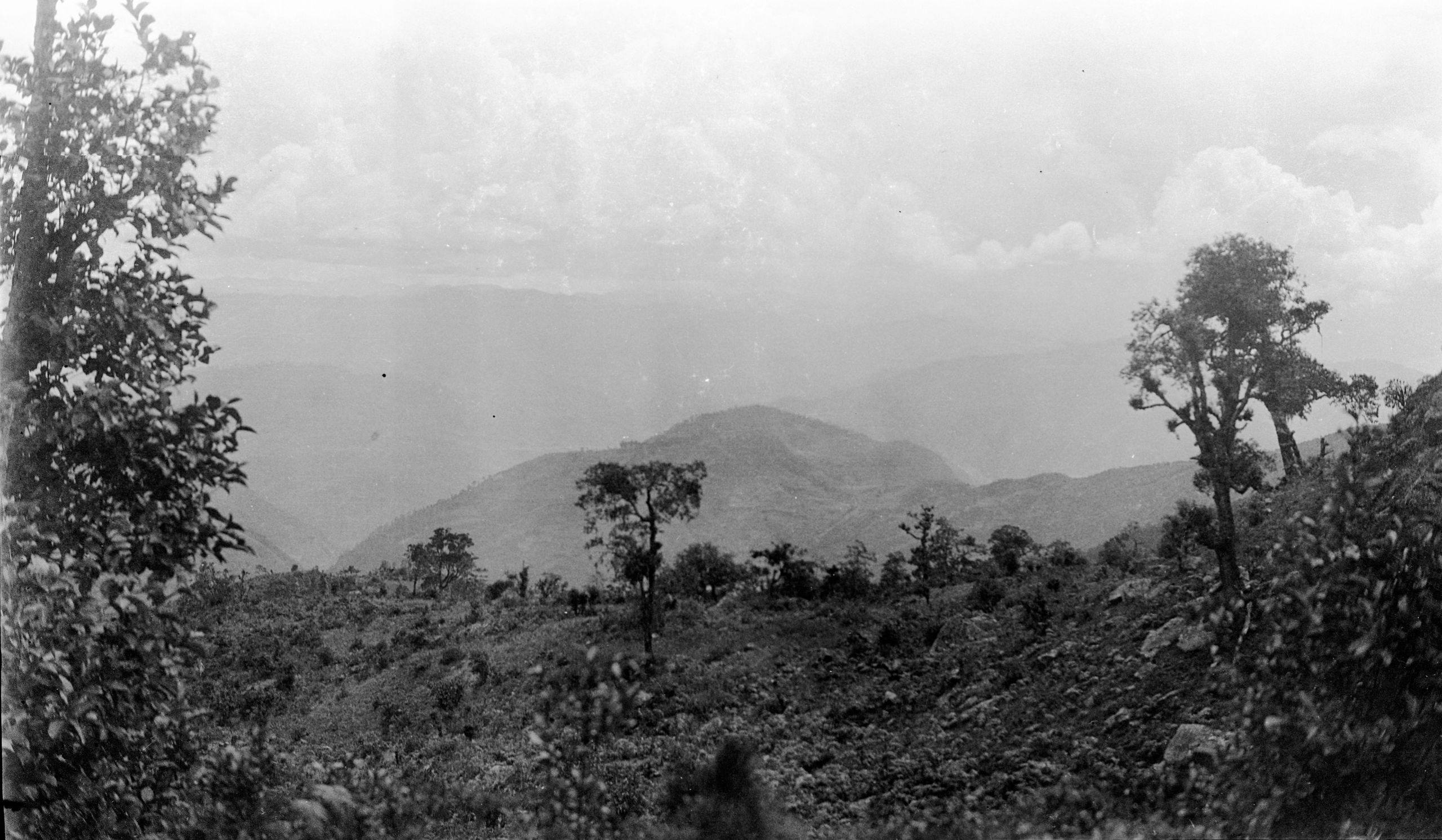
They did not follow the usual road, which was viâ Talifu, but struck north-north-west to the Soling (Longchuan), which joins the Yangtze where it gives its most southerly bend. Taking a route about 10 miles from the right bank of the Yangtze (also known as the Jinsha) they went almost due north, crossed the Yangtze by ferry at a little place called Hsin Chuang (now Jianbiang), and from there in five stages, going almost due west. On August 4th they reached Yungpeh (now Yongbei), - a Hsien city with a good wall, but the city itself was in rather a dilapidated condition. On Day 21 they reached Chu Ya-k'ou, or Bamboo Pass where they got “a wonderful view of the Yangtze. - some of the most magnificent scenery in the world

Looking North across the Yangtze
Looking North across the Yangtze
At Tsz Liu (now Jin’an) they crossed what was then the only known bridge across the Yangtze in the whole of its course. (This bridge is currently known as the Jinlong Bridge). Here the Yangtze, locally known as the Tzu-li-chiang, dashed past in a wild tumult of muddy rapids.
They reached Li Kiang (now Lijiang) on August 7th 1923.
---------------------------------------
Day One July 17th 1923 Yunnan-fu to Shiu Tsuen - 15¾ miles

The West gate of Yunnan-fu (Kunming)
The West gate of Yunnan-fu (Kunming)
They left family and friends at the West Gate of Yunnan-fu (6,140 ft. above sea-level) (now to be seen at Jinma Alley, Xishan, Kunming) and set out with an escort of thirty-five soldiers.
“The General calls the escort “the army” and they certainly are amusing and singing as they go along”.
“We had a good walk for about 3 miles and then got on the ponies. It rained until about 1 o'clock, and then cleared up. “We stopped at Pi-cheh for lunch and enjoyed some chicken from Mrs Sly (the wife of the Consul General), with some good home-made bread and marmalade, and chocolate"
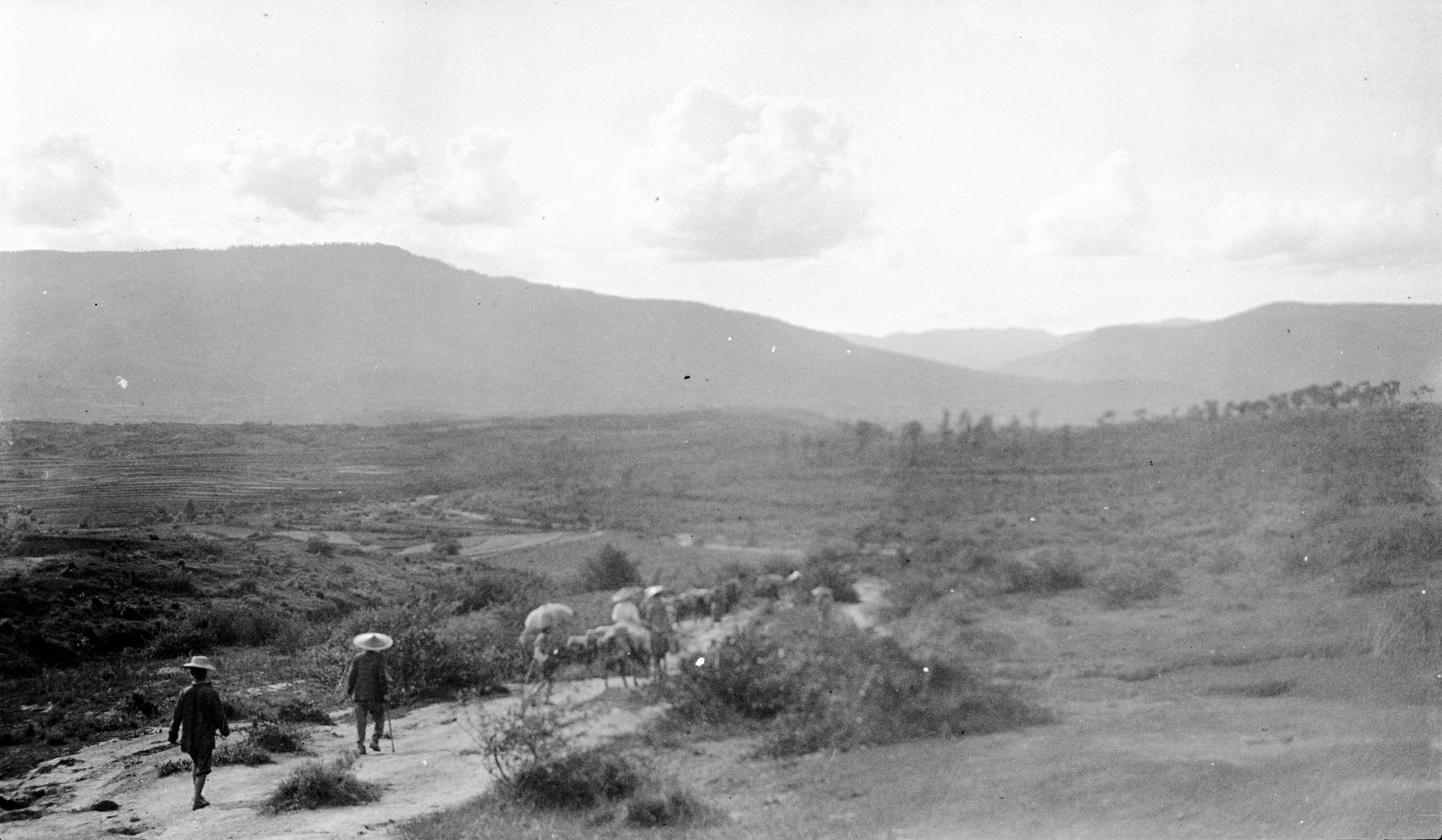
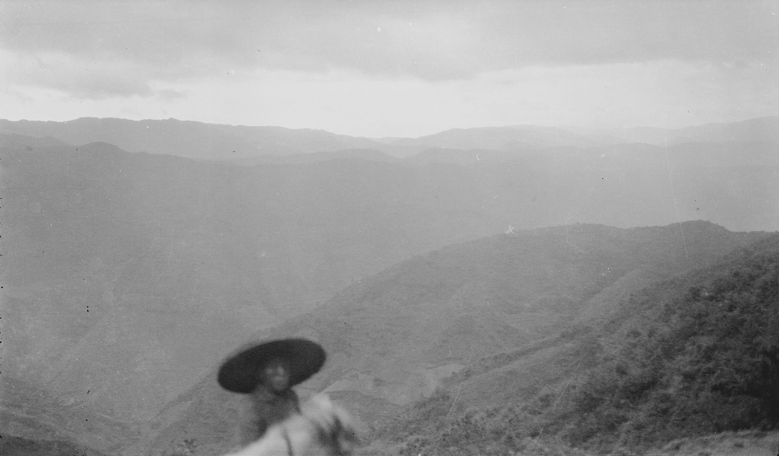
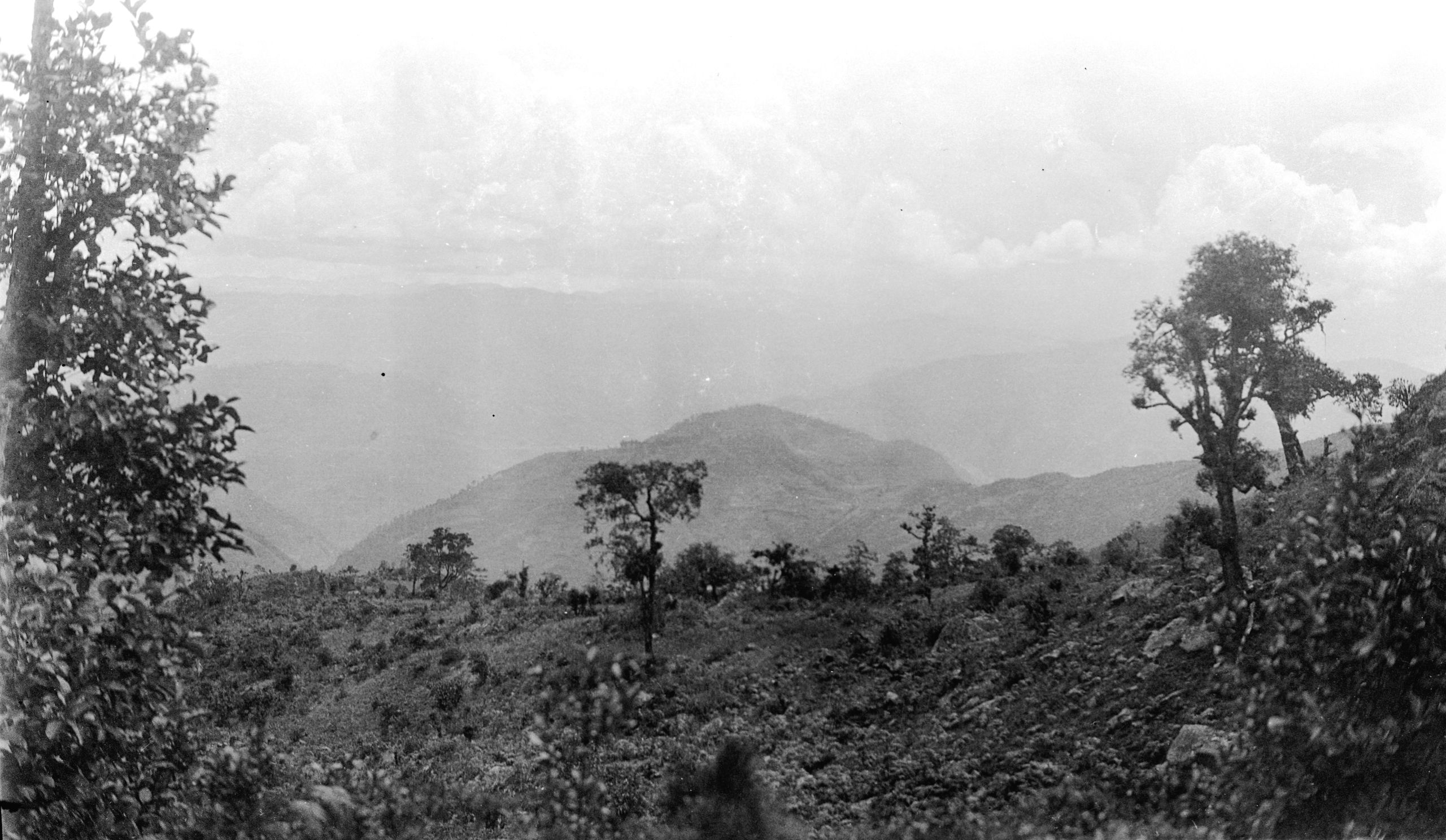
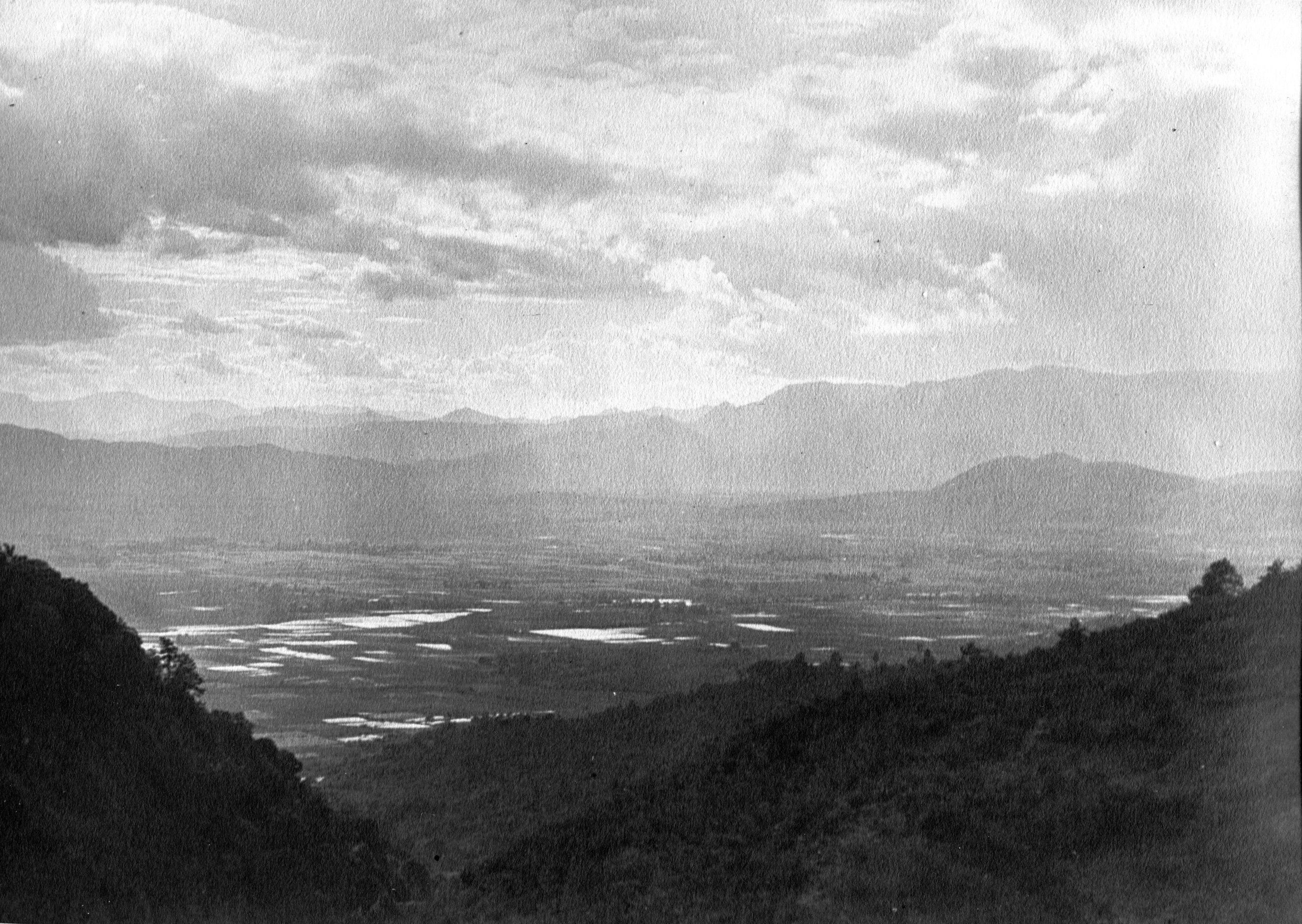
“A few miles out, from a hill-side vantage point, we had a last view back over the beautiful Yunnan plain. The paved road then led among hills and down a narrow valley. The day’s journey was uneventful except that the soldiers kept telling us that this was the place for robbers”.

View over hills towards Lang Tsuen
View over hills towards Lang Tsuen
Arrived at 6 pm at Shiu-Tsuen (or Erh-ts'un) after 15¾ miles.
“There is no inn, but we have found a house where we can stay. It is rather filthy and the inside rooms are swarming with bugs. The old lady told the soldiers that they often came down in hundreds from the roof. It helped to know that even the soldiers complained of being bitten!”
HGT and GP found it better to sleep downstairs on the veranda where the ground was beaten earth, and not boards. GP had a Tibetan boy called Al to help him on the journey. As well as looking after their transport, he would wash and dubbin the boots. HGT also had a young Chinese boy whom he would refer to as ‘the boy’ or as Mafoo, a Chinese word for a groom or stable boy.
That evening HGT wrote home to his wife:
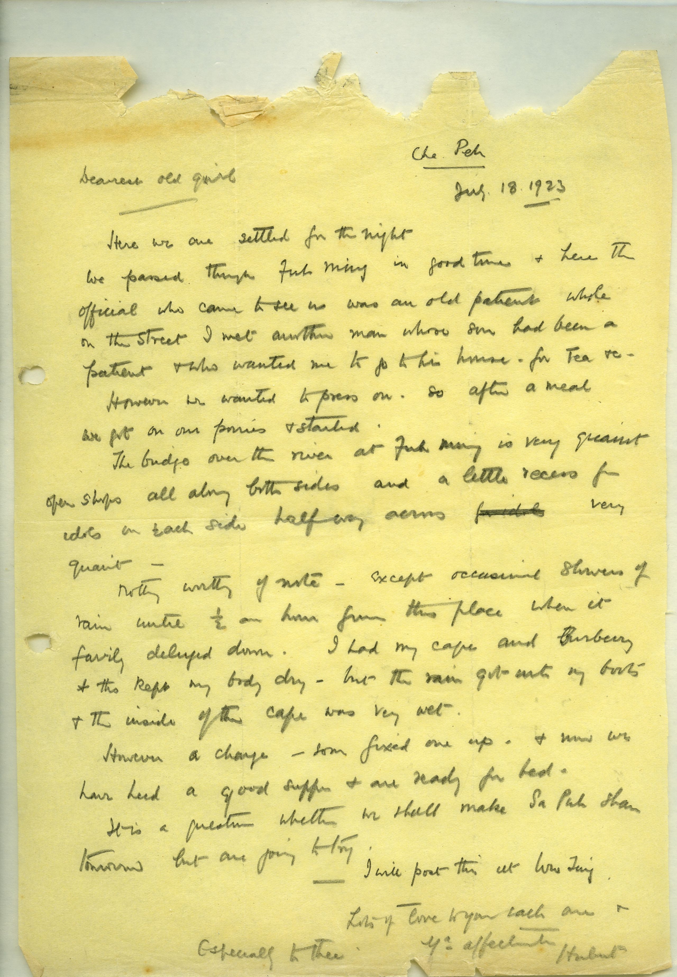
CHE PEH.
July 18th, 1923.
Dearest old girl,
Here we are settled for the night.
We passed through Fuh Ming in good time, and here the official who came to see us was an old patient. While on the street I met another man whose son had been a patient, and who wanted me to go to his house for tea &c. However, we wanted to press on, so after a meal we got on our ponies and started.
The bridge over the river at Fuh Ming is very quaint, open shops all along both sides and a little recess for idols on each side, half way across, very quaint,
Nothing worthy of note - except occasional showers of rain until half an hour from this place when it fairly deluged down. I had my cape and Burberry and this kept my body dry – but the rain got into my boots and the inside of the cape was very wet.
However, a change soon fixed one up, and now we have had a good supper and are ready for bed.
It is a question whether we shall make Sa Puh Shan tomorrow, but one is going to try.
I will post this at Wu Ting,
Lots of love to you each one, and especially to thee.
Your affectionate,
Hubert,

Day two July 18th 1923 Shiu Tsuen to Che-Pei - 21½ miles
The night was wet and there was drizzling rain as they left in the morning for Che-Peh (or Che-pei), a distance of 21½ miles. At 10 miles they passed through Fu-Ming (Fumin) Hsien, a town of a thousand families, where HGT was able to post a letter home. Here there was a fine old covered bridge over the river with open shops all along both sides and, half way across, a little recess for religious statues on each side.

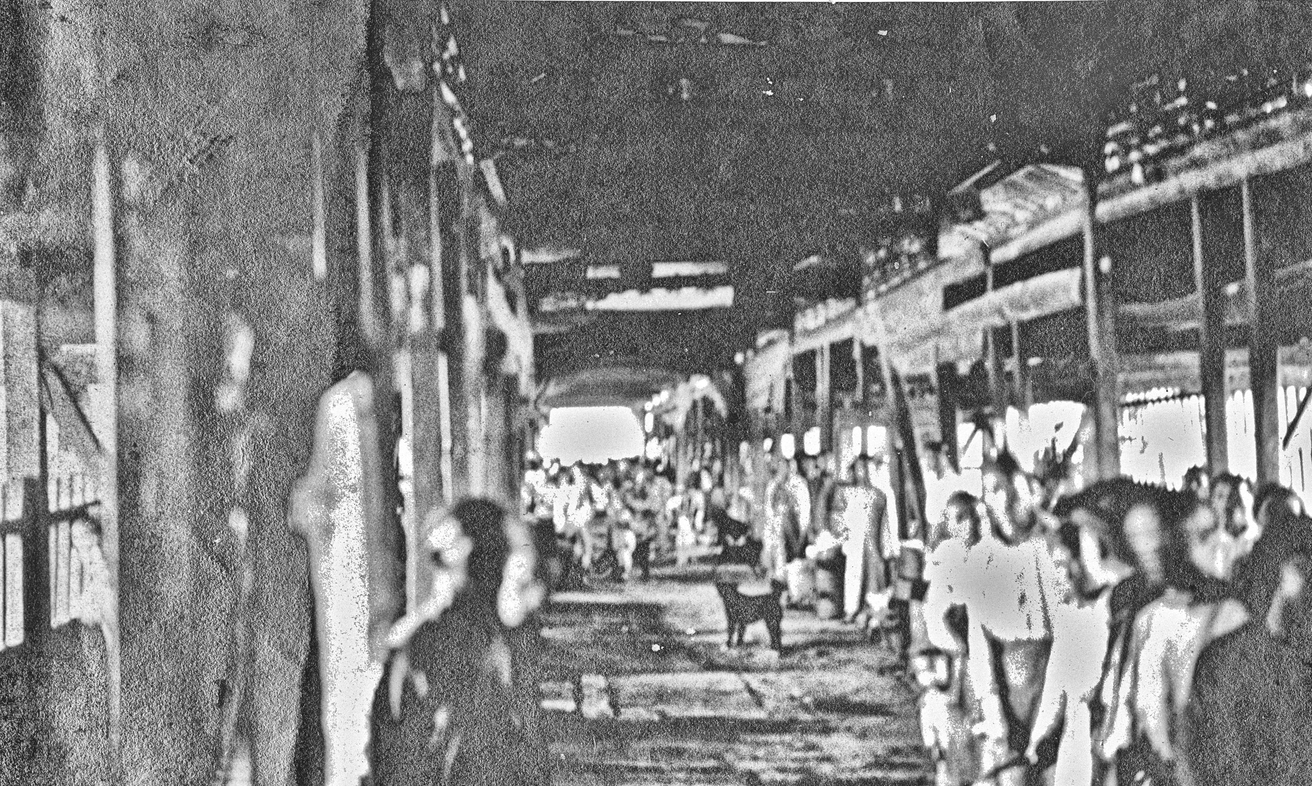
Bridge with shops at Fu-Ming
Bridge with shops at Fu-Ming
“The official who came to see us was an old patient. While on the street I met another man, whose son had also been a patient, and who wanted us to go to his house for tea etc. However, we wanted to press on, so after a meal we got on our ponies and set off again".
GP was now riding a mule instead of being carried in a chair as on his previous journey!

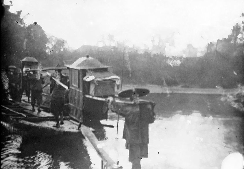
Riding in Sedan chair
Riding in Sedan chair
“The escort is now reduced to ten. The road, partly paved but often very muddy, leads up and down over low hills”.
Arrived at Che-Pei (5,394 ft.)
Day three July 19th, 1923. Che-Pei to Wu-Ting - 21½ miles, then on to Sa Pu Shan - 26½ miles
The road led up and down over slopes rising to 800 ft. at the highest.
Wu-ting-Chow (Wuting), a town of seven hundred families, (5,664 ft.), was reached at 5pm after 21½ miles. There had been occasional showers of rain until half an hour from Wu-ting when it fairly deluged down. Their waterproofs kept them dry – but the rain got into their boots.
"I was able to post a letter home at Wu Ting. The General stayed on at Wu Ting as he had the mapping to do. I set off, with a small boy, known as Mafoo, as a guide, for Sa Pu Shan 5 miles to the north where there was a Mission station and primary school run by Mr & Mrs Nicholls".
“They were very surprised to see me turn up so late, but it was worth the extra 20 Li to get a tub and a comfortable bed!”

Approaching Wu-ting
Approaching Wu-ting
"I was told the children in the school were from 6 different tribes’ people - mostly Lisu, Tahua (or maybe Tujia) Miao and Nuosuo (Lo los). I can see by their dress and faces they are different to the other Miao tribes’ people".
(Note: The Miao are a minority ethnic group living in southern China, and recognized by the government of China as one of the 56 official ethnic groups. The Miao is a Chinese term, for a number of groups of people, which include Hmong, Hmu, Xong, A-Hmao, and the Tujia).
The Lisu people are a Tibeto-Burman ethnic group who inhabit mountainous regions of southwest China. They are also recognized by the government of China as one of the 56 official ethnic groups.
The Lolo (now called Yi people or Nuosuo people) are another ethnic group in China. They are the seventh largest of the recognised ethnic minority groups.)
“A little Miao girl aged about 8, kept coming and shyly looking in to the sitting room with such a bright smile. Mrs. Nicholls said she wanted to see me, finally she came most coyly and gave me a beautiful spray of tiger lilies and then ran away”.
Day four July 20th 1923 Sa Pu Shan to Ma an Shan 25¾ miles
Breakfast at 7 a.m. and HGT saw a couple of patients. After lunch Mr. Nicholls accompanied him on a short cut to join the road along which the General would come from Wu Ting. They were halfway up the mountain when they saw the convoy of mules winding their way along the valley. GP passed the junction before they could get down, and so was a quarter of an hour ahead. However, by pushing their ponies they caught them up after about ¾ of an hour. After joining the General, Mr. Nicholls and he chatted for about 10 minutes as they went along, and them Mr. Nicholls turned back.
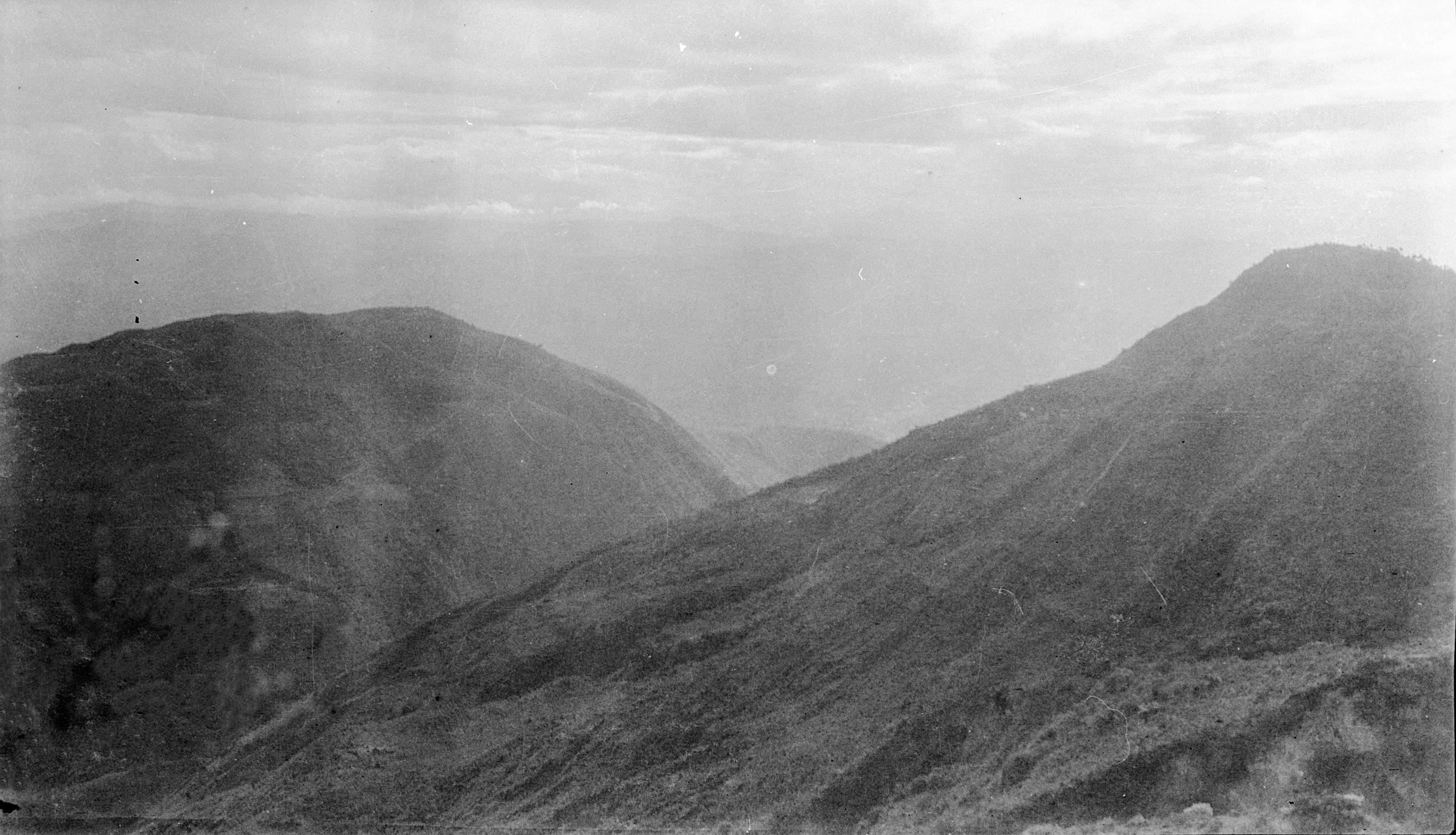
“We had a long steep climb, but before crossing a ridge of hills there was a magnificent view right back, and we could see the white houses of Sa Pu Shan 10 miles away, on the side of the mountain near the top”.
A long day of up and down hills followed. For a couple of miles, the road led across a fertile rice plain and then up the narrow valley of the Hsi-ts'un Ho, in which rice and a little maize were grown. At 10½ miles there was a steep climb over the Yao-yin Ya-k'ou, about 7,000 ft., and then down among low hills and rice valleys. After 25¾ miles they arrived at Ma an Shan at 6 o'clock. The elevation was 6,366 ft.
Day five Saturday, July 21st 1923. Ma an Shan to Ma-t’ao shan - 22½ miles
“The oil sheets on the floor were a great success at combatting the bugs!”
They were up early and started at 6.45 for the 22½ mile trek to Ma Tao Shaan (or Ma-T’ou). A steady climb up for 7 miles, crossing the Kung P'o ridge, (8,300 ft.), the divide between the So-Ling Ho on the west and the Lung-kai Ta Ho on the east, both tributaries of the Yangtze.

Across the valley from Cha Fan shan
Across the valley from Cha Fan shan
“It was just gorgeous, right at the top of things with views over ranges of mountains. At the highest point we passed through a most beautiful glade with meadow land, uncultivated but carpeted with flowers - one like a buttercup, and small blue flowers, and meadow sweet in great profusion. The air crisp and cold, so that I put on my Burberry and cape for warmth. Leaving this lovely spot, we wound round the side of the hills - at an elevation of about 6,800 ft. - with indescribably beautiful views all the time - occasionally a shower of rain made us get into our mackintoshes, and the road became muddy and slippery, but nothing to stop our getting on”.
“Where the road passed through cultivated fields there were hedges - full of flowers: big yellow buttercup-like flowers. A white cha hwa - a beautiful blue flower in sprays, most delicate in structure, with a leaf something like maidenhair. The beauty was only spoilt by the escort of 20-30 soldiers with their guns, ready to take the life of their fellow man if necessary”.
At 12 miles there was another rise to about 8,000 ft., and the road then kept high up along the top of the Ch'a-fen Shan, with a deep valley on the left and beautiful views to the south and west over many ranges. At 17 miles, at about 3 p.m. they began the gradual descent with picturesque views over the broad fertile Ma-t'ou- shan valley.

Looking towards Ma-tao-shan
Looking towards Ma-tao-shan
At 19 miles they began a steep stony descent (3,000 ft.), down zigzags to the valley. Ma-t'ou- shan is a valley of forty families, at an elevation of 4,964 ft. They arrived at Ma Tao Shan at about 5.45. GP, as always, then spent about 2 hours working on the day’s observations and mapping.
“The best rig for this rainy season is Burberry with the cape on top, and the oil-cloth saddle protection tied to the front of the saddle and then drawn up over the knees and tied to the saddle bags at the side - the big Chinese hat is a huge success, and I wear mine all the time, occasionally with the squash sport's cap inside. The big hat protects the shoulders so well from the rain.”
“At Ma Tao Shan I got the boy to pour a bucket of water over me in the pouring rain in the courtyard of the inn - much to everyone's amusement, and to my great refreshment. Now I must stop - the light is wretched.”
Day six Sunday July 22nd, 1923. Ma-t’ao shan to Ma Kai (or Yüan-mow-hsien) - 9 miles
They left Ma T’ao Shan in pouring rain 8.15. The small streams were in flood and they had considerable difficulty in crossing some of the small rivers.

Looking back towards Ma-tao-shan
Looking back towards Ma-tao-shan
"Fields of melons on each side of the road, from which the farmers were extracting the seeds - we got some nice Hwa Hung (?) in Ma Kai - 5 cash each".

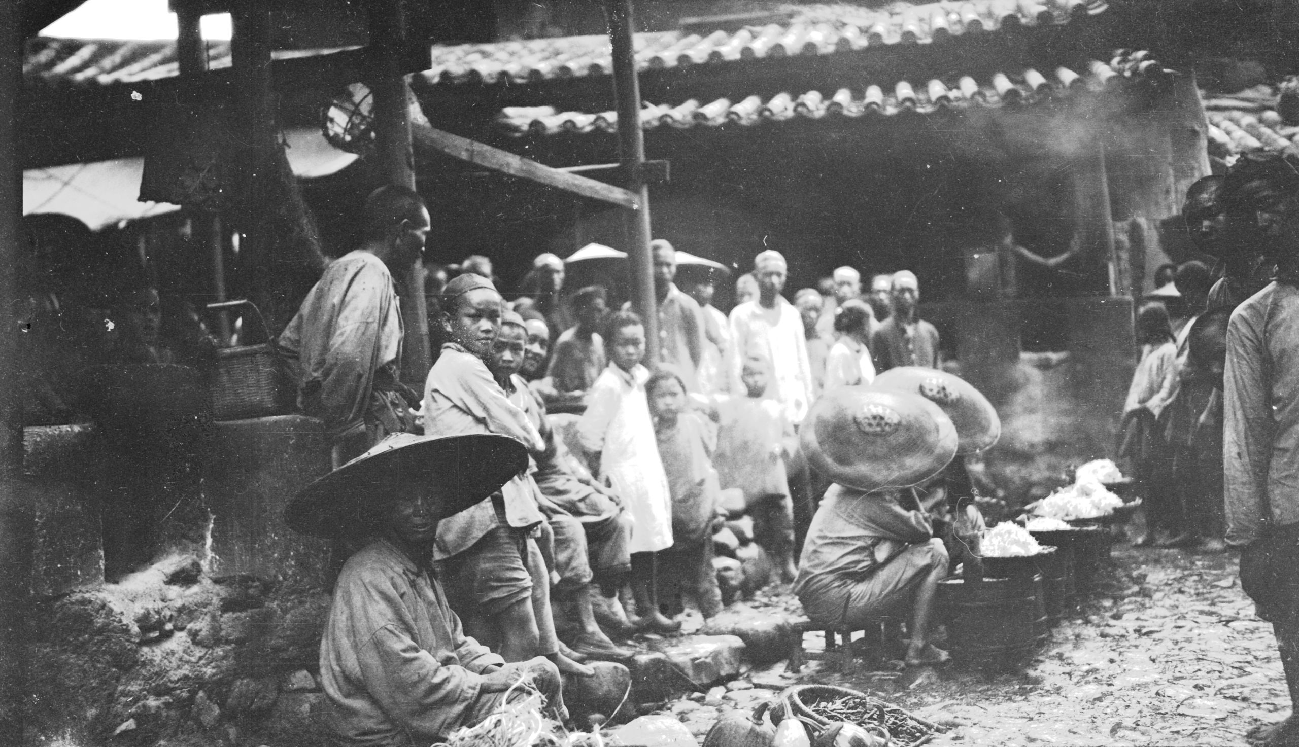
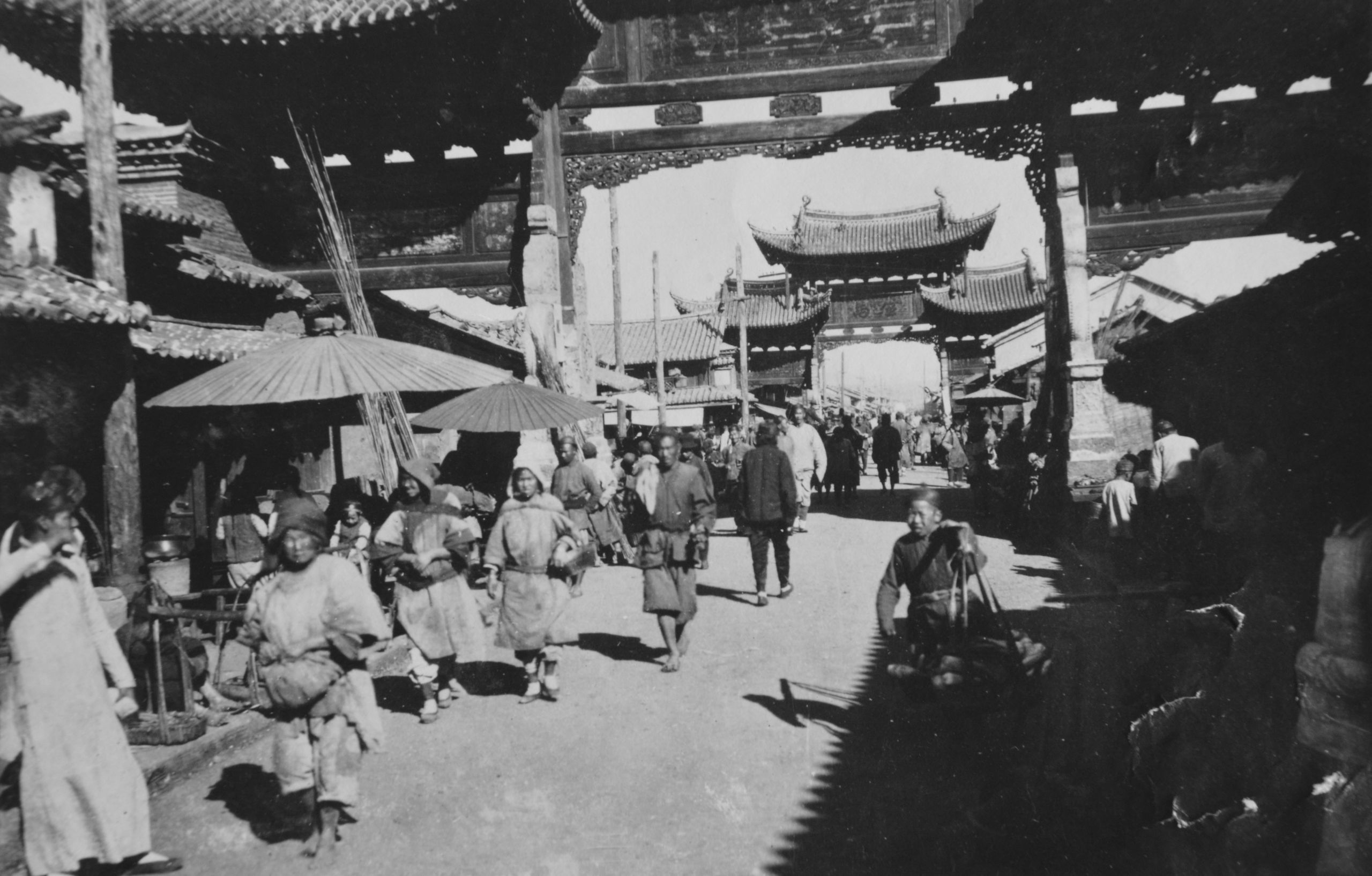
The market at Ma-Kai
The market at Ma-Kai
After 9 miles fairly hard going, they arrived at Ma Kai (also called Yuan-mow-hsien), a town of eight hundred families, at 12 noon. HGT had a stroll round once the rain had cleared. One quarter of the town had been burnt out by brigands in the Chinese 3rd month (April). He took a couple of photos of the market and the burnt-out houses.
“We were told 1,000 brigands came over from Lufeng or from Szechwan, looted and burnt and then went back”.

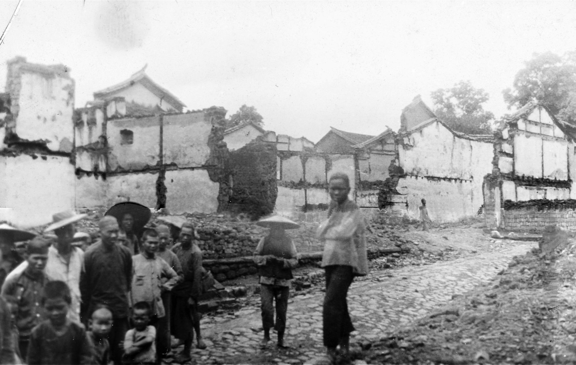
The result of bandit visitation at Ma-Kai
The result of bandit visitation at Ma-Kai
Eventually he had to give out tickets to those who were waiting and refuse to see any more - as they kept arriving all the time. Each one was given a copy of the leaflet tract. When HGT stopped seeing patients there were still about 40 more waiting at the door - but he had to stop and pack up ready for the next day’s journey.
In his letter home HGT wrote:
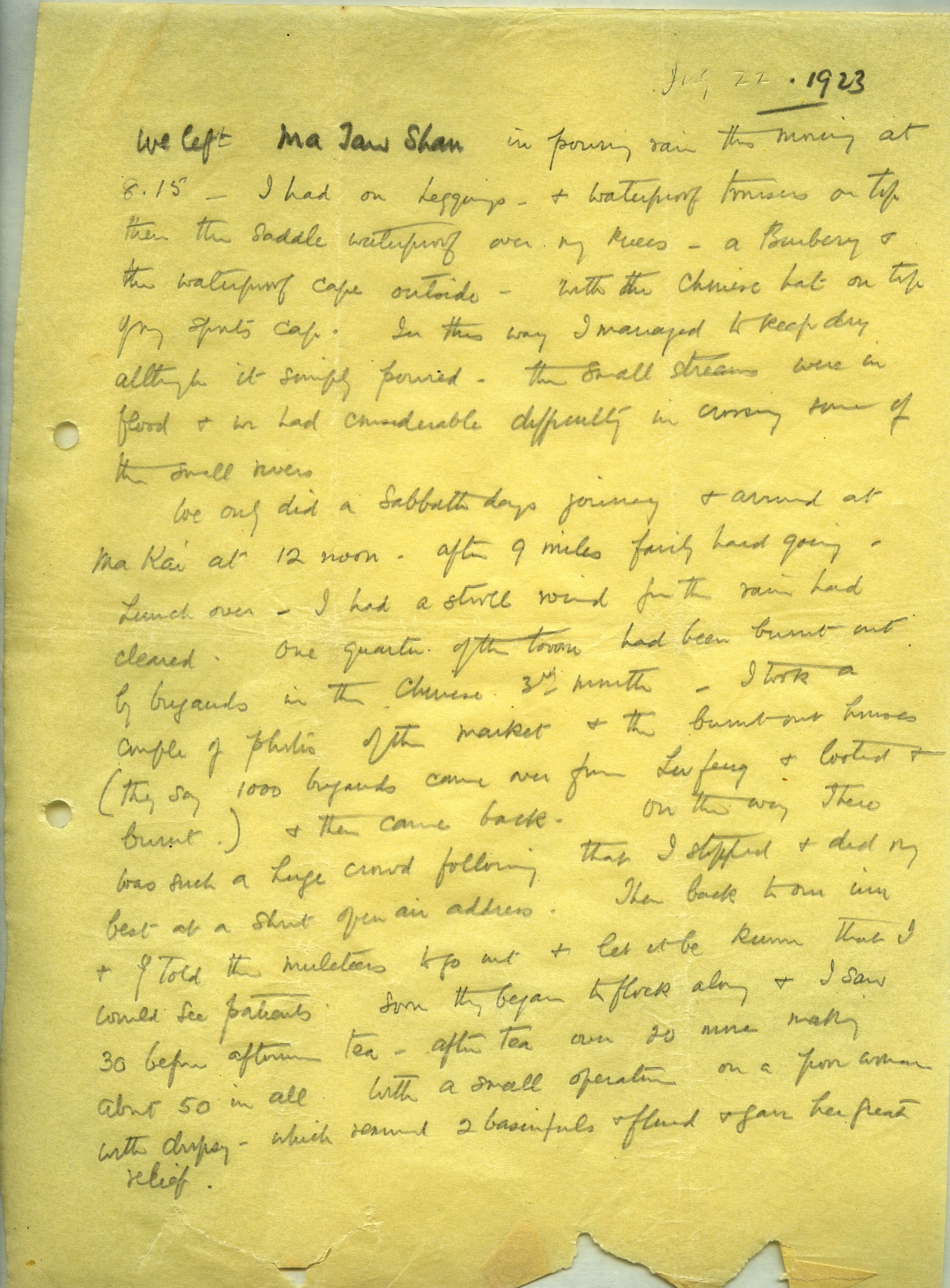
July 22nd, 1923.
We left Ma Tao Shan in pouring rain this morning at 8.15. I had on leggings and waterproof trousers on top, then the saddle waterproof over my knees, and a Burberry and the waterproof cape outside, with the Chinese hat on top of my sport's cap. In this way I managed to keep dry, although it simply poured. The small streams were in flood and we had considerable difficulty in crossing some of the small rivers.
We only did a Sabbath day's journey and arrived at Ma Kai at 12 noon. After 9 miles fairly hard going - lunch over - I had a stroll round for the rain had cleared. One quarter of the town had been burnt out by brigands in the Chinese 3rd month. I took a couple of photos of the market and the burnt-out houses (they say 1,000 brigands came over from Lufeng and looted and burnt) and then went back. On the way there was such a huge crowd following that I stopped and did my best at a short open air address. Then back to our inn and I told the muleteers to go out and let it be known that I would see patients. Soon they began to flock along, and 1 saw 30 before afternoon tea - after tea over 20 more, making about 50 in all. With a small operation on a poor woman with dropsy - which removed two basinfuls of fluid and gave her great relief.
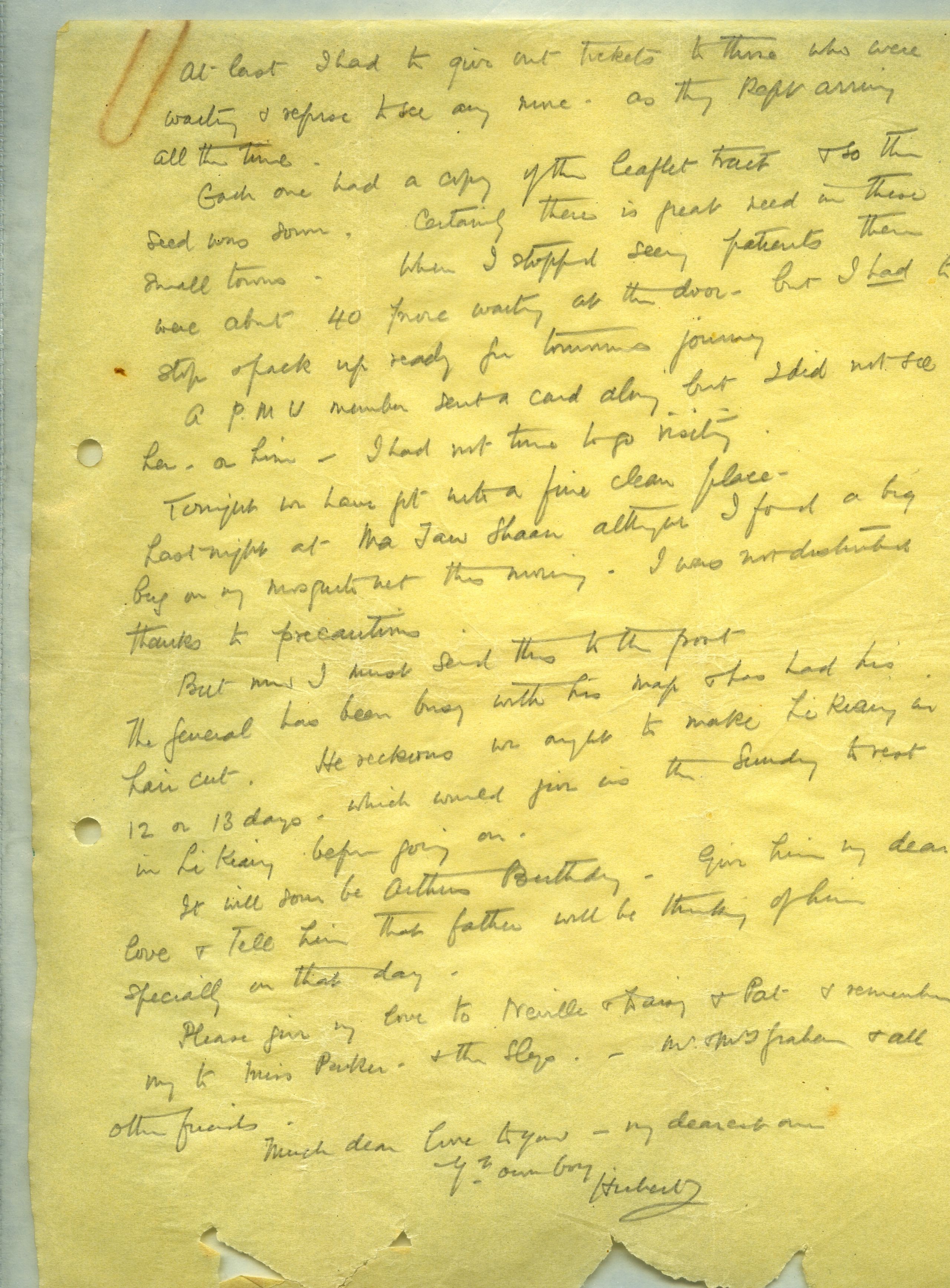
At last I had to give out tickets to those who were waiting and refuse to see any more - as they kept arriving all the time.
Each one had a copy of the leaflet tract, and so this seed was sown. Certainly there is great need in these small towns. When I stopped seeing patients there were about 40 more waiting at the door - but I had to stop and pack up ready for tomorrow's journey,
A P.M.U. member sent a card along but I did not see her - or him - I had not time to go visiting.
Tonight we have got into a fine clean place.
Last night at Ma Tao Shaan, although I found a big bug on my mosquito net this morning, I was not disturbed, thanks to precautions.
But now I must send this to the post.
The General has been busy with his map, and has had his hair cut. He reckons we ought to make Li Kiang in 12 or 13 days, which would give us the Sunday to rest in Li Kiang before going on.
It will soon be Arthur's Birthday - Give him my dear love, and tell him that father will be thinking of him specially on that day.
Please give my love to Neville and Daisy and Pat, and remember me to Miss Parker, and the Slys, Mr. and Mrs. Graham and all other friends.
Much dear love to you - my dearest one,
Your own boy,
Hubert.


Day seven July 23rd, 1923. Ma kai to Wu Moh - 13¾ miles
“Two of the mules were played out before we got to Ma Kai, and so were "exchanged" but the new ones are very feeble little things and will probably have to be swapped again in 2 days. The escort has now again increased to thirty”.

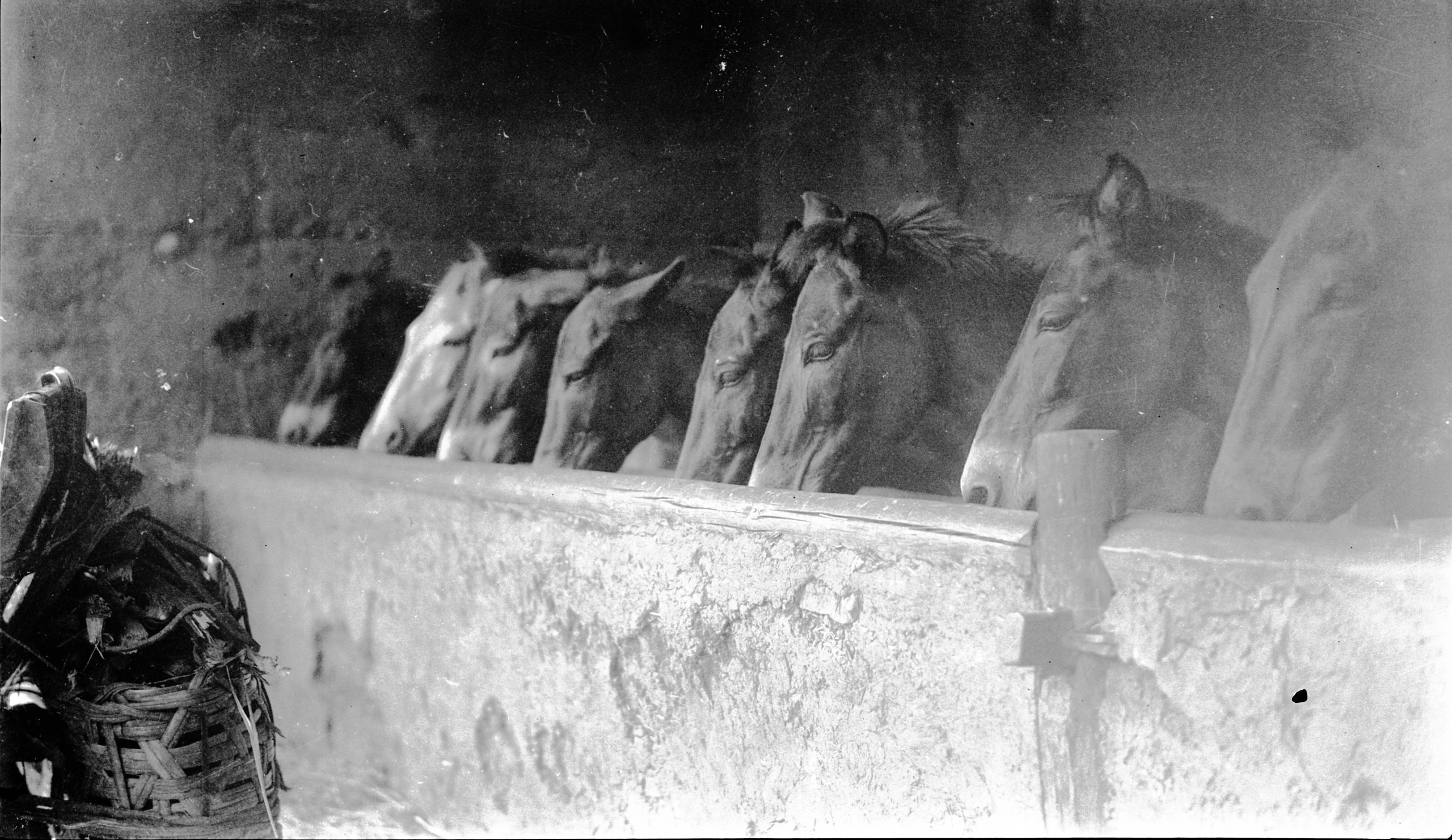
Stabling for the mules
Stabling for the mules
"We travelled 13 ¾ miles to Wu-moh, down the fertile Sha Ho valley, 2 or 3 miles wide. It was a gorgeous day - brilliant sunshine and very hot. The going was good over an un-paved path".

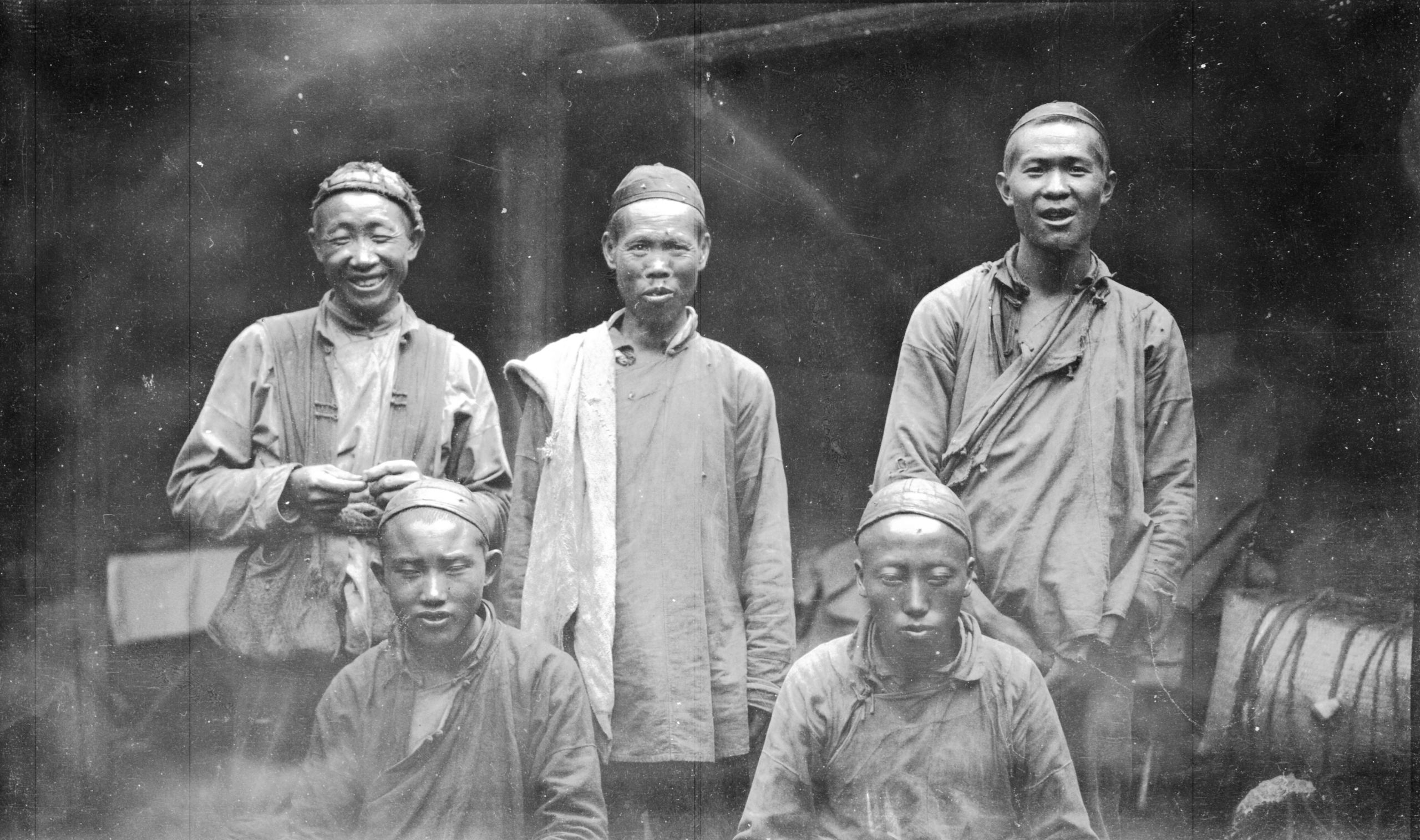
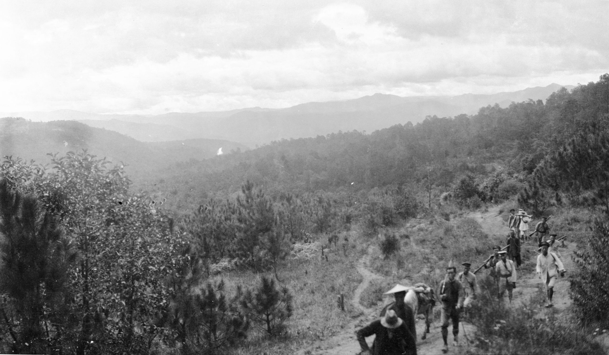
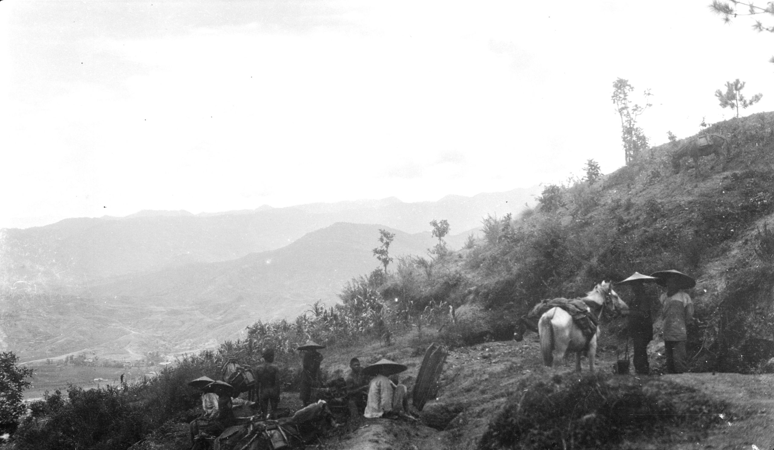
Muleteers from Yunnan-fu to Likiang
Muleteers from Yunnan-fu to Likiang
“We had to cross two rivers. At 6 ½ miles the Sha Ho joins the So-Ling Ho, (Note: Ho (now usually written as Hé) means river) which is the main tributary of the Yangtze. This river is the one into which the Wu Ting - Lufeng and the river from the Kun-Yang lake at Yunnan-fu flows - and goes on to the Yangtze, which is now only 20 miles distant. This is joined by the Fu-min Ta Ho, the Lu-feng Ta Ho and the Anning River”.

View over the plain where the Sha Ho joins the Su-ling Ho
View over the plain where the Sha Ho joins the Su-ling Ho
At 8½ miles they left the road to Chengtu by Hui-li-chow and crossed the So- Ling Ho by a ferry at Ho-Kai. The river was here 100 yards wide and 8 feet deep.
“There was only one small boat, so the sixteen animals had to swim. The mules were driven in high up the river, and as they were swept off their feet they struggled and swam to the other side. It took over an hour for all to cross, and the loads to be ferried over. I got over in the first ferry load, and then undressed and had a dip in the river. It was just delightful, and I feel as clean as a new pin again. As most of our midday halts have to be where there is water for the mules, I hope to get opportunity for a tub in this way.”

Crossing river at Ho-kai ½ way between Ma-Kai and Wu-moh
Crossing river at Ho-kai ½ way between Ma-Kai and Wu-moh
They then left the So-Ling valley and crossed a low hill into a small fertile valley, and crossed the junction of the Wen-tao Ho and the Wu-mo Ho by another ferry.
Wu-mo has seventy-five families and is at an elevation of 3,660 ft.
There was some most interesting loess formation as they journeyed, looking like wonderful buildings with minarets on.
Day eight July 24th, 1923. Wu-mo to Tso Ch'io - 8 miles
After leaving Wu Moh at 7 a.m. they climbed steadily for 8 miles up the Ta-shao-Shan to the top, (from 3,600 ft. to 5,060 ft.) and then along the ridge for 3 miles. It became perceptibly cooler - for with the sun shining brilliantly it had been extremely hot.
“After the climb we could look back and see the course of the Sa lo River, as it went North to join the Yangtze. Our road lay along the tops of dividing ridges, and the views on all sides were magnificent. It was like the open moorland of Yorkshire - but with ranges of mountains about 8,000 ft. high in the background.”
From here the most southerly bend of the Yangtze was only 6 miles off to the eastward. There was then an easy descent to Tso-ch'io, a city of 550 families, at 5,071 ft. elevation
“No rain - but after midday it was cloudy - and therefore, cooler. All along the road, which was only a mountain track, there were some beautiful flowers - a small blue one like a forget-me-not, and a grass bearing a flower very like candy-tuft, also another grass with a flower in sprays - like a Star of Bethlehem. I wish that I knew more about flowers, all were so beautiful”.
“We had lunch at a quiet spot with some large trees which the Chinese called Chue shue - rather like a Banyan, but with no descending branches - and a different leaf.”
After lunch they had a snooze, until the mules were ready, (for they generally gave them 2 hours rest in the middle of the journey), and then they started again. GP makes a practise of walking 6 miles a day but today they put in 8 miles.
“I am really very fit - sleeping soundly all night from 9 p.m. till 5 a.m. when we get up and about.”
“We expect to reach Ren Hon Kai on Friday, July 27th, and I expect will have a day’s rest there before going on. I am told that there is a post office there. I cannot tell how long it will take to reach you - all will depend upon how often the mail leaves for Yunnan-fu.”
It was now just a week today since they started, and in another day, they should be half-way to Li Kiang.
Day nine 25th July, 1923. Tso-ch’io to Ta Pa Kuan – 13¾ miles
“We left Tso Ch’ioh at 7.30 - weather very hot - no rain. Decided to make only a 40 li stage - and go right through - with the result we arrived at Ta Pa Kuan at about 12 noon. On the way we noticed a lot of kao liang (high grass), a millet which grows very high - in appearance, very like Indian corn, except that it does not bear the corn cobs”.
“By the road side there was also a lot of shrub bearing a black berry - very like a British blackberry - quite sweet, but with a small stone in the centre”.
“We still have an escort of over 20 men, but as we are told that the country from here on was clear of bandits, we hope to get rid of some of these soldiers”.
A beautiful ravine about 3 miles from Tso Chioh with a river flowing through it, gave a chance for a very pretty snapshot.

Beautiful ravine about 3 miles from Tso Chio
Beautiful ravine about 3 miles from Tso Chio
“We followed the course of this river, and crossed it again three times - at the second crossing three of the mules got a bit out of their course across the ford and got into holes - one went almost over, but fortunately his load, which got wet, was mostly stores in tins so did not matter much”.

Crossing river ½ way between Tso-chu and Ta-pao-kwan
Crossing river ½ way between Tso-chu and Ta-pao-kwan
“The two other loads got wet, but the day was so hot that they soon dried again".

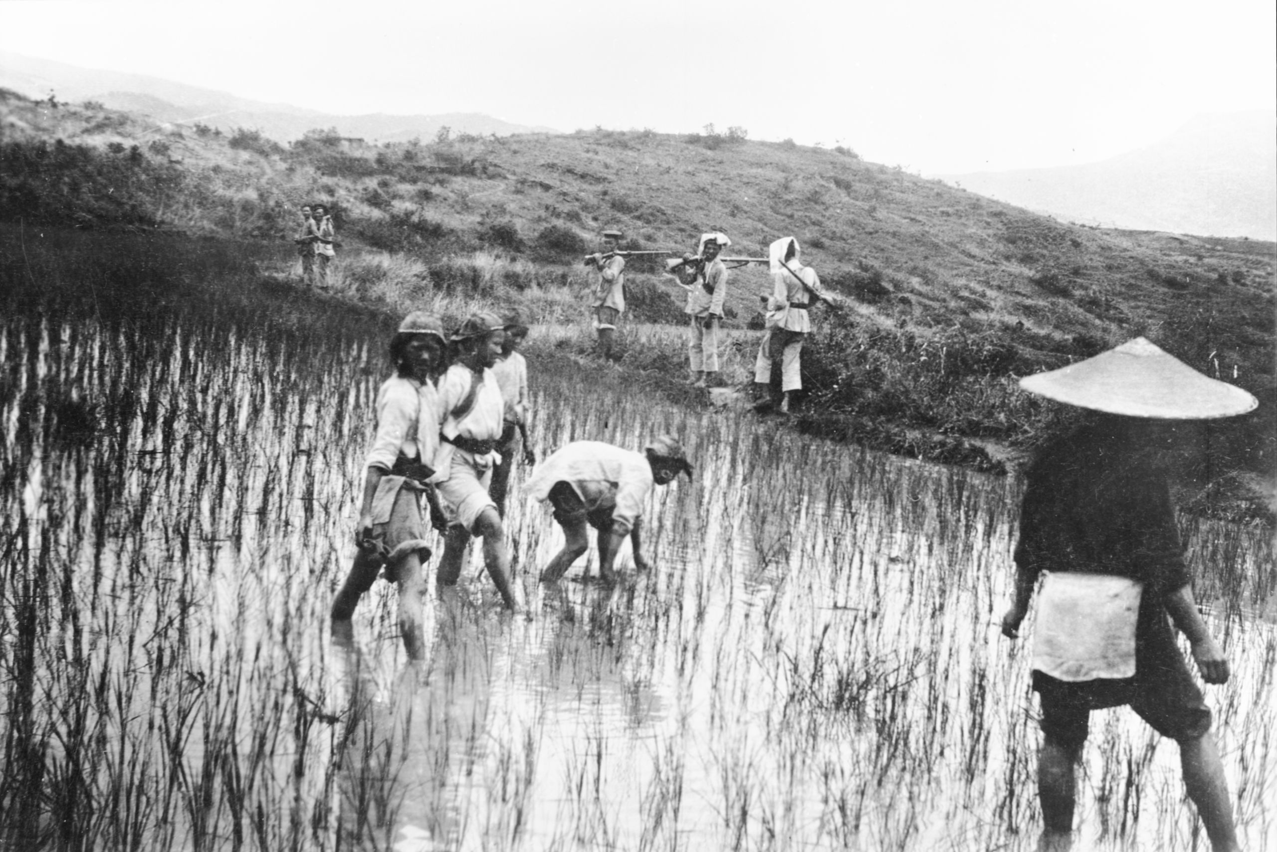
Lo Lo women planting rice in Ta Pa Kwan
Lo Lo women planting rice in Ta Pa Kwan
“Just outside this place, Ta Pa Kwan (5,502 ft.) – we saw some Lolo women working in the fields, and I took a snap of them. Too hot to do any developing today”.
Day ten 26th July, 1923. Ta Pa Kuan to Ta Tien Kai – 15¼ miles
“Overnight we put our watches on 1 hour, and so left at 6.30 a.m. which meant 5.30 real time. It was beautifully cool and a glorious morning”.
“Before starting a number of Chinese and Lolo came swarming into the inn asking for medicine. I saw about 8 more patients - bringing the number at Ta Pa Kwan up to 80. Considering that there are only 130 houses at Ta Pa Kwan this is a pretty fair percentage of the population”.
“Mostly eye cases. Each one received one of the leaflet tracts, and at this rate we will soon get through the 1,000 which we brought - so far 142 people have been seen".

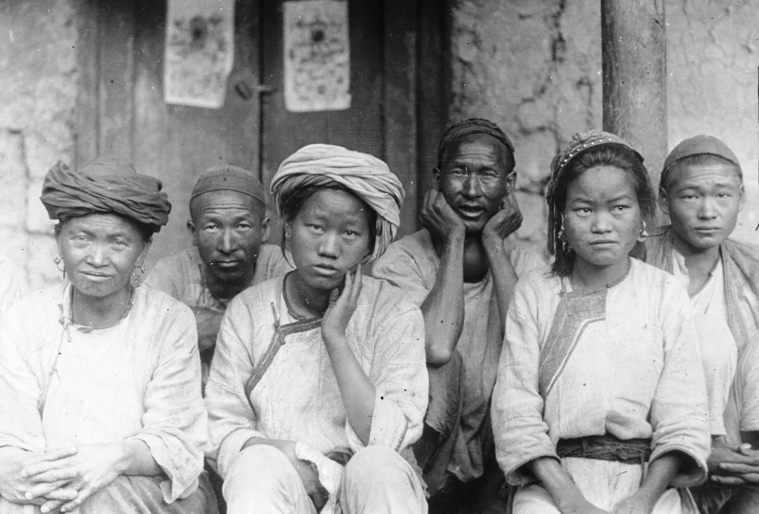
LoLo men and women patients at Ta Pa Kwan
LoLo men and women patients at Ta Pa Kwan
“I got a good photo of Lo Lo men and women who came as patients at Ta Pa Kwan by promising them medicine, and after the snapshot I quickly gave out what I could in the way of ointment etc. They then simply ran away, the people laughing as they saw that the General had started and the mules were ready. Some caught me by the arm and begged for a little more ointment. It was all so good humoured, and made one feel what a big need these poor folk have for some simple medical help”.
It was a glorious day, and they walked the whole stage of 16 miles – starting at 5,502 ft. and climbing Ma-p’o Shan at 7,510 ft. On the top of a ridge with glorious views on both sides looking towards the Yangtze - the valley of which could be seen but not the river. On the top of this ridge it was quite well wooded - the first wooded country which they had passed through. At 8 ¼ miles was Kuan-yin-ai Shan, 7,490 ft., and a very steep descent to 5,270 ft. at 13 miles. Lunch and a rest away up near the top in a wooded glade - then downhill all the way to Ta Tien Kai a place of 94 families (5178 ft.)

Looking down ½ way between Ta-pa-kwan and Ta-kien-kai
Looking down ½ way between Ta-pa-kwan and Ta-kien-kai

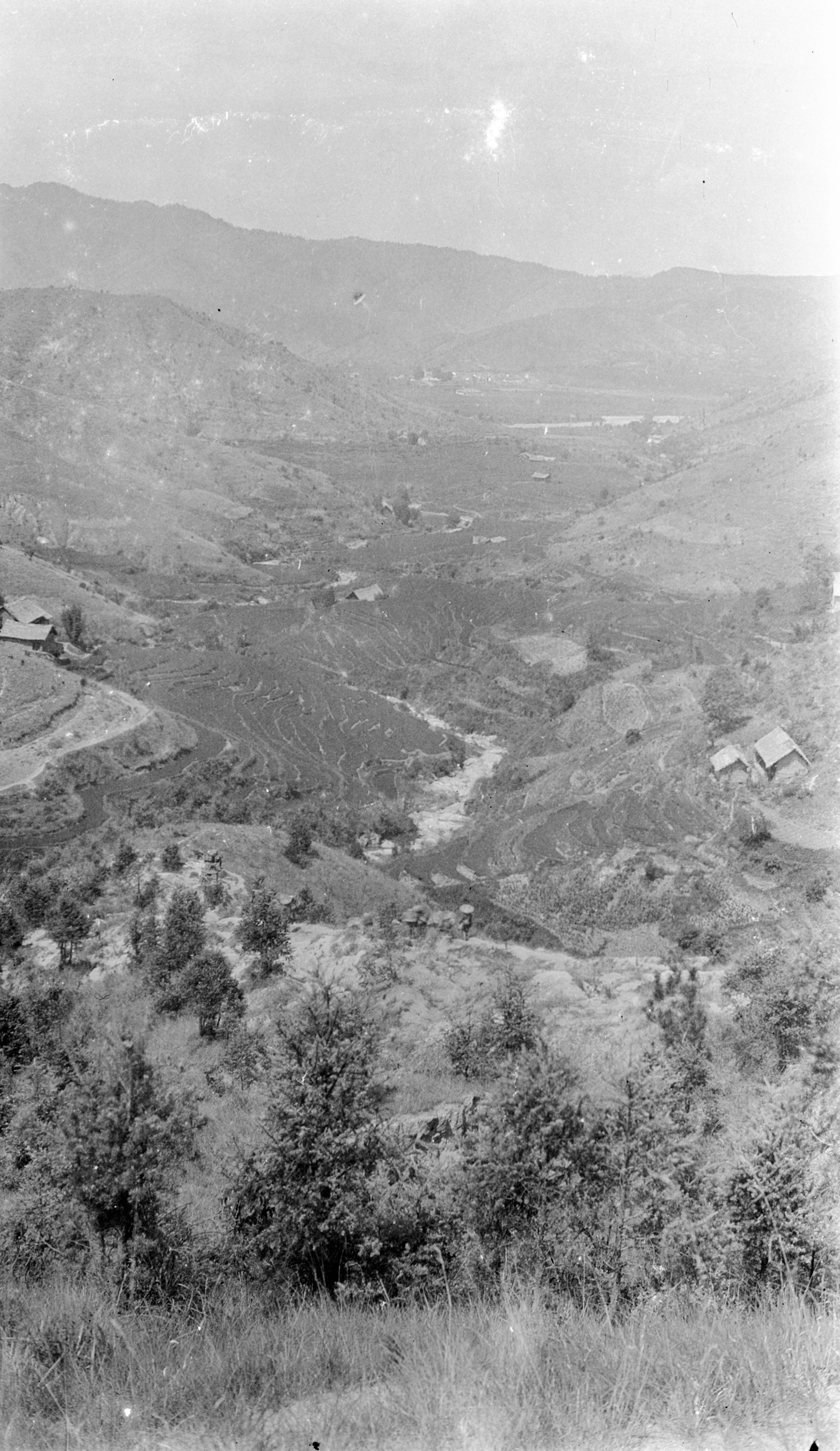
Overlooking Ta-tien-Kai
Overlooking Ta-tien-Kai
At Ta Tien Kai there was a R.C. Mission, with a Chinese priest in charge. There was a big following of R.C.s at this place. HGT did not see any patients at Ta Tien – They kept it quiet that a doctor was about so he had a quiet evening.
They were now halfway to Li Kiang.
Later that day in a letter home HGT wrote to his wife, Amy:
26/7/23
Dearest one.
Another un-copied letter.
You are often in my thoughts and I keep saying to myself - How Amy would enjoy this glorious scenery - even Pereira who has travelled so much keeps exclaiming at it.
I hope to hear at Li Kiang that the salt deeds are all in order and they have paid you some more money, please be sure and let me know because I want to know whether you have to draw on my Hong Kong account.
Don't be anxious about it - but if any hitch occurs it must simply wait till my return, do not on any account return the money they have paid.
By the way, would you call in and tell Chan that I am lending him the instrument which I put in my safe, and the packet of the small size cartridges - do not give him the larger packet. At the same time, tell him I said he would be paying you 300 odd dollars. I hope he will stump up and get this matter finished.
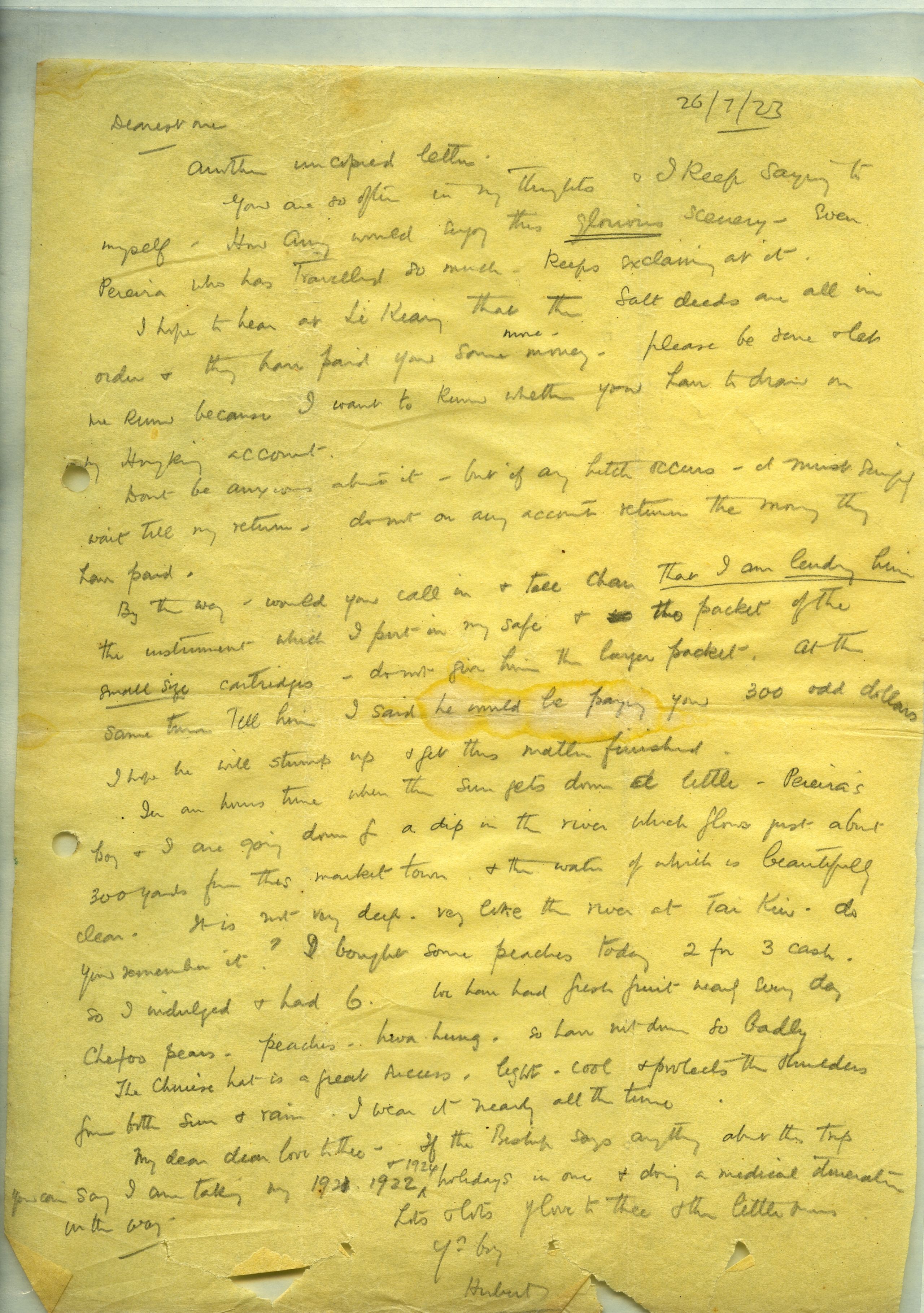
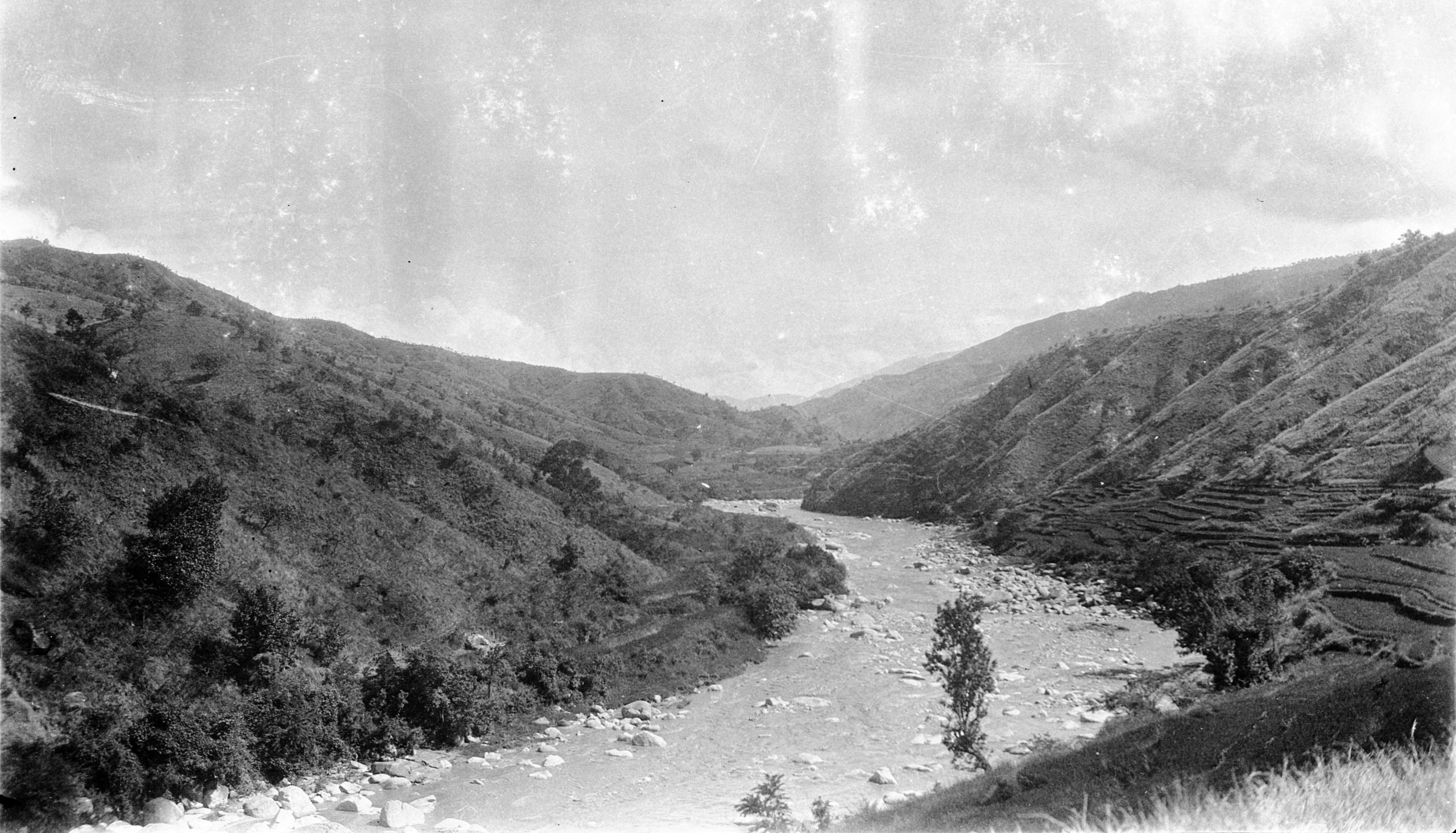
In an hour's time, when the sun gets down a little,
Pereira’s boy and I are going down for a dip in the river which flows just about 300 yards from this market town, and the water of which is beautifully clear. It is not very deep, very like the river at Tai Kiu, do you remember it? I bought some peaches today, 2 for 3 cash, so I indulged and had 6. We have had fresh fruit nearly every day - Chefoo pears, peaches, hwa hung - so have not done so badly.
The Chinese hat is a great success - light, cool and protects the shoulders from both sun and rain. I wear it nearly all the time.
My dear love to thee. If the Bishop says anything about the trip, you can say I am taking my 1921, 1922 and 1924 holidays in one, and doing a medical itineration on the way.
Lots and lots of love to thee and the little ones.
Your boy,
Hubert.

Day eleven July 27th, 1923. Ta Tien Kai to Jen Hoh Kai – 18½ miles
They left Ta T’ien Kai at 7 o'clock by their time (6 o'clock true time), and followed the course of this small river all the way down.
“It is piping hot, but as we got an early start, we arrived at the mid-stage resting place in 4 hours. The scenery is very like that of the English lakes - but much grander and on a bigger scale altogether.
After a walk of 18½ miles down the Jen Ho valley, they reached Jen Hoh Kai (3,830 ft.) - a nice little market with 450 families, on the banks of the River that they had been following all day.

View along the Jen Ho towards Jen-Ho-Kai
View along the Jen Ho towards Jen-Ho-Kai
In his letter home HGT noted:
“You will probably receive my letters from Li Kiang as soon as these - because the couriers only travel by day on this route, whereas from Talifu they do double stages”.
Day twelve 28th July, 1923. Jen Hoh Kai - Continued
“We decided to give the mules a day's rest. We had breakfast at 7 a.m. and immediately after I began to see patients in an old shop and went on steadily till lunch time - saw 148. Then stopped for lunch and began again. Saw about 100 more, bringing the number for this place alone up to 250”.

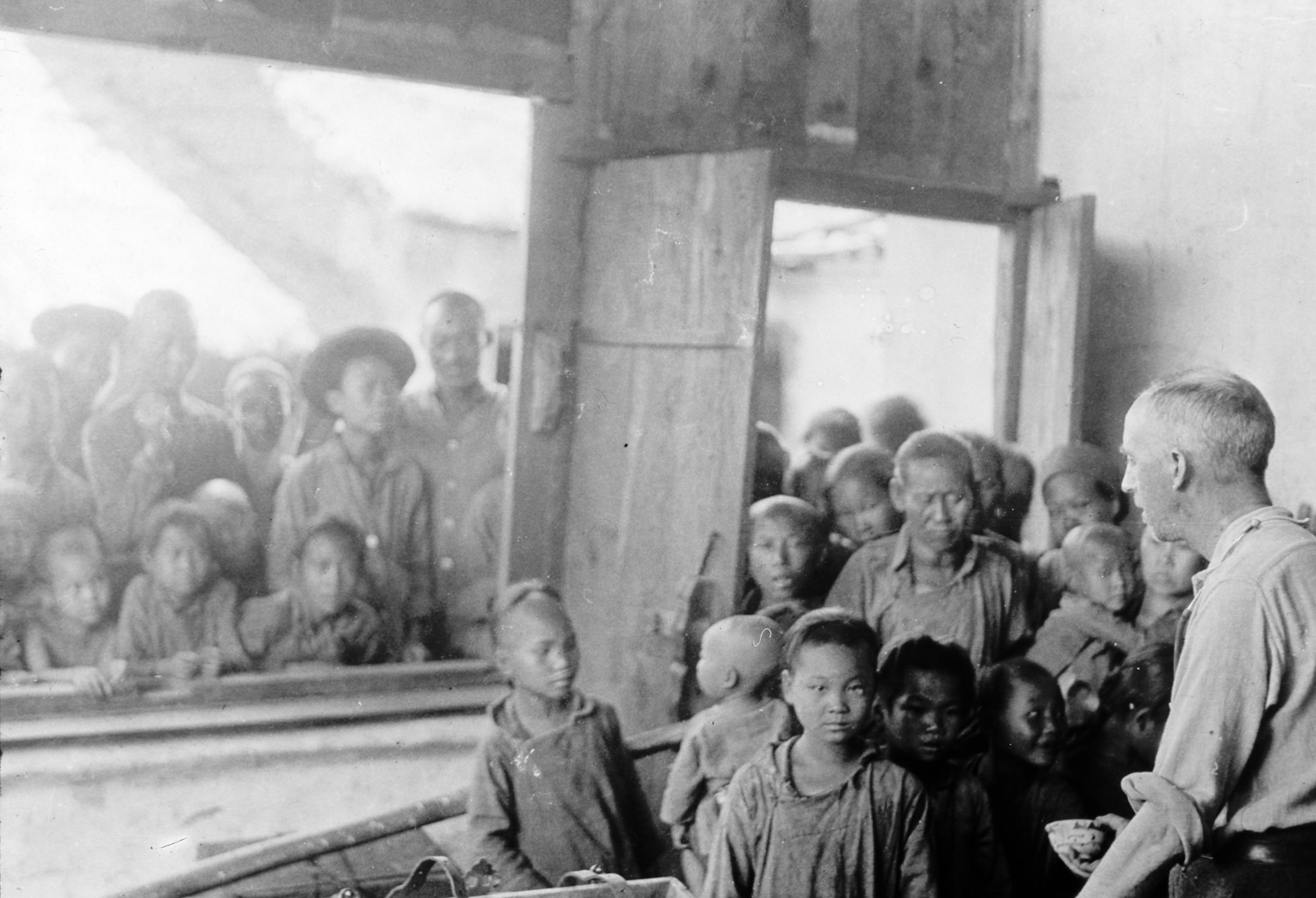
HGT seeing patients in an old shop at Jen-ho-kai
HGT seeing patients in an old shop at Jen-ho-kai
The thermometer was 88°F in the shade in the house and the weather was stifling. They were able to obtain some bananas.
“If I had gone on, I suppose I could have seen quite 100 more, but there is a limit to what one can do. Just think what this means in the way of suffering, and let us hope relief. There are only 450 families in this place so it means that perhaps half have been touched. I stopped every now and again to give a little talk on the doctrine, and each patient received a copy of the simple little tract I wrote before leaving”.
“This is truly pioneer medical missionary work - I suppose no medical man has ever visited this place or gone along this route, and I only wish I had Mr. Yu with me to preach to the crowds who come for healing. The ideal is a doctor and an evangelist going together and the doctor’s wife to talk to the women. It is hard and strenuous but I am very fit and certainly my sleeping precautions reduce discomforts to the minimum. These horse inns are bad for flies, but I think they are better as far as fleas and bugs are concerned than the ordinary inns, and one can generally get the place to oneself and so have quiet”.
“Would you ask Neville to post me - letter post - 100 Santonine and Calomel powders, 1½ grains each, to Batang at once”.
“After a long day I had a most delightful bathe in the river and I got one of the boys to give me a close-cropped haircut”.
Day thirteen 29th July, 1923. Jen Hoh Kai to Hsin Chuang - 14¼ miles
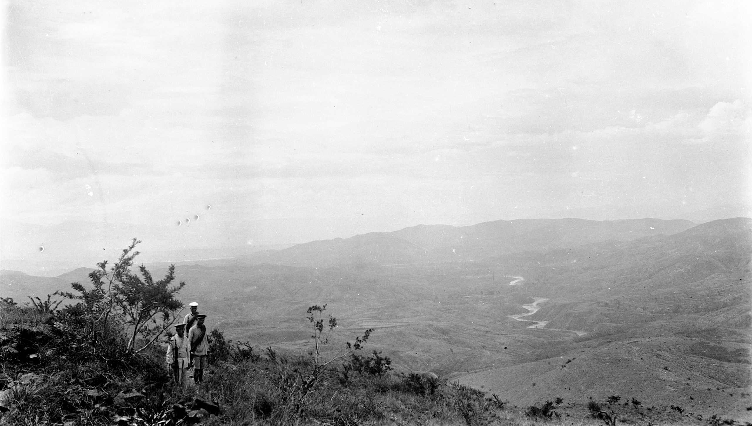
“We left Jen Hon Kai soon after daylight and I walked on ahead of the mules. It was a lovely morning - There had been rain during the night and it was quite cool. Shortly after leaving Jen Hoh Kai, I saw a most beautiful bird, like a large dove - almost the size of a magpie, but with most beautiful blue plumage - wings and tail - head small and like that of a dove. At first, I thought it was a parrot, but on looking carefully the head was quite unlike that of a parrot. From the description GP thought it might have been an Imperial Dove”.

View on the climb to the top of the Ping-chun P'o
View on the climb to the top of the Ping-chun P'o
As soon as they got clear of the little town the road was clear and they only had to ask the way a few times. People they met on the road said that the Great River was not far away, so they did not stop for the mules but pushed on ahead - covering the 30 li (9 miles) in about 3 hours.
“The Great River – the Yangtze, is here called the Peh Shui (or Pai-shui) Chiang, the southern bend being known as the Chin Chiang, and the Ya Lung which joins it near the bend as the Chia Chiang”.
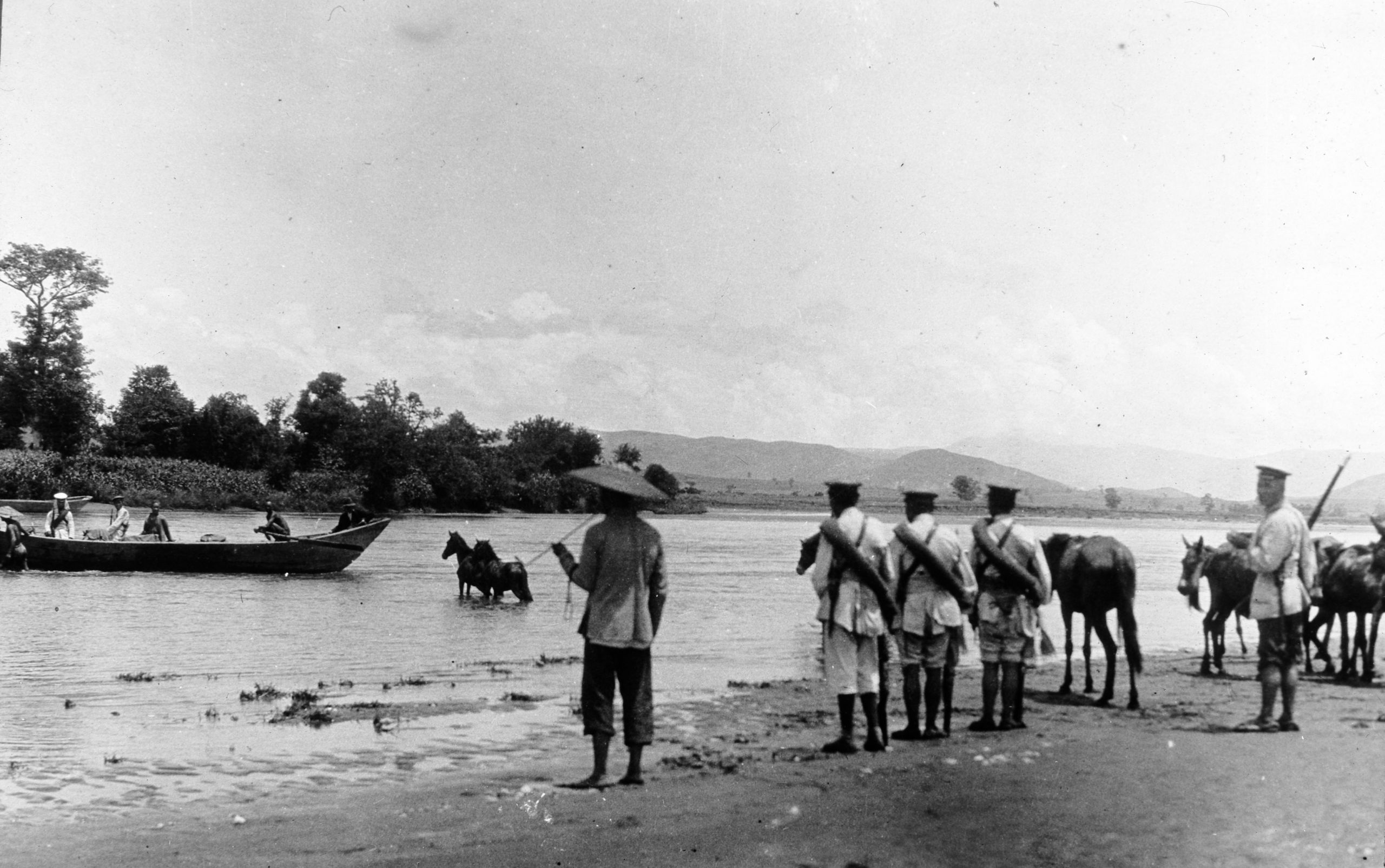
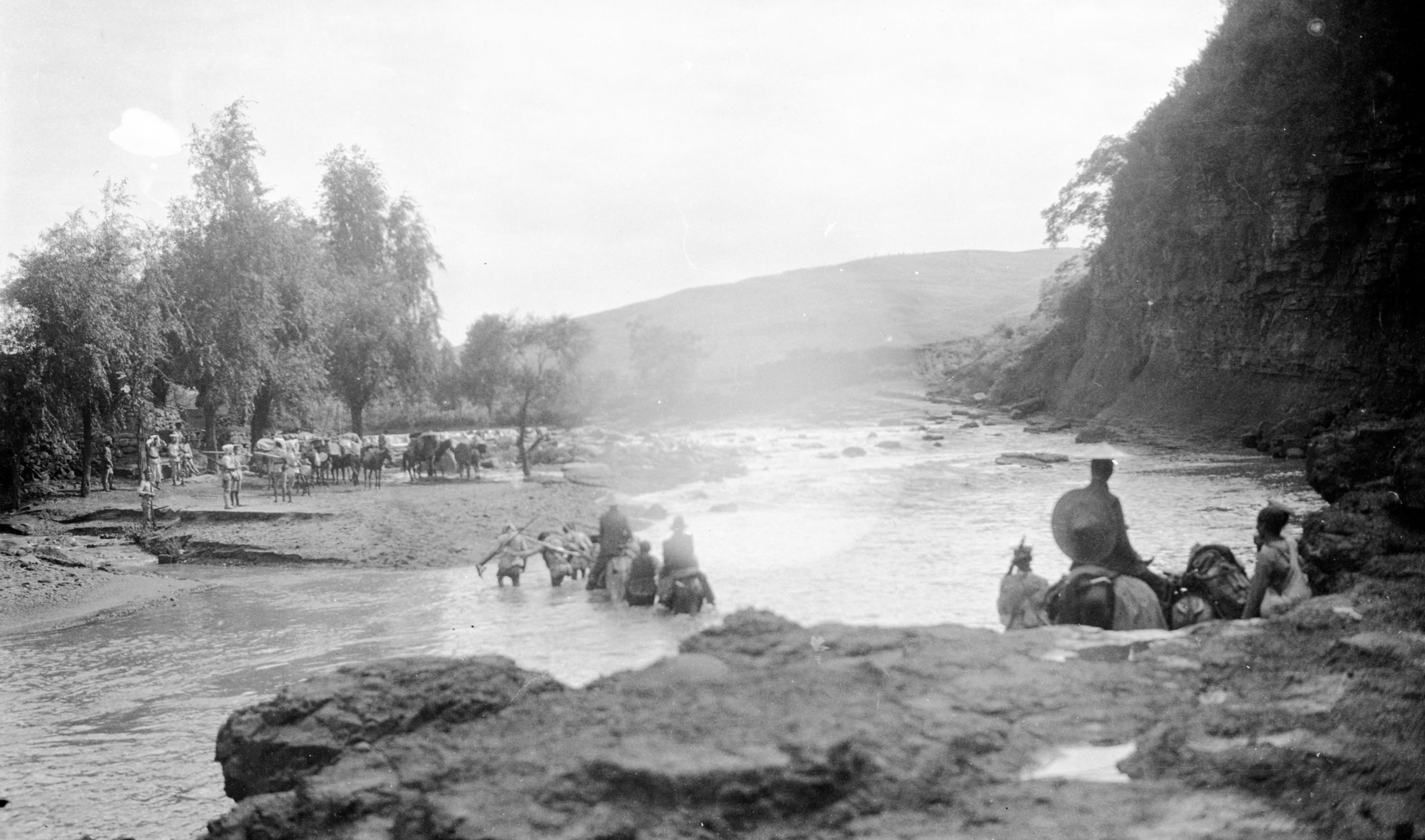
“At last after climbing a little spur of hill - there before us was the Great River- with its deep brown waters eddying and swirling and hurrying along to the East to Suifu, Chungking, Hankow and Shanghai. To me it was quite thrilling to see the River one had heard so much about, here in a place hardly ever crossed by Europeans. I took a photo and hope it will come out well. Then I sat under a tree and in about a quarter of an hour - up came the pack ponies and mules”.

First glimpse of the Yangtze
First glimpse of the Yangtze
“It took us 3 hours to cross (by the Ta-tu-k’ou ferry), there being about 7 boat loads. At this point the river is 200 yards wide and has a fierce current. The mules all had to be unsaddled and ferried across. As soon as four were in the boat it was towed up stream about ¼ of a mile and then cast off. The boatmen pulled at their oars until they were well into the current, when with shouting and renewed effort the boat, as it was swept down, was ferried across. Once the animals were unloaded - the boat was towed up stream again for the return journey".
“While waiting our turn we had lunch, a tin of salmon, bread and jam and chocolate to drink - most enjoyable, then a snooze under the trees. I had a paddle in the cool water whilst waiting for our turn to be ferried over”.
After another short rest while the ponies and mules were being saddled, HGT walked on again with just one soldier to act as guide. They went steadily on for 10 li (3 miles) before stopping to wait for the mules.
“We rested by a most beautiful little stream with a quaint arched bridge, the water coming tumbling straight down from the mountain side. Trees made it cool and there was a great variety of ferns - maiden hair etc. I stripped to the waist and having a towel had a good wash down. It was most refreshing. After ¼ of an hour, the mules came up and I rode. We followed the course of the Yangtze for another 10 li and then left it. We went by a small fertile valley for 14¼ miles to Hsin-chuang (4,107 ft.), a hamlet of forty-three families. We are now in Szechuan but only for a very short time because 5 li from this place we get back into Yunnan again. Now we are settled here for the night and I hope to go down to the stream for a dip - so must stop”.
“Just before supper I slipped away with a towel and found a splendid bathing pool just up the valley, 5 minutes walk, - The water was clear as crystal and quite cold - so I had a glorious bathe. Got into clean things and came back for supper arid bed”.
Day fourteen July 30th, 1923. Hsin-chuang to Hsin Kai – 22½ miles
Up at 5, breakfast at daybreak and off again. After 5 li they crossed back into Yunnan. They passed through Ta Shiu Ching and went on to Ma Shong - 45 li (14¼ miles). Here they had lunch and then went to call on the 2 Catholic priests who lived there - Père Salvat and the younger one Père Durieu.
“They were most kind. They wanted to know all the latest news which we could give them and gave us coffee and offered us a glass of Sherry. Their mission station, with a courtyard in the middle of which was a big acacia tree, is in a most glorious spot, just where the road leaves the Yangtze which we have been following, due West, all morning".
“The road as it followed the great river was merely a path on the steep slopes of the hills, going down to the river where we saw another Imperial Dove. At one point we were blocked for ½ an hour at a ford - of a flooded river. It was very difficult to find the place to cross. It came up to our hips, so you can guess it was fairly deep. One of the mules went over in crossing, but recovered himself".
They then left the Yangtze and ascended the Han-po Ling (4,500 ft.) It then descended over low hills and they reached Hsin Kai, a market town of fifty families perched up on the side of the mountain (4,420 ft.). 22½ miles in total that day.
Day fifteen July 31st, 1923. Hsin Kai to Hwa P’ing hsien – 16¼ miles
They left Hsin Kai at 7 a.m., crossed a small river which runs past the town and then climbed a steep road - to a height of 1,200 ft. above the town. Then the road became more level zigzagging up the mountain side, until they came to a wayside cottage where they crossed the crest of the ridge.
“A fresh view of glorious scenery burst on our view. We could see down this valley at least 15 miles - with a river away in the distance winding away towards the Yangtze. We stayed up at that level for most of the day's journey - skirting along the mountain side of Kan-chia-ya-k'ou, (5400 ft.) about 500 feet below the crest. At 10.30 we stopped to rest the mules and have lunch. On again at 12.30 - crossed numerous mountain torrents with clear crystal water where we had a dip”.
The road lay along fairly well-wooded hill-side, with pretty views over the fertile valley of the San Ho on the left. The trees were mostly firs. They travelled on for another 15 li., still at the high level, past a little mountain-side temple and then a steady drop of 15 li. down to Hwa Ping (4,215 ft.).
“As we came down the hill, we noticed coal on the surface, and at one place, men stripped naked were bringing it out of two holes in the hillside which ran in a distance of about 25 yards. I went in a little way, but there was nothing to see. They said they got out about 20 pony loads a day. It looked quite good coal”.

Coal mining on the surface
Coal mining on the surface
Hwa Ping, stands on the banks of a river, and has a beaten mud wall, the top of which is battlemented and provided with round stones - the size of cobble stones – possibly put there to rain down on any attackers. The town of seven hundred families, was reached after a day’s journey of 16¼ miles. There was also a Post Office so HGT was able to post his letters.
“GP is tremendously keen on his map making. He keeps jotting down rough notes as we go along and then as soon as we reach our resting place his camp table, chair and leather bag are hauled out first and he gets going before the light fails”.
Day sixteen August 1st, 1923 Hwa P’ing to Pien Wa – 18 miles
“At about 2 a.m. there was a terrific thunderstorm - the rain beat through the roof of the inn and came sprinkling down upon us – I pulled the waterproof cover of my valise and went on sleeping. Nothing except the mosquito net got wet at all”.
The morning dawned clear and fine – they started out at 7 a.m. down the Hwa-p'ing Ho valley for 3 miles, and then gradually turned westward up the very fertile Hsin-chuang Ho valley.
“Here we saw rice being eaten for the first time. Maize, millet, cotton, egg plant and oil-bearing plants are also grown, and we bought some very hard pears which are quite good to eat. We were interested to see a number of women wading about in the river, each with a piece of bamboo about 3 feet long, and a bit of rag on the end. This they poked between the stones of the river bed and about every half minute pulled it up with a creature attached like a lizard which they shook into a basket and went on fishing again. We were told they are good to eat – we took their word for it!”
They did 40 Li before getting to Hsin-Chuang, with twenty- five families – their lunching place, at about 11.3O a.m. As it was very hot (93° in the shade), and they only had another 12 to 15 Li to do they stayed there for about 3 hours and had a good rest.
“We got our chairs out and really made ourselves comfortable”.
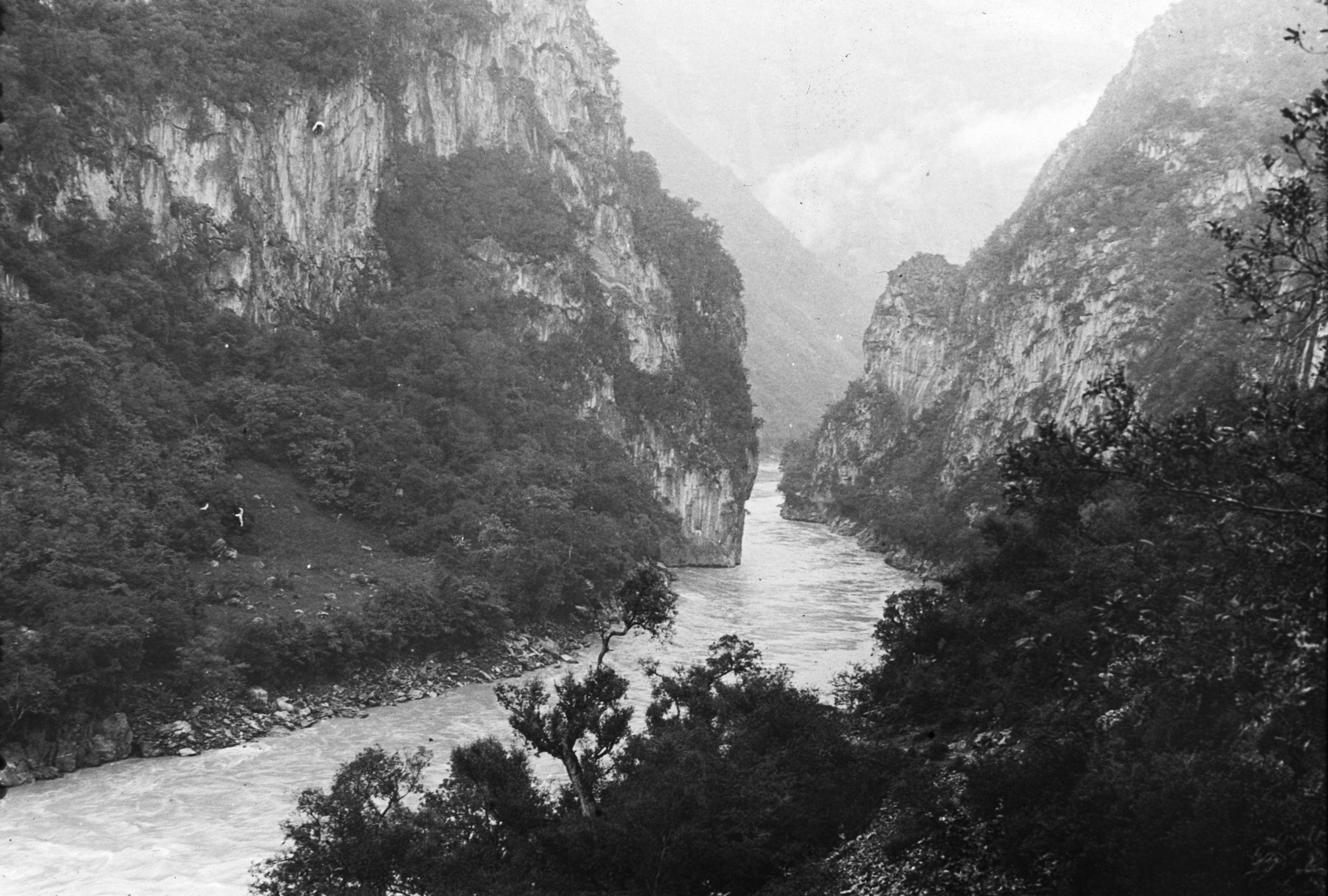
At 2.30 they set off again and arrived at Pien Wa (4696 ft.) at 4 p.m. after passing through a most beautiful gorge, the Al-I-kou Ravine, with great towering rocks on each side.

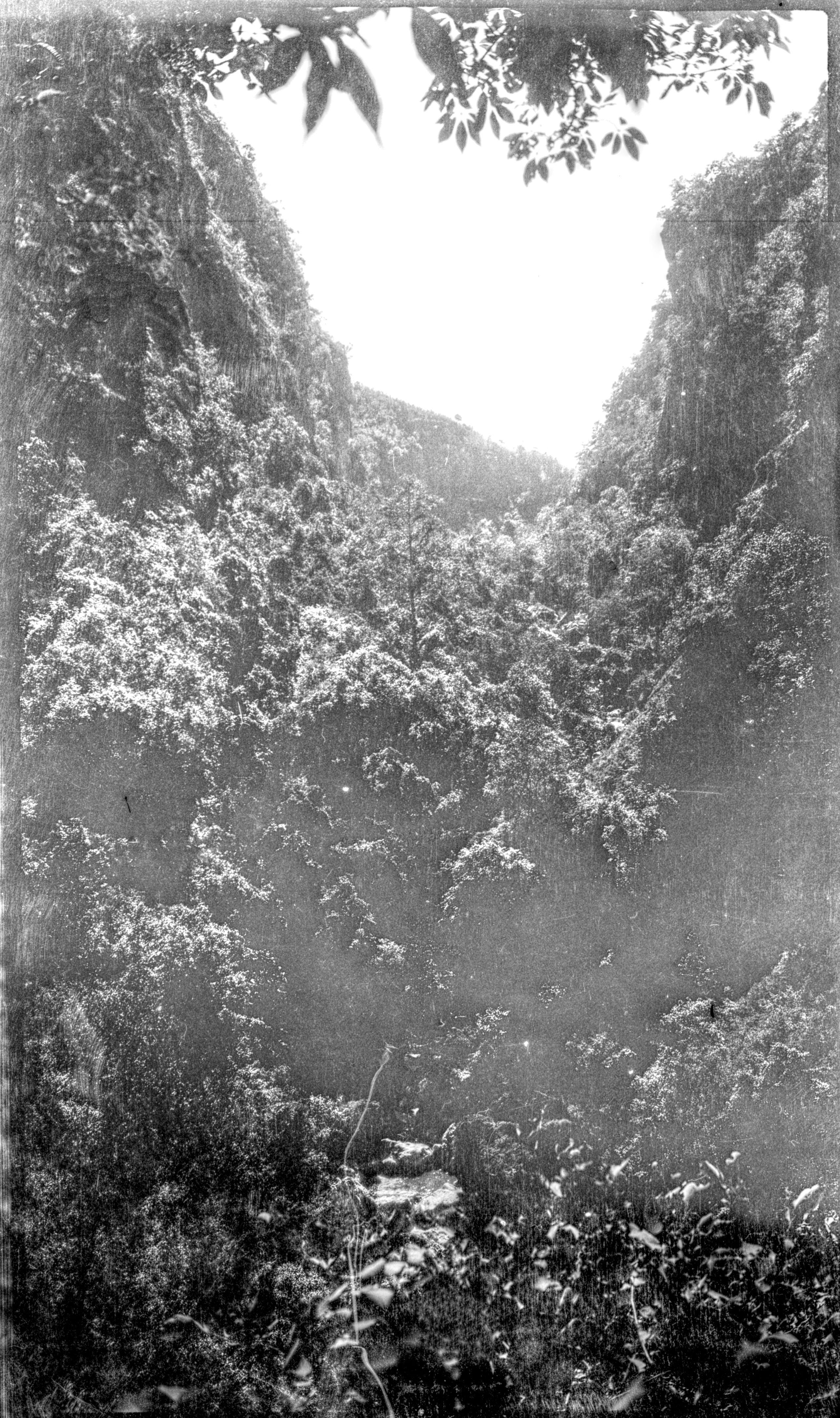
The Al-I-kou Ravine between Hwa-Ping and Pien-Wa
The Al-I-kou Ravine between Hwa-Ping and Pien-Wa
“The distance travelled today was about 16 ½ miles - but as the crow flies, we only did half that distance. That was because of a big bend in the road to avoid crossing the mountain ridges. The inn where we stayed was only a thatched open shed as the road was not used very much. GP has finished his mapping and is having a game of patience. The old white pony is carrying me quite well. He is very sure-footed on the bad roads - but in a chronic state of hunger, wanting to have a bite at everything appetising that he sees by the road side”.
"It is August 1st and the temperature is 93°F in the shade when we reached here at 4 p.m. so you can guess it is pretty hot in the sun”.
Day seventeen August 2nd 1923. Pien Wa to Wei Sha – 11¾ miles
They left Pien Wa (or Pien Wu) at 7.3O a.m. and the road went up steadily until they were at 7,300 ft., then a gradual drop to Wei Sha (6,745 ft.).
“After we had done about 35 Li we stopped for lunch. It was a lovely spot on the crest of a ridge which we were slowly ascending. There were plenty of pine trees and good shade. About 400 ft. below on one side of the valley were numerous Li Su cottages in the village of Ai-chüch.
“We met about half a dozen Li Su men who came through the millet and maize fields outside their cottages and came up a little path to cross the ridge. Two of the men were just starting out on a bird shooting expedition and had very primitive guns – old Chinese flint-locks. They got talking and I got a snapshot”.

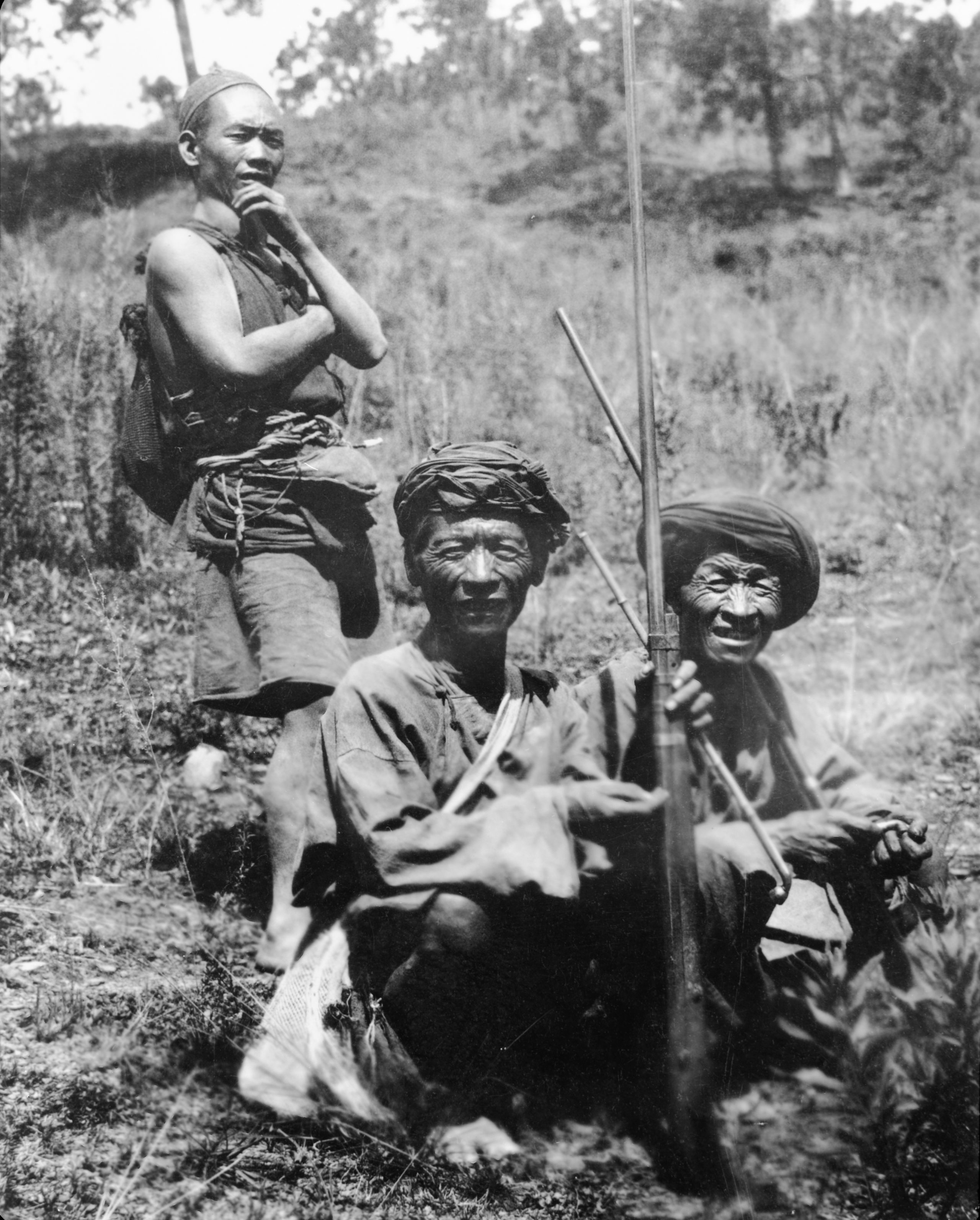
Miao or Lisu hunters
Miao or Lisu hunters
One of them spoke a little Chinese and showed them his cottage.
“They were wooden log huts with mud in between the logs and they usually had thatched roofs. There was a plank for a bed and a block of wood for a pillow - some millet, a fox tail, a little oil cruse, a wooden mortar for pounding grain and a few stones with charcoal ashes for the fire - a bit of an old tree trunk for a seat. There were a few wicker baskets and some cooking pots, and that was the furniture complete”.

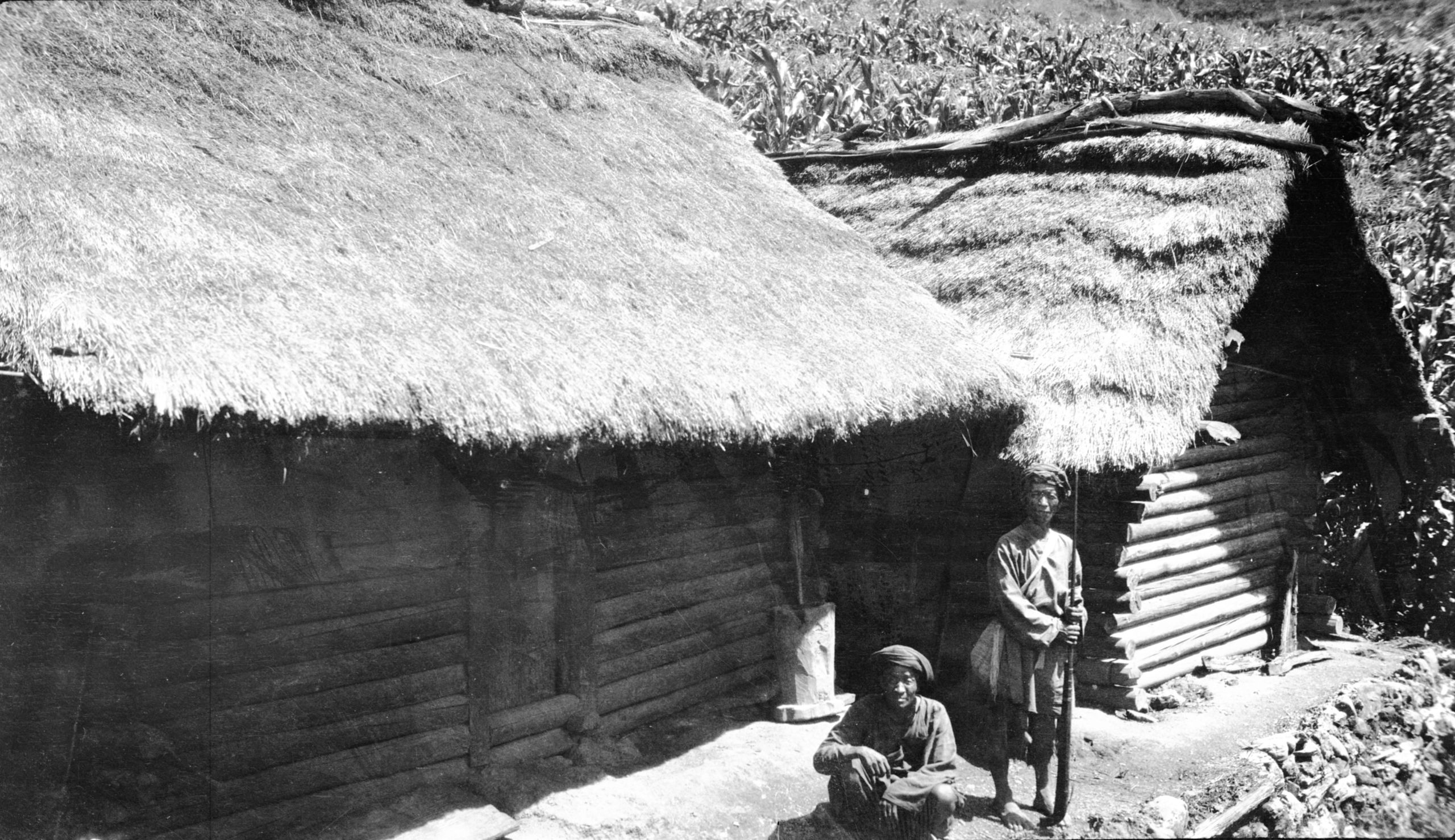
Lisu men by their hut
Lisu men by their hut
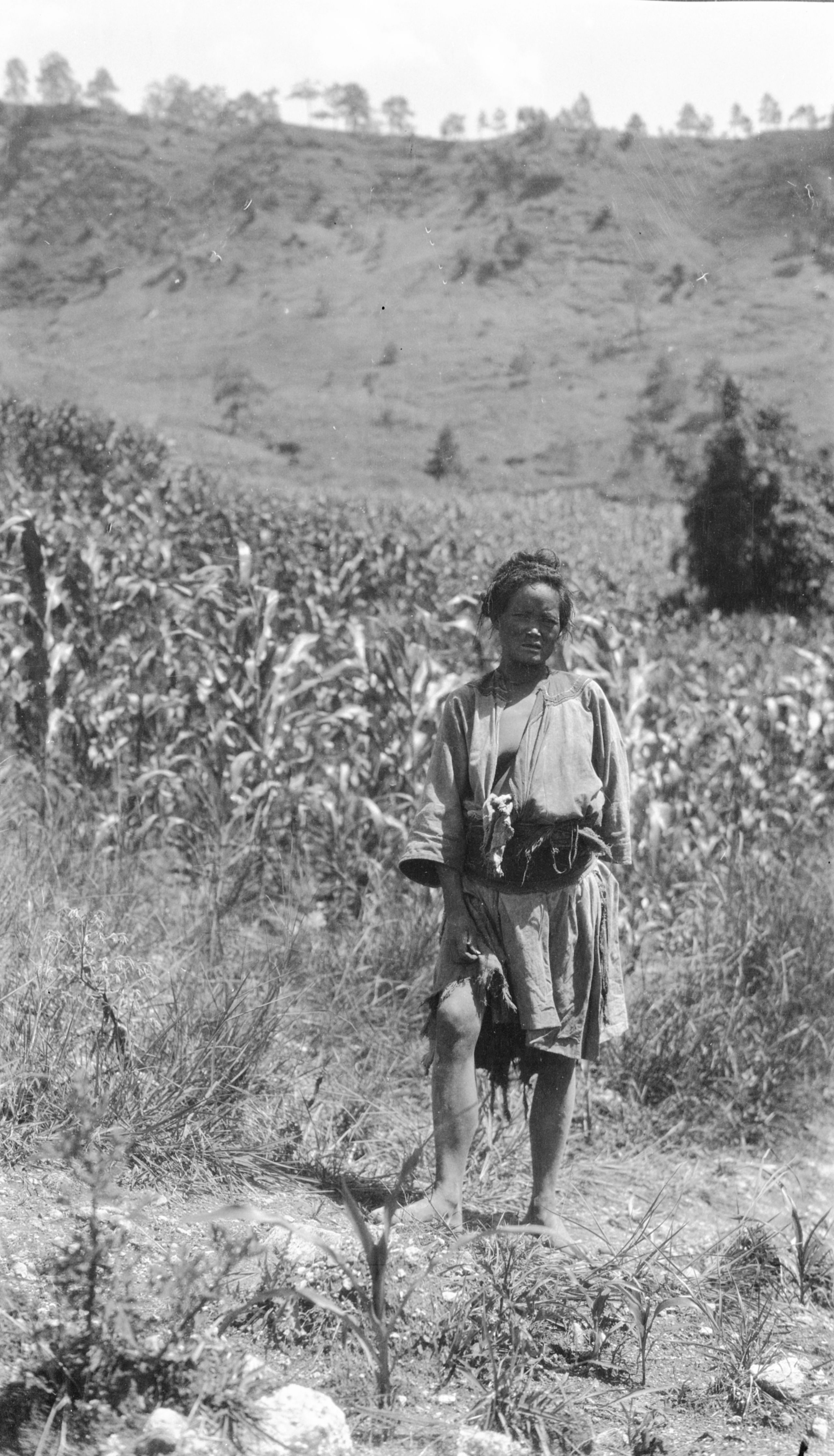
“I got a picture of the cottage with the 2 men outside, but there were no women. The men were dressed in a short blue gown with hemp cloths beneath. They wore turbans and had bare legs. We saw two women disappearing down a path as we approached, one dressed in a kind of kilt, a pleated blue skirt with a little red sash round her waist, and a turban with a touch of red in that, but we could not get near enough in time for a photo”.
“The old man whose cottage we visited said there were no women at home. We went on to another cottage 100 yards away, and as we approached a woman came out and went away - evidently frightened. I caught her up and kept her talking until GP came along, then managed to get two snapshots before she went off. She was wearing a similar hemp skirt, rather tattered - a bluish coat and a bright red girdle”.

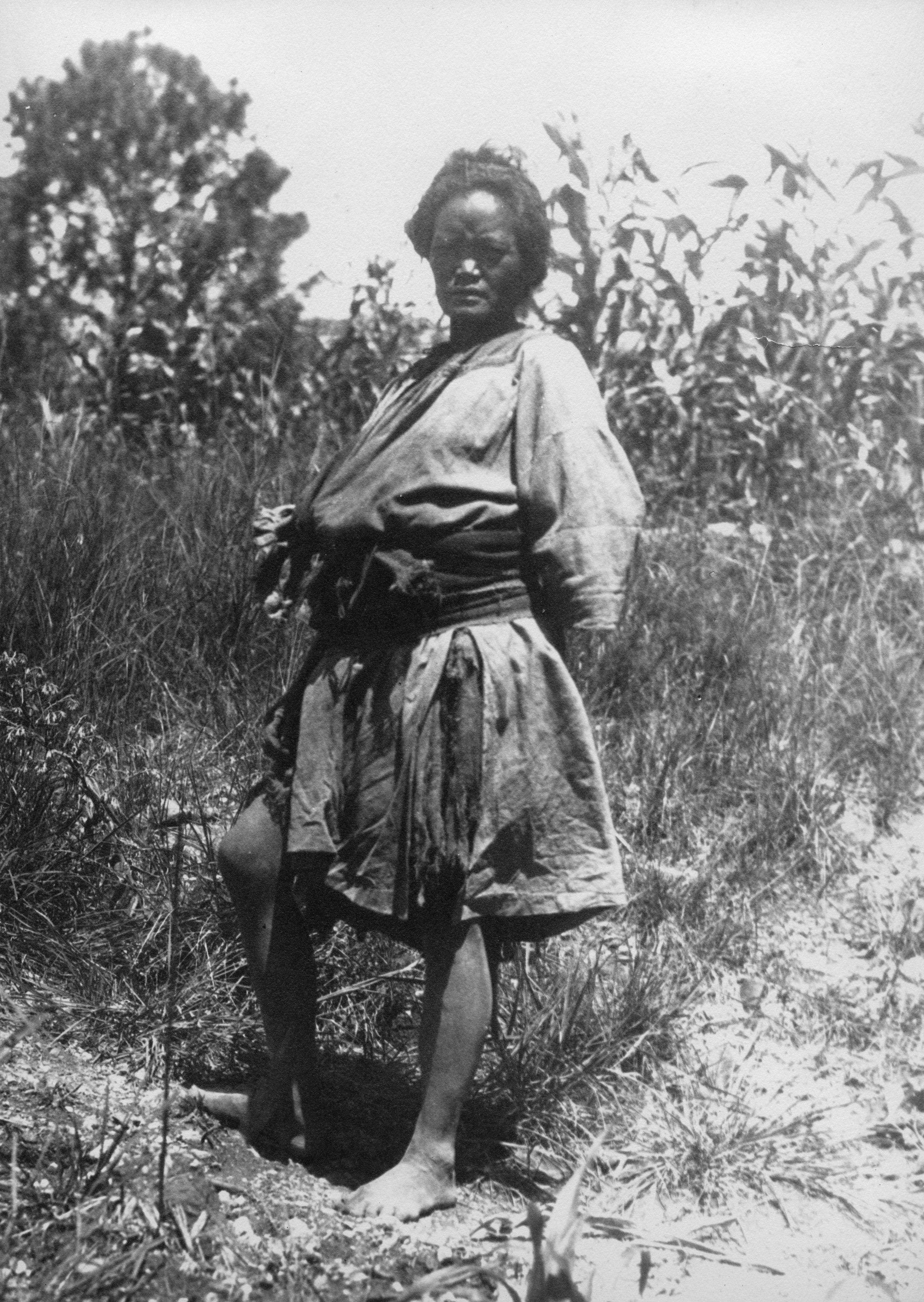
Lisu woman
Lisu woman

Lisu woman
Lisu woman
"All this country appears to be thickly populated by Li Su in the small valleys at the tops of the mountains. After visiting this village, we climbed back to where their mules were waiting, had lunch and then travelled on".
“Not so hot today for we are up higher and we passed through much wooded country on the mountain tops, which gives nice shade. We reached another little wayside farm-house in Wei-Sha where they have a shed for mules - and stayed there for the night”.
“That night I gave out some ointment for the old innkeeper's eyes, and in the morning the old woman of the inn asked me for something for her daughter. I had a look at her and found it was a bad case of leprosy”.
Day eighteen August 3rd, 1925. Wei-Sha to Ta Liu - 20¼ miles
They expected a heavy day - so left Wei Sha at 6.20 a.m.
“I had rather a disturbed night for there was a constant tickling - fleas. I put it down to the fact that fowls had the run of the best bedroom, and also that, as I discovered in the morning, the oil sheet under my bedding was not hanging down properly. However, there were no bats and I got some sleep”.

View on the climb to the top of the Ping-chun P'o
View on the climb to the top of the Ping-chun P'o
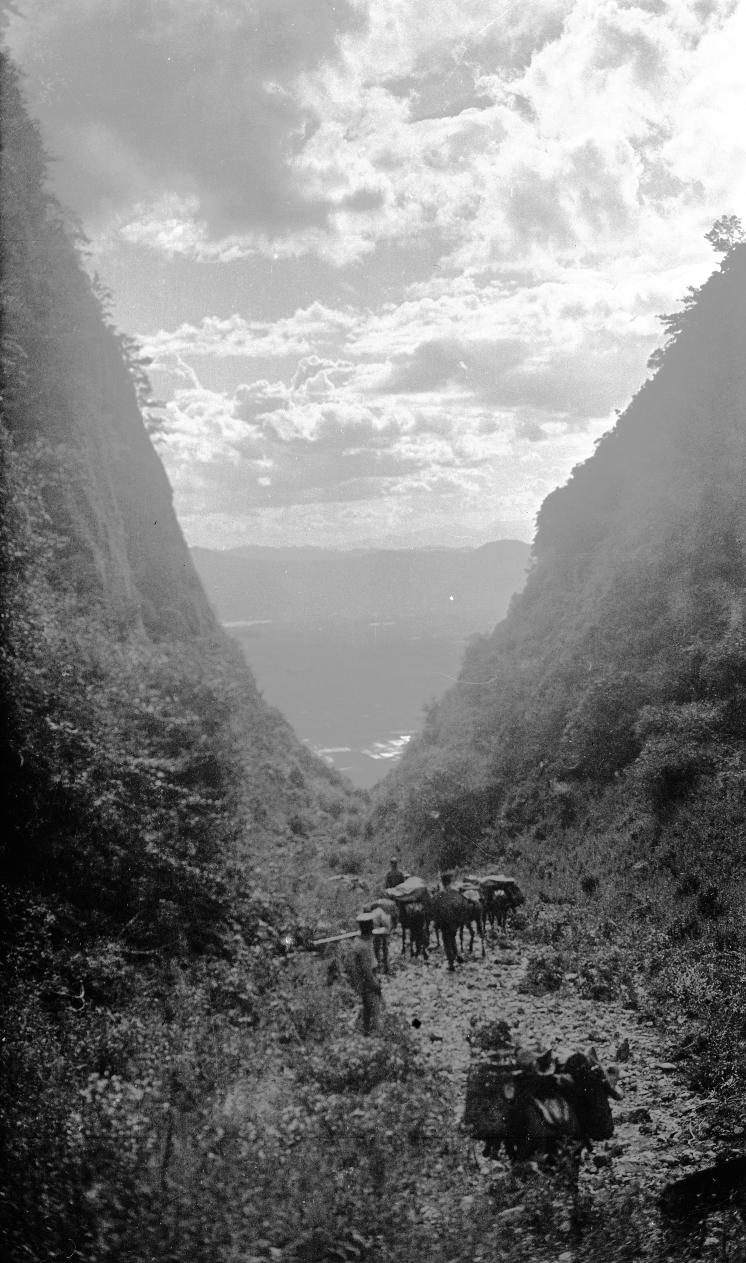
"It was a glorious morning when we started, with many ups and downs, mostly "ups". After a short climb and a very steep descent there was a bigger climb out of a very steep and rocky ravine to the Wa-la-p'ung slope, where there was an easy road along the top with hills on the left and grand views over the valley on the right towards ranges beyond. At 4½ miles there were some very steep rocky ascents up a beautifully wooded glen, and then an easier climb to the top of the Ping-chun P'o, 8080 feet, at 6¾ miles, and a further steep climb to the top of Yeh-ya-t'an Ya-k'ou, 8520 feet, at 8¾ miles. From the top there were more grand views down the valley, which is bounded by high ranges, well wooded and with patches of Lisu cultivation on the lower slopes".
They eventually reached the summit of Tsuan-t'ien P'o (8,670 ft.) after 13½ miles.
“On the way up, we followed the course of a small river, it came down through a gorge by a series of cataracts. The entrance to the gorge was quite narrow and at first glance we could not see which way the mules could go - but there was a gap between two steep faces of rock - where the stream issued and where the mules could enter”.

Entering the gorge between Weinsha and Ta-lu
Entering the gorge between Weinsha and Ta-lu
“Once inside the gorge widened out and was most beautiful - the water was as crystal - tearing its way over the stones and rocks. Creepers like long streamers were hanging from some of the trees. GP had noted the same in Tibet and West Szechwan. His Tibetan boy called it Lao-wa-yen, or "Raven smoke”. Some of the last of the rhododendrons were in bloom, and there were a good many ferns on the hill-sides”.
“I thought a good name would be “The Fairy Glen” - It was like Betws-y-Coed, only 100 times more beautiful and about 500 times as big. I kept saying to myself "Beautiful! Beautiful!" Mosses covered the rocks - ferns in great profusion, flowers of all colours and in the midst a series of foaming cascades. I went on ahead of the mules to enjoy it to the full - had to cross the stream about 8 or 10 times where the path went from one side to the other. Just behind came the mules with the muleteers whooping out weird noises to encourage the animals as they struggled over the stones”.
They lunched at a height of about 8,200 ft. beautifully cool - looking down a huge valley - with ranges of mountains beyond, evidently joining the valley of the Yangtze.
Soon after starting again they reached 8,500 ft. The road wound along the hill-side, and finally there was a steep descent through a wood to Ta-Liu, (7451 ft.), a village of twenty houses, with ninety more scattered round. The people were partly Chinese and partly Lisu.
HGT said in his letter home:
“Tomorrow we ought to reach Yung Peh, only three days from Li Kiang. We seem to have got past the Tu fei area and for the last 3 days have only had 2 soldiers as escort, and they act as guides for the various roads which the muleteers have not been over before”.
"Now I must stop again. Goodnight to you my dear one. I am constantly thinking of you and the little ones, and wishing you were with me".
"Rain each night for the last 3 nights - beautiful days, except today we were caught in a heavy shower - but with our macs on our saddles we took no harm”.
Day nineteen August 4th 1923. Ta Liu to Yung Peh – 17¾ miles
"Off from Ta Liu at 6.45 this morning, and had a big drop, about 2,000 ft, to the river Ch’u-i-Ho, with a quaint old bridge crossing it (6,230 ft.). The bridge was covered with a wood roof on mud walls".

Bridge across Ch'u-i-Ho between Ta-lin and Yung-peh
Bridge across Ch'u-i-Ho between Ta-lin and Yung-peh
"On the other side of the river was a very steep climb, up steep rocky places among trees, chiefly fir, to the top of Ta-lo-han-sung-P'o, (7,810 ft.), at 5¾ miles. Then the path lay high up along the hill-side with a deep valley on the left to the top of Chi-tan P'o, the Egg Hill, (8,200 ft.) at 8½ miles, a pleasant spot with grass, some trees and a spring".
Then after a steep descent of 450 feet the road rose to K'ou-tzu-chin P'o, (8,050 ft.) at 10½ miles, after which there were some more steep descents. The road passed along the hill-side among fir and bush. They passed a deserted cottage at the top of the ridge, where there was a grand view down a fresh valley that gave their first glimpse of the Yung Peh plain. They descended to the very fertile Yung-Peh valley; three-quarters of a mile wide and covered with rice fields.

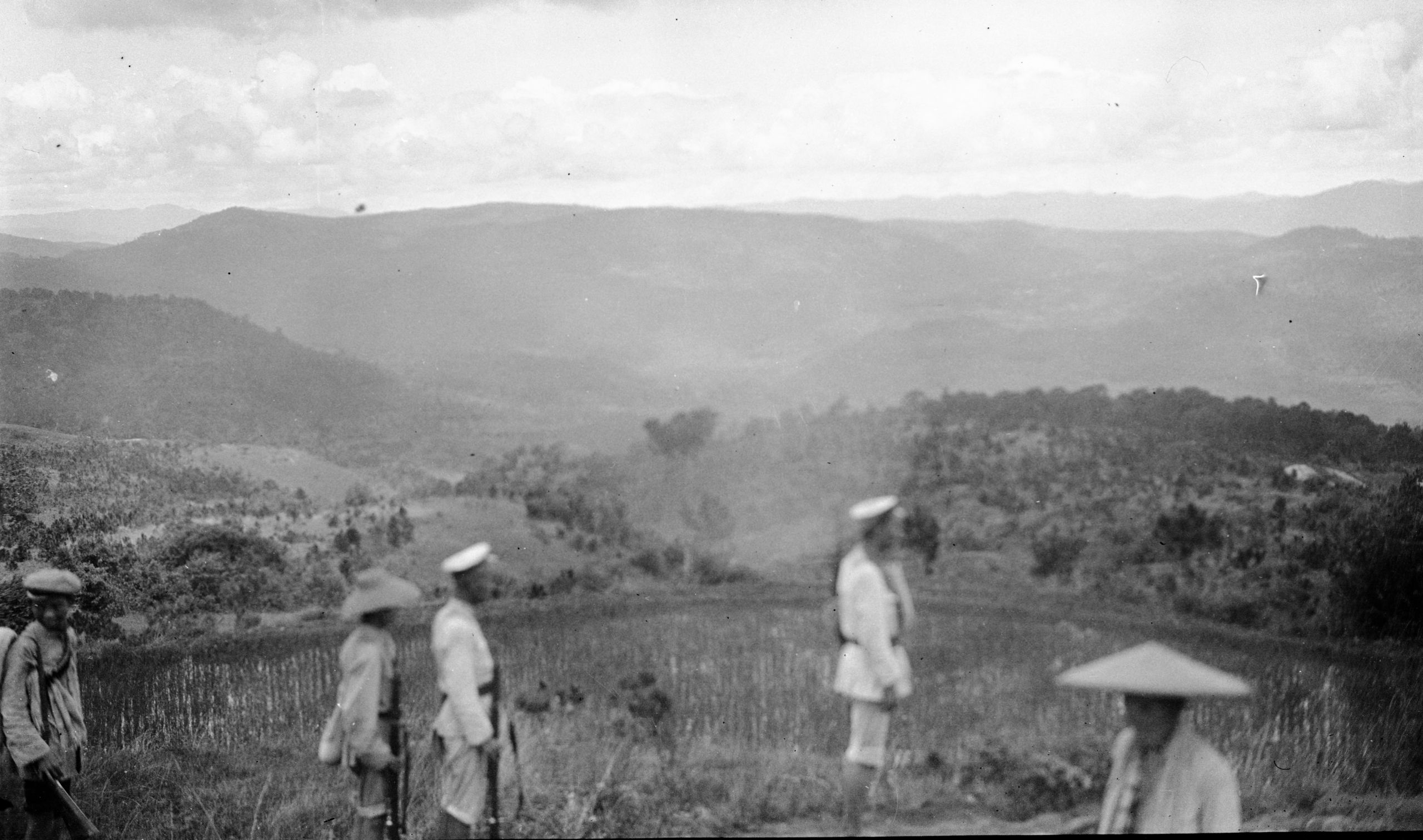
Looking SW towards Yang-tze Lisu cottage in Rt foreground
Looking SW towards Yang-tze Lisu cottage in Rt foreground

Panorama from ridge across Chao-Tu valley Yung-Peh is to the right
Panorama from ridge across Chao-Tu valley Yung-Peh is to the right
“We saw a number of Li Su women with their quaint dress, who, when they were carrying a basket on their back, only wore a skirt, had their back bare - to the basket, but covered the chest with a coarse woven piece of hemp cloth which evidently formed a coat when not bearing a burden”.
It took them about 4 hours from the mid-day halt to reach Yung Peh Tsien - a town about the size of Amichow. It is a walled and gated town, in the centre of a fair sized plain, about 10 miles long by 4 miles broad. It was reckoned that there were about 1,200 families.
“The R.C. priest at Ma Shang had told us we should stay at their mission station premises. The R.C.s are not very numerous. The caretaker said that they only have 4 or 5 families, and though they have a school for boys and one for girls they only have 4 or 5 children in each - but the town is an important place, and they have a good piece of land for a compound”.
HGT wrote in a letter
“The country is all peaceful and no signs of Tu-fei” (bandits).
“I was told at the P.O. that their mail for Yunnan-fu goes via Li Kiang. So, as there will not be one leaving for another 2 days, I decided to keep the letter and post it as soon as we arrive at Li Kiang”.
Day twenty August 5th 1923. Yung Peh to Ta Hwa Shu – 14 miles
They hoped to get to Li Chiang in 3 days, so were up at 4.30 a.m.
“We finally left Yung Peh at 7.45. The reason was difficulty with the mules. Two had broken down and the official promised to arrange for fresh ones – but at the last minute they did not turn up. Then they came and were loaded up but when we got outside the West Gate, we found they were not with us as there was some wrangle about the price. Back we all went; the matter was fixed up and again we got started, but precious time had been lost and now we shall not get to Li Chiang in under 4 days. However it can't be helped”.
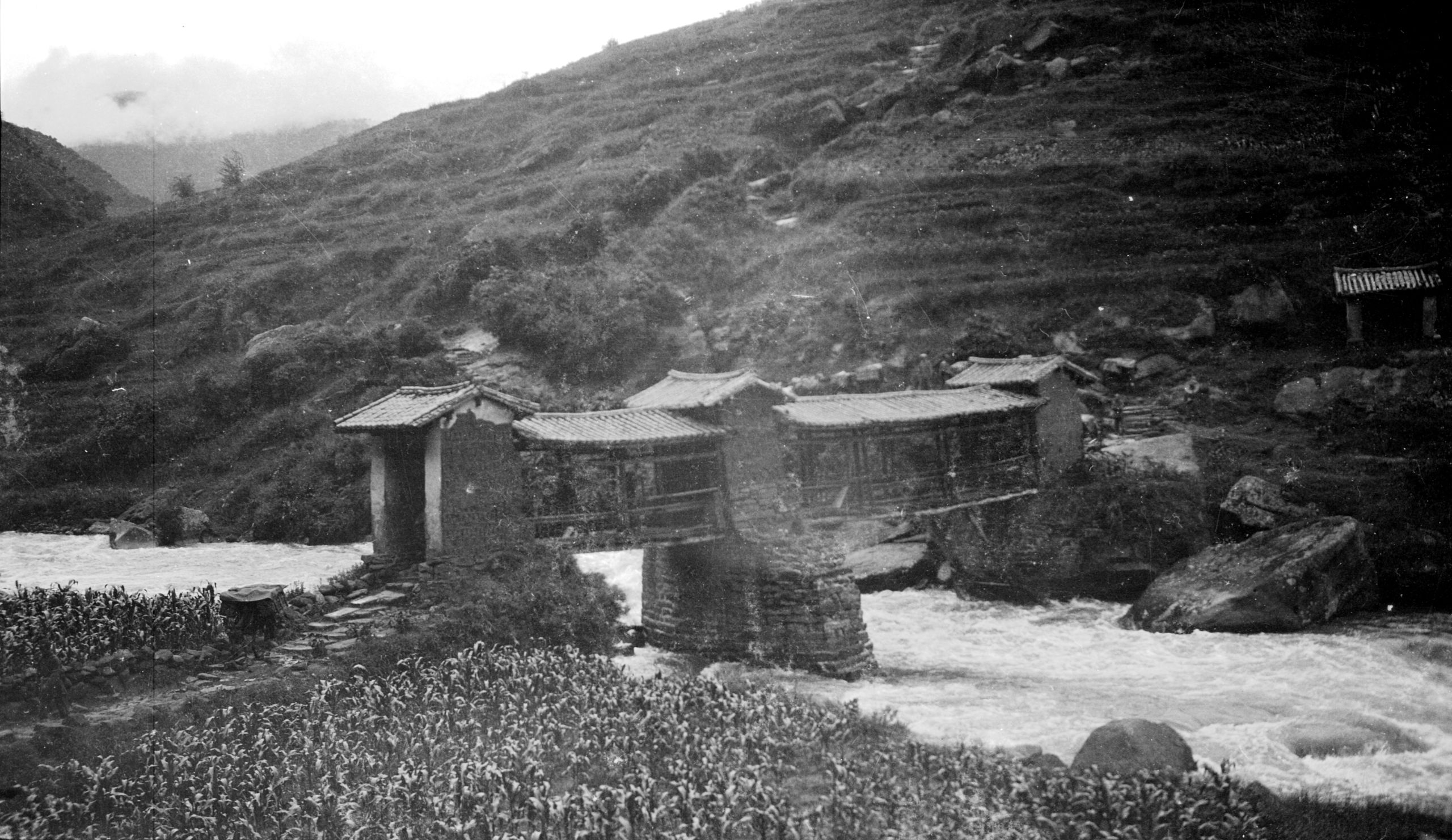
“After we left Yung Peh, we had about 1½ miles of muddy road through paddy fields before we started to climb the ridge which separated the Yung Peh valley from the next one, the Ch’ao Tu valley. When we reached a gap at the top of the climb there was a small wayside shrine, and a wonderful view. The Ch’ao Tu River away down below, winding through paddy fields and the valley dotted over with small villages. In the background the mountains, which form the Eastern side of the Yangtze valley, and further back still, those joining the Western side, white banks of cloud hanging over the tops of the mountains. At the foot of the steep descent which they have to make, is the Ch’ao Tu River, crossed by a. bridge - roofed in, and with the usual little temple attached - the river a foaming torrent, roaring away beneath".

Bridge across the Ch'ao tu River - 5 Li from Yungpeh
Bridge across the Ch'ao tu River - 5 Li from Yungpeh
They had estimated it would take them half an hour to go down, cross the bridge and get through the rice fields to the other side of the valley. In the end it took an hour and a quarter to get down, and altogether 4 and a half hours to get across to the beginning of the ascent on the other side to Ta Hwa Shu for the night, having only done half the distance they had hoped to do.
In a letter home, HGT recorded information about their meals and usual itinerary.
“We are up betimes each morning - at 4.30, breakfast at 5 a.m. before starting. Porridge, bread and butter and jam, tea or chocolate. (The boy makes quite nice little rolls with the Baking Powder). Meanwhile, our bedding, etc., is being packed. Breakfast over, our chairs and the camp table is packed. The mules are loaded and we are off.
"Generally, we stop at 11 am. for lunch and to give the mules a rest (2 hours). Lunch consists of cold chicken or eggs, scrambled or done some other way, potatoes and what fresh vegetables the boys have been able to buy. Sometimes cucumber, or corns, or beans".
"After the 2 hours rest on again for the rest of the stage. Getting in about 4 p.m. Chairs unpacked, table fixed up and Pereira gets at once to his mapping. The boy makes tea and we have tea and biscuits (or bread and jam). Then the General goes on with his writing, I do mine and as soon as the sun goes down I wander out with a towel, find a quiet spot with a pool, for all these villages are near mountain streams which provide them with water - I have a dip, back again for a quiet read till say 3 p.m. Dinner, soup, chicken or eggs, vegetables, stewed fruit, and then bed!! "
"In between times, I occasionally see patients, but unless we stay a day in a place there is no time to see many. What is needed is to go to a place and stay a day, then people get to know and many come along".
"Now it is almost sundown, so time for a dip. So, I will wish you a very good and peaceful night. I hope we shall have one too - but this is one of the dirtiest places we have struck, so I must get out some more powder and sprinkle my bed well. Dear, dear love to thee and the children".
"Your own boy",
Hubert.
Day twenty-one August 6th 1923. Ta Hwa Shu to Tsz Liu – 18 miles.
They were off early and on the road at 6.20 - a long steady uphill from the Chao Tu River through the Ch’ing-shui Ho valley. They passed a small place called Jen Shui Ching (or Shui-ch’ung - also known as Ho-tsung), 3 hours after leaving Ta Hwa Shu (Hua shu).
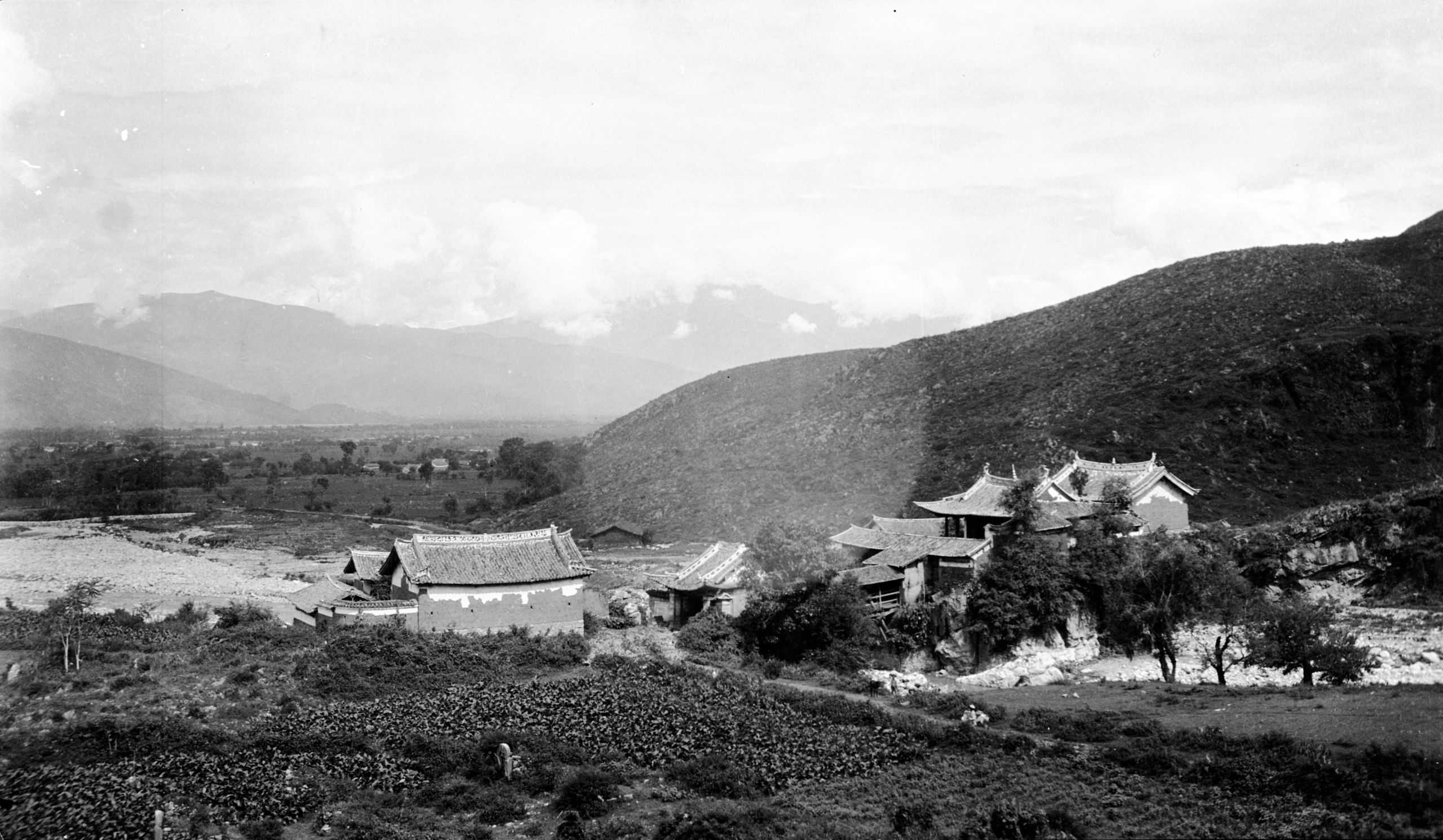
“We climbed up and up and always up until, after 10½ miles, we reached the Chi-ch’ing-kang Po at a height of 8,088 ft. I decided not to use the pony until we topped the last ridge, from where it was downhill. It was a big pull of 2,400 ft. but I thoroughly enjoyed it. When the last ridge was crossed, we had gone 40 li (12 miles). At 13½ miles we reached Ta Waan (Da’an) (which they had hoped to reach the night before), at 12.15, where we had a mid-day 2 hours rest. Here we came across the Mo-su, and I tried to get a snapshot, but the women all bolted as soon as they saw the cameras”.

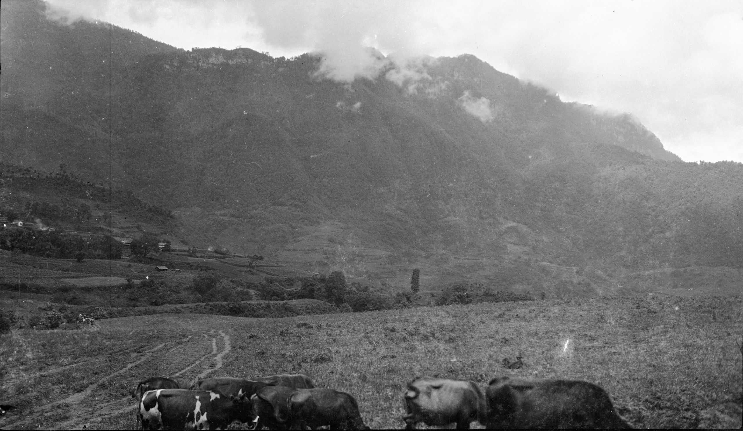
Ta Waan village with cattle in the foreground
Ta Waan village with cattle in the foreground
“We left at 2.15 p.m. This part of the journey was mostly downhill, through trees, and with walnut trees in abundance, the walnuts were not yet ripe, but a good size”.
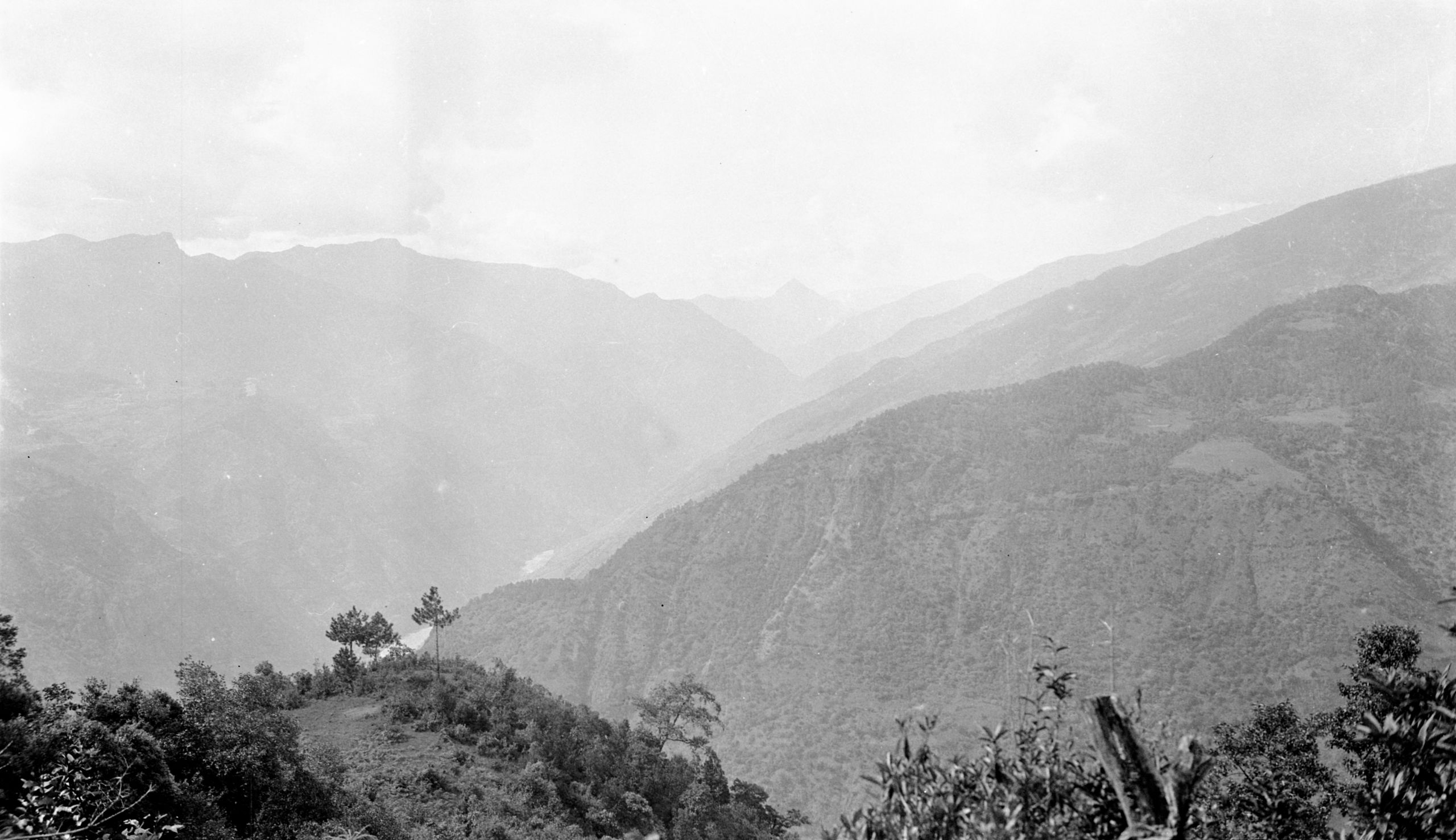
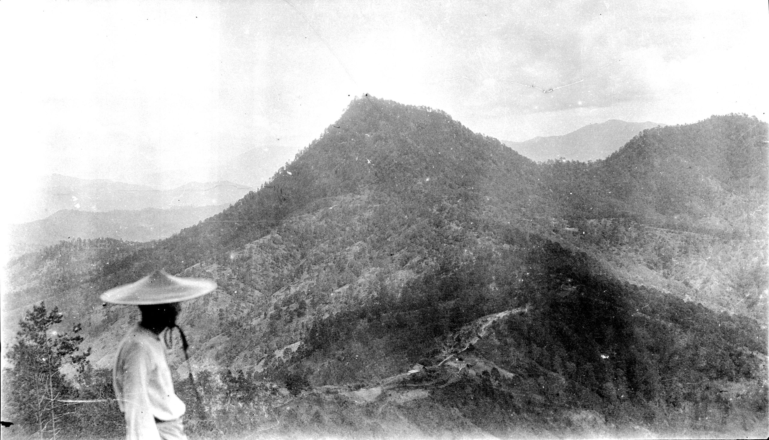
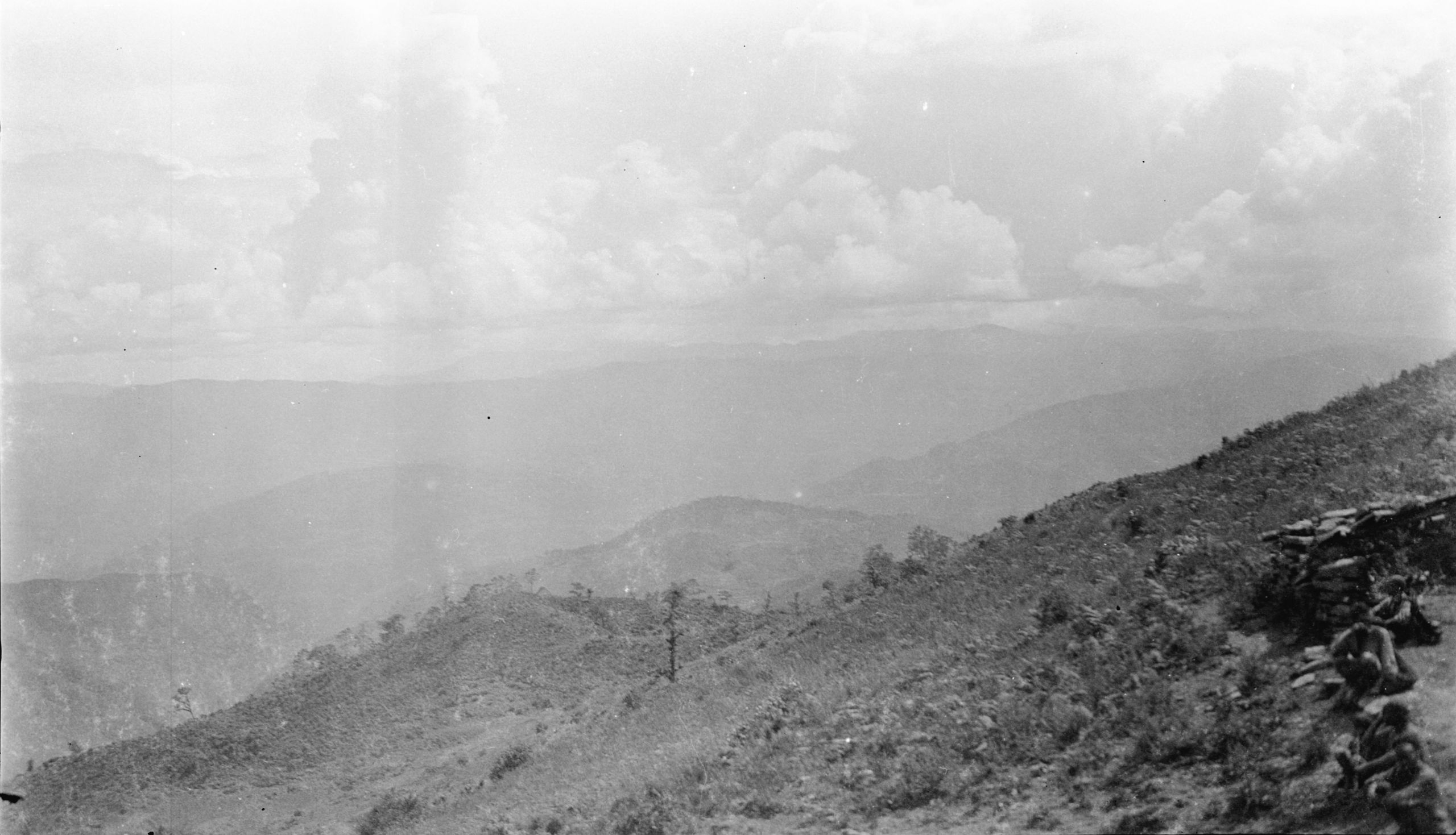
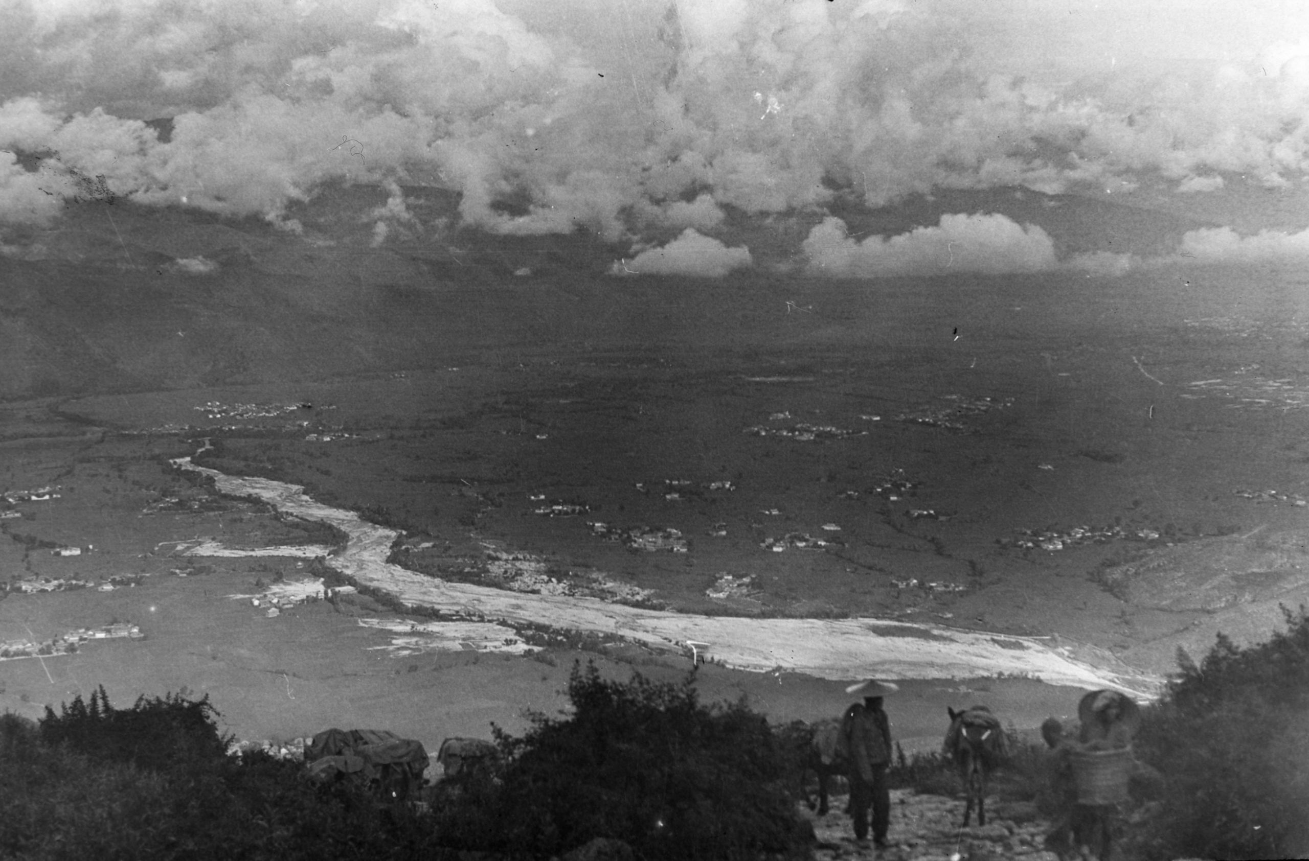
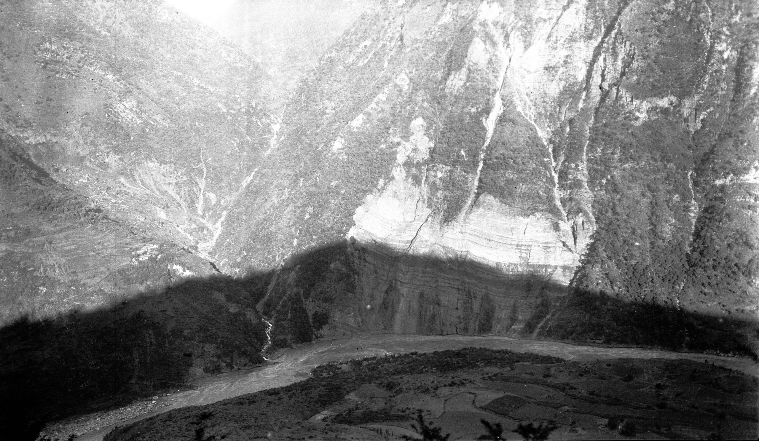
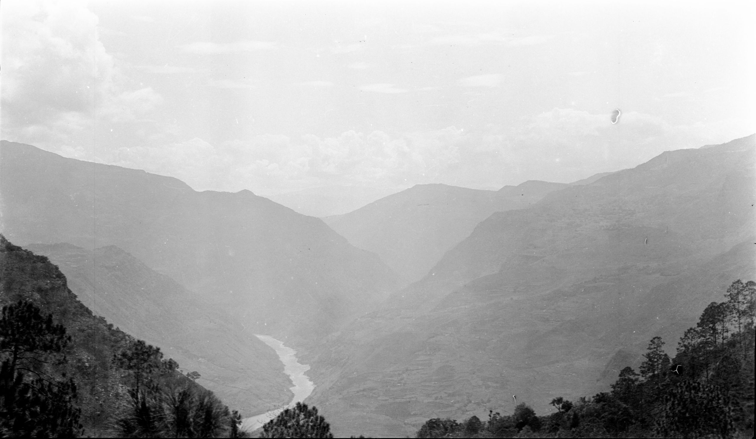
"About 4 p.m., after 16½ miles, we reached the Chu Ya-k'ou, or Bamboo Pass where we got our first view of the Yangtze - It was truly wonderful. GP said it was some of the most magnificent scenery in the world”.
They eventually arrived at Tsz Liu (5825 ft.) at 5.50 p.m.

Across the Yang-tze looking north near the Tsz-Liu-Chiang bridge
Across the Yang-tze looking north near the Tsz-Liu-Chiang bridge
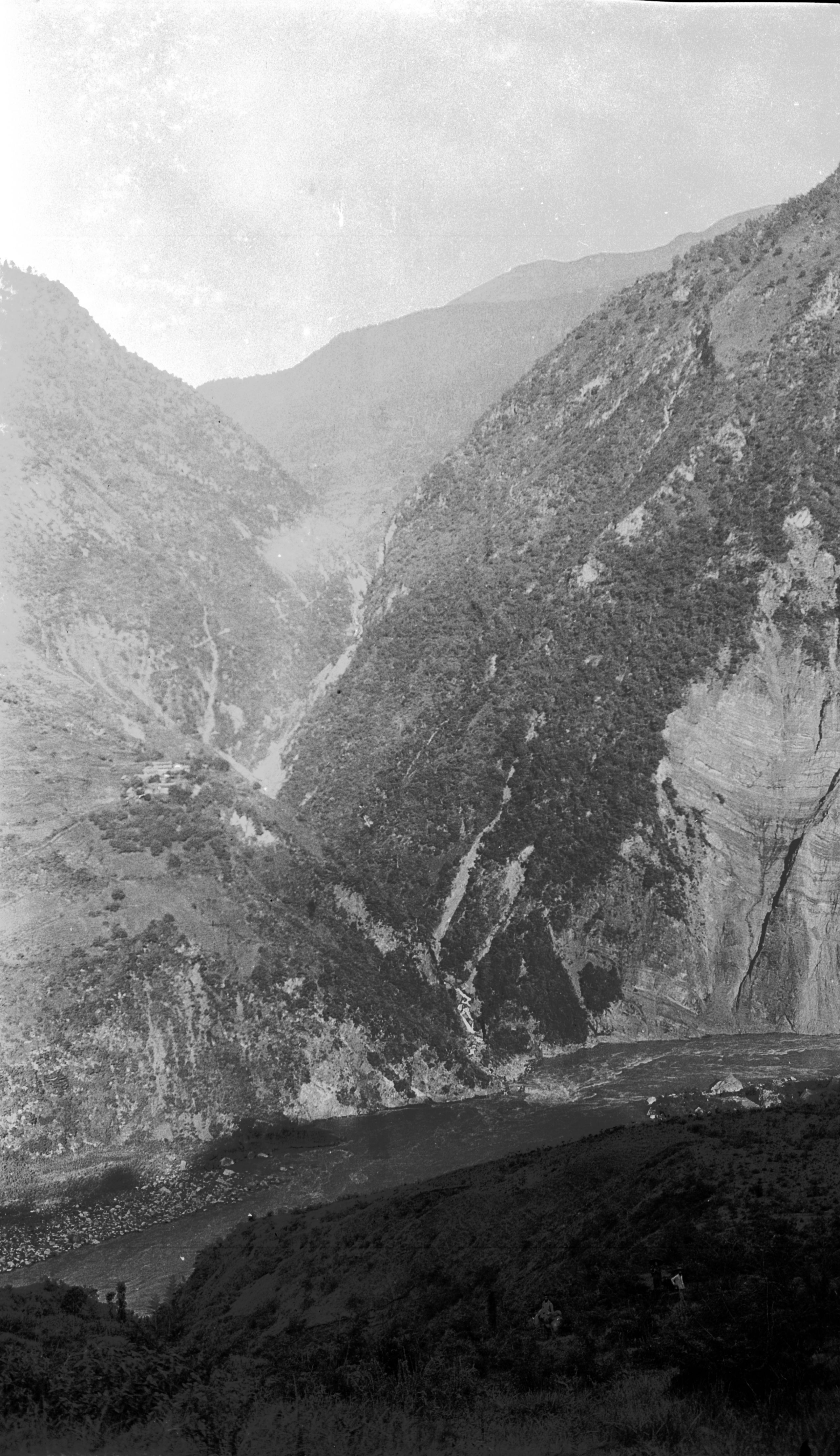
“Imagine a tremendous valley - along the sides of which we were making our way at a height of about 7000 ft, this valley running North and joining the Yangtze, which here gave a bend, so that we could look right up the Yangtze valley. Great cliffs rising 8000 ft, and the river which we could see like a dark sullen stream at the bottom. In the background - great ranges of mountains, and away to the north one peak looking like a pyramid rising up clear of the rest - so steep that probably no human being has ever been to the top”.

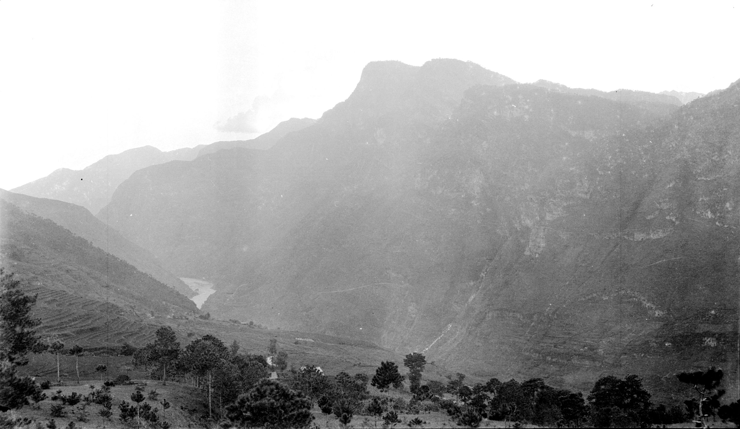
Looking south up the Yangtze valley
Looking south up the Yangtze valley
As soon as they got into the inn GP got going with his mapping, and HGT went off with the camera to see if he could get anything before the light was quite gone.
“The great precipices on the other side of the river, with huge patches of red and white sandstone cliff I could not get as the sun was too far down, but I tried a time exposure of the river and mountains looking South”.
“Oh! It was just wonderful! I have never seen anything like it”.

Looking across the Yangtze E to W near Tsz Li at sunrise
Looking across the Yangtze E to W near Tsz Li at sunrise
Day Twenty-two 7th August 1923. Tsz Liu to Li Kiang fu – 22½ miles
“We left Tsz liu at 6.30 a.m. and had about 2 miles walk down 1500 ft. to the Great River. The sun was just lighting up the opposite hills while we were in the shadows".

Across the Yang-tze E to W near Tsz-Iiu
Across the Yang-tze E to W near Tsz-Iiu
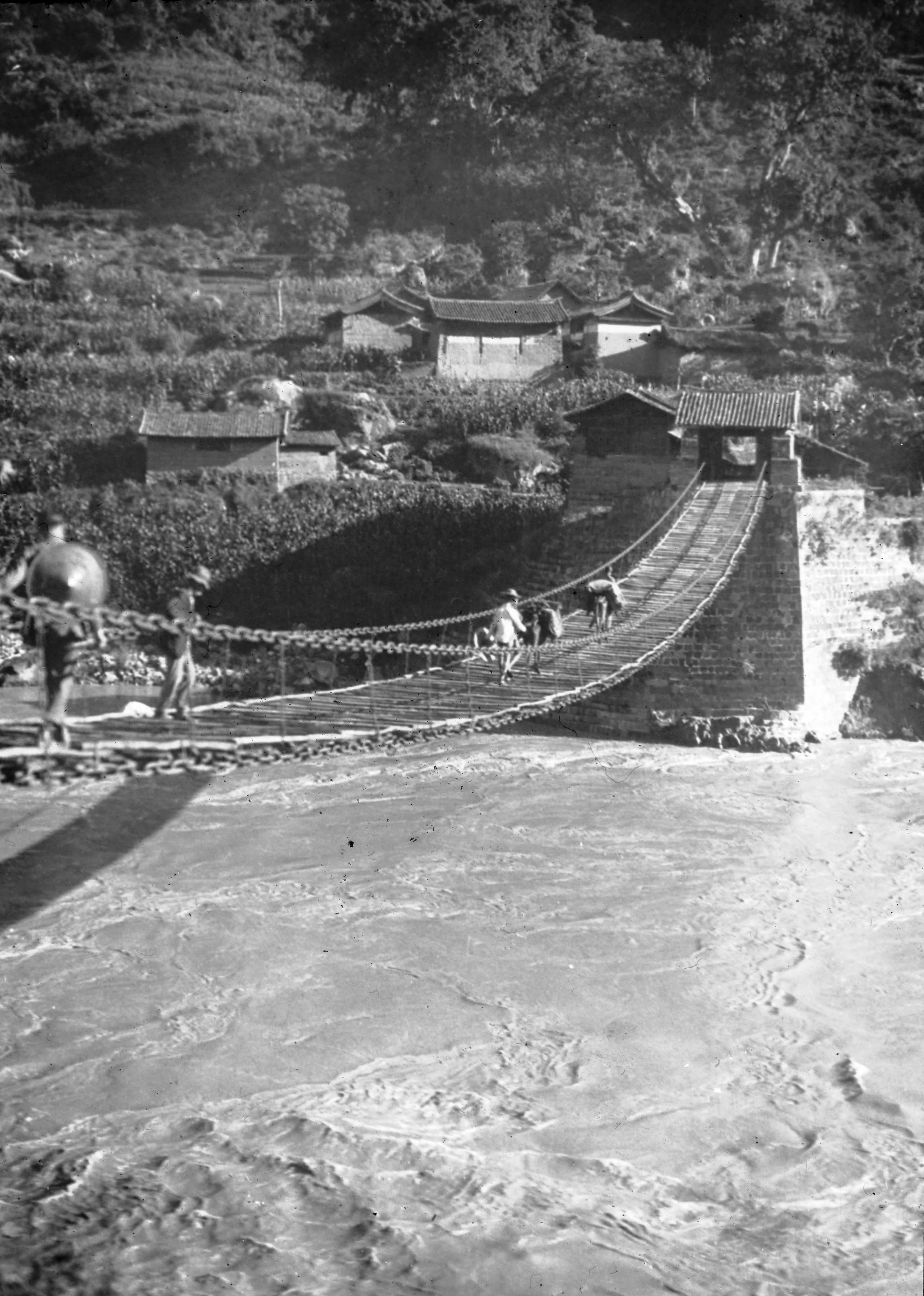
“On the face of the steep cliffs opposite we could see the track by which we were to climb up. A small village and a temple with white walls glistening in the sun. Then on down and along the river bank - with its dark brown water eddying and swirling in great whirlpools until at last the bridge came into sight”.
“The (Jinlong) bridge is a Chinese suspension bridge of the usual pattern, with two pairs of six chains slinging the boards, and supporting a plank roadway 9 feet wide. There is an iron chain on either side as a hand- rail. The bridge is supported by stone piers on either bank. The bridge sags a good deal in the centre, and the mules went over by driblets. It was 185 paces long. The height above sea-level at this point was 4,321 ft.”

GP and HGT on the only bridge across the Yangtze at Tzu-li
GP and HGT on the only bridge across the Yangtze at Tzu-li

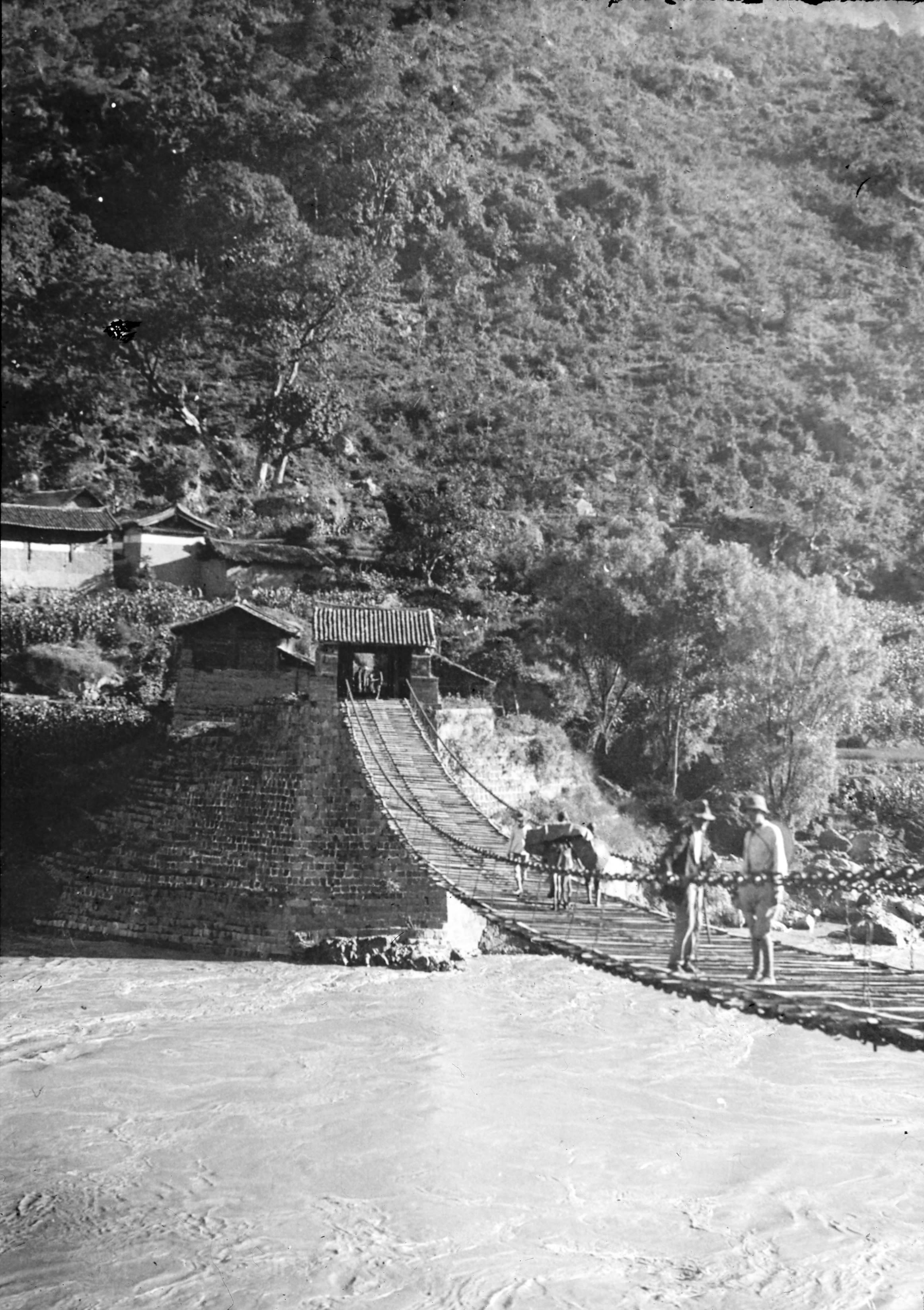
Another view of GP and HGT on the only bridge across the Yangtze at Tzu-li
Another view of GP and HGT on the only bridge across the Yangtze at Tzu-li
“GP was on ahead taking altitudes etc., and I was getting photographs. I then caught him up and found him resting by the roadside - he had had a tumble from his pony, the girth or something gave way, and it was so steep that he and saddle went over the horse's head. However, he was none the worse, except a bit shaken”.

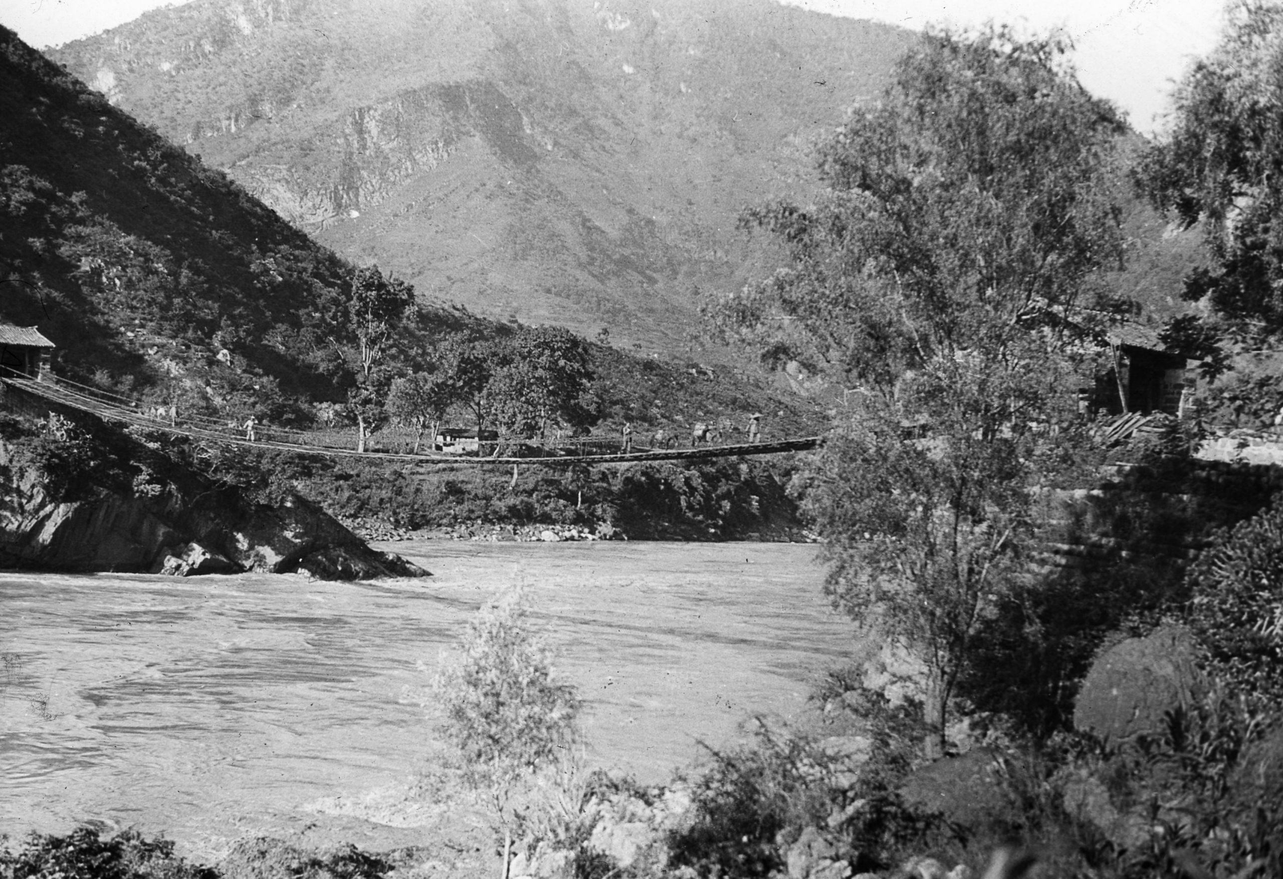
The caravan crossing the bridge at Tzu-li
The caravan crossing the bridge at Tzu-li
“I took photos of the bridge – (then) the only known bridge across the Yangtze in the whole of its course. The Yangtze, here called Tzu-li-chiang, dashed past in a wild tumult of muddy rapids”.
(Note: The Jinlong Bridge in Lijiang, a simple iron chain suspension bridge was built during the Qing Dynasty in 1880 and took 5 years to build. It is 116 meters long, 3 meters wide, and is fixed to cliffs on the riverbanks by 16 iron ropes. It was destroyed in the Yangtze River flood in 1935 and rebuilt the following year. The bridge was named a National Historical Site in 2006.)

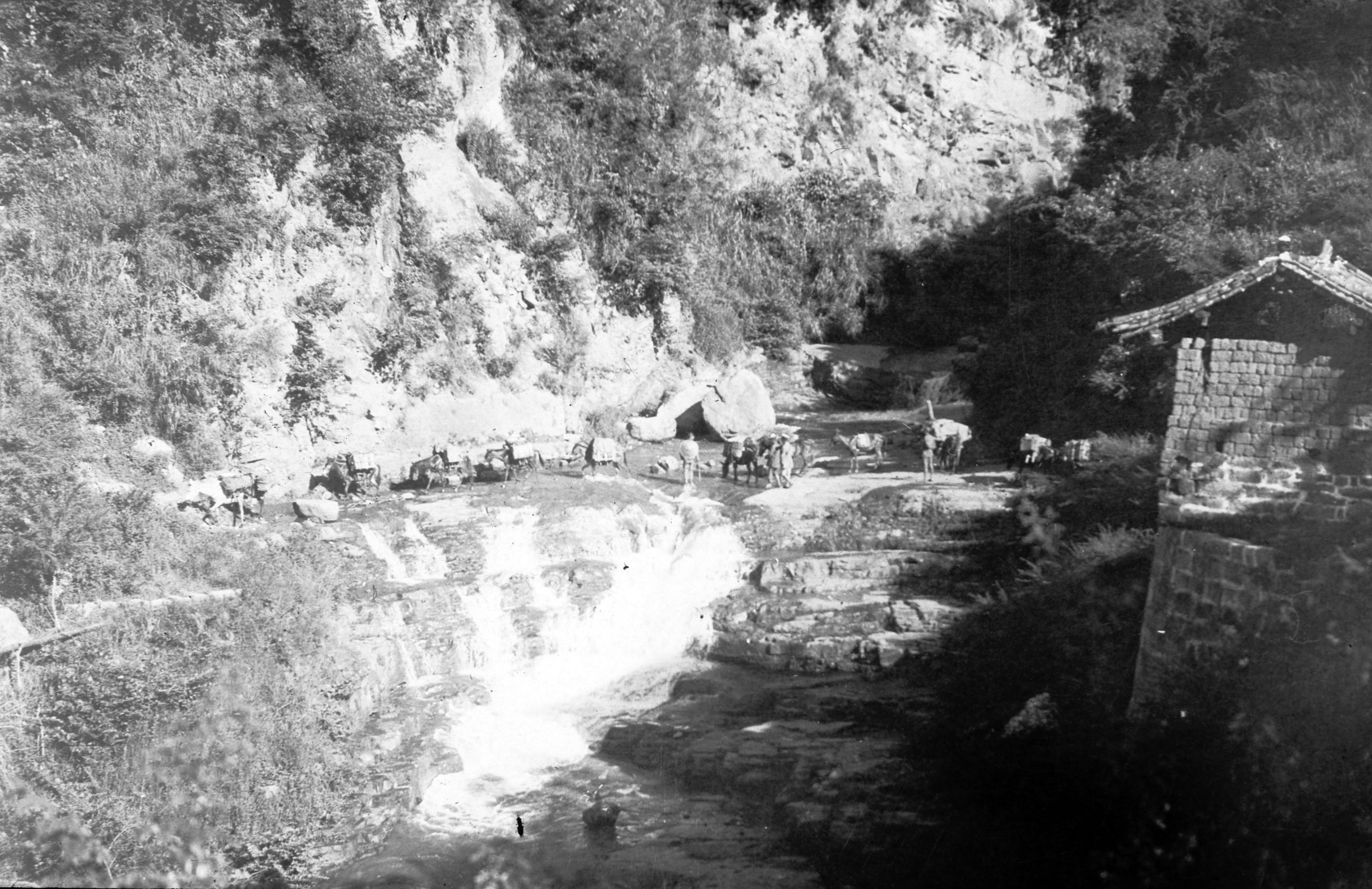
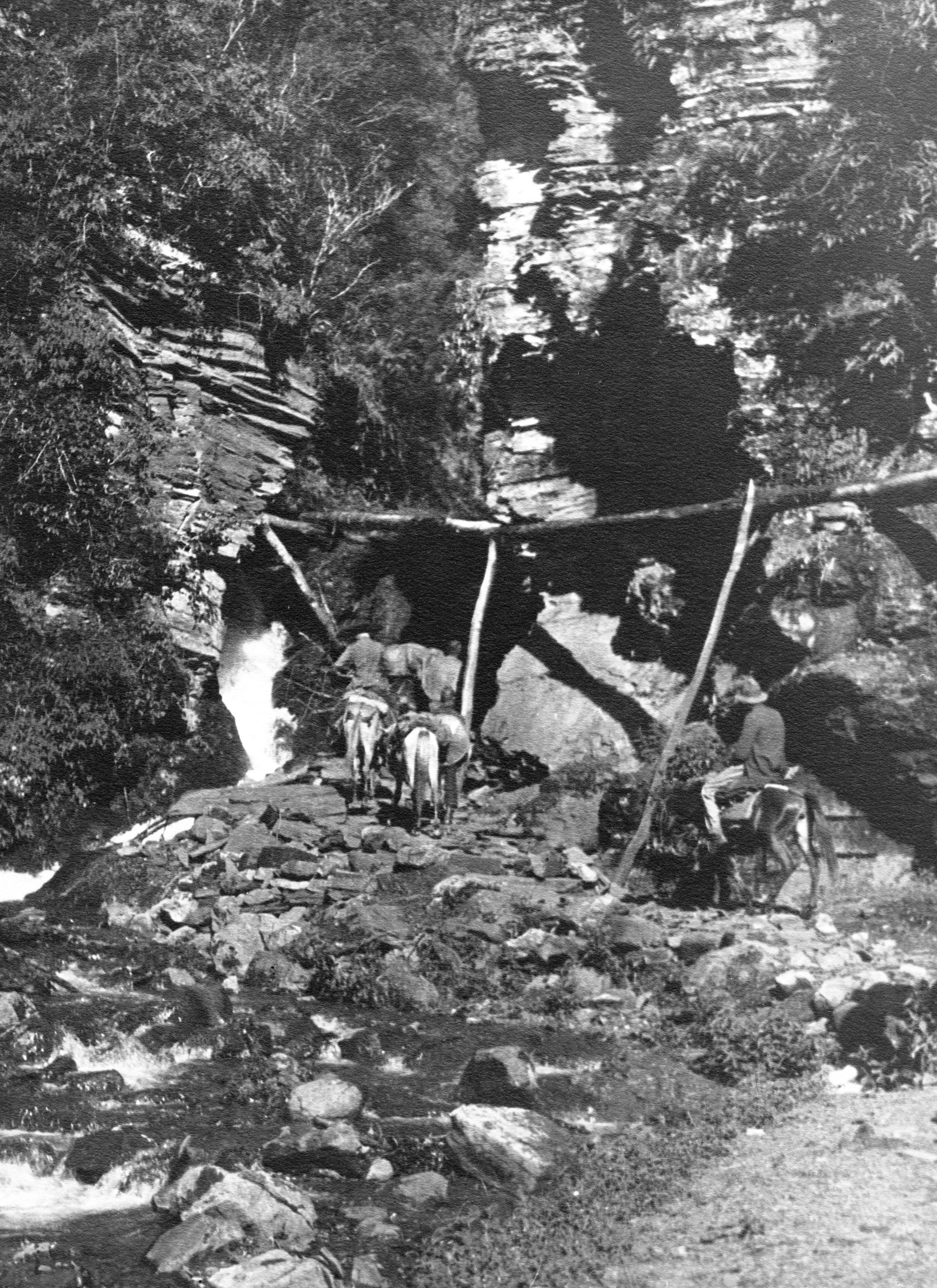
Waterfall at western end of bridge at Tsz-li
Waterfall at western end of bridge at Tsz-li
After crossing they began the climb, zig-zagging up the hill and cliff though pine woods, with everywhere fresh views of glorious mountains and deep valleys. At 12 noon they reached the village of Tui Lao Koh (or Tui-neo-k'e), at 7,888 ft. The village of sixty-five families, were mostly Mosuo. They rested the mules and themselves till 2p.m. and then set off again. The first part of the climb was very hot, and then it became milder. At 14¼ miles, after a rise of about 1,000 ft. they reached the top of the pass, called San-shen-miao P'o or Ch'ing-ming- k'ou, (9,481 ft.), a rise of 5,160 feet from the bridge over the Yangtze.
(Note: The Mosuo people, often called the Na among themselves, are a small ethnic group living in Yunnan and Sichuan Provinces in China, close to the border with Tibet.)

View of the Yangtze looking north after crossing the Tsz Li bridge & climbing 2,005 ft.
View of the Yangtze looking north after crossing the Tsz Li bridge & climbing 2,005 ft.
“The descent led down through a beautifully wooded gorge, along a track between two vertical cliffs of rock. When this opened out, we first saw the Likiang Pagoda, and later when we turned a big shoulder of hill, we caught our first glimpse of the great Likiang plain. It was then a gradual descent and at 15¾ miles the Likiang plain was reached. After a long 5 miles of paddy fields we reached Likiang Fu (7,561 ft.) at 22½ miles".

Entering the Likiang plain
Entering the Likiang plain
They arrived at Likiang (now known as Lijiang) at 7.30 p.m. and the first stage of their journey was over; the general went to an inn to stay with the baggage, and HGT went on to the Mission settlement.
“After arriving at the Mission - had a wash, supper, a nice hot bath and then bed. Everything seems so spotless and delightful after the Inns”.

Likiang plateau approaching from Yung-peh (Likiang on Rt)
Likiang plateau approaching from Yung-peh (Likiang on Rt)
Copyright © 2021 John Hague. All Rights Reserved
Special thanks to Mr Edward Pereira, great nephew of Brig. Gen. George Pereira for providing me with copies of his great uncle's journal.
References:
The Geographical Journal Vol. LXVII No. I
The Royal Geographical Society January 1926
Published by Edward Stanford 1926
Peking to Lhasa by Sir Francis Younghusband. The Narrative of Journeys in the Chinese Empire Made by the Late George Pereira . Compiled by Sir Francis Younghusband from Notes and Diaries.
Published by Houghton Mifflin, Boston, 1926
The Illustrated London News
No 4528 Vol 168 published on 30th Jan 1926
and
No 4529 Vol 168 published on 6th Feb 1926